Located near the popular town of Moab in southeastern Utah, Arches National Park is famous for its spectacular desert landscapes, rock formations, stellar night skies and epic sunsets. It’s also one of the easiest U.S. national parks to visit.
It’s usually the last destination on a Utah national parks road trip from cities like Las Vegas or Salt Lake City. Once you’re there, all the highlights and best trails in Arches National Park are along or just off of the Arches Park Road.
Contents
Top Hiking Trails in Arches National Park, Utah
This best Arches National Park hikes post contains affiliate links. You can read more about our Terms of Use / Disclosure here.
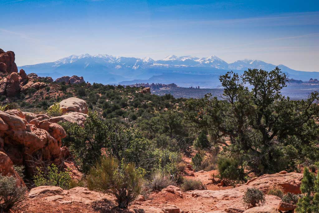
Meandering its way through the marvelous Arches landscape, the Arches Scenic Drive is 18 miles long—a 36-mile round trip. It starts at the Visitor Center and runs all the way to Devils Garden, the starting point of what I think is the single best hike in Arches National Park.
On the way, you’ll have convenient access to all other Arches National Park trails, including majestic Park Avenue, famous Delicate Arch and the super-fun Windows Section.
To really experience the beauty and depth of this iconic park, there’s no better way than doing some of the following Arches National Park hikes. Hiking is unquestionably the best way to see Arches National Park.
7 Best Arches National Park Hikes
The Arches trails I’ve selected below take you to, through and around several of the 2,000+ natural rock arches in the park, the greatest concentration of those rock formations on Earth.
Below, I’ve listed all the best hikes in Arches National Park from easy to difficult. Note, however, that the majority of these trails are pretty easy, relatively flat and no longer than 3 miles.
Only the last two—the Devils Garden Hike and Fiery Furnace—require some more planning and preparation.
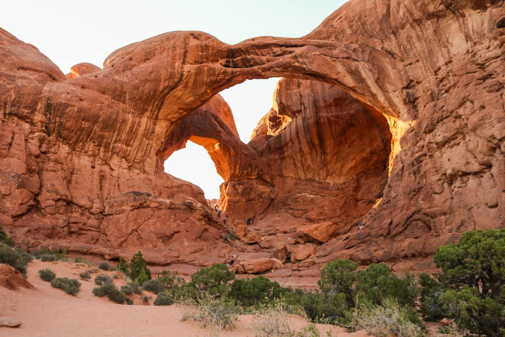
The Windows and Double Arch
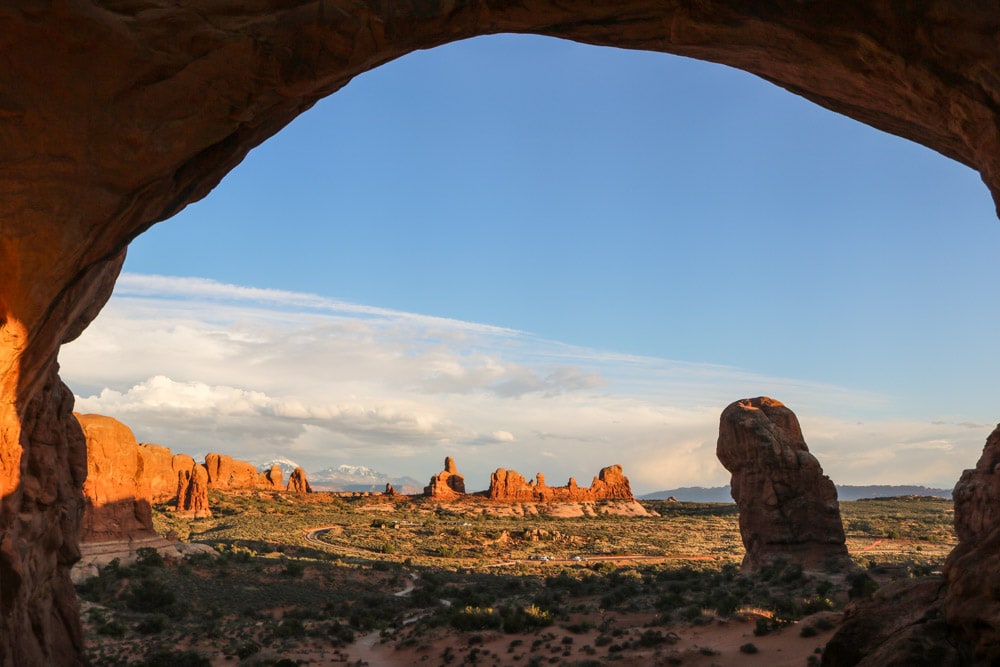
The Windows Section lies at the end of The Windows Road, a spur road of the Scenic Drive. One of the park’s most popular areas for short strolls and sunset photos, it’s exceptionally scenic.
You’ll find several iconic rock formations in this area, accessible via a 1-mile loop trail, including North and South Windows, Turret Arch, Elephant Butte, the Parade of Elephants and the Garden of Eden.
Iconic Double Arch lies on the other side of the parking lot, at the end of the short 0.5-mile Double Arch Trail.
I recommend leaving this area for last. Basically, it has some of the easiest and best short hikes in Arches National Park and the varied types of rock formations make for amazing sunset-viewing spots.
- Roundtrip distance: up to 1.5 miles (2.4 kilometers), there and back or loop
- Duration: 1 hour
- Difficulty: Easy
- Trailhead: The Windows Parking Area, end of The Windows Road, off Arches Scenic Drive
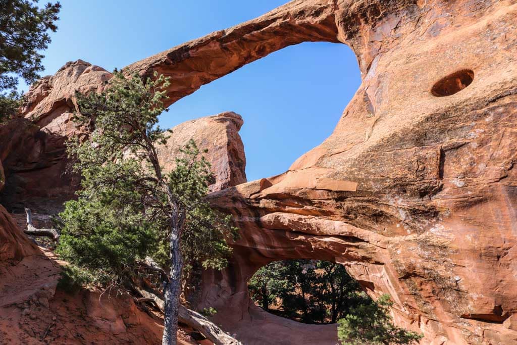
Landscape Arch Trail
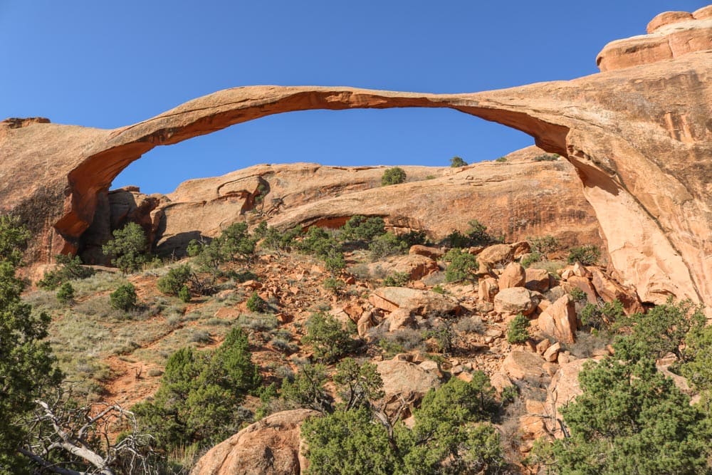
Long and narrow Landscape Arch spans no fewer than 306 feet (which is about the length of a football or soccer field). Yet, it’s only 6 feet wide at its narrowest point. It’s one of the longest known rock arches in the world, one of the top attractions in Arches National Park.
Seeing this wonder of nature doesn’t require a whole lot of effort on your part, though. The Landscape Arch hike starts at the Devils Garden Parking Area, the terminus of the Park Road.
The hard-packed gravel trail is pretty flat, which makes it suitable for most people, including wheelchair users. (Some steeper sections might require some assistance, though.)
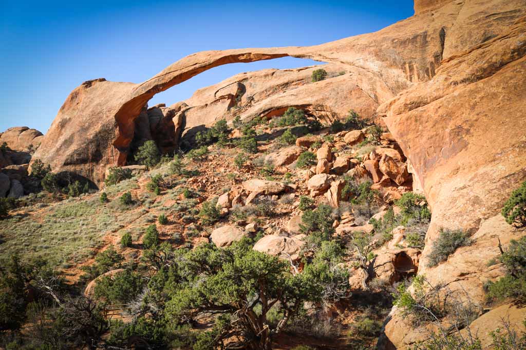
It’s only 0.8 miles to the Landscape Arch viewpoint. On the way, you’ll also pass spur trails to Tunnel Arch and Pine Tree Arch.
Beyond Landscape Arch, the trail gets rougher and more challenging. I’ll talk about that extended hike—my favorite Arches National Park hike—further down this post.
- Roundtrip distance: 6 miles (2.6 kilometers)
- Duration: 45 minutes
- Difficulty: Easy
- Trailhead: Devils Garden Parking Area, end of the Arches Scenic Drive
Broken Arch Loop Trail
Impressive Broken Arch can be reached via two trails. One starts at the Sand Dune Arch parking area, while the other, which I recommend, begins at the Devils Garden Campground.
This fun loop hike is no longer than 2 miles and runs to the base of Broken Arch, also taking in Tapestry Arch and offering the opportunity to hike through rock fins to Sand Dune Arch.
The northern part of this loop is a bit steeper than the rest and might require some rock scrambling.
This is a great little Arches National Park hike to do if you have some time left. When camping at the Devils Garden Campground, it’s mandatory hike. The trail literally starts a few steps from your campsite!
- Roundtrip distance: 2 miles (3.2 kilometers), loop
- Duration: 1 hour
- Difficulty: Easy
- Trailhead: Devils Garden Campground
Park Avenue Trail
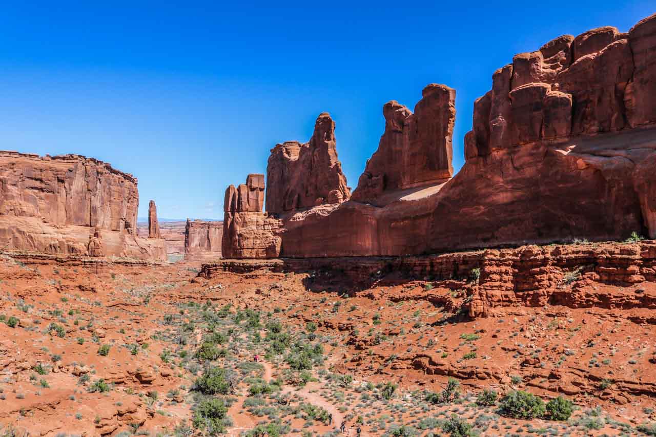
One of my favorite places in Arches National Park, Park Avenue consists of massive rock walls, monoliths and fins. It’s one of the first attractions you’ll see after leaving the Visitor Center.
You can start it at one of two trailheads—the Park Avenue Viewpoint or Courthouse Towers Viewpoint—both of which are on the Scenic Drive.
It doesn’t matter which one you choose, since the there-and-back hike will be the same. If you have more than one car, you can also make this a one-way hike and shuttle back to your starting point.
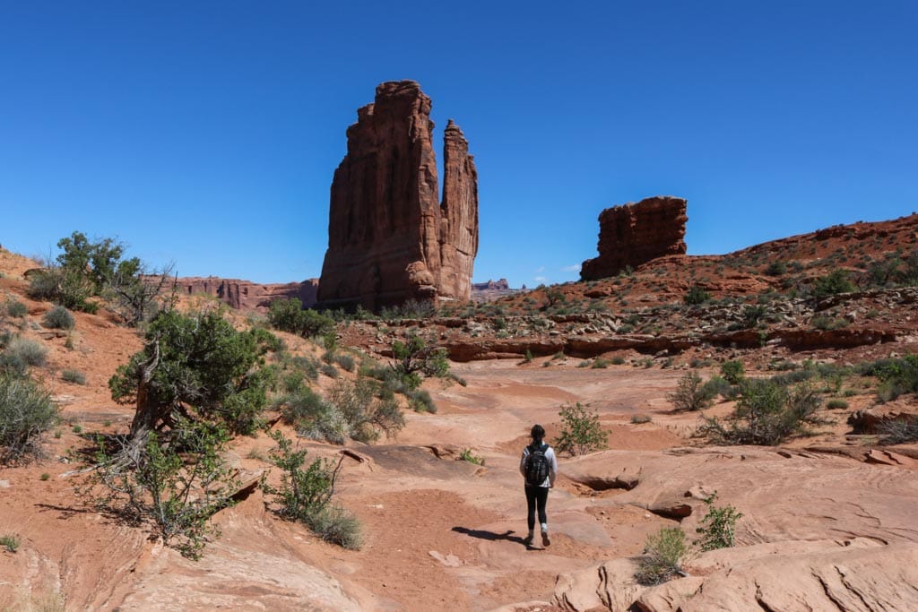
The trail is 1 mile long, making for a 2-mile round trip, and runs through a spectacular canyon flanked by huge walls of rock. It’s a breathtaking sight and a great introduction to Arches National Park.
If you only have time for a couple of Arches National Park hikes, I highly recommend including the Park Avenue Trail. It’s a fairly easy hike and the scenery is absolutely majestic.
- Total distance: 2 miles (3.2 kilometers), there and back
- Duration: 1 hour
- Difficulty: Moderate
- Trailhead: Park Avenue Viewpoint or Courthouse Towers Viewpoint on the Park Road
Delicate Arch Trail
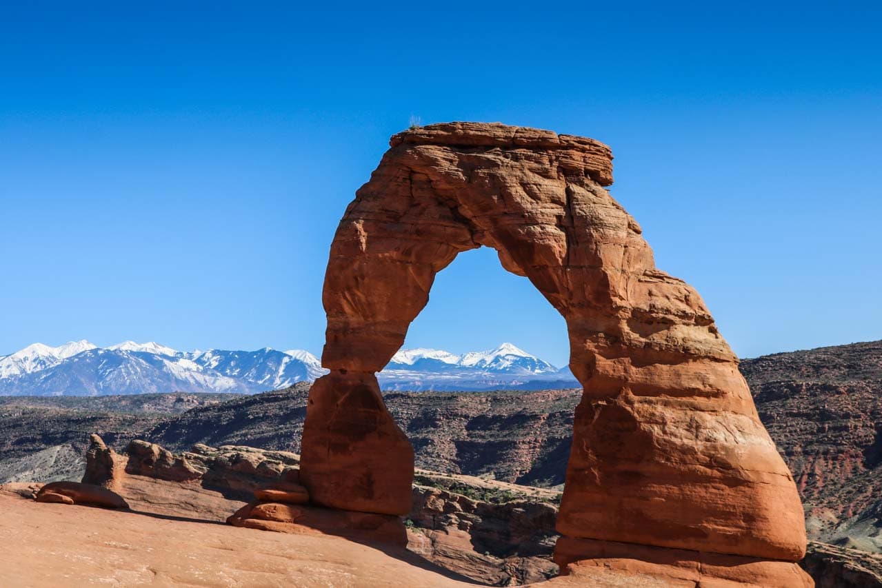
Of the more than 1.6 million people who visit Arches National Park every year, many come to see Delicate Arch.
Measuring 32 feet wide and 46 feet high, this spectacular arch is extraordinary because it’s a free-standing arch—the largest of its kind in the park.
Throughout its history it’s had its share of different names, from “Old Maid’s Bloomers” and “Cowboy’s Chaps” to “Salt Wash Arch.” Its current name dates from 1934, when the arch was described as “the most delicately chiseled arch in the entire area.”
Nowadays, this famous free-standing arch is a symbol of the state of Utah and one of the world’s most recognizable geological formations.
Although Delicate Arch isn’t visible from the road, there are a couple of wheelchair-accessible viewpoints where you can see it from about a mile away. Those are known as the Lower and Upper Delicate Arch Viewpoints.
Those viewpoints aren’t anything compared with the Delicate Arch Trail, though. There’s nothing like seeing Delicate Arch from up close.
From the Wolfe Ranch Trailhead, the trail climbs steadily for 1.5 miles, first as a well-defined trail, then across an open slickrock slope.
There’s very little shade on this hike, so make sure to wear sunscreen and a hat. Bring lots of water, at least 2 quarts or 2 liters per person.
- Total distance: 3 miles (5 kilometers), there and back
- Duration: 5 hours
- Difficulty: Moderate
- Trailhead: Wolfe Ranch parking lot on Delicate Arch Road, off the Arches Scenic Drive
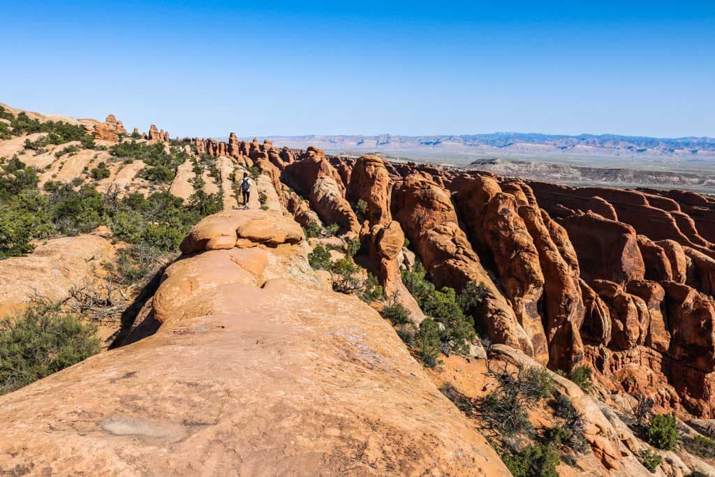
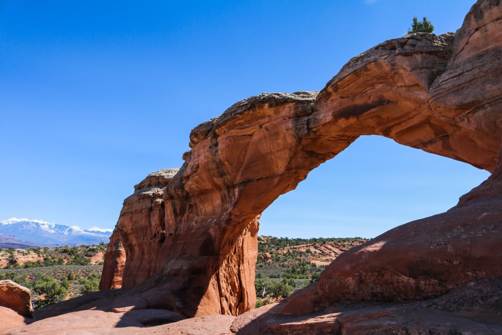
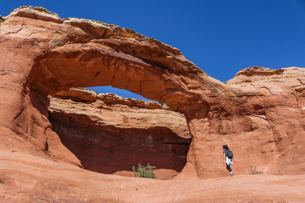
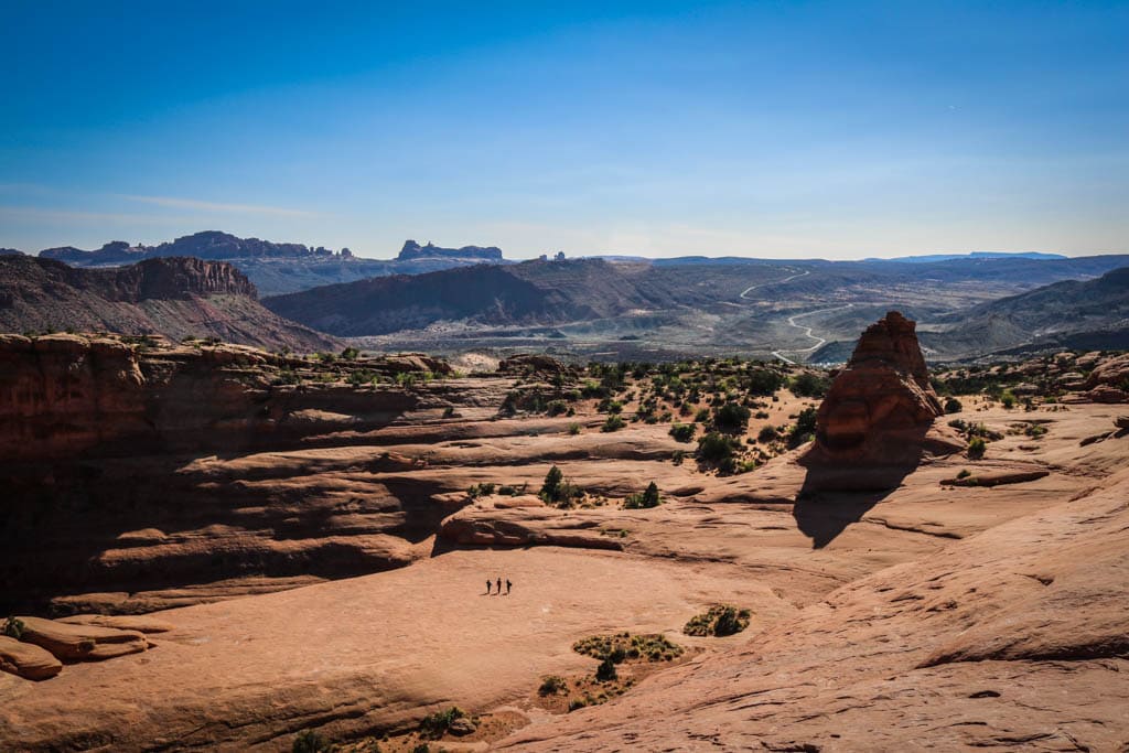
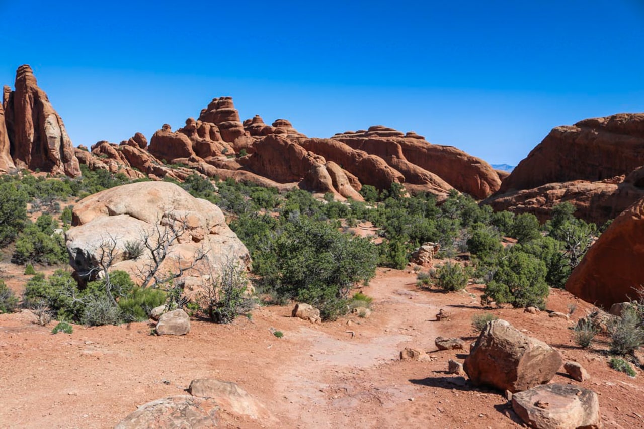
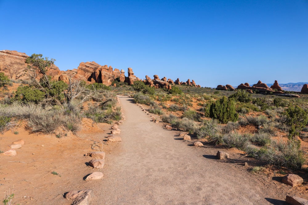
Devils Garden Primitive Trail Loop
In my opinion, the Primitive Trail at Devils Garden is the best Arches National Park hike. In fact, it’s easily one of the best day hikes in all the national parks. The first section of this epic hike is the Landscape Arch Trail (see above), but the real excitement lies beyond that famous arch.
The Primitive Trail is just what its name suggests—there’s few markers to rely on, some rock scrambling, steep slopes and a couple of drop-offs.
The remoteness of this hike is what appealed to me most. You’ll feel like you’re alone in the desert, which is a pretty awesome feeling actually.
The full loop is made up of both the Primitive Trail and the Double O Arch Trail. Both trails split up just beyond Landscape Arch, that point being linked to the Devils Garden Parking Area by the Landscape Arch Trail.
If that sounds a bit complicated, a quick glance at the Devils Garden trails map here will offer some clarity.
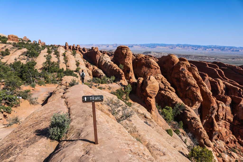
On the Devils Garden Primitive Trail Loop, you get to see no fewer than seven awesome rock arches, including iconic Landscape Arch, but also picturesque others like Double O Arch, Partition Arch and Private Arch.
The furthest point on this magnificent day hike in Arches National Park is the mighty Dark Angel rock formation.
This is the longest of all Arches National Park hiking trails, a journey into the park’s remotest still-accessible area. Allow at least 4 hours to complete this superb hike and bring plenty of snacks and water.
You might find some welcome shade underneath the arches, but the trails are exposed. Wear a hat and sunscreen.
- Total distance: 9 miles (12.6 kilometers), lariat including all spur trails
- Duration: 4 hours
- Difficulty: Difficult
- Trailhead: Devils Garden Parking Area, end of the Arches Scenic Drive (trail past Landscape Arch)
Fiery Furnace
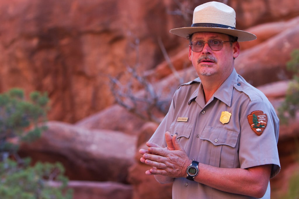
One of the most famous places in Arches National Park, the Fiery Furnace is a maze of sandstone canyons, cliffs and fins. You see a part of it from the Fiery Furnace Viewpoint, but entering this spectacular area requires either getting a permit or joining a ranger-guided hike.
This is a popular area, so even though there are daily ranger hikes from spring through fall, they do often sell out. More information about the Fiery Furnace hike with a ranger is available on the park’s website.
If you’d like to get hiking permit for a self-guided Fiery Furnace adventure, you have to get one at the Arches Visitor Center. They can’t be booked in advance.
Note that there’s a marked route through the Fiery Furnace, but it’s still possible to get lost. This truly is a maze of rock and you should know what you’re doing when you enter.
You have to wear sturdy hiking boots or shoes with good traction, while carrying one quart or one liter of water per person is a bare minimum.
Additionally, this is also the most physically challenging of all Arches National Park hikes. You’ll have to squeeze through narrow canyons, climb sections of broken sandstone, scramble through cracks, walk along narrow ledges flanked by steep drop-offs,…
When prepared, however, this is one of the best hiking experiences in the U.S. national park system!
- Total distance: Various (no trail)
- Duration: Various
- Difficulty: Difficult
- Trailhead: Fiery Furnace Viewpoint on the Park Road
Arches National Park Trail Map
The map below shows the locations of the best hikes at Arches National Park
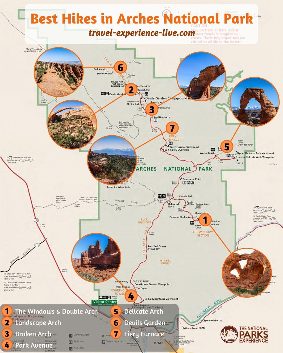
You can also pick up an Arches National Park map and newspaper at the Visitor Center, while some trailheads have more detailed local trail maps.
For a topographic map of the Arches National Park trails, there’s no better one than this illustrated trail map from National Geographic.
If you’re looking for more hiking ideas in the Moab area, including both Aches and Canyonlands National Parks, check out this Falcon Guides Hiking Guide.
Arches National Park Hiking Tips & Guidelines
To protect and preserve the immense beauty of Arches, there are a number of things you should do when hiking in Arches National Park. Most of them are simply common sense and applicable anywhere, while some are specific to this park.
- Leave rocks as you see them
- Do NOT climb on the arches
- Don’t disturb ephemeral pools and potholes
- Take all waste out with you
- Stay on the trails
- Be a courteous hiker
- Respect historic and archaeological sites
- Always bring plenty of water and snacks
- Wear sturdy hiking shoes or boots with good traction
- Put on sunscreen and a hat
What Are Your Favorite Arches National Park Hikes? Share Your Arches National Park Experience in the Comments Below!
Other Great National Park Hikes
- Bryce Canyon National Park Hikes
- Crater Lake National Park Hikes
- Haleakala National Park Hikes
- Joshua Tree National Park Hikes
- Death Valley National Park Hikes
- Mount Rainier National Park Hikes
- Shenandoah National Park Hikes
- Capitol Reef National Park Hikes
- Saguaro National Park Hikes
- Petrified Forest National Park Hikes