10 Must-Do Day Hikes at Mount Baker, Washington
Situated in the far northwestern corner of the contiguous United States, Mount Baker has some of the greatest (sub)alpine trails in the nation.
Rising 10,781 feet to the heavens, Mount Baker—also known as Komo Kulshan or simply Kulshan—is the third highest mountain in Washington State, after Mount Rainier and Mount Adams.
Located within sprawling Mount Baker-Snoqualmie National Forest, it’s also one of the most thermally active volcanoes in the Cascade Range.
Various day hikes are available to visitors at Mount Baker, allowing them to explore an incredible outdoor wonderland, encompassing quintessential Pacific Northwest forests, glacier-fed rivers, tranquil tarns, wildflower meadows, and spectacular peaks.
From short strolls through meadows to challenging treks in the magnificent Mount Baker Wilderness, there’s a hike (or two, or three) for everyone!
This blog post about the best day hikes at Mount Baker contains affiliate links. You can read more about our Terms of Use / Disclosure here.
Hiking Mount Baker: FAQs
Before I share the top Mount Baker day hikes, let’s first talk about some essential information related to hiking in Mount Baker-Snoqualmie National Forest.
From permit requirements to the optimal hiking season and potential wildlife viewing opportunities, I highly recommend reading through these FAQs. They’re here to help you plan your Mount Baker hiking trip a bit better.
Where Is Mount Baker Located?
Mount Baker is in the northwest of Washington, close to the Canadian border, and is visible from Seattle and Vancouver, British Columbia.
A 10,871-foot-high stratovolcano, it is one of the highest mountains in Washington and one of the major volcanoes in the Cascade Range.
Additionally, Mount Baker is also part of the greater North Cascades region and sits just outside the western boundary of North Cascades National Park.
What’s the Best Way to Get Around Mount Baker?
While you can’t technically get all the way around Mount Baker, getting to the mountain is as straightforward as it gets. There’s only one road: the scenic Mount Baker Highway.
Officially known as Washington SR 542, the Mount Baker Highway runs from the I-5 exchange in Bellingham along the North Fork Nooksack River to aptly named Artist Point high on the mountain’s northeast flank.
On the way, this wonderful road passes through a few small towns and communities, such as Maple Pass, and Glacier. These communities serve as the gateways to the alpine wonders of Mount Baker.
Do I Need a Permit to Go Hiking at Mount Baker?
Most likely, yes, you do need a permit to hike the trails at Mount Baker.
The entire area at Heather Meadows and Artist Point is a fee area, meaning you need a pass to legally park at the trailheads and facilities. Valid passes include:
– Northwest Forest Passes, valid in national forests in both Washington and Oregon; and
– Interagency Passes, such as the popular America the Beautiful Annual Pass, which provides year-long access to public lands, including all national parks.
You can find more information about recreation passes and permits here.
What Is the Best Season for Mount Baker Day Hikes?
In winter, Mount Baker is one of the snowiest places in the world, averaging over 500 inches of snow per year. It’s an incredibly popular winter sports destination, attracting snowboarders, cross-country skiers, and snowmobilers alike.
Hikers, on the other hand, will have to wait until summer to hit the high-elevation trails on Mount Baker.
By mid-July, most trails will be (almost) free of snow, while wildflowers bloom profusely on the subalpine slopes. August is a phenomenal month to explore the more than 200 miles of hiking trails at Mount Baker.
Mid-July through August is a great time for subalpine wildflowers.
Additionally, early fall is also a gorgeous time to go hiking at Mount Baker. September brings glorious fall foliage, crisp mornings, and is the month with the least snow cover.
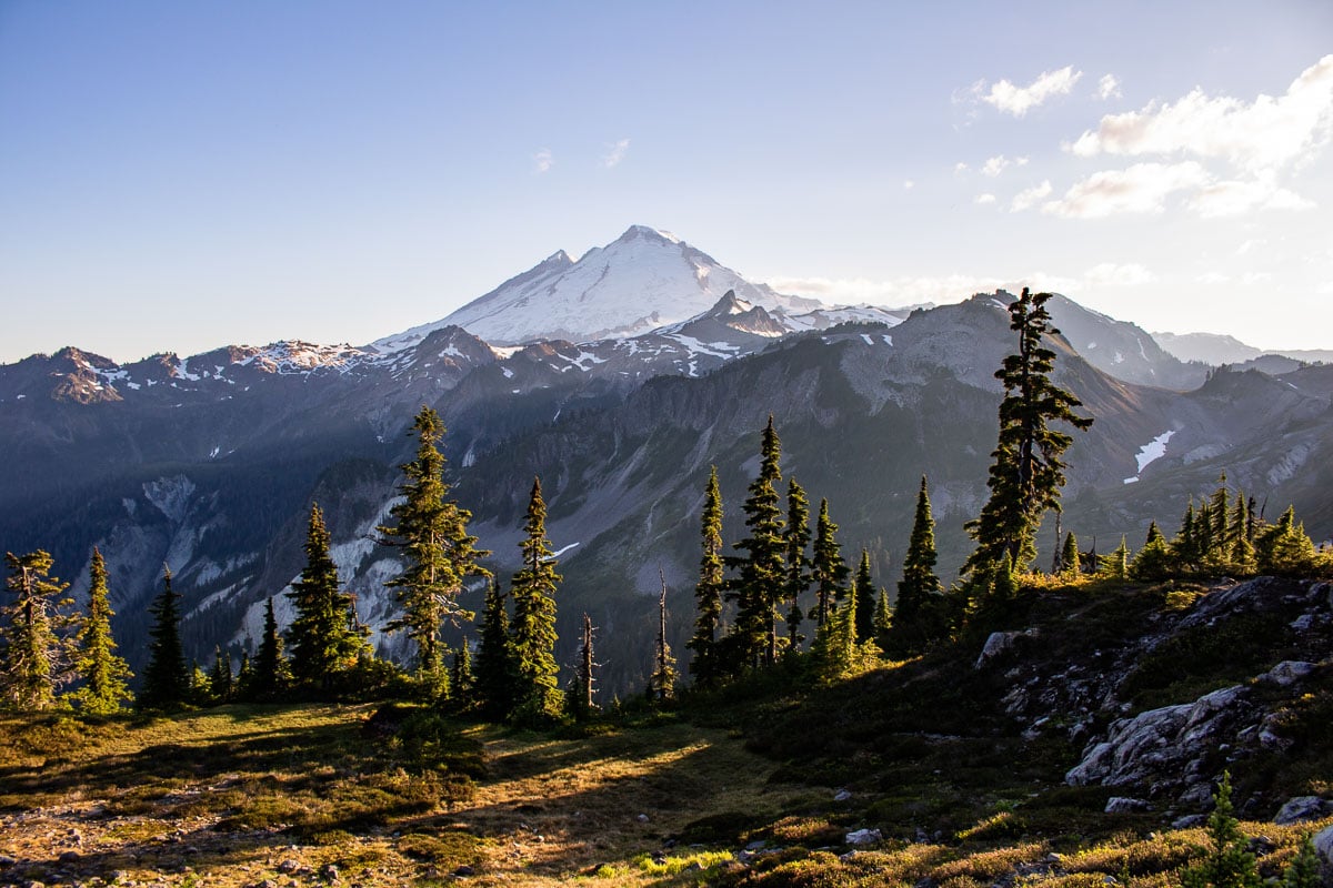
Late-September through early-October is the best time for fall colors at Mt. Baker.
What Is the Best Time of Day for Mount Baker Day Hikes?
My favorite time of day to hike at Mount Baker is sunrise. The brief summer season, which runs from July through August, is incredibly busy. On weekends, trailhead parking lots typically fill up (or even overflow) by mid-morning.
I recommend arriving at the trailhead of your chosen day hike as early as you can, especially on weekend days.
Sunrise is also the quietest time of day at Mount Baker, allowing you to soak up and immerse yourself in these stunning landscapes in peace and solitude.
Some amazing morning hikes at Mount Baker I personally love are Chain Lakes, Table Mountain, Bagley Lakes, and Yellow Aster Butte. Although short, the Picture Lake Path is arguably at its most stunning at dawn, too.
Afternoons can get pretty hot on these high-elevation trails in summer. This is because many of them are above the tree line and don’t have much shade.
If you’re flexible, I recommend planning your hikes either before or after the hottest time of the day, which is roughly between 12 and 4 pm.
If you are hiking in the afternoon, choose one of the easy Mount Baker hikes. Great examples of those are Horseshoe Bend, Picture Lake Path, Fire and Ice Trail, Lower Wild Goose, and Artist Ridge.
Evenings can be delightful for Mount Baker day hikes, too, though. Pick one of the shorter hikes below if you’re starting later in the day.
Artist Ridge, Table Mountain, Fire and Ice Trail, and Bagley Lakes are all fantastic evening hikes.
Is Mount Shuksan in Mount Baker-Snoqualmie National Forest?
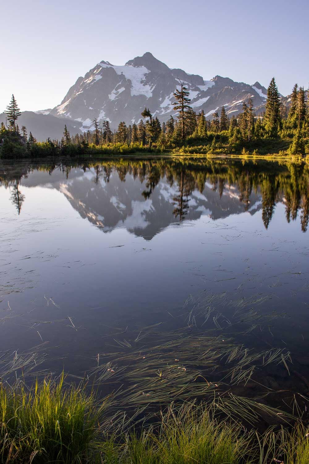
Although it is a striking and prominent feature in the greater Mount Baker landscape, famous Mount Shuksan is not in Mount Baker-Snoqualmie National Forest.
Instead, Mount Shuksan comprises the westernmost section of North Cascades National Park, which borders the national forest.
Are There Bears at Mount Baker?
Yes, absolutely! There are many bears in Mount Baker-Snoqualmie National Forest, including and perhaps especially in the subalpine meadows around Mount Baker itself.
Black Bears
Black bears are extremely common at Mount Baker and sightings aren’t unusual at all. Visitors regularly see black bears on roadsides, in meadows, and even on trails. Some black bears frequent campsites, too, so always be vigilant when camping.
Read more about what to do when you encounter a black bear here.
Both the Forest Service and National Park Service, which manages the adjacent North Cascades National Park Service Complex, implore visitors to follow regulations, keep a clean campsite, store all scented items in a locked car or bear-proof containers, and to never approach bears.
Grizzly Bears
The North Cascades ecosystem, of which Mount Baker is an integral part, is also home to a very small, and rarely seen, population of grizzly bears. Although chances are minimal you’ll ever see a grizzly at Mount Baker, they’re not entirely zero.
Read more about what to do when you encounter a grizzly bear here.
Bear Spray
I strongly recommend carrying bear spray when hiking at Mount Baker. Even on crowded trails near busy parking areas, it’s still possible to encounter a bear. Better safe than sorry!
Learn how to use bear spray correctly here.
What Wildlife Can I See at Mount Baker?
Besides bears, Mount Baker is home to an abundance of other wildlife, too. On Mount Baker day hikes, the most common animals you might see include hoary marmots, also known as whistle pigs, and the adorable pikas.
In lower-elevation meadows, you might spot elk and deer. The high country, on the other hand, is the undisputed home of the iconic mountain goats, which you might see on alpine trails like Ptarmigan Ridge or even from Artist Point with binoculars.
Where Can I Find More Information About Mt. Baker-Snoqualmie National Forest?
The best resource for all kinds of information about Mount Baker-Snoqualmie National Forest is the U.S. Forest Service website.
On that website, you’ll find everything from outdoor recreation activities and campground information to current conditions, passes, and history.
7 Tips For a Successful Mount Baker Hiking Experience
Let’s condense those FAQs above into a handful of tips to optimize your hiking trip at Mount Baker.
1. Get a valid recreation pass. Make sure to get a valid pass, such as a Northwest Forest Pass or Interagency Pass. You can get those online, at visitor centers, or at select local businesses.
2. Research current conditions. Know which roads are accessible, if there any trail closures, or any recent issues with wildlife.
3. Book your accommodation well in advance. Mount Baker is a very popular hiking destination in summer. Various types of accommodation are available in gateway towns like Maple Falls and Glacier, but I recommend planning your trip weeks, if not months, in advance.
4. Arrive at trailheads early (or late). Parking spaces usually fill up by noon, even earlier on weekends. It’s recommended to get to your trailhead as early in the morning as you can. (Alternatively, consider starting your day hike at Mount Baker later in the afternoon when many day hikers have left.)
5. Pack plenty of water and food. Depending on the length of your hike, it’s imperative that you pack sufficient water, high-energy food, and even some electrolytes.
6. Don’t forget other essentials. Remember to bring sunscreen, a hat, bug repellent, a flashlight, one or two extra layers of clothing, and some kind of fire starter (just in case you get stranded). I also strongly recommend bringing bear spray when hiking at Mount Baker.
7. Watch out for wildlife. Lots of animals call the Mount Baker Wilderness home, some of them potentially dangerous. Keep an eye out for bears, cougars, and mountain goats. Give all wildlife plenty of space, and please stay on the trail to preserve their habitat.
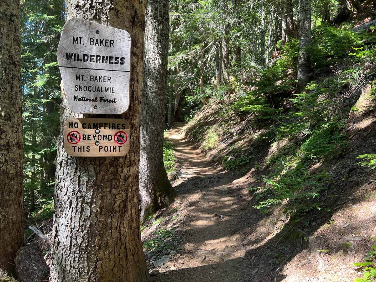
10 Best Day Hikes at Mount Baker, Washington
Okay, so now that we got all that visitor information out of the way, let’s move on to the fun stuff—the best day hikes at Mount Baker.
As I said above, these trails are listed from short to long, starting with a 10-minute stroll and ending with a multi-hour trek to a mountain peak.
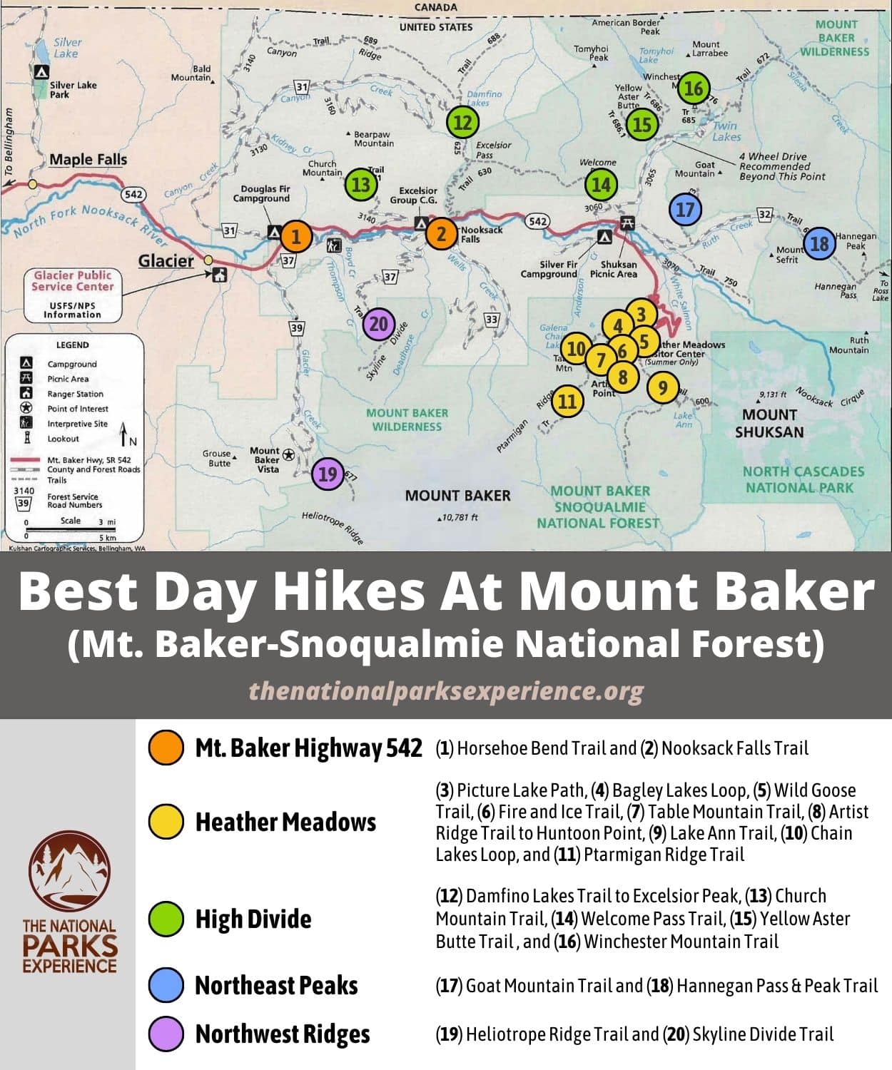
For the approximate locations of each of these Mount Baker trails, I’ve provided a map at the end as well.
Note: Depending on the source, the distance, hiking time, and/or elevation gain of these Mount Baker hikes may differ. Even the “official” U.S. Forest Service information isn’t always entirely accurate in practice. I’ve used the very reliable Washington Trails Association website as the source of the trail details throughout this blog post.
1. Nooksack Falls Trail
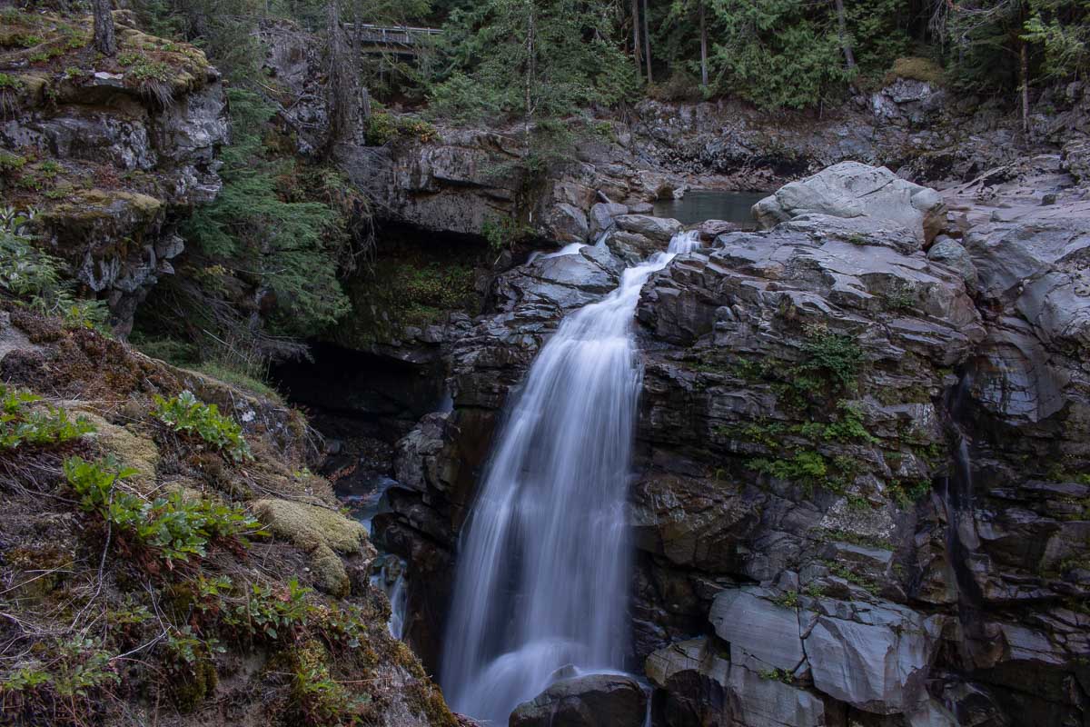
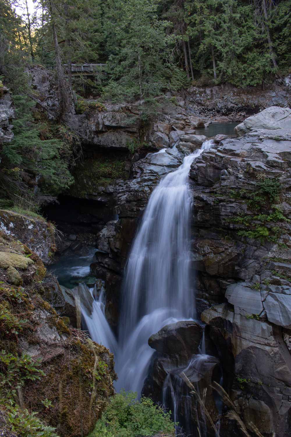
The Nooksack Falls Trail isn’t so much a “hike” as it is a very short stroll. A top attraction on the Mount Baker Highway, it’s worth doing, nonetheless.
The trailhead parking area is just down the occasionally bumpy Forest Road 33 from Highway 542. There are signs on the highway indicating the direction to Nooksack Falls.
From the parking area, it’s just a few minutes’ walk to a viewing platform.
Due to its location high above the falls and canyon below, the viewing area is completely fenced in. The view, however, is still pretty stunning and a worthwhile stop on the way to (or from) other Mount Baker hikes.
Nooksack Falls Trail Details
Distance: 0.1 miles, out and back
Duration: 10 minutes
Elevation gain: 14 feet
Difficulty: Very easy
Trailhead: About 7.5 miles east of Glacier on Mt. Baker Highway 542, 0.6 miles down Forest Road 33
Pets allowed: Yes
More information: https://www.wta.org/go-hiking/hikes/nooksack-falls
2. Picture Lake Path
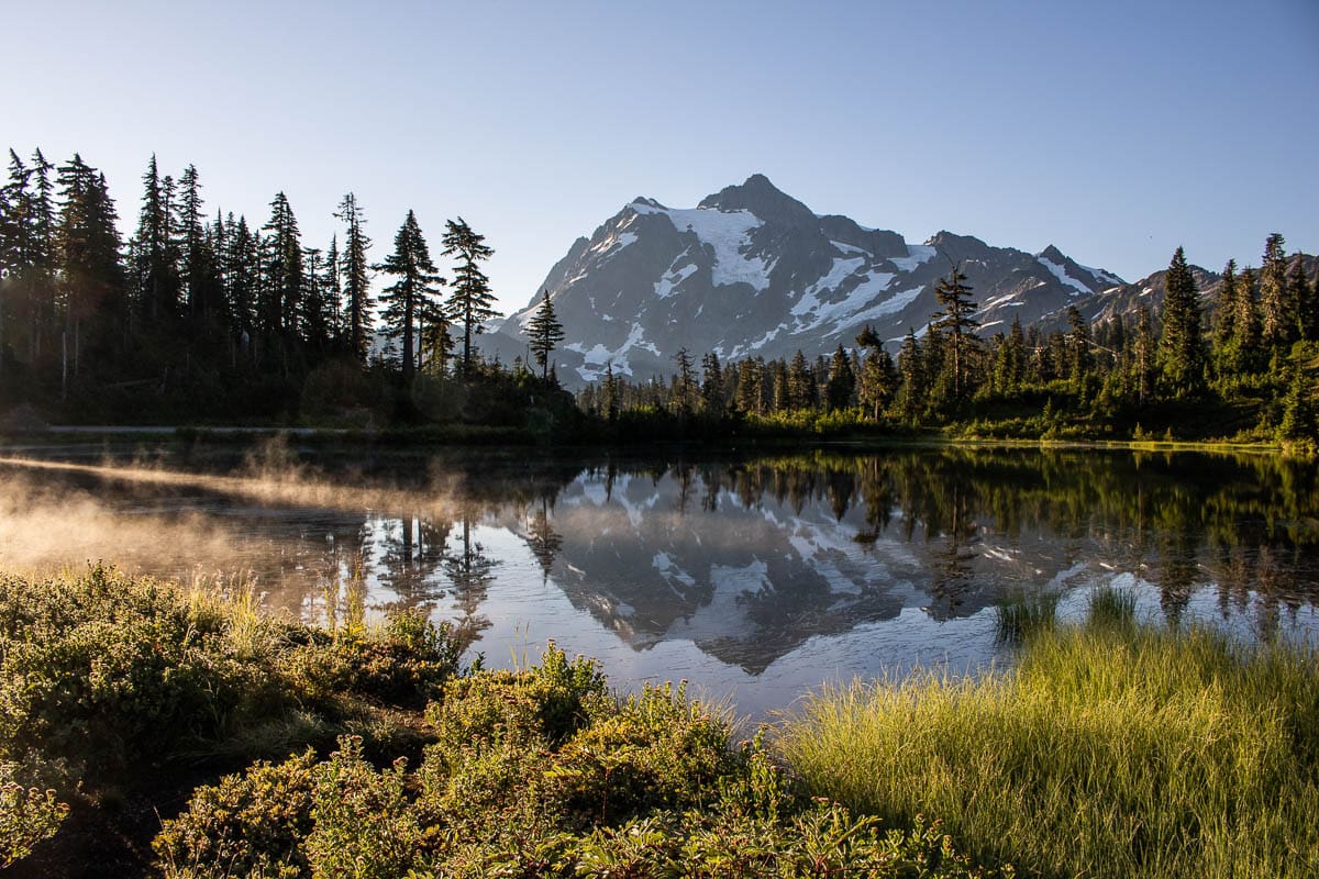
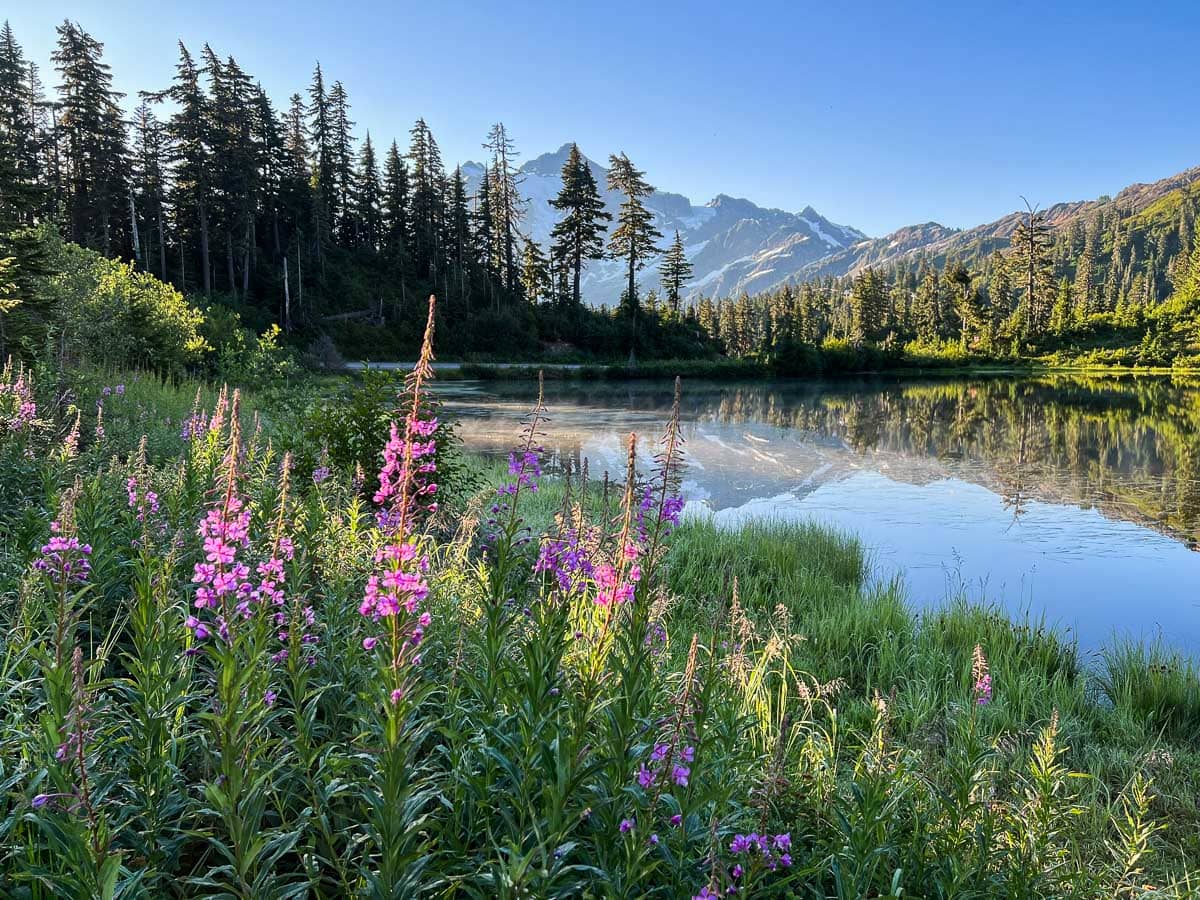
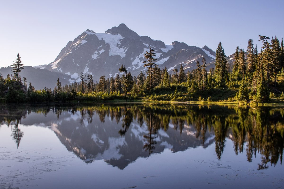
According to the Forest Service, as well as several other sources, the “classic alpine vista of Mt. Shuksan mirrored in Picture Lake is one of the most photographed mountain scenes in North America.”
This truly is an iconic and unforgettable view, especially in the morning when the lake’s still water provides a perfect reflection of Shuksan.
The Picture Lake Path loops around the lake, an easy 0.6-mile walk that offers different vantage points. In summer, various wildflowers bloom along the lakeshore, while fall brings vibrant foliage.
A number of interpretive panels line the trail, too, providing some more background information about the area and famous Mount Shuksan.
Picture Lake Path Details
Distance: 0.6 miles, loop
Duration: 15 minutes
Elevation gain: 45 feet
Difficulty: Very easy
Trailhead: Parking lot just past the Firs Lodge, on the left side of the road on the north shore of Picture Lake
Pets allowed: Yes
More information: https://www.wta.org/go-hiking/hikes/picture-lake
3. Fire and Ice Trail
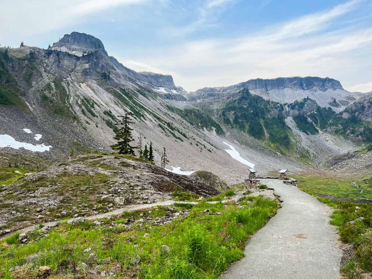
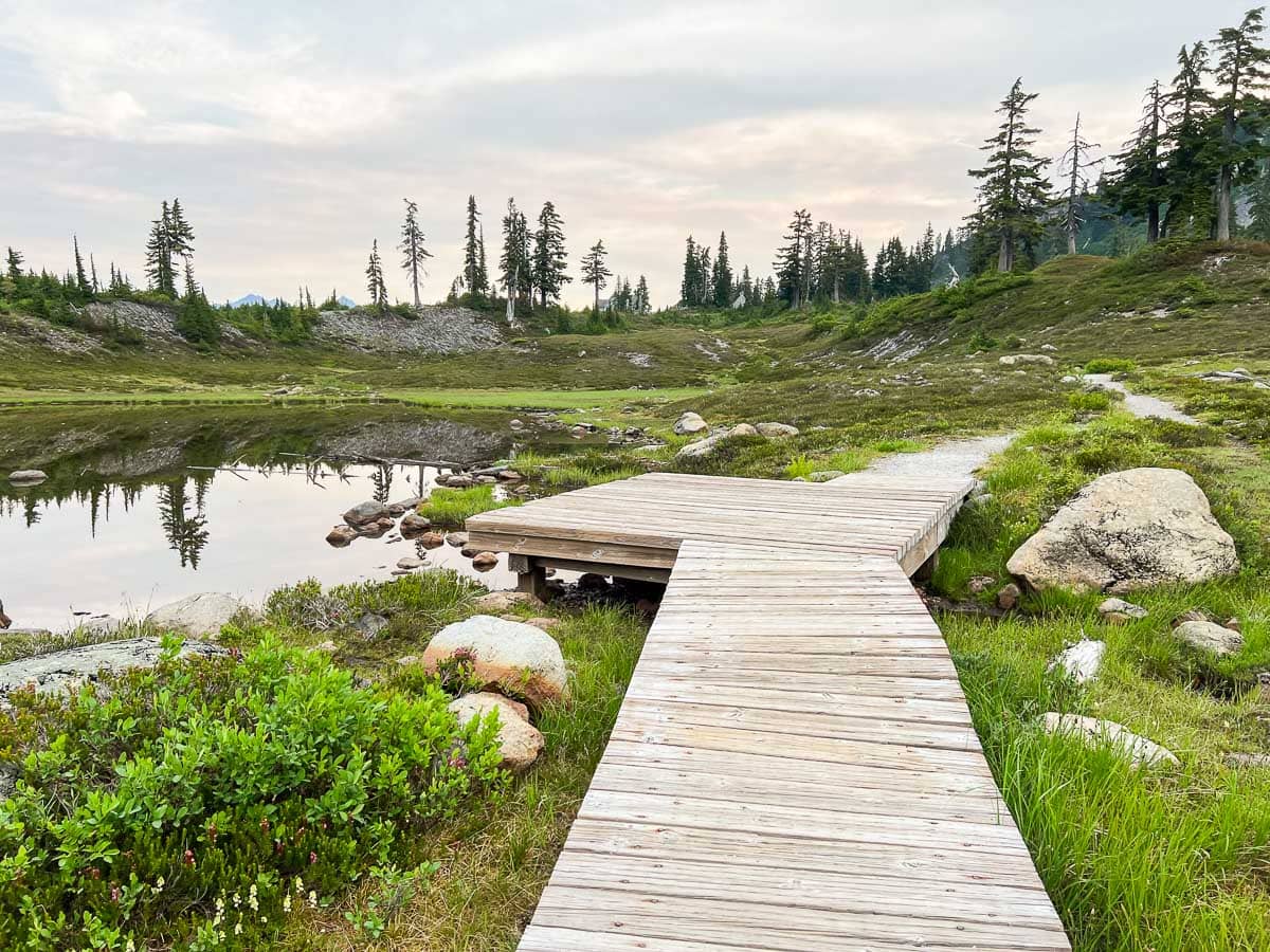
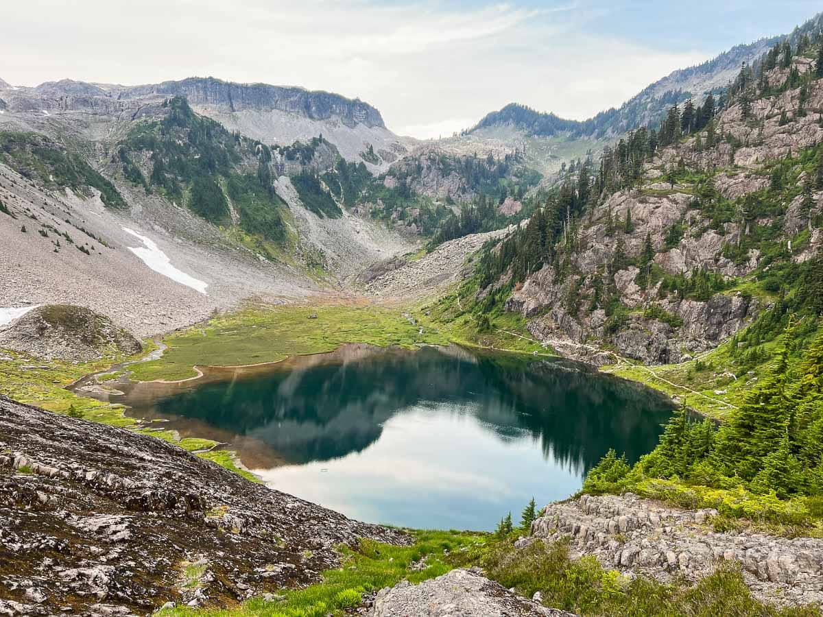
Starting from the Heather Meadows Visitor Center parking lot, the Fire and Ice Trail is the perfect introduction to the magnificent geological formations at Mount Baker.
Only half a mile long, this family-friendly loop trail runs through the small pond-and-mountain-hemlock- dotted valley between Table Mountain and Mount Herman.
It’s a fantastic interpretive trail, featuring several information signs that explain how volcanoes and glaciers, together, have shaped the marvelous scenery that surrounds you on all sides.
Along the way, you can also enjoy streamside wildflowers, birds frolicking in the meadows, and beautiful reflections in the valley’s many ponds.
Fire and Ice Trail Details
Distance: 0.5 miles, loop
Duration: 15 minutes
Elevation gain: 100 feet
Difficulty: Easy
Trailhead: Heather Meadows Visitor Center
Pets allowed: Yes
More information: https://www.wta.org/go-hiking/hikes/fire-and-ice-trail
4. Artist Ridge Trail to Huntoon Point
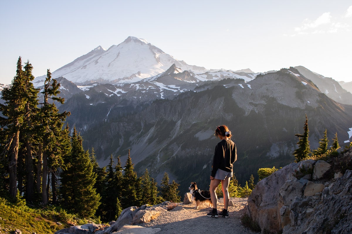
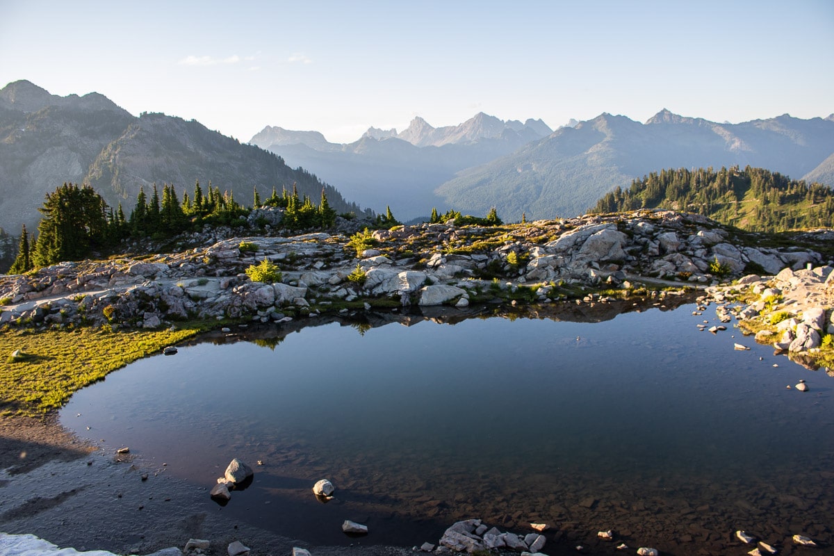
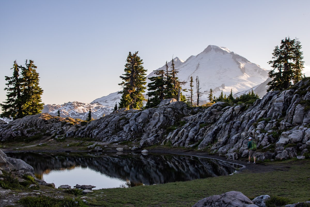
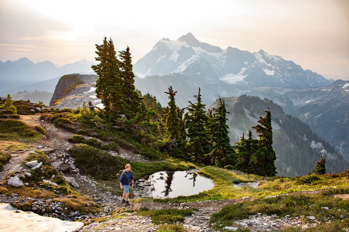
Arguably the best sunrise or sunset hike at Mount Baker, the Artist Ridge Trail to Huntoon Point offers huge rewards for very little effort.
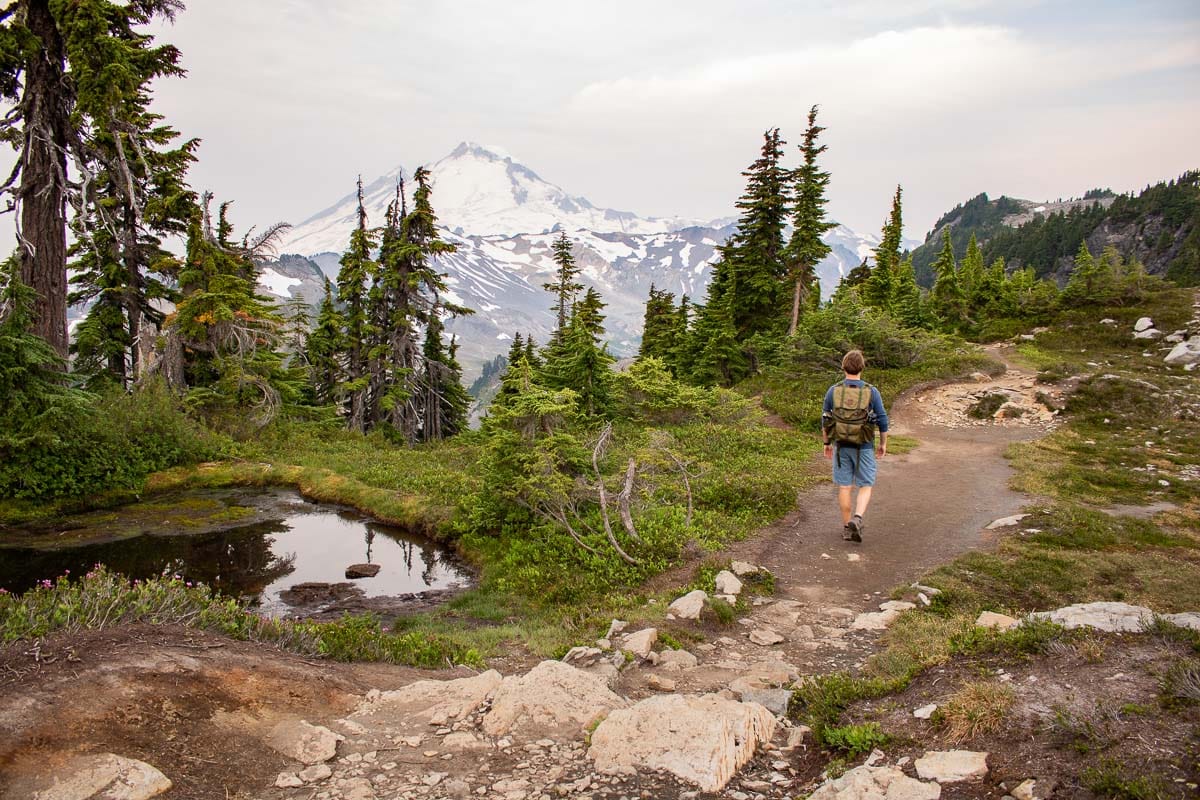
Starting from the sprawling Artist Point parking lot, this easy trail has no lack of epic vistas. Almost the entire way, you can admire panoramic views of both Mount Baker and Mount Shuksan, as well as Mount Larrabee and Goat Mountain.
Wildflowers line the trail, while a number of glacial tarns mirror the surrounding scenery beautifully—excellent places for photos.
Because of its relatively level grade and amazing landscapes, the Artist Ridge Trail is hugely popular at midday and in the afternoon. The best times to hike this trail, both to avoid the crowds and to enjoy the most beautiful light, are either at dawn or dusk.
This is easily one of the best day hikes at Mount Baker. Don’t miss it!
Artist Ridge Trail to Huntoon Point Details
Distance: 1.2 miles, lollipop
Duration: 45 minutes
Elevation gain: 200 feet
Difficulty: Easy
Trailhead: Southern side ofArtist Point parking lot
Pets allowed: Yes
More information: https://www.wta.org/go-hiking/hikes/artist-ridge
5. Wild Goose Trail
The Wild Goose Trail runs through the entire Heather Meadows area, from the Bagley Lakes parking lot all the way up to Artist Point.
On the way, it provides access to the Austin Pass Picnic Area, the Heather Meadows Visitor Center, and a few other hiking trails at Mount Baker.
The trail is generally considered to consist of two separate sections: the Lower Wild Goose Trail and the Upper Wild Goose Trail, each of which has a different level of difficulty.
5a. Lower Wild Goose Trail
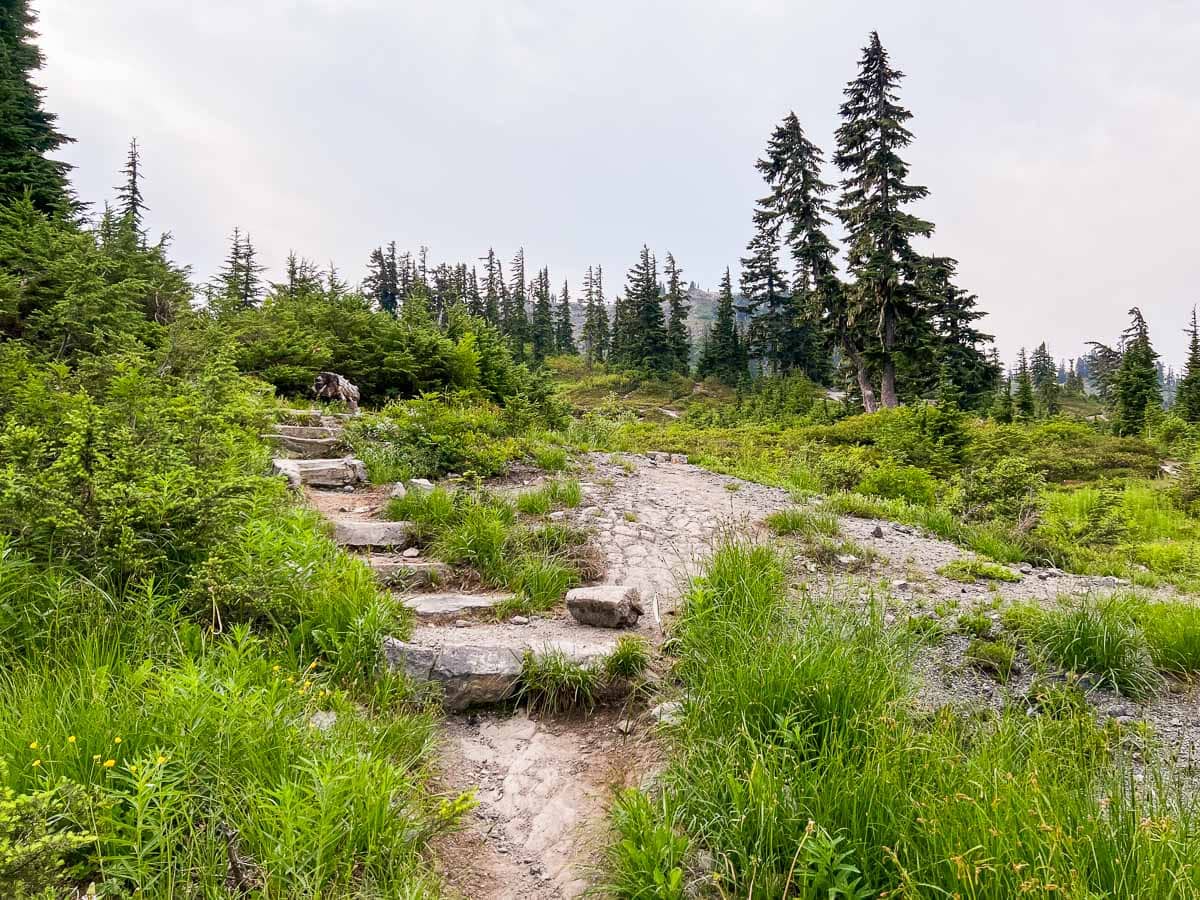
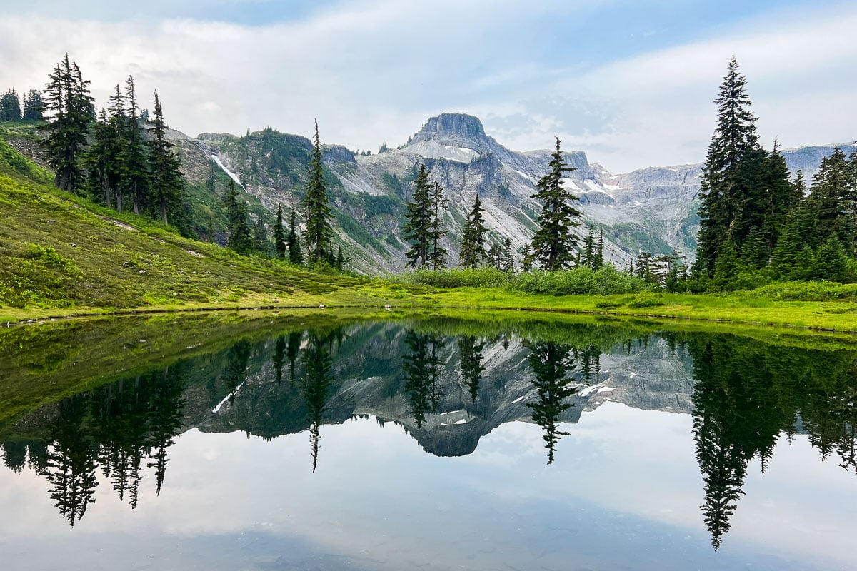
The Lower Wild Goose Trail travels from Bagley Lakes to the Austin Pass Picnic Area and is an easy 1.5-mile out-and-back hike.
It parallels the Bagley Lakes Trail below and provides fine views of the Heather Meadows scenery. Combine it with the wonderful Fire and Ice Trail (see above) for an extended hike.
Lower Wild Goose Trail Details
Distance: 1.5 miles, out and back
Duration: 45 minutes
Elevation gain: 200 feet
Difficulty: Easy
Trailheads: Wild Goose Trailhead at Bagley Lakes, Meadows Visitor Center, and Austin Pass Picnic Area
Pets allowed: Yes
5b. Upper Wild Goose Trail
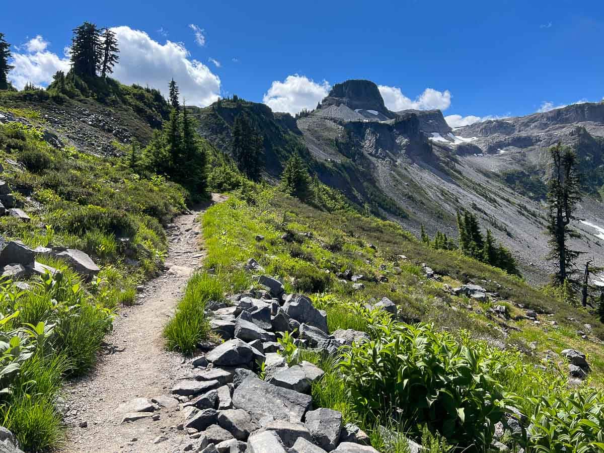
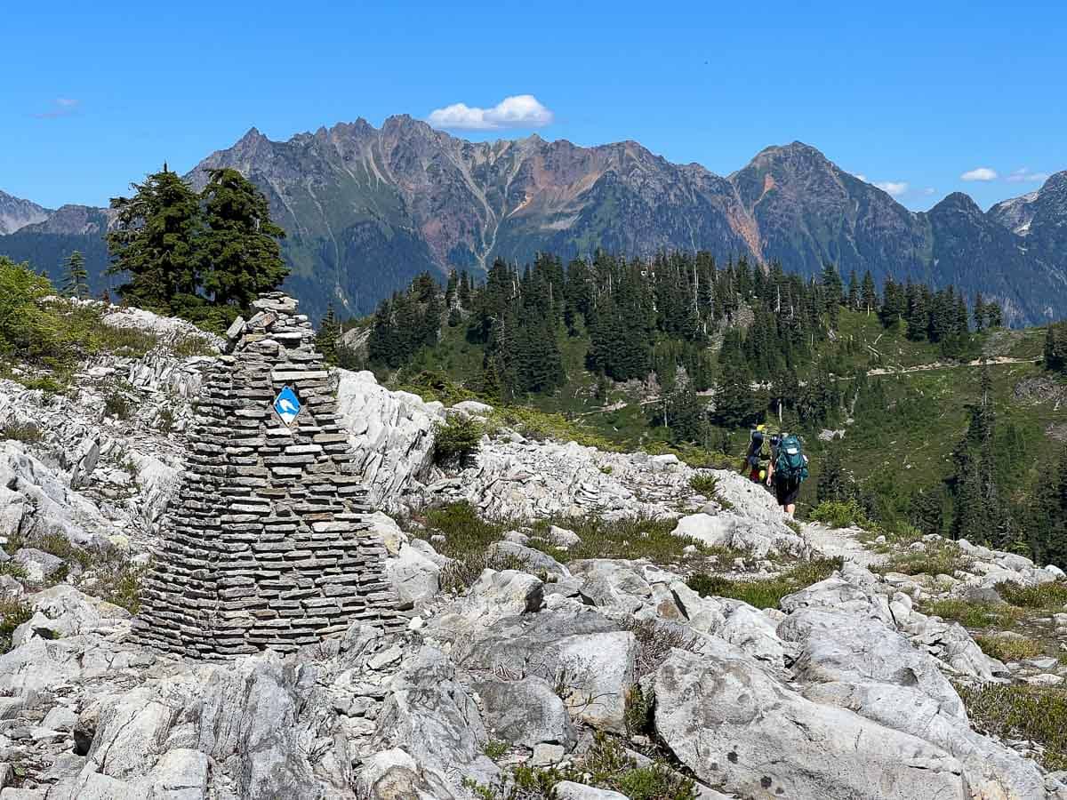
The Upper Wild Goose Trail, on the other hand, starts at Terminal Lake near the Austin Pass Picnic Area and climbs rather steeply to Artist Point, providing jaw-dropping views of Heather Meadows below.
This is a moderate-to-difficult hike due to its significant elevation gain, much of which is on a series of stairs.
The Upper Wild Goose Trail is part of the Chain Lakes Loop (see below), so if you’re doing that hike, which I absolutely recommend, there’s no need to do it separately.
If you’re not planning on hiking the Chain Lakes Trail, however, the Upper Wild Goose Trail is fantastic when combined with the Artist Ridge Trail that starts at Artist Point (see above).
Upper Wild Goose Trail Details
Distance: 1.4 miles, out and back
Duration: 45 minutes
Elevation gain: 1,100 feet
Difficulty: Moderate/difficult
Trailheads: Meadows Visitor Center, Austin Pass Picnic Area, and Artist Point parking lot
Pets allowed: Yes
More information: https://www.wta.org/go-hiking/hikes/wild-goose
6. Bagley Lakes Loop
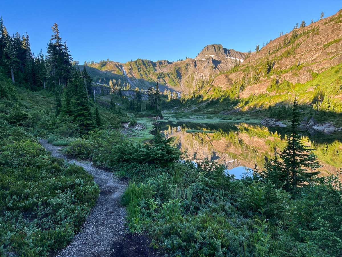
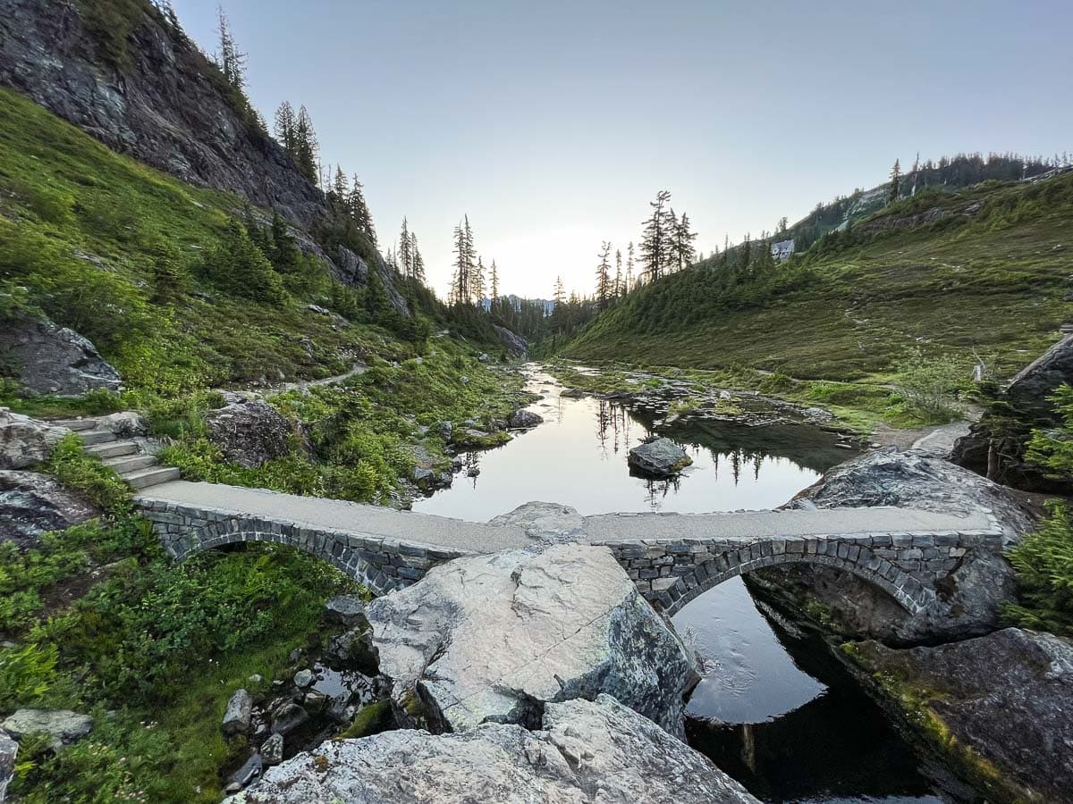
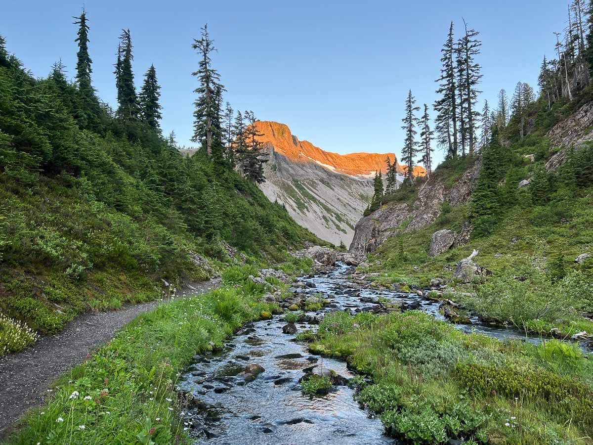
I hiked the Bagley Lakes Loop at sunrise in early-August and it was sensational. Although it’s neither long nor challenging, it’s one of my favorite Mount Baker hikes.
Starting from the Wild Goose Trail and Bagley Lakes Trailhead, which is clearly signed on the Mount Baker Highway, the trail parallels the east shore of Lower Bagley Lake.
The surrounding cliffs are mirrored wonderfully in the lake’s still water, while Table Mountain dominates the landscape ahead. Look around you for a variety of colorful wildflowers.
The first section of the Bagley Lakes Loop ends at a scenic stone bridge, which sits at the east end of Upper Bagley Lake.
Cross the bridge and loop back to the trailhead along the opposite, northwest side of Lower Bagley Lake.
Easy and with lots to see on the way, this is an excellent hike for families with small children.
Bagley Lakes Loop Details
Distance: 2 miles, loop
Duration: 1 hour
Elevation gain: 150 feet
Difficulty: Easy
Trailheads: North access from Bagley Lakes Trailhead near Mt. Baker Ski Area; south access from the Heather Meadows Visitor Center
Pets allowed: Yes
More information: https://www.wta.org/go-hiking/hikes/bagley-lakes
7. Table Mountain Trail
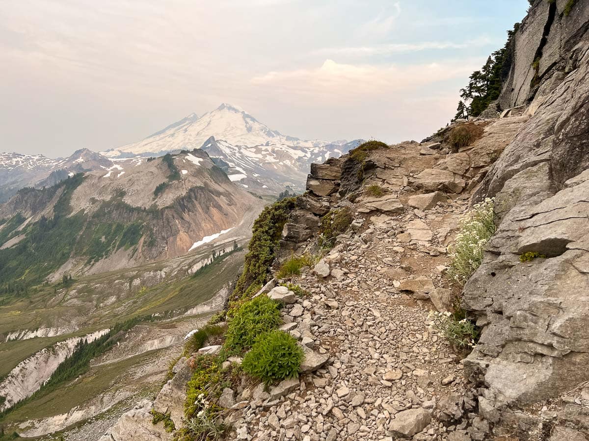
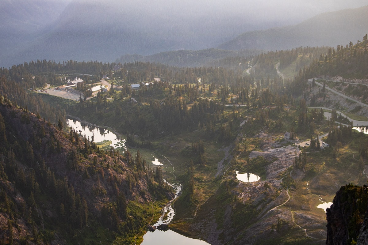
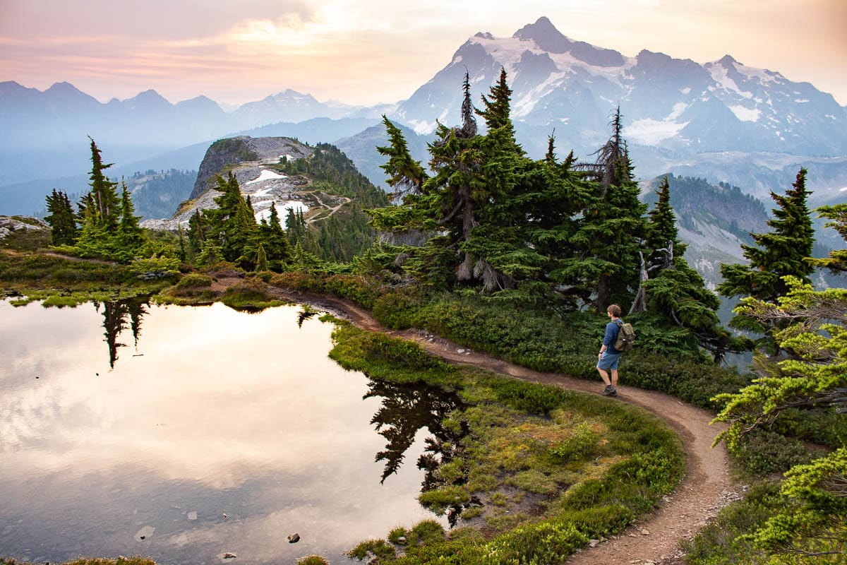
Without question one of the coolest day hikes at Mount Baker, the Table Mountain Trail ascends one of the area’s most prominent geological formations.
“The dramatic andesite plateau of Table Mountain is one of the first mountains you see entering the Heather Meadows area,” the Forest Service says.
It’s visible from many places in and around Heather Meadows, as well as from other Mount Baker trails, particularly from the Bagley Lakes Trail, Fire and Ice Trail, Wild Goose Trail, and Chain Lakes Trail.
The Table Mountain Trail itself, on the other hand, allows you to climb to the top of this very formation. Although not overly long, it does involve a series of very steep and exposed switchbacks on the side of the cliffs.
As such, it’s not recommend for people with a fear of heights, limited mobility, balance issues, or for small children.
Because of its steepness and challenging terrain, this is the only trail at Mount Baker where dogs are not allowed.
After traversing Table Mountain’s southeast face, you’ll emerge on a large plateau at the top. Here, the trail continues, relatively flatly, across this extraordinary plateau high above the valleys below.
The views from the top are magnificent and panoramic. Major landmarks you can see include the Chain Lakes Trail far below, Ptarmigan Ridge, Heather Meadows and its numerous tarns, and Mount Baker, Mount Shuksan, and other peaks of the North Cascades. Return the same way you came.
Table Mountain Trail Details
Distance: 2.6 miles, out and back
Duration: 1 hour 30 minutes
Elevation gain: 725 feet
Difficulty: Moderate
Trailhead: Western side of Artist Point parking lot
Pets allowed: No
More information: https://www.wta.org/go-hiking/hikes/table-mountain
8. Horseshoe Bend Trail
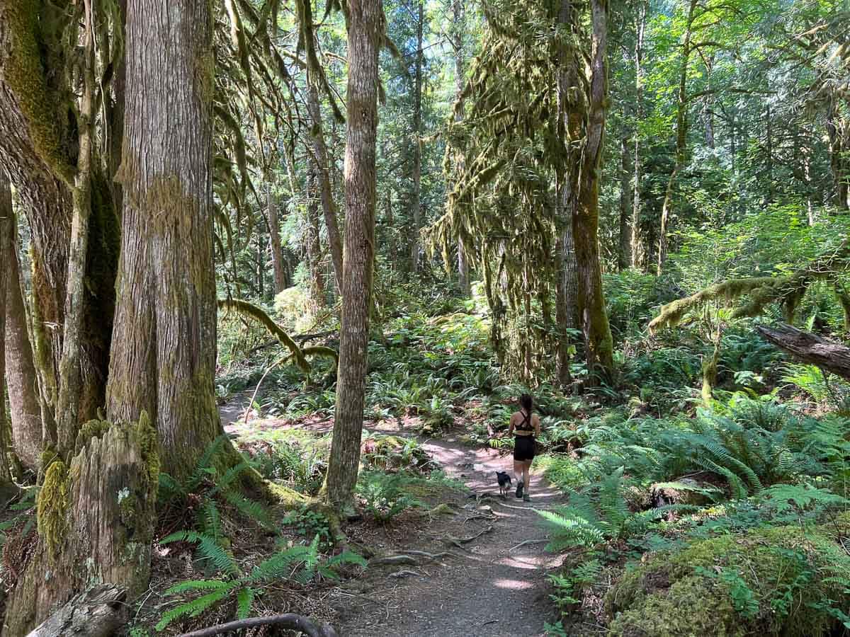
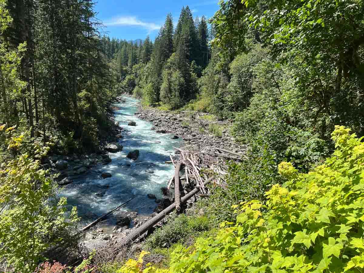
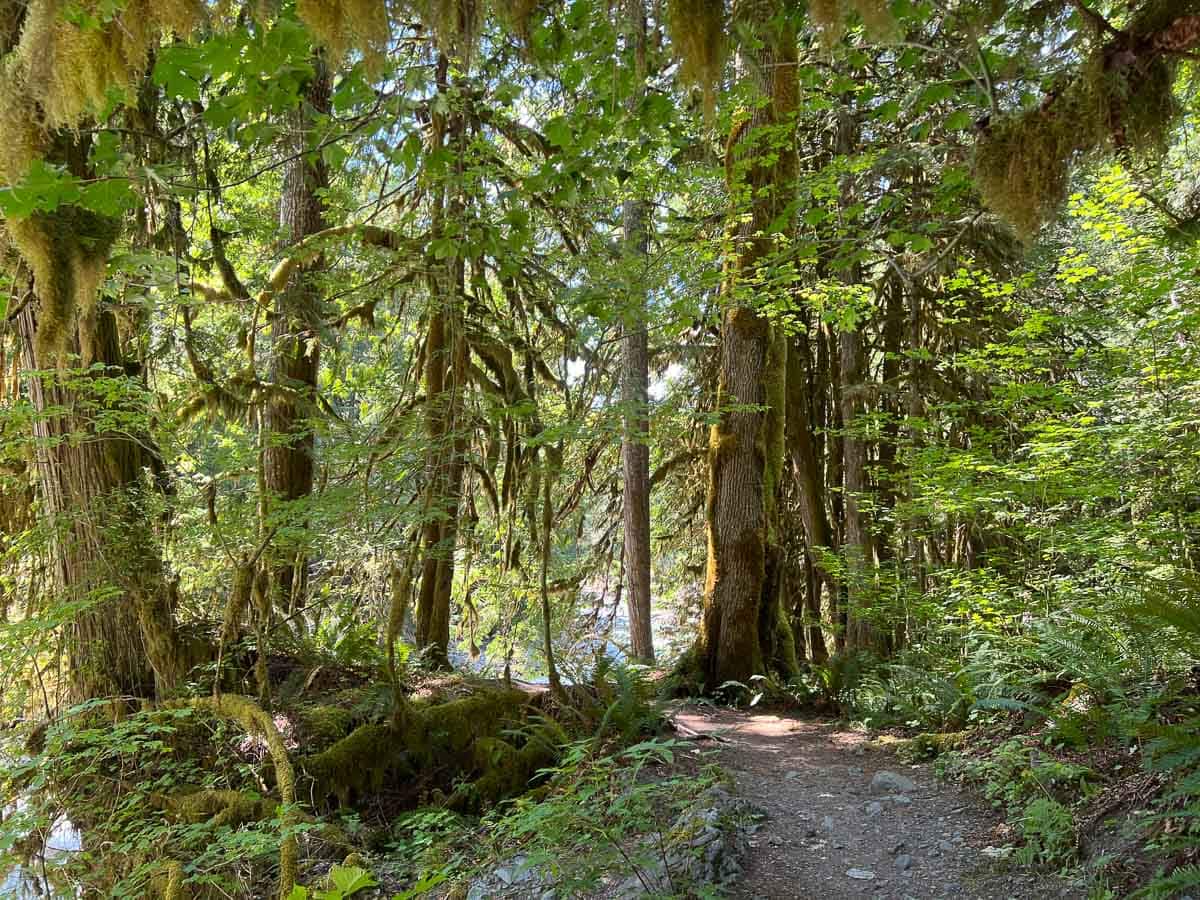
A wonderous woodland walk, the Horseshoe Bend Trail is not located in Mount Baker’s popular Heather Meadows area.
Instead, you’ll find it about 2 miles east of the village of Glacier, across the road from the Douglas Fir Campground. The trailhead itself is not signed from the road, but the entrance to the campground is easily visible and quite obvious.
One of only a few trails near Mount Baker that is open and hikeable all year, the Horseshoe Bend Trail follows the North Fork Nooksack River through a typical Pacific Northwest forest.
You’ll walk through verdant patches of ferns, past marvelous moss-covered maples, and underneath towering and ancient evergreens.
All the while, the raging water of the river, which is fed by Mount Shuksan’s glaciers, are always within view or earshot, or both.
There are no wide-open panoramas or mighty peaks to be seen here. Instead, you get to immerse yourself in a lush temperate rain forest and experience the power of a glacial river.
The Horseshoe Bend Trail is a great hike to simply enjoy the littler things, with all your senses.
From hearing the sounds of water and smelling the scents of the forest to feeling the different kinds of mosses and even tasting edible berries like huckleberries and salmonberries, this is one of the most sensory and experience-rich hikes at Mount Baker.
Horseshoe Bend Trail Details
Distance: 2.4 miles, out and back
Duration: 1 hour 30 minutes
Elevation gain: 220 feet
Difficulty: Easy
Trailhead: Right across the road from the entrance to Douglas Fir Campground on Mt. Baker Highway 542, about 2 miles east of Glacier
Pets allowed: Yes
More information: https://www.wta.org/go-hiking/hikes/horseshoe-bend
9. Chain Lakes Loop
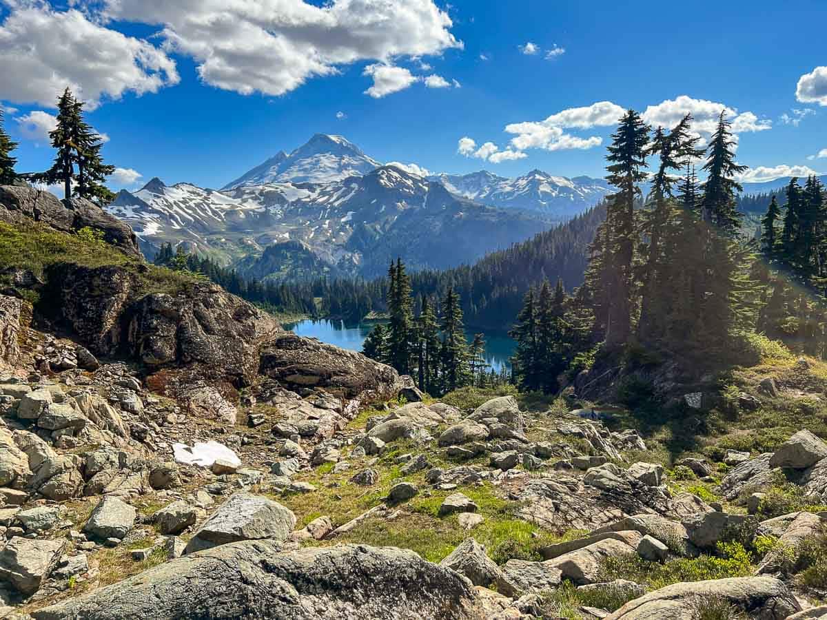
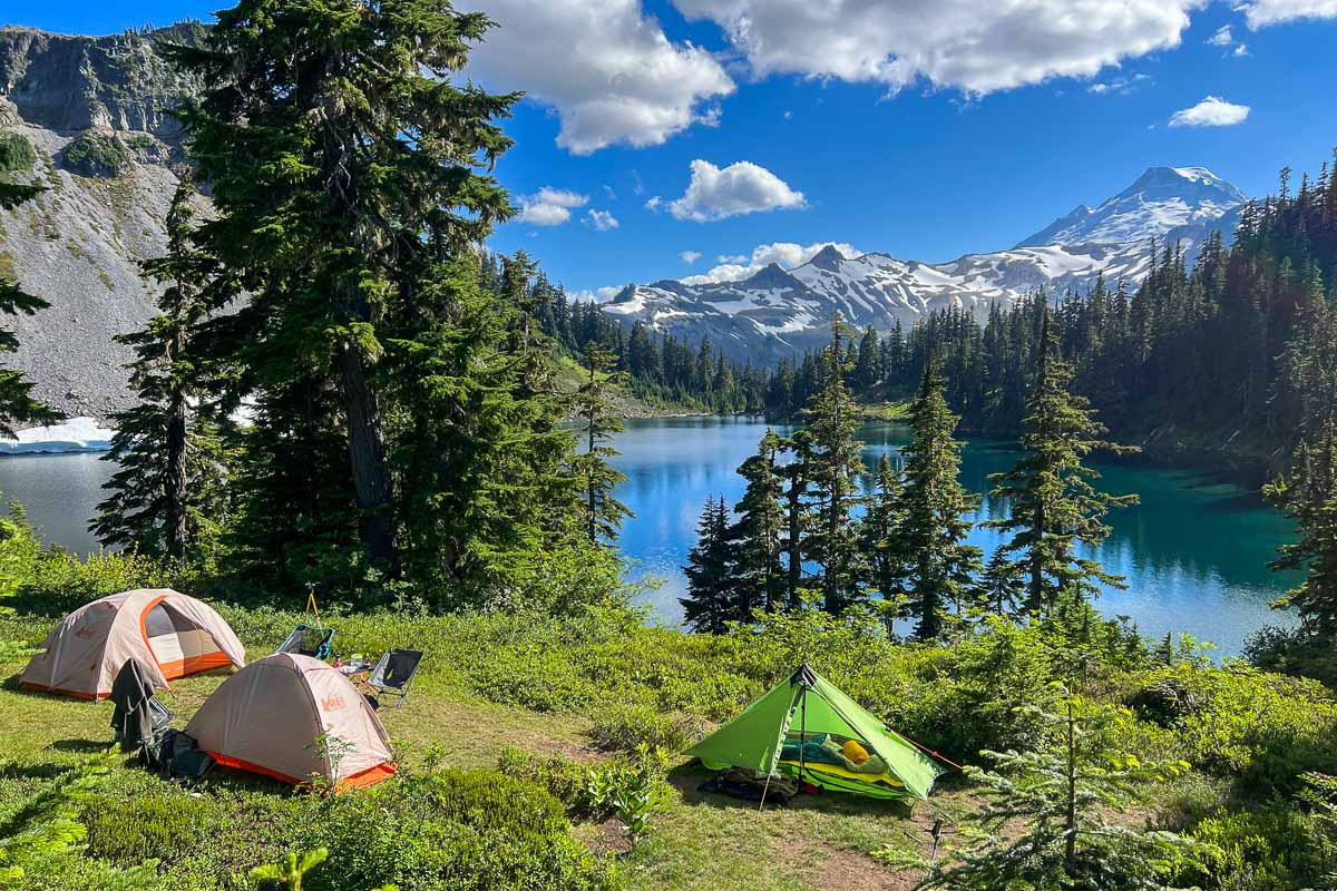
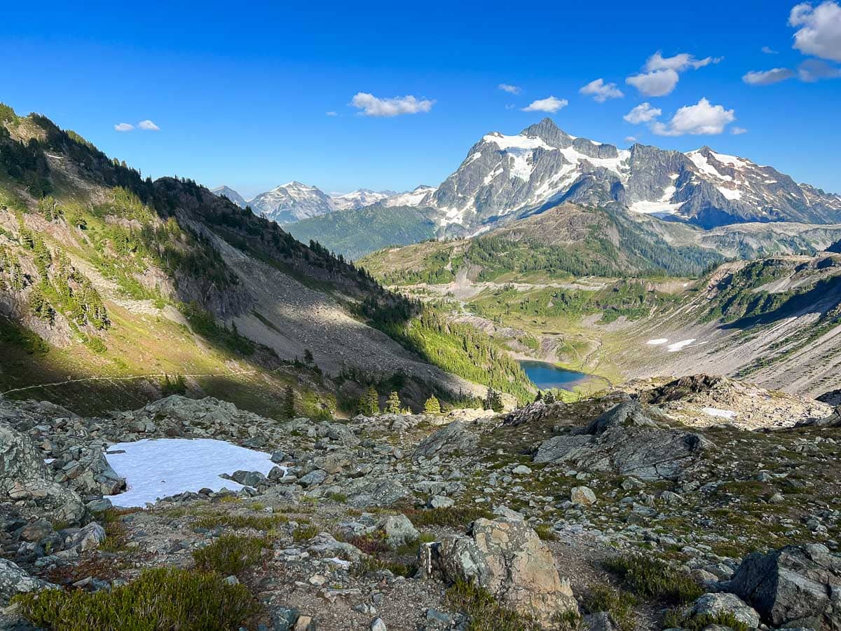
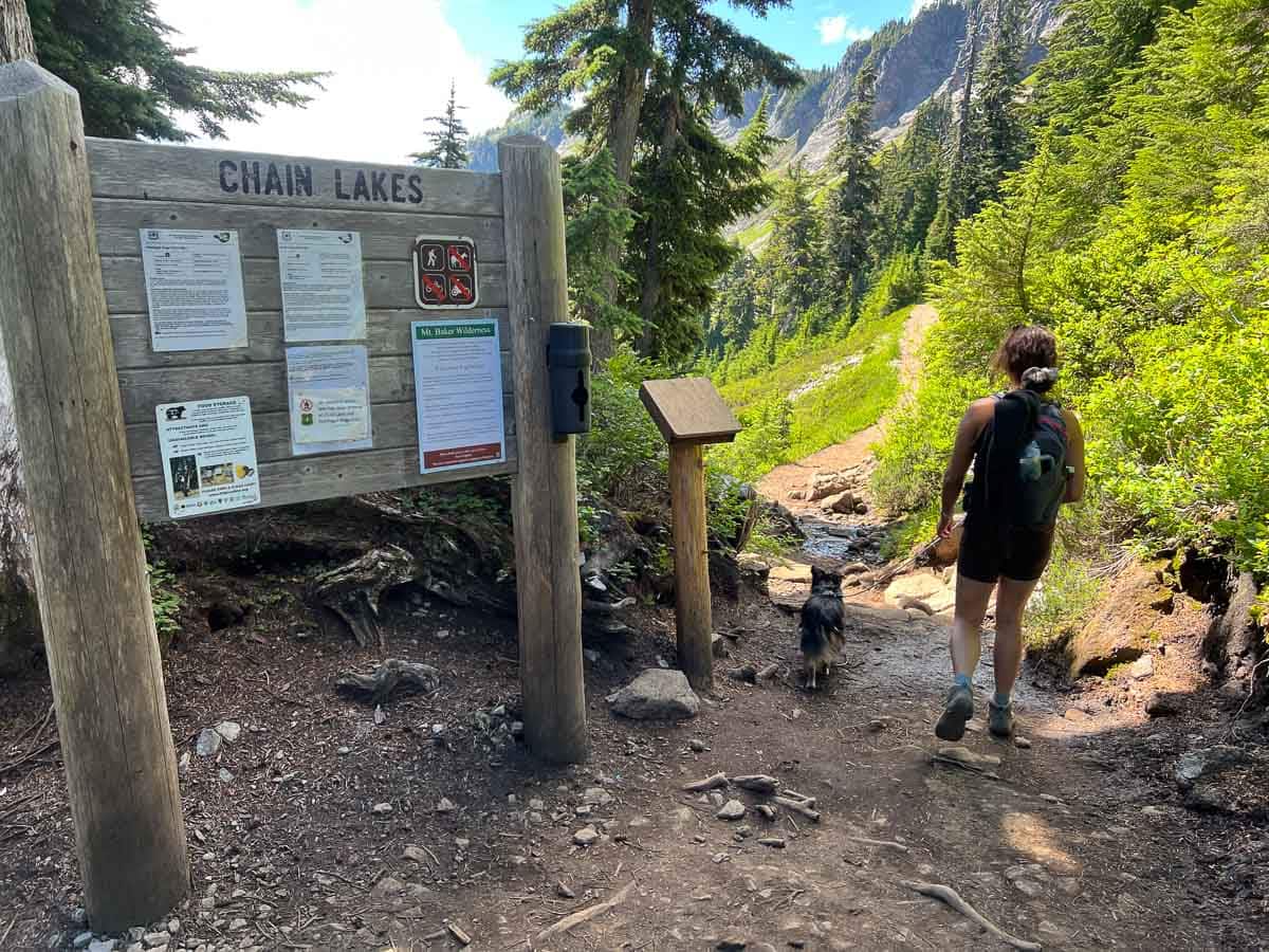
The superb Chain Lakes Loop is arguably the number one hike at Mount Baker’s Heather Meadows. It’s a 6.5-mile loop with views that don’t stop. Literally.
There are ever-changing views all along the trail, whether it’s of Mount Baker itself, Table Mountain, Iceberg Lake, Hayes Lake, or Mount Shuksan.
The scenery is gorgeous, the hike varied, the wildflowers abundant, and the memories unforgettable.
There are two directions in which you can hike the Chain Lakes Loop: clockwise or counter-clockwise. Both options have their benefits and disadvantages, as well as their proponents and critics.
I, myself, prefer to hike the Chain Lakes Trail clockwise, starting from the Austin Pass Picnic Area near the Heather Meadows Visitor Center.
This way, you’ll get the steep climb on the Upper Wild Goose Trail out of the way first, when your legs are still fresh. Once you’re at Artist Point, cross the large parking lot to the “actual” Chain Lakes Loop trailhead.
You’ll hike towards Mount Baker for about a mile, before turning right at the intersection with the Ptarmigan Ridge Trail. The trail then descends a bit towards Mazama, Iceberg, and Hayes Lakes, before climbing quite steeply to Herman Saddle.
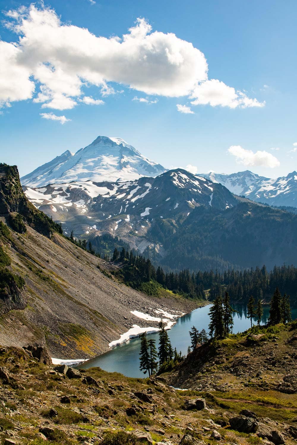
In my opinion, the Herman Saddle area has the best views on the entire Chain Lakes Loop. Looking to the southwest, you can see Iceberg Lake backed by mighty Mount Baker.
When you direct your gaze eastward, on the other and, there’s an unobstructed view of striking Mount Shuksan.
The descent from Herman Saddle to Upper Bagley Lake is long, gradual and relatively uneventful, but this is a great area to look and listen for marmots and pikas.
Cross the stone bridge at Upper Bagley Lake toward the Heather Meadows Visitor Center and back to your starting point.
Chain Lakes Loop Details
Distance: 6.5 miles
Duration: 4 hours
Elevation gain: 1,820 feet
Difficulty: Challenging
Trailheads: Austin Pass Picnic Area, Heather Meadows Visitor Center, and Artist Point parking lot
Pets allowed: Yes
More information: https://www.wta.org/go-hiking/hikes/chain-lakes-3
10. Yellow Aster Butte Trail
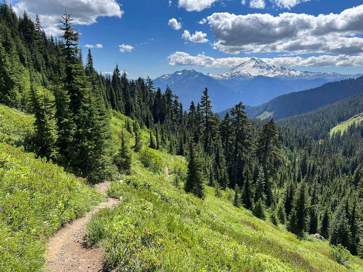
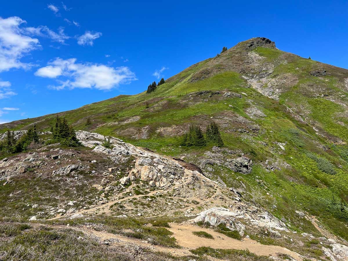

With an elevation gain of more than 2,500 feet, the Yellow Aster Butte Trail is one of the most challenging day hikes near Mount Baker. Yet, it’s absolutely spectacular and well worth your time and effort. The views are fantastic.
This trail is not in Heather Meadows, but it’s actually way to the north on the High Divide, on the other side of the Nooksack River.
The trailhead is about 4.5 miles up the Twin Lakes Road, also known as Forest Road 3065. Note that this is a pretty bumpy road lined with sometimes deep potholes, which is why I’d recommend AWD or 4WD. Our Subaru Forester did just fine on this road.
The first section of the Yellow Aster Butte Trail is primarily through an old forest. This is a steep section, too, gaining almost 1,500 feet of elevation in just 1.5 miles.
Once you emerge out of the woods and onto the open meadow area, the trail becomes a bit easier. This is by far the most beautiful part of the hike, the reward for that steep ascent.
Look around you and notice all the different types of wildflowers that thrive in these subalpine meadows. From lupines and Indian paintbrush to heather and, of course, asters, this truly is a wildflower paradise.
The trail gently meanders up the slopes to an unsigned junction. This is a great place for a break and to enjoy the spectacular panoramic view to the south, including both Mount Shuksan and Mount Baker, and numerous other North Cascades peaks.
If you’re not tired yet, you can continue the ascent to the very top of Yellow Aster Butte, where the views are a full 360 degrees and extend into Canada to the north.
Yellow Aster Butte Trail Details
Distance: 7.5 miles, out and back
Duration: 5 hours
Elevation gain: 2,550 feet
Difficulty: Challenging
Trailhead: Approximately 4.5 miles up Twin Lakes Road (Forest Road 3065), which is on the left just past the WSDOT Shuksan maintenance building on Mt. Baker Highway 542
Pets allowed: Yes
More information: https://www.wta.org/go-hiking/hikes/yellow-aster-butte
More Amazing Day Hikes at Mount Baker
Besides all the Mount Baker day hikes I’ve described in this blog post, there are lots of other excellent trails to explore in the general Mount Baker area.
Below are several more day hikes at Mount Baker that were recommended to me. Unfortunately, for reasons ranging from time constraints to indefinite road closures, I haven’t had the opportunity to do these hikes yet. I will in the future, though, and I’ll update this Mount Baker day hikes list accordingly.
– Ptarmigan Ridge Trail – 9 miles, challenging
– Lake Ann Trail – 8.2 miles, challenging
– Damfino Lakes Trail to Excelsior Peak – 5.6 miles, moderate/challenging
– Church Mountain Trail – 8.5 miles, challenging
– Welcome Pass Trail – 4.6 miles, challenging
– Winchester Mountain Trail – 3.4 miles, moderate
– Goat Mountain Trail – 8.2 miles, challenging
– Hannegan Pass and Peak Trail – 10.2 miles, very challenging
– Heliotrope Ridge Trail – 5.5 miles, moderate (UNREACHABLE BY VEHICLE UNTIL FURTHER NOTICE DUE TO ROAD WASH-OUT)
– Skyline Divide Trail – 9 miles, challenging (UNREACHABLE BY VEHICLE UNTIL FURTHER NOTICE DUE TO ROAD WASH-OUT)
Map of the Best Day Hikes Near Mount Baker
This map shows the approximate locations of all the Mount Baker trails mentioned above: the ten featured trails (that I’ve done) and the ten other trails (that I haven’t done myself yet).
For exact trailhead locations, I encourage you to check out the “more information” links I’ve included with each trail description.
