23 Spectacular Day Hikes in the National Parks
It’s no secret that spending time outdoors has a variety of health benefits. From a stroll in your neighborhood park to day hikes in national parks or long backpacking trips, there’s that intangible feeling you get when you’re in nature.
In fact, a bunch of scientific research supports and proves that spending time in nature—and even just looking at natural scenes—is good for your overall wellbeing, both mentally and physically, even spiritually.
There’s nothing quite like long day hikes in one of America’s national parks to really get away from it all. Almost all national parks have many miles of trails, whether it’s in the mountains, deserts, forests or along coasts. Below, I’ve listed some of the most epic day hikes in the national parks.
This post about the best day hikes in the national parks contains affiliate links. You can read more about our Terms of Use / Disclosure here.
23 Spectacular Day Hikes in the National Parks
May these world-class hikes inspire you to get out and visit a national park, immerse yourself in America’s spectacular landscapes and—quite literally—become a better person.
After all, going on regular national park day hikes will lower your levels of stress, anxiety and depression, effectively making you happier. Exercise, of course, also has physical results, as you get stronger and in better shape after each hike. A happier mind plus a fitter body equals an all-round better human being!
Okay, I realize I might just have wasted a few paragraphs trying to convince you of something you probably already know.
So, let’s move on and check out some of those legendary day hikes in America’s national parks.
Angels Landing Trail, Zion National Park
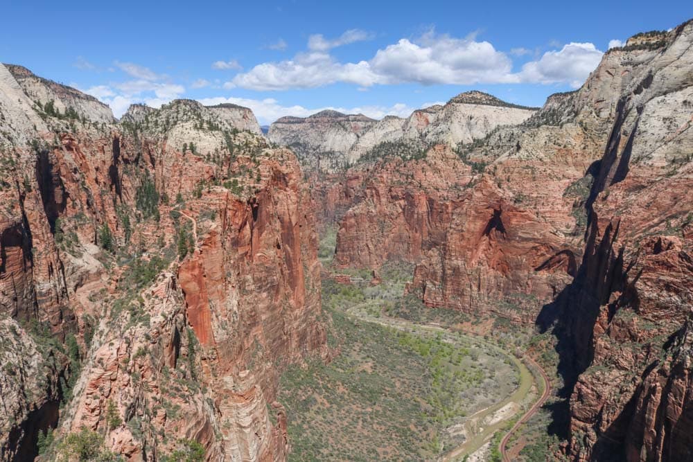
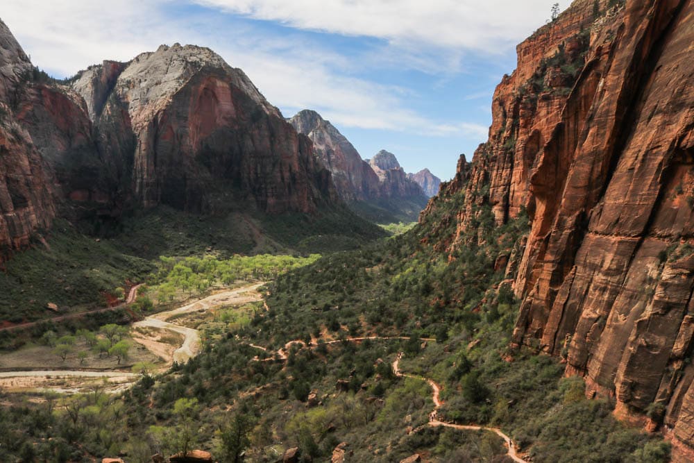
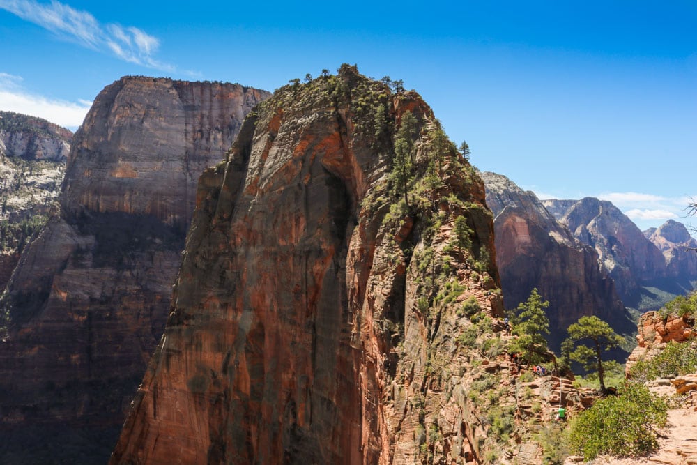
One of the most (in)famous day hikes in the national parks, Angels Landing in Zion National Park is a hike that often features on lists of “the world’s most dangerous hikes.”
And while it can be dangerous, when done with care and caution, it’s also among the most memorable national park day hikes you could ever do.
Accessed via the West Rim Trail, across the road from the Grotto shuttle stop, Angels Landing is a massive rock formation in the heart of Zion Canyon.
This challenging trail involves a series of switchbacks known as Walter’s Wiggles, as well as a traverse of a sometimes ridiculously narrow ridge. Steel cables and chains offer welcome assistance on this spectacular ascent.
Once at the top, you get to enjoy one of the absolute best views in Zion National Park, taking in the massive cliffs of Zion Canyon and the meandering Virgin River.
The awesomeness of Angels Landing is known far and wide, however, and this is one of the most popular day hikes in the national parks system. So, I’d recommend starting your hike as early in the morning as possible, preferably on a weekday. Hiker jams are not unusual on this narrow, steep and slow climb.
If it’s too busy, the Observation Point Trail is an excellent alternative.
- Distance: 5.4 miles (out and back)
- Duration: 3-4 hours
- Difficulty: Moderate to strenuous
More About Zion National Park
- Park Website
- Travel Guide
- Topographic Map
- Best Zion Hikes
- Best Views in Zion National Park
- Accommodation
Bright Angel Trail, Grand Canyon National Park
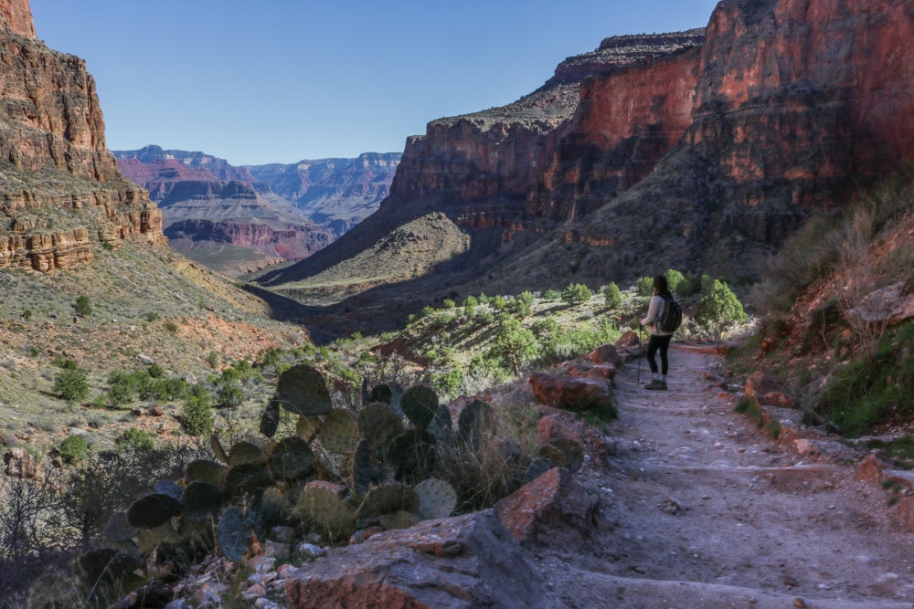
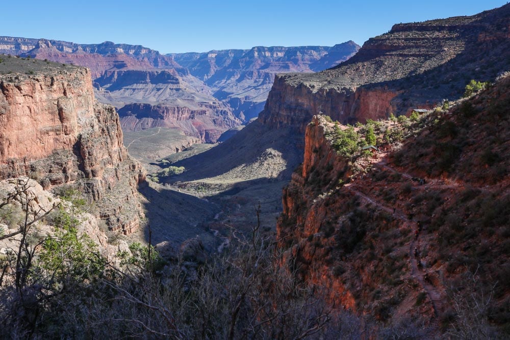
This is one of the most popular hikes in Grand Canyon National Park. It’s a phenomenal hike, equally as challenging as it is rewarding.
Starting from the mule corral near Bright Angel Lodge, the Bright Angel Trail’s countless switchbacks take you down the upper canyon cliffs, offering a unique perspective of the true grandeur of the Grand Canyon.
That first section is pretty steep—remember that for the way back up—but the trail does flatten out a bit once you’re on the lower plateau.
The most popular stopping point on this hike is Indian Garden, well down into the canyon, which has a campground, water and another mule corral. This is where mule excursions turn back.
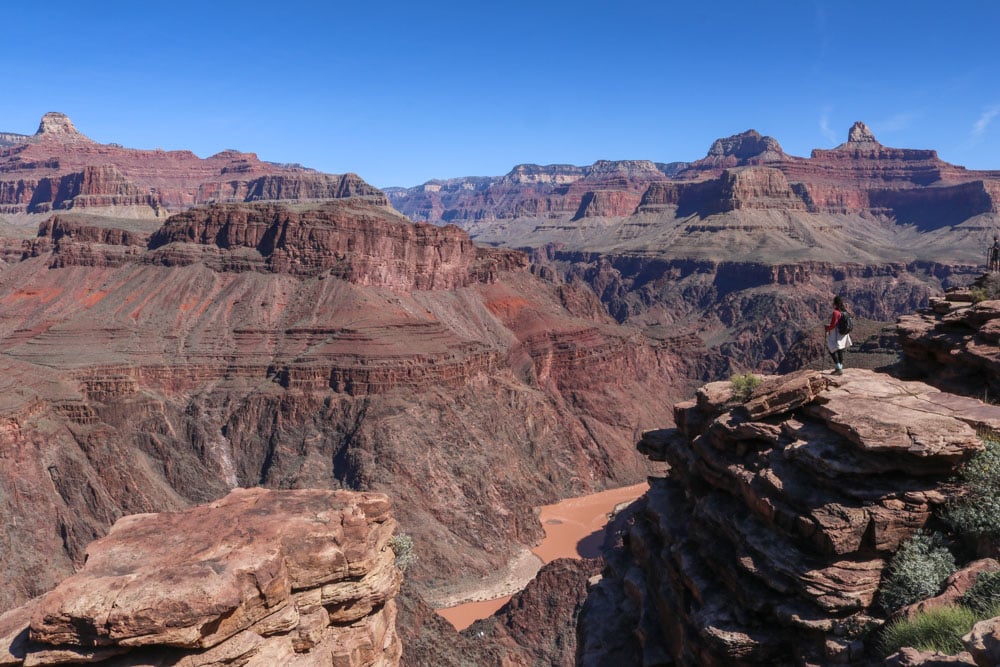
Because the National Park Service does not recommend that you hike down to the river and back up in one day, I suggest that you hike to Plateau Point instead of following the Bright Angel Trail down to the Colorado River. This is a doable day hike for in-shape hikers.
The one-way distance of this immersive hike is 6 miles. There are resthouses after every 1.5 miles—1.5 Mile Resthouse, 3 Mile Resthouse and Indian Garden. Note that Indian Garden has potable water year-round, but water is available at the resthouses only seasonally. Carry plenty of water anyway.
Remember that the hardest part of this trail is the ascent back to the South Rim. Don’t misjudge the trail’s difficulty and your own ability on the relatively easy descent. It takes twice as long to hike back up as it does to get down.
- Distance: 12 miles (out and back)
- Duration: 5-8 hours
- Difficulty: Very strenuous
More About Grand Canyon National Park
- Park Website
- Travel Guide
- Topographic Map
- Best Grand Canyon Hikes
- Top Things To Do in Grand Canyon National Park
- Accommodation
Brokeoff Mountain Trail, Lassen Volcanic National Park
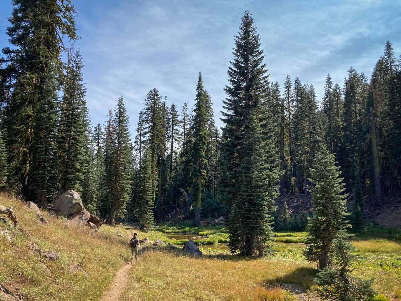
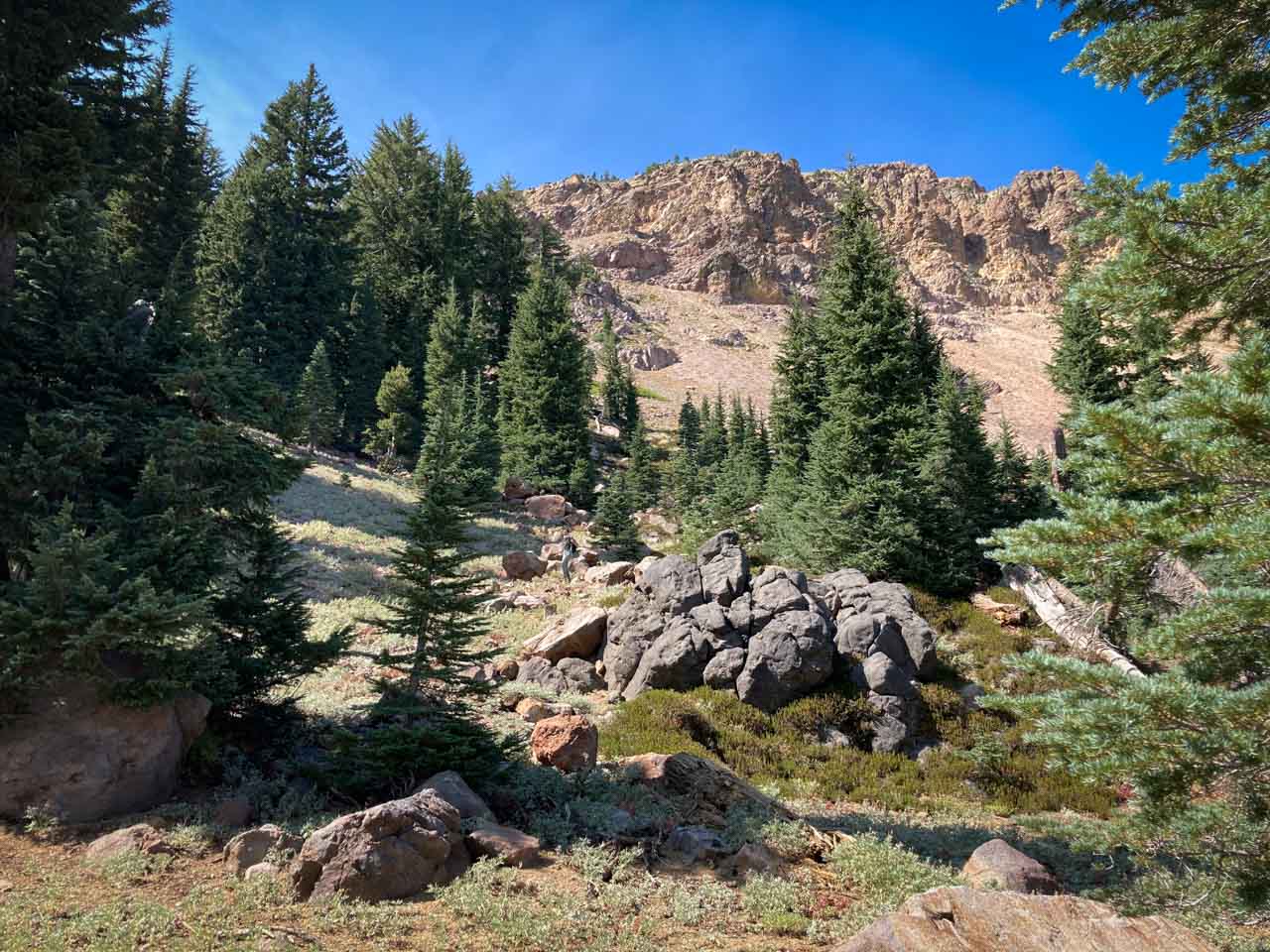
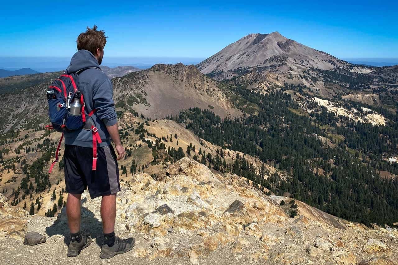
One of my favorite strenuous national park day hikes, the hike to the summit of Brokeoff Mountain is long, challenging, varied and, above all else, spectacular.
If you’re looking for a day hike that offers solitude, a sense of adventure and remoteness, and wild mountain scenery, this is the best hike in Lassen Volcanic National Park.
The trailhead is a quarter-mile south of the Southwest Entrance, across the road from a small roadside parking lot. Note that, although it’s outside of the park’s entrance, you’re still technically within the park’s boundaries and still have to pay the entry fee—or display your America the Beautiful Pass.
The 3.7-mile trek to the top of Brokeoff Mountain comes with an elevation change of 2,600 feet. The total roundtrip distance is 7.4 miles. On the way, you’ll hike through wonderful woodland scenery, across gorgeous meadows, underneath steep slopes and, finally, on an exposed section above the timberline.
The top of Brokeoff Mountain, which is part of a composite volcano, one of the park’s four types of volcanoes, offers sensational views of Lassen Peak and the rest of the national park to the northeast.
Various birds and deer are common sights on the trail, while black bears are occasionally seen as well. So, be aware, know what to do when you see a black bear and carry bear spray.
- Distance: 7.4 (out and back)
- Duration: 5-6 hours
- Difficulty: Strenuous
More About Lassen Volcanic National Park
- Park Website
- Travel Guide
- Topographic Map
- Best Lassen Volcanic Hikes
- Top Things To Do in Lassen Volcanic National Park
- Accommodation
Bryce Amphitheater Figure 8 Loop, Bryce Canyon National Park
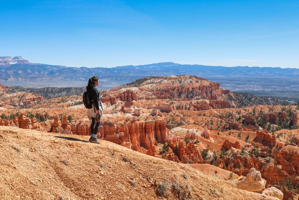
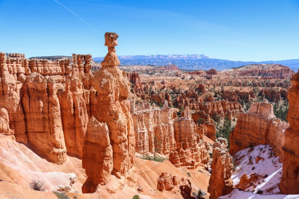
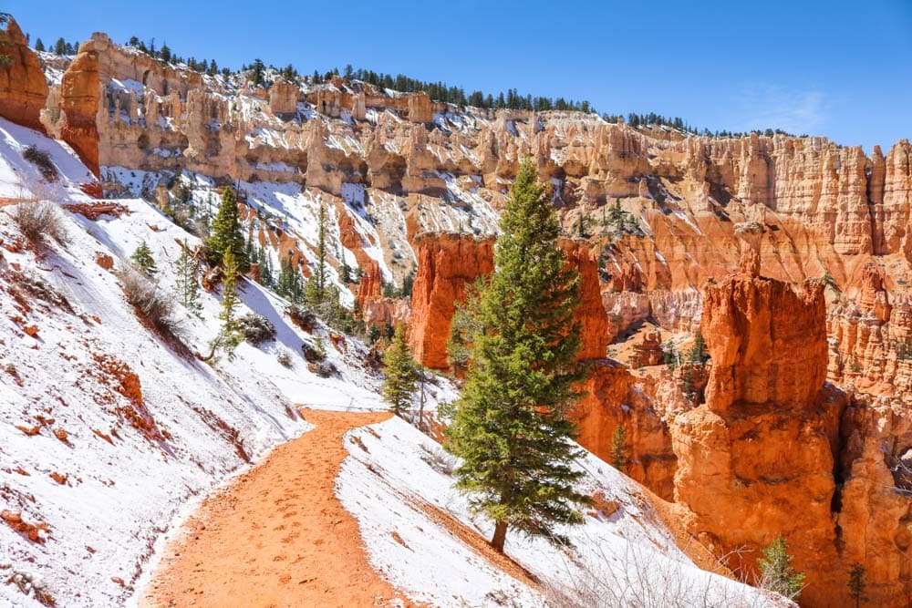
The network of hiking trails in Bryce Amphitheater in Bryce Canyon National Park, Utah allows you to create a bunch of different day hikes. From short and easy to long and strenuous, all kinds of hikes are possible in these spectacular setting.
One of my favorite options is the Bryce Amphitheater Figure 8 Loop. This world-class day hike combines three trails in Bryce Amphitheater—the Peekaboo, Navajo Loop and Queen’s Garden Trails.
All of those are excellent day hikes on their own, too, but together they’re simply sensational.
You can start the Figure 8 Loop in Bryce Canyon National Park at either Sunrise Point or Sunset Point. As the name indicates, it’s a double loop in the shape of the number 8, which takes you past essentially all major landmarks in Bryce Amphitheater. Awesome!
- Distance: 6.4 miles (double loop)
- Duration: 4 hours
- Difficulty: Strenuous
More About Bryce Canyon National Park
Chimney Rock Loop, Capitol Reef National Park
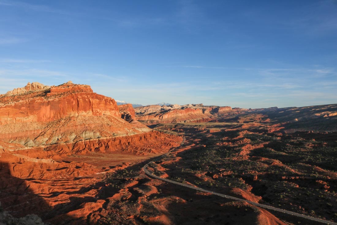
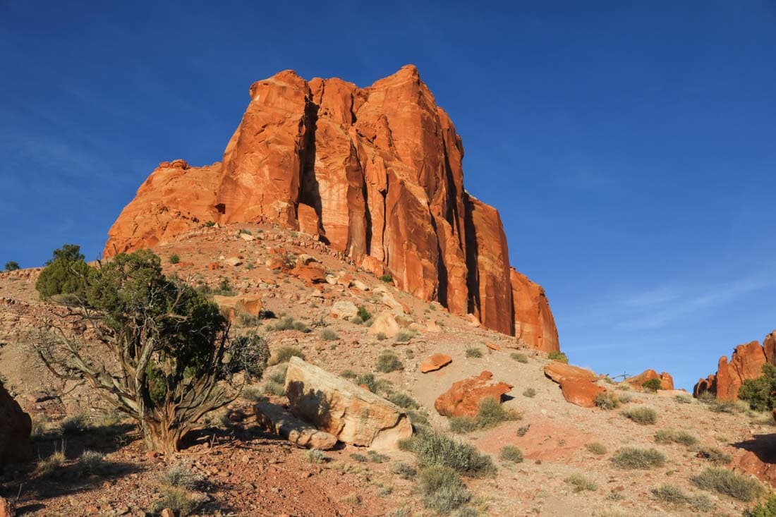
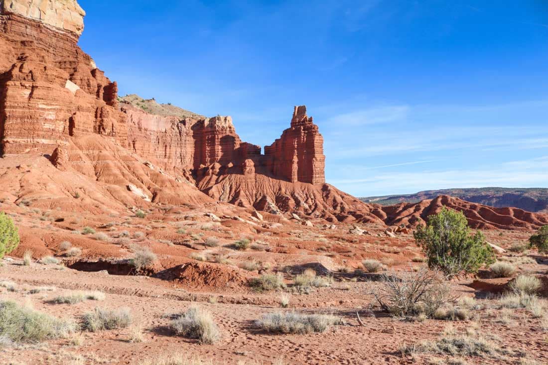
This might just be the best hike in Capitol Reef National Park under 4 miles. Chimney Rock is one of the first striking natural features you’ll see after entering this underrated national park from the west. The parking lot is on the left side of the road.
The Chimney Rock Trail climbs up to and loops around the red-rock plateau behind Chimney Rock. On the way, you’ll have fantastic views of this imposing rock formation.
Besides the initial climb, this superb desert hike is actually fairly easy. It’s classified as strenuous, though, but that’s mainly because of that first steep section, which involves most of the total elevation gain of 590 feet.
On the plateau, the views are breathtaking. You can clearly see the cliffs of the Waterpocket Fold, the 100-mile-long geological wrinkle in the Earth that runs through Capitol Reef National Park. This hike is especially beautiful in the evening, just before sunset.
- Distance: 3.6 miles (loop)
- Duration: 2 hours
- Difficulty: Moderate
More About Capitol Reef National Park
- Park Website
- Travel Guide
- Topographic Map
- Best Capitol Reef Hikes
- Top Things To Do in Capitol Reef National Park
- Accommodation
Cascade Pass Trail, North Cascades National Park
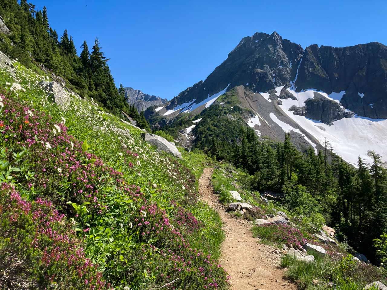
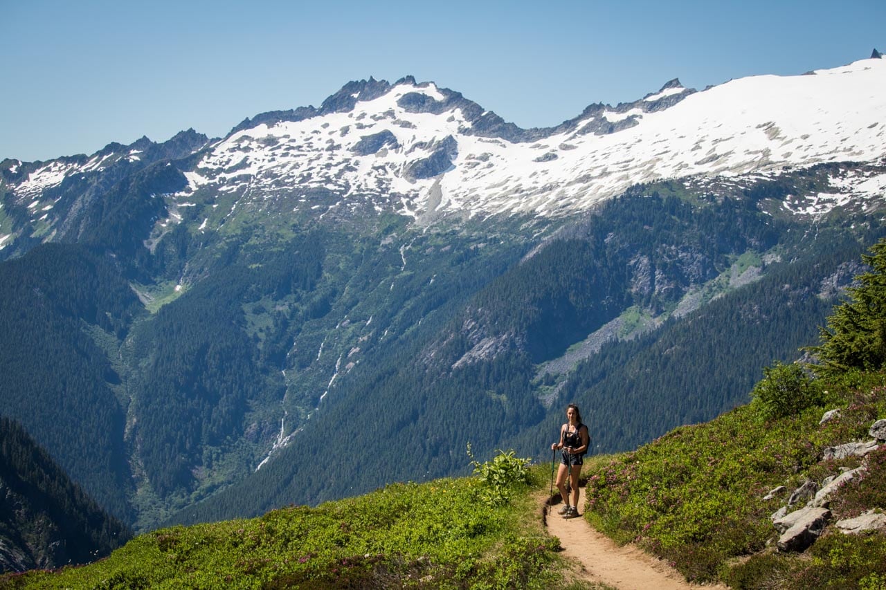
The most popular hike in North Cascades National Park, the Cascade Pass Trail is actually the only trailhead in the national park that’s accessible by car.
It lies at the end of the long, winding and sometimes-bumpy Cascade River Road—the only road into North Cascades National Park, 94% of which is designated wilderness.
The road starts in the small community of Marblemount, off of Highway 20. It runs eastward for 23 miles, the last section of which is unpaved, along the Cascade River and deep into the mountains.
The hike begins at the parking lot at road’s end, underneath massive Johannesburg Mountain and its glaciers and roaring cascades. At first, you’ll hike through a beautiful forest, a section made up a literally dozens of switchbacks.
Eventually, you’ll pop out of the woods and into an area of glorious alpine meadows, snow fields, glaciers, jagged peaks and wildflowers.
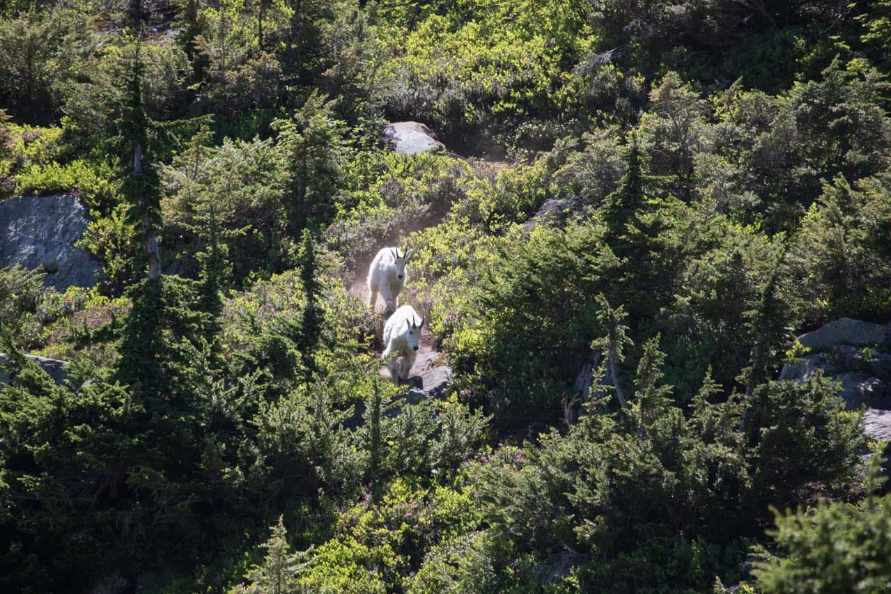
Once you’re in that alpine environment, look for wildlife on the slopes around you. We saw several mountain goats running down the mountainsides. Sightings of marmots, black bears and even wolverines are not unusual either.
The Cascade Pass Trail is a moderate there-and-back hike with a total distance of 7.4 miles. Count on 4-5 hours for the entire hike.
If you’re feeling like hiking some more, you can continue on the Sahale Arm Trail for more breathtaking views. Additionally, backpackers can thru-hike to the remote lakeshore town of Stehekin on the Cascade Pass Trail.
- Distance: 7.4 miles (out and back)
- Duration: 4-5 hours
- Difficulty: Moderate
More About North Cascades National Park
- Park Website
- Travel Guide
- Topographic Map
- Top Things To Do in North Cascades National Park
- Accommodation
Devastation, Byron Ledge & Kīlauea Iki Crater Loop, Hawai‘i Volcanoes National Park
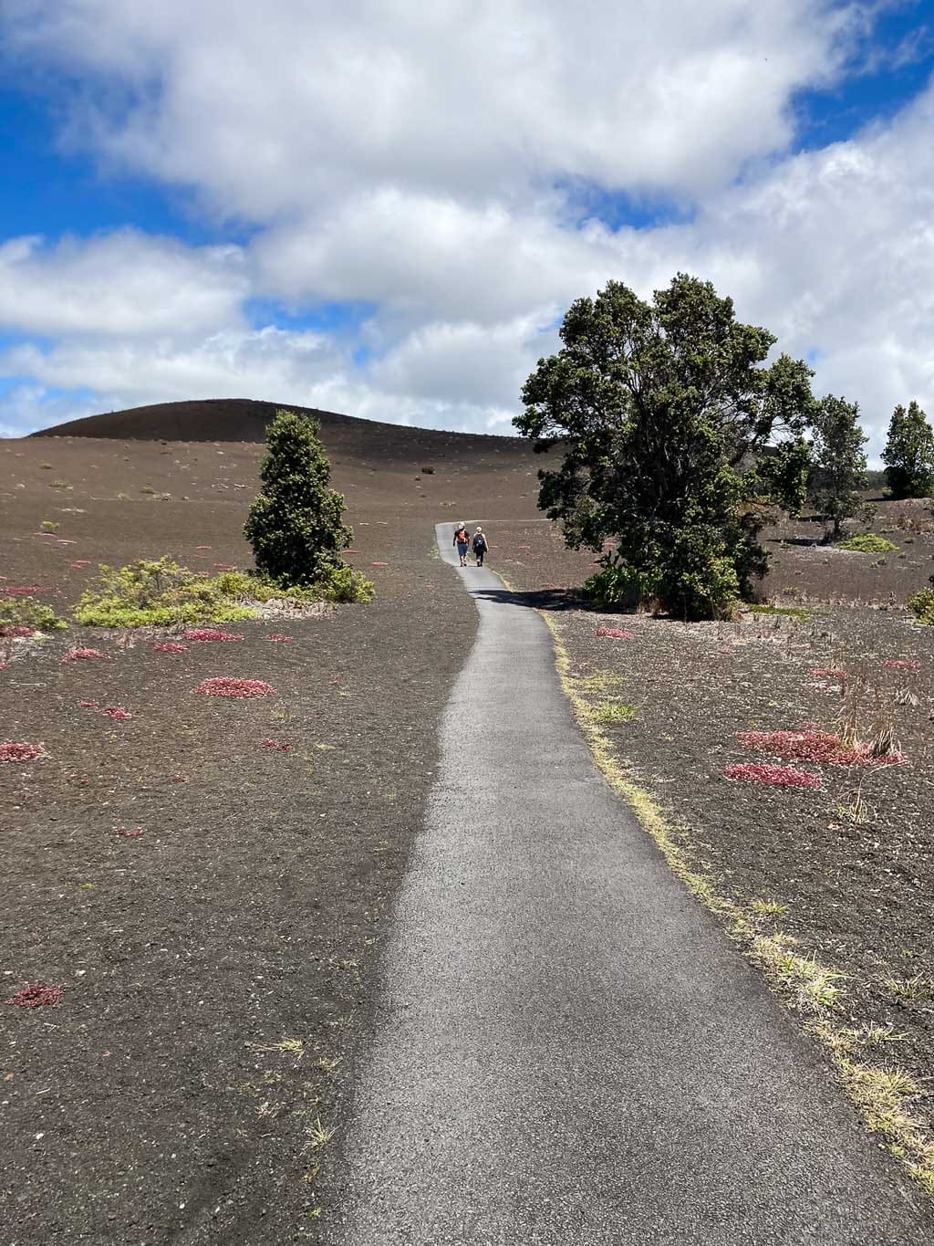
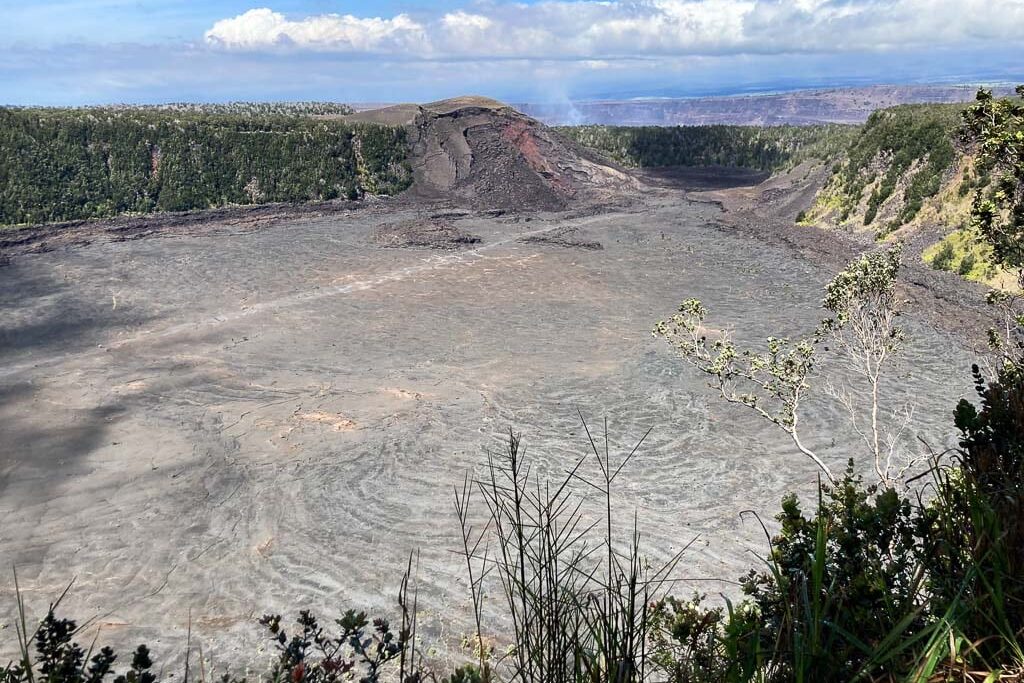
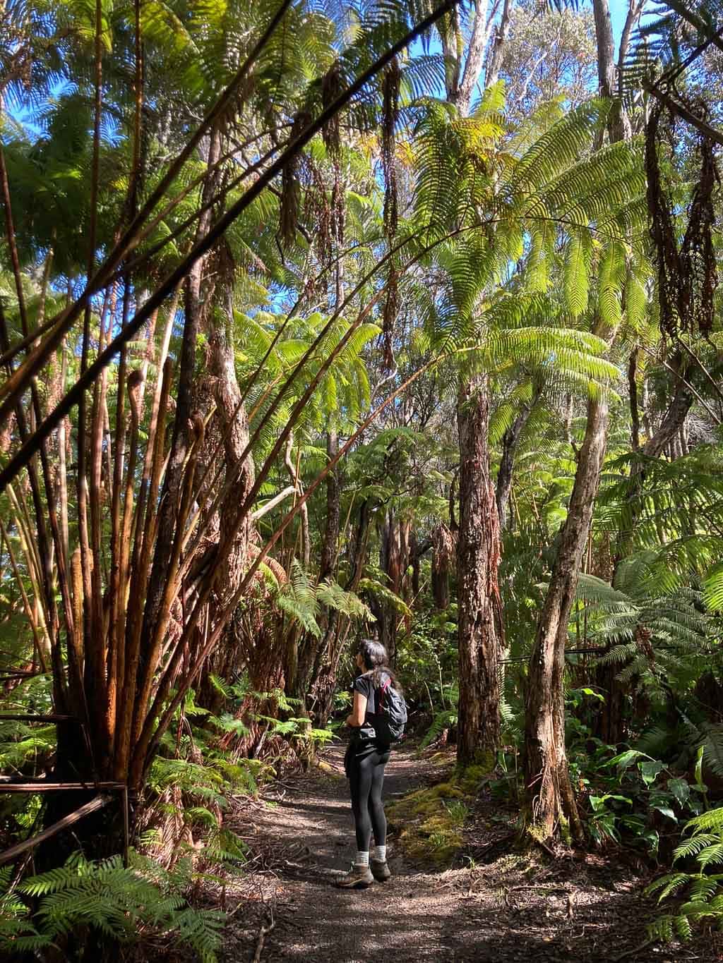
Without question one of the best Hawai‘i Volcanoes National Park day hikes, if not the best day hike, is the Kīlauea Iki Crater Loop.
This popular hike includes everything that makes Hawai‘i Volcanoes National Park so special. There are sections of stunning rain forest, spectacular overlooks and a stretch that runs—literally—across a solidified lava lake.
The Kīlauea Iki Crater filled with seething lava after a vent erupted below the Pu‘upua‘i Cinder Cone in 1959.
The vent spewed lava thousands of feet into the air, “considered by some to be the most spectacular eruption event of the 20th century”, according to the National Park Service.
Nowadays, the lava is solid at the top, but still lingers in its red-hot molten state not all that deep below the trail.
You can hike the 3.3-mile Kīlauea Iki Crater Loop from either the Kīlauea Iki Overlook or Nāhuku (Thurston Lava Tube) parking lot, which are the shortest hiking options.
I would, however, suggest combining the Kīlauea Iki Crater Loop with Nāhuku (Thurston Lava Tube) and the Devastation and Uēaloha (Byron Ledge) Trails.
Together, these four individual trails make for a phenomenal 7-mile roundtrip hike. The trailhead for this longer day hike is at the Pu‘upua‘i Overlook parking lot.
In my opinion, this second route is easily one of the greatest day hikes in the entire National Park System.
- Distance: 3.3 miles (loop) to 7 miles (lollipop)
- Duration: 2 to 4 hours
- Difficulty: Moderate to strenuous
More About Hawai‘i Volcanoes National Park
- Park Website
- Travel Guide
- Topographic Map
- Best Hawai‘i Volcanoes Hikes
- Top Things To Do in Hawai‘i Volcanoes National Park
- Best Views at Hawai’i Volcanoes
- Accommodation
Devils Garden Primitive Trail Loop, Arches National Park
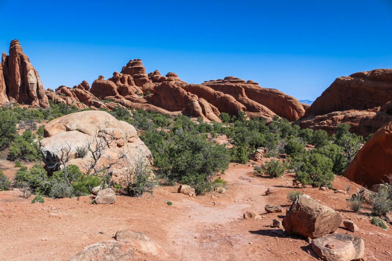
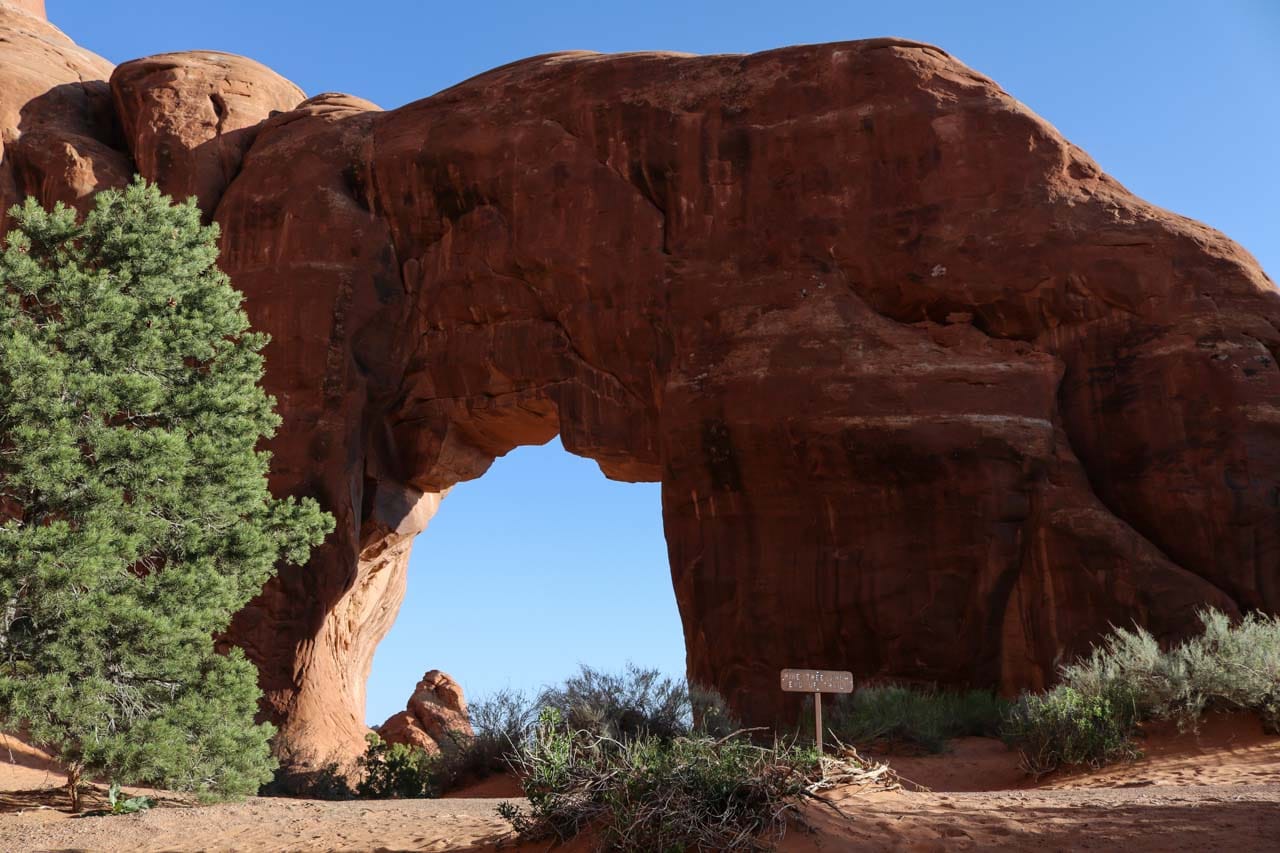
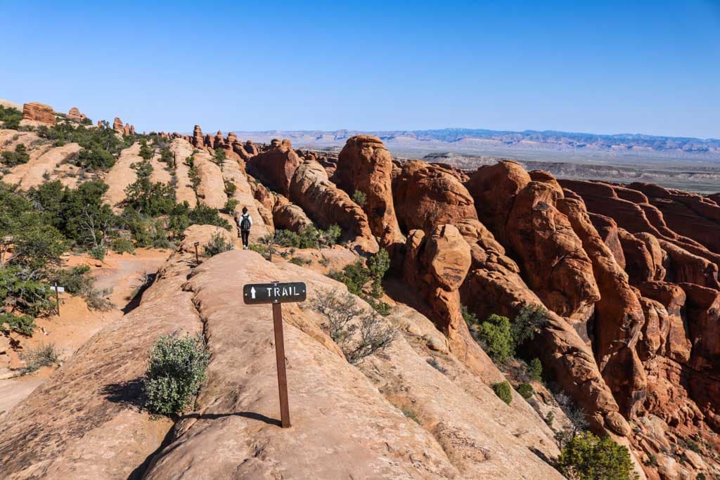
In my opinion, the Primitive Trail at Devils Garden is the best Arches National Park day hike. The first section of this hike is the Landscape Arch Trail, but the real excitement awaits beyond that famous arch.
The Primitive Trail is just what its name suggests—there’s few markers to rely on, some rock scrambling, steep slopes and a couple of drop-offs. The remoteness of this day hike is what appealed to me most. You’ll feel like you’re alone in the desert, which is a pretty awesome feeling actually.
The full loop is made up of both the Primitive Trail and the Double O Arch Trail. Both trails split up just beyond Landscape Arch, that point being linked to the Devils Garden Parking Area by the Landscape Arch Trail.
On the Devils Garden Primitive Trail Loop, you get to see no fewer than seven awesome rock arches in Arches National Park, including iconic Landscape Arch, but also picturesque others like Double O Arch, Partition Arch and Private Arch.
This is the longest of all Arches National Park day hikes, a journey into the park’s remotest still-accessible area. Allow at least 4 hours to complete the hike and bring plenty of snacks and water.
You might find some welcome shade underneath the arches, but the trails are exposed. Wear a hat and sunscreen.
- Distance: 7.9 miles (lariat including all spurs)
- Duration: 4 hours
- Difficulty: Strenuous
More About Arches National Park
- Park Website
- Travel Guide
- Topographic Map
- Best Arches Hikes
- Most Beautiful Arches in Arches National Park
- Top Things To Do in Arches National Park
- Best Views on the Arches Scenic Drive
- Accommodation
Doyles River – Jones Run Falls Loop, Shenandoah National Park
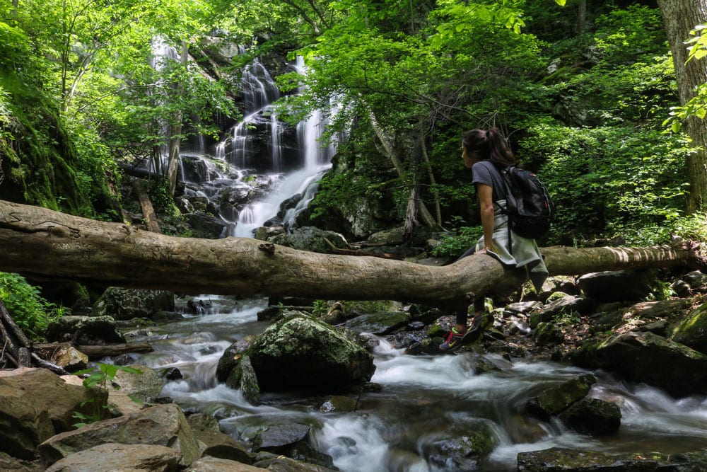
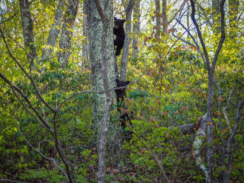
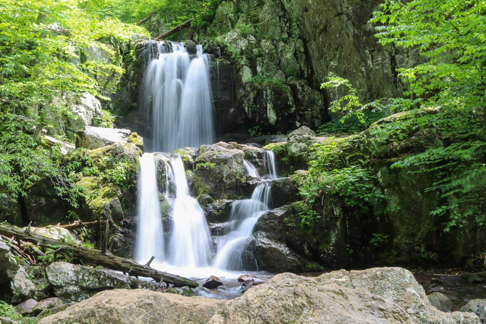
In spring and early summer, when the snow melts and water flows, the Doyles River – Jones Run Loop is one of the nicest day hikes in Shenandoah National Park.
Even though none of the waterfalls on this hike are extraordinarily tall or spectacular, it’s the setting and scenery that set this hike apart from the rest.
This great loop hike includes a few gorgeous waterfalls in Doyles River and one particularly scenic one in Jones Run. The numerous swimming holes you’ll find along the way make this a superb hike on a balmy day.
However, the best time of year for this hike is spring. When meltwater feeds the streams of the Blue Ridge, these cascades grow exponentially in size, making this one of the best waterfall hikes in the national parks in spring.
- Distance: 7.8 miles (loop)
- Duration: 4-5 hours
- Difficulty: Moderate
More About Shenandoah National Park
- Park Website
- Travel Guide
- Topographic Map
- Best Shenandoah Hikes
- Top Things To Do in Shenandoah National Park
- Where to See Wildlife in Shenandoah National Park
- Best Views in Shenandoah
- Fall Foliage Viewing on Skyline Drive
- Accommodation
Discovery Point & Rim Trails to Watchman Peak, Crater Lake National Park
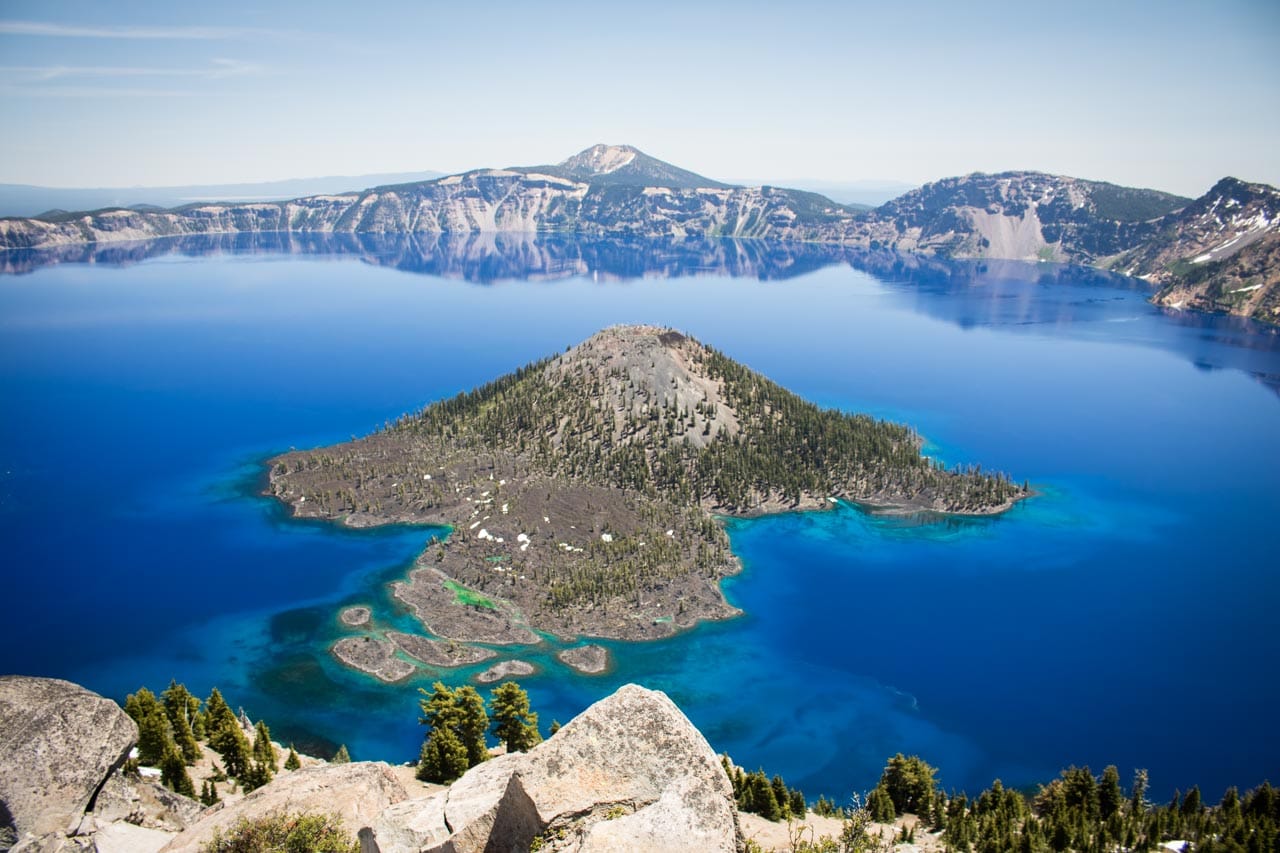
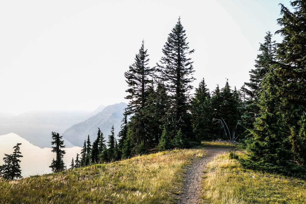
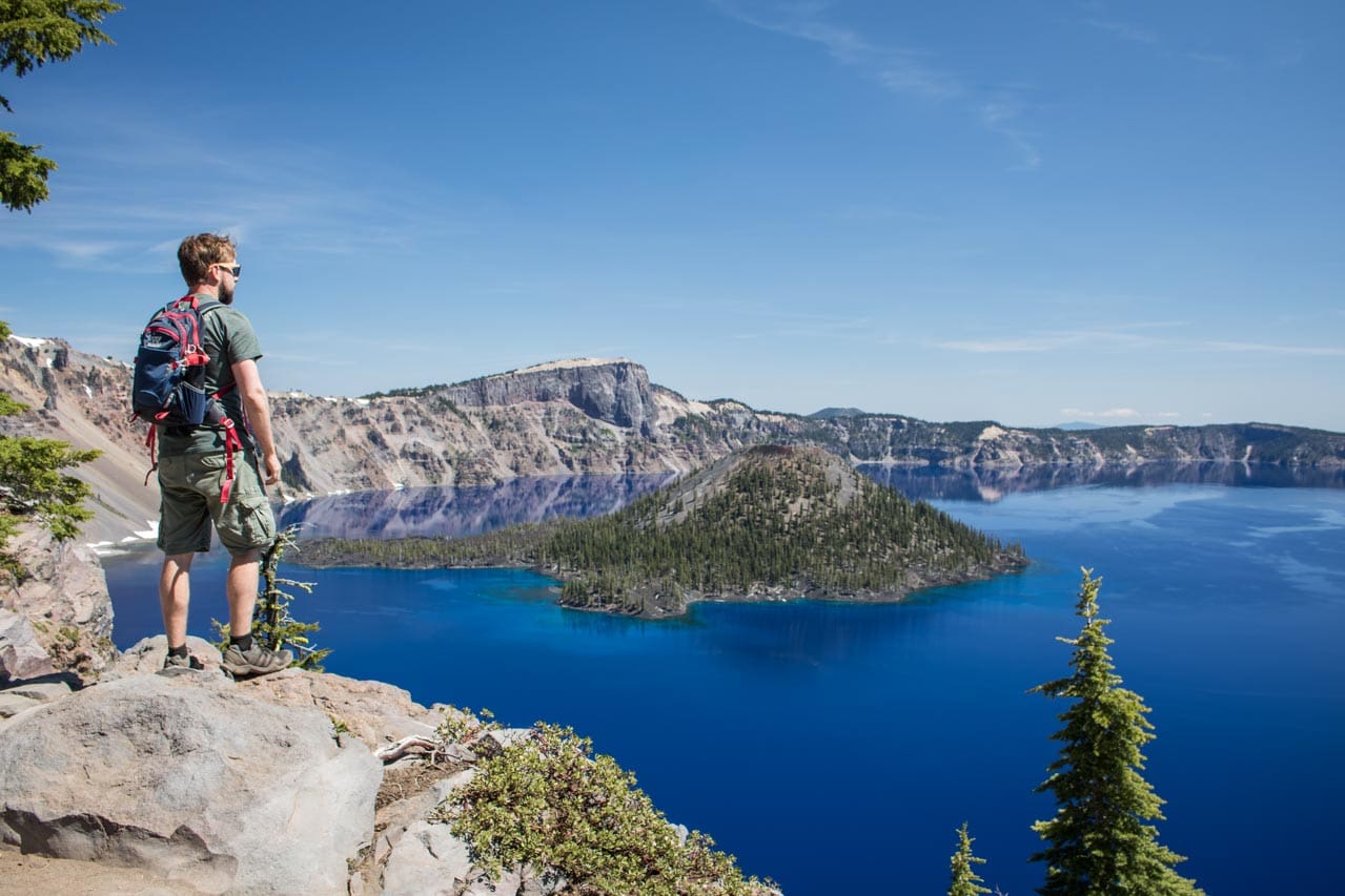
If you’re looking for a long day hike in Crater Lake National Park, this is arguably the best one there is. Starting in Rim Village, home to the iconic Crater Lake Lodge, this amazing hike combines the easy-to-moderate Discovery Point and Rim Trails, connecting to the strenuous Watchman Peak Trail.
It takes you along the West Rim of Crater Lake, the deepest and clearest lake in the United States, and offers awesome views almost the entire way.
You’ll hike past parking lots and overlooks, where motorists stop for a minute or two to snap a photo, while you get to enjoy the view for literally hours.
The apex of this hike, which is easily one of my favorite national park day hikes, is Watchman Peak. It offers the singularly best panoramic view of Crater Lake in the entire park, with Wizard Island prominently in the foreground.
- Distance: 7.5 miles (there and back)
- Duration: 3-4 hours
- Difficulty: Moderate to strenuous
More About Crater Lake National Park
- Park Website
- Travel Guide
- Topographic Map
- Best Crater Lake Hikes
- Top Things To Do in Crater Lake National Park
- Best Views of Crater Lake
- Accommodation
Golden Canyon, Gower Gulch & Badlands Loop, Death Valley National Park
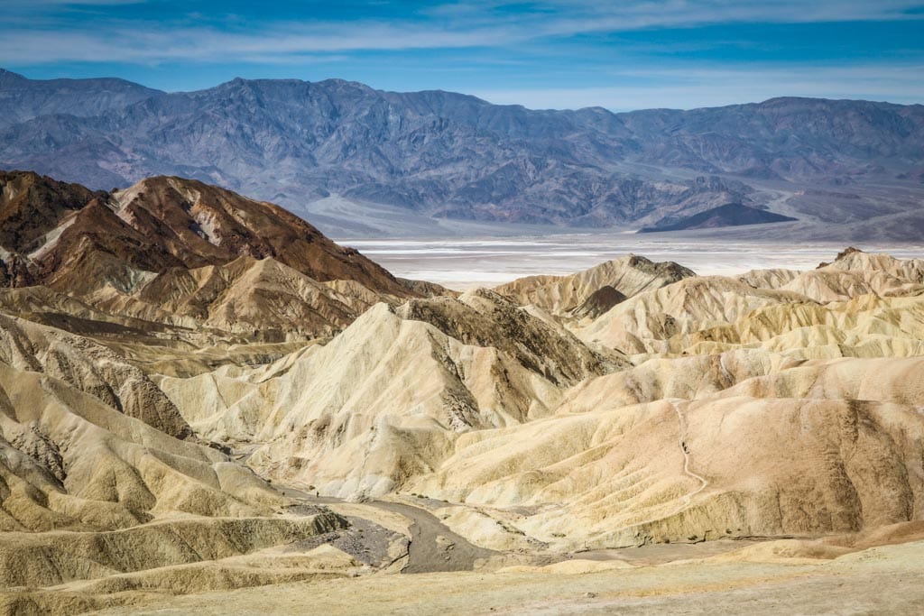
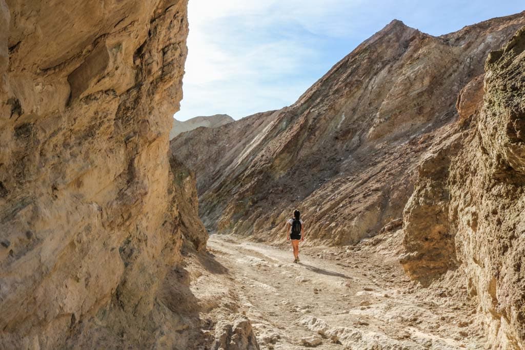
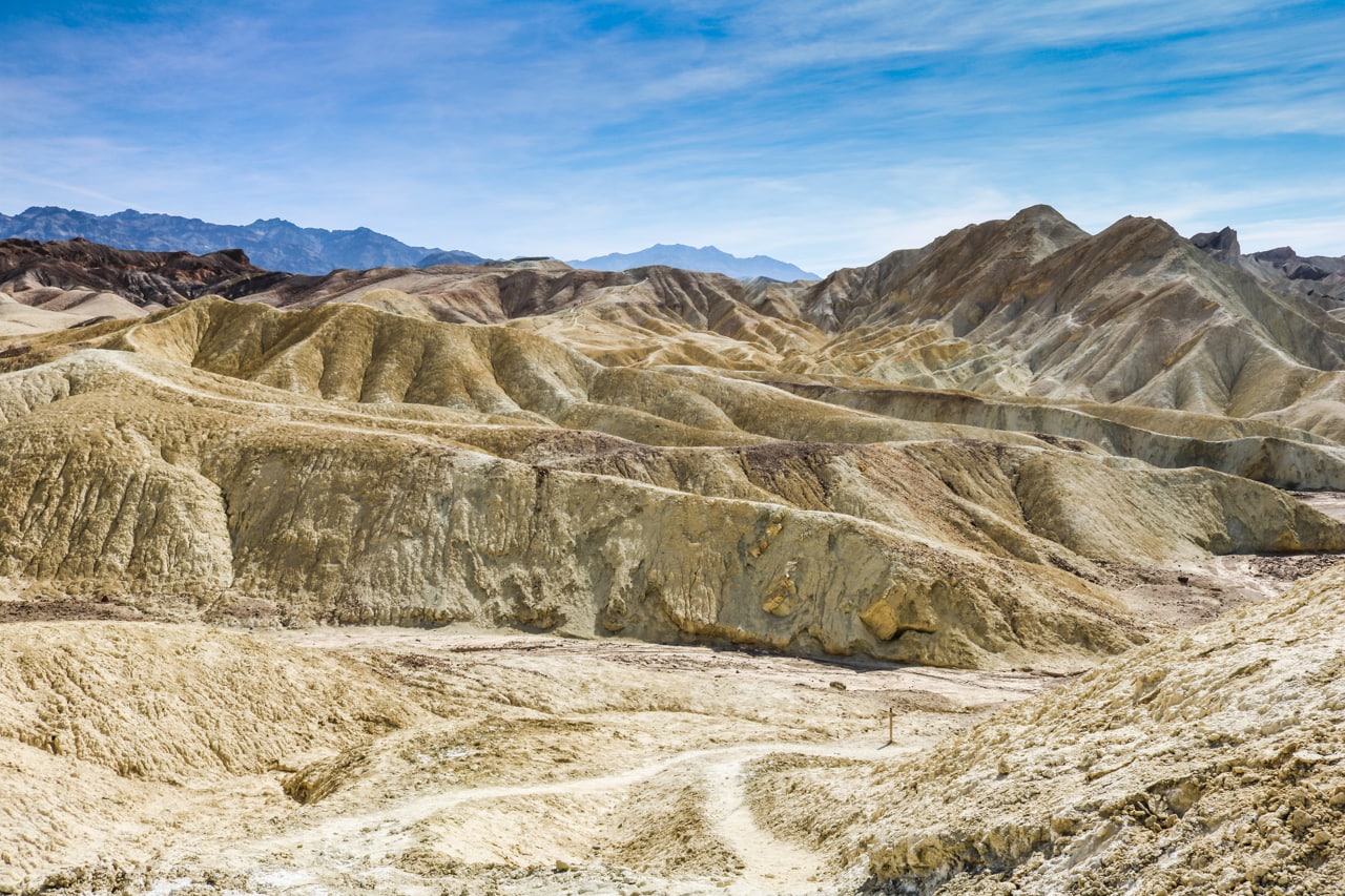
One of my favorite Death Valley activities, this three-trail loop hike takes you into the heart of Death Valley’s golden badlands. It runs through barren canyons and gullies, and to places like Red Cathedral and spectacular Zabriskie Point.
This entire loop, one of the most iconic national park day hikes, is about 8 miles long and takes at least 4 hours.
You can start the hike at either Zabriskie Point or at the parking lot off Badwater Road. I suggest starting at the Badwater Road parking lot. This way, you’ll save the (more or less) downhill part of the hike for the way back.
The sun-drenched, shadeless and hot desert landscape makes this a pretty challenging hike. Saving the most strenuous section—back up to Zabriskie Point—for last isn’t an option I would recommend.
This strenuous hike is one of the best day hikes in a national park I’ve ever done. In fact, if you do anything in Death Valley National Park, let it be this hike (besides visiting Badwater Basin, of course).
Start the Golden Canyon, Gower Gulch and Badlands Loop as early in the morning as you can, bring lots and lots of water, put on a hat and wear sunscreen. You’ll need all of it.
- Distance: 8 miles (loop)
- Duration: 4-5 hours
- Difficulty: Strenuous
More About Death Valley National Park
- Park Website
- Travel Guide
- Topographic Map
- Best Death Valley Hikes
- Top Things To Do in Death Valley National Park
- Best Views in Death Valley
- Accommodation
Gooseberry Canyon Trail, Canyonlands National Park
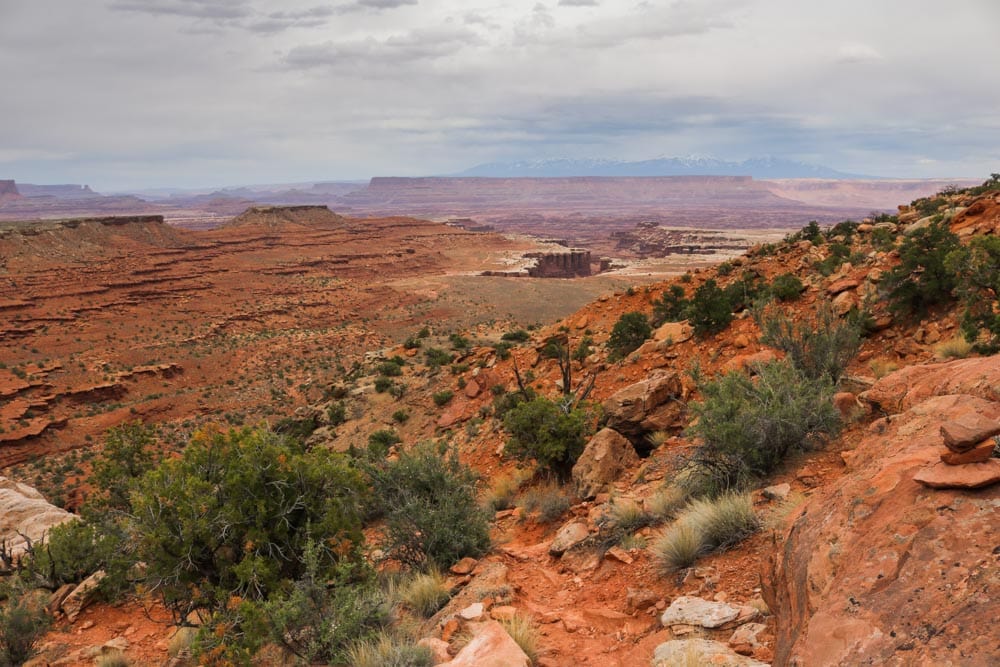
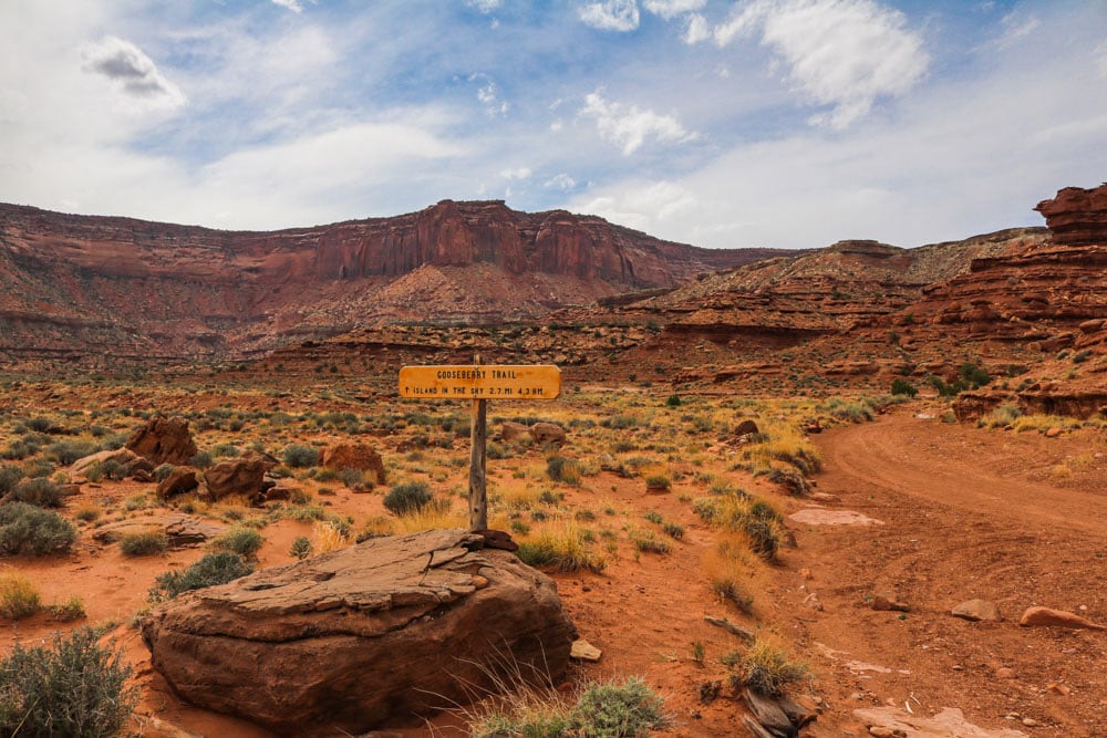

The Gooseberry Canyon Trail is arguable the best day hike in Canyonlands National Park’s Island in the Sky. It’s especially awesome if you want to get a real sense of the sheer magnitude of the park’s majestic landscapes.
This is the steepest trail in the Island in the Sky district. A path lined with switchbacks, it swiftly descends 1,400 feet from the mesa’s rim to the White Rim bench.
Some sections are very steep, running along sheer cliffs and near-vertical slopes. There are no handrails, rungs or ladders, so taking uttermost care is advised.
Watch your step and keep an eye on the weather. There’s no way you can get out of the canyon quickly if a thunderstorm surprises you.
That said, it’s an absolutely spectacular trail. As is the case in places like, for example, Grand Canyon National Park or Death Valley National Park, there’s no way to fully grasp the dimensions of the landscape if you’re not completely immersed in it.
And if you’re looking for an immersive experience, the Gooseberry Trail is one of the greatest day hikes in Canyonlands National Park.
- Distance: 5.4 miles (out and back)
- Duration: 3-4 hours
- Difficulty: Strenuous
More About Canyonlands National Park
- Park Website
- Travel Guide
- Topographic Map
- Top Things To Do at Island in the Sky (Canyonlands National Park)
- Accommodation
Grinnell Glacier Trail, Glacier National Park
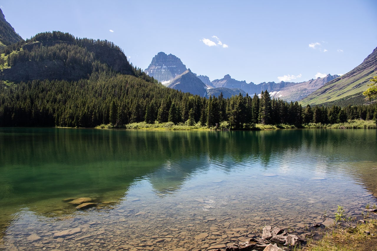
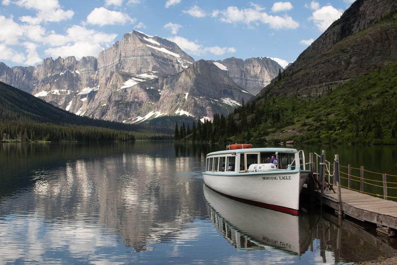
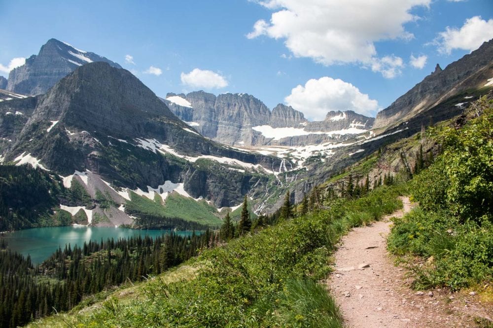
The spectacular Grinnell Glacier Trail starts at the Swiftcurrent Picnic Area or Many Glacier Hotel, one of the most iconic and historic national park hotels.
It runs along Swiftcurrent Lake and the north shore of Lake Josephine until the junction at Lake Josephine’s west end. The trail overlaps with the Grinnell Lake Trail, which makes for a nice side trip if you’re up for that.
There, the Grinnell Glacier Trail splits off and runs directly uphill. After a short distance, views of Grinnell Lake below begin opening up. Once you’re well above the tree line, the vista gets nothing less than awe-inspiring.
Following a cliffside above Grinnell Lake, you’ll continue toward Grinnell Glacier itself, accompanied by views of Gem Glacier and Salamander Glacier.
The last section of the Grinnell Glacier hike is usually closed until early-July, but when it’s open, it leads to Glacier National Park’s only accessible glacier.
From the moraine and Upper Grinnell Lake, the views are absolutely sensational. Be careful, though, to not step onto the glacier itself—it has numerous hidden crevasses, falling can be deadly.
To get back to your car, you have two options. You can either hike back the same way you came or catch the boat shuttle back at the far end of Lake Josephine.
It’s important to know, however, that people with boat reservations have priority.
When it’s busy, which it will be in mid-summer, you may have to wait a while to find a seat on a boat shuttle, or you may not find a seat at all. It’s best to plan this hike in advance and get reservations if you’d like to combine the awesome Grinnell Glacier Trail with a boat trip.
- Distance: 10.6 miles (out and back)
- Duration: 4-5 hours
- Difficulty: Strenuous
NOTE: Because of an abundance of food sources, the Swiftcurrent and Grinnell Valleys are home to one of the densest concentrations of grizzly bears in Glacier National Park. The trails to Lake Josephine, Grinnell Lake and Grinnell Glacier (see below) are often posted for bears frequenting. Carrying bear spray and making noise while hiking are essential for your safety.
More About Glacier National Park
- Park Website
- Travel Guide
- Topographic Map
- Best Glacier Hikes
- Top Attractions on Going-to-the-Sun Road
- Must-See Panoramic Views on Going-to-the-Sun Road
- Best Things to Do at Many Glacier
- Best Things to Do at Lake McDonald
- Where to See Wildlife in Glacier National Park
- Accommodation
High Dune Trail, Great Sand Dunes National Park
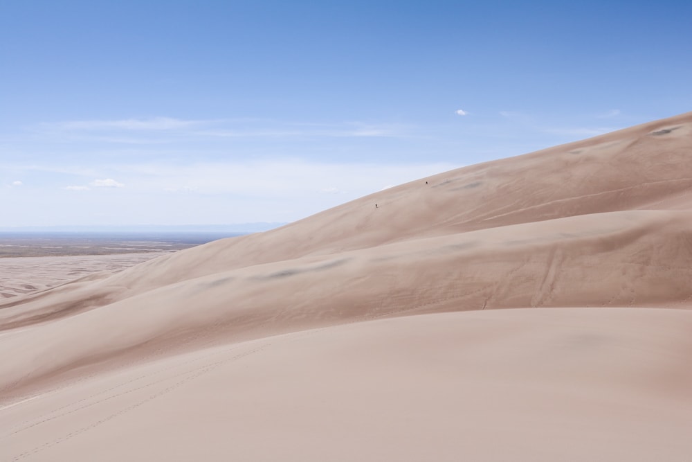
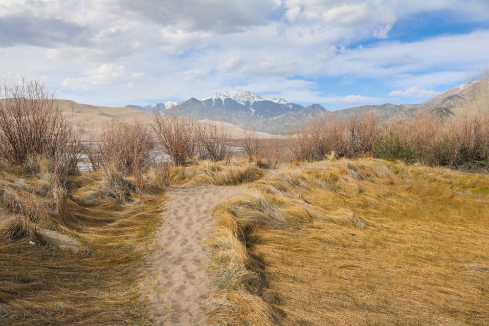
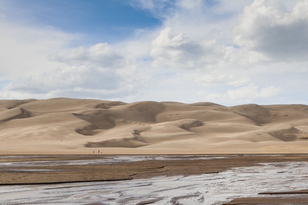
The namesake Great Sand Dunes of Great Sand Dunes National Park in southern Colorado are designated wilderness. There are no official trails here and you can basically go wherever you want.
There are, however, a couple of hiking destinations in these massive dunes, the tallest sand dunes in North America.
High Dune on the first ridge is the most prominent dune when looking at the dune field from the visitor center, although it’s not the tallest in the park (Star Dune is the highest sand dune in Great Sand Dunes National Park and in North America).
High Dune is the most popular hiking destination in the Great Sand Dunes, though. You can reach it from the parking lot by crossing Medano Creek and zigzagging your way to the top.
Although it’s about 699 feet tall and the hike is about a mile one way, don’t underestimate this. Hiking in soft sand is not easy, while the high altitude and afternoon sun are also factors that make this day hike more challenging than you might expect.
From High Dune, you can continue on to Star Dune, making this an 8-mile, 6-hour roundtrip.
While this is a great day hike, it’s also an amazing night hike! The night sky in Great Sand Dunes National Park is sensational and night hiking is a pretty popular thing to do here. Hiking under a full moon is amazing, while the best stargazing occurs when it’s a new moon.
- Distance: 2.5 miles (out and back) (8 miles to Star Dune and back)
- Duration: 2 hours (6 hours to Star Dune and back)
- Difficulty: Moderate
More About Great Sand Dunes National Park
- Park Website
- Travel Guide
- Topographic Map
- Top Things To Do in Great Sand Dunes National Park
- Accommodation
Jenny Lake Loop, Grand Teton National Park
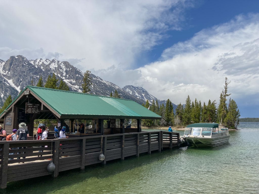
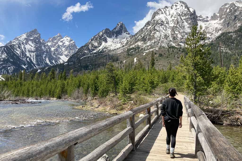
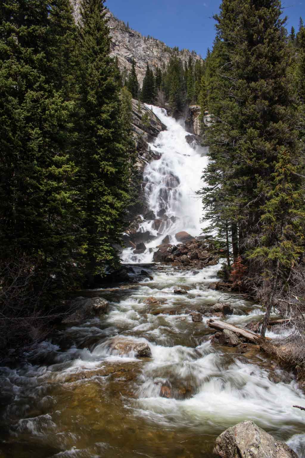
Without question one of the absolute best day hikes in Grand Teton National Park—and among the best hikes in the entire national park system—the Jenny Lake Loop offers spectacular views and occasional wildlife encounters.
It also has opportunities to see the three Grand Teton highlights described above (Hidden Falls, Inspiration Point and Moose Ponds) on short spur trails.
Although quite a popular trail, you can often find solitude along the northwest shore of Jenny Lake. For the best views, the Jenny Lake Loop hike is best done in a counterclockwise direction.
Starting at the Jenny Lake Visitor Center, follow the east shore northward to the south end of String Lake. Cross the bridge across a fast-flowing stream and enjoy the spectacular views of the famous Cathedral Group—Mount Owen, Grand Teton and Teewinot.
Continue along the north and west shore until you get to the Hidden Falls trailhead and shuttle boat dock. There, you can hike to Hidden Falls and Inspiration Point.
Take the Jenny Lake shuttle back to the visitor center or follow the trail around the lake’s south shore.
- Distance: 7.6 miles (loop)
- Duration: 3-5 hours
- Difficulty: Moderate
More About Grand Teton National Park
- Park Website
- Travel Guide
- Topographic Map
- Best Grand Teton Hikes
- Top Things To Do in Grand Teton National Park
- Where to See Wildlife in Grand Teton National Park
- Best Views of the Tetons
- Names of Major Teton Range Peaks (With Photos)
- Accommodation
Kings Canyon Trail to Wasson Peak, Saguaro National Park
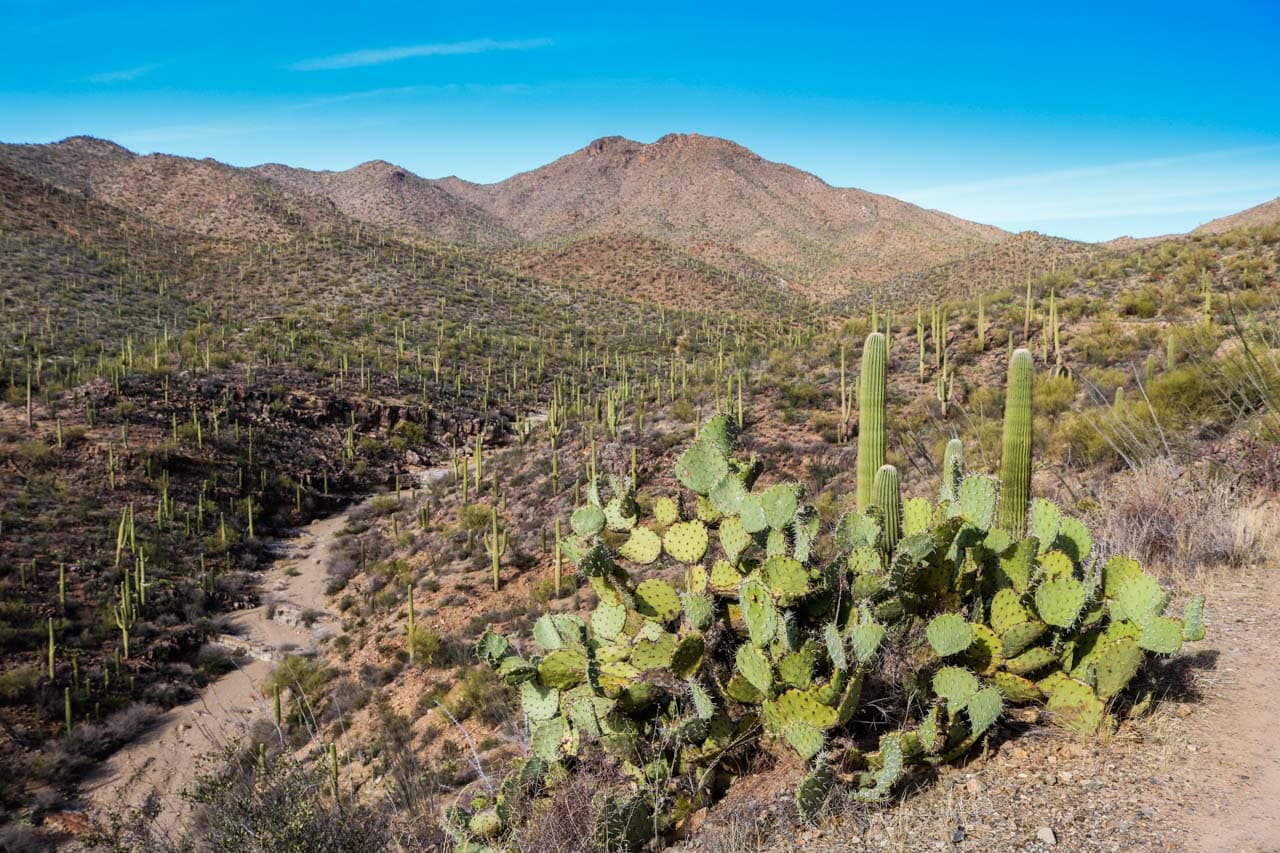
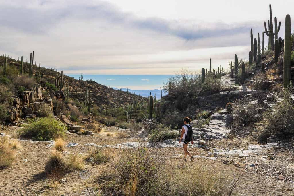
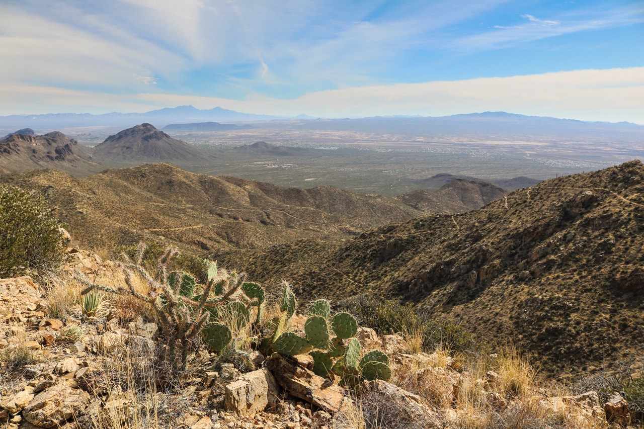
My personal favorite hike in Saguaro National Park is the 7-mile round-trip to Wasson Peak via the King Canyon Trail. With its height of 4,687 feet, Wasson Peak is the highest mountain in the Tucson Mountains.
The views from the top are spectacular—I’d even go as far as to stay they’re the best in the entire park.
The parking area and trailhead are directly across the road from the Arizona-Sonora Desert Museum, which is also worth visiting if you have some spare time.
I particularly love this hike because it offers a well-rounded desert experience. On the way, you can see and often even hike in desert washes and canyons, past tall saguaro cacti, and on old mining roads.
As you climb higher, the views start opening up, up to the point where you’re literally above the entire landscape.
- Distance: 7 miles (out and back)
- Duration: 3-4 hours
- Difficulty: Strenuous
More About Saguaro National Park
- Park Website
- Travel Guide
- Topographic Map
- Best Saguaro Hikes
- Top Things To Do in Saguaro National Park
- Accommodation
Lost Horse Mine Loop, Joshua Tree National Park
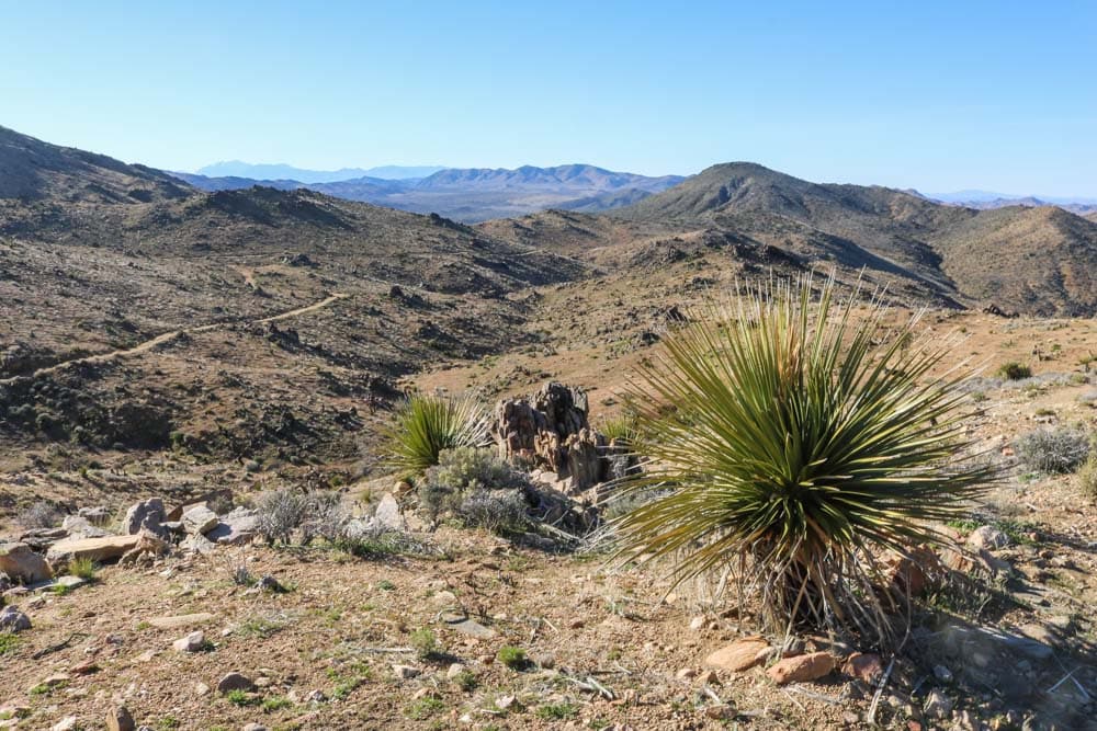
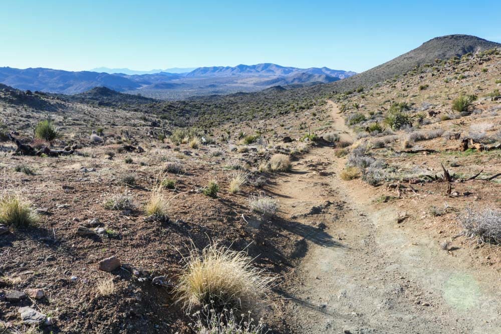
Joshua Tree National Park is famous for its iconic Joshua trees and boulder fields, but the park also has a completely different side. On the Lost Horse Mine Trail, you can hike to one of the park’s most successful gold mines.
You can get to the trailhead via a short dirt road off the Keys View Road. This loop hike takes you through beautiful desert landscapes, passing a few—not that many, though—Joshua trees on the way.
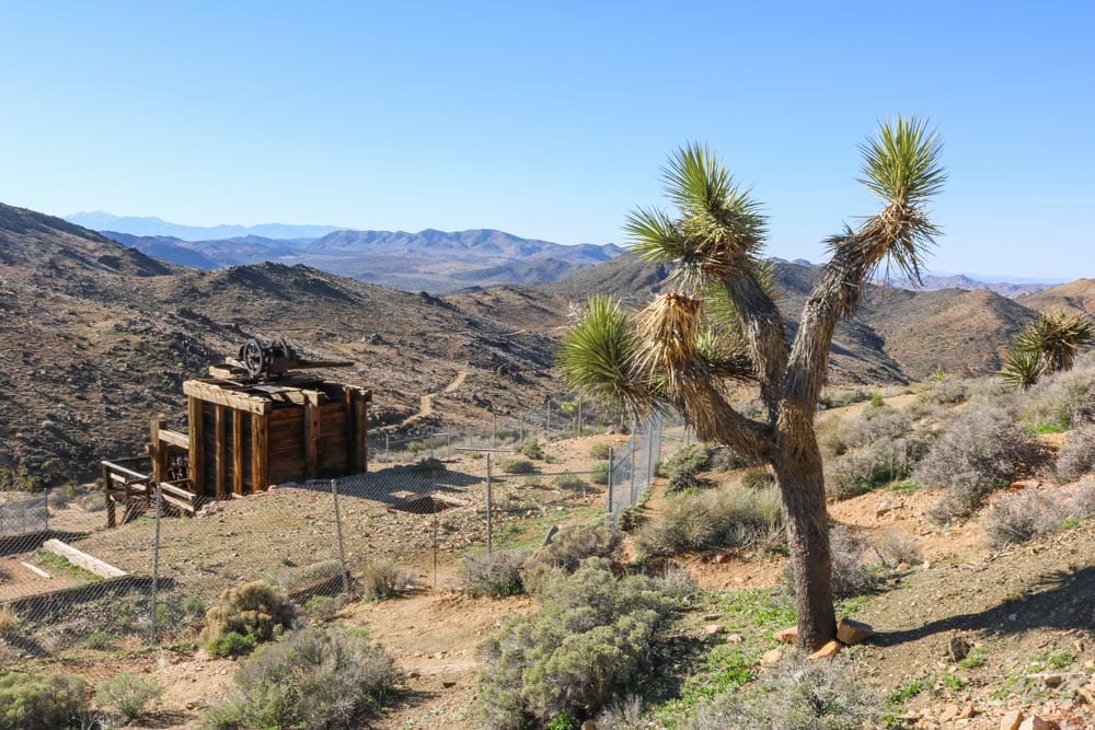
It ends at the 19th-century Lost Horse Mine, one of only a couple of successful gold mines in the national park. The remains of the mine are fenced in, so you can’t actually get there, but it’s still a worthy Joshua Tree hike because of the historic significance of the place.
The Lost Horse Mine Loop is an extension of the Lost Horse Mine Trail, which is a shorter out-and-back hike option. Instead of retracing your steps after reaching Lost Horse Mine, you can continue to make it a 6.5-mile loop hike.
- Distance: 6.5 miles (loop)
- Duration: 3-4 hours
- Difficulty: Moderate to strenuous
More About Joshua Tree National Park
- Park Website
- Travel Guide
- Topographic Map
- Best Joshua Tree Hikes
- Top Things To Do in Joshua Tree National Park
- Accommodation
Miner’s Ridge, James Irvine & Fern Canyon Trails Loop, Redwood National & State Parks
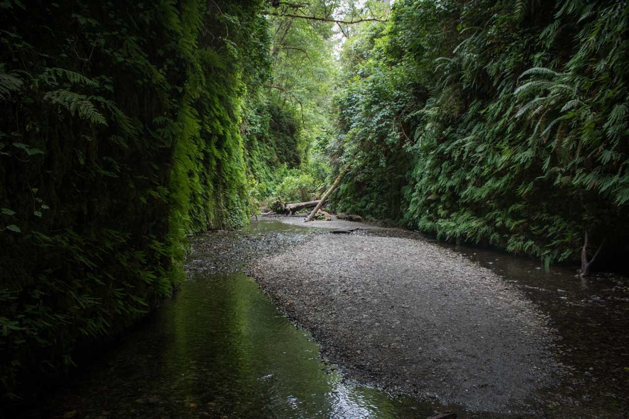
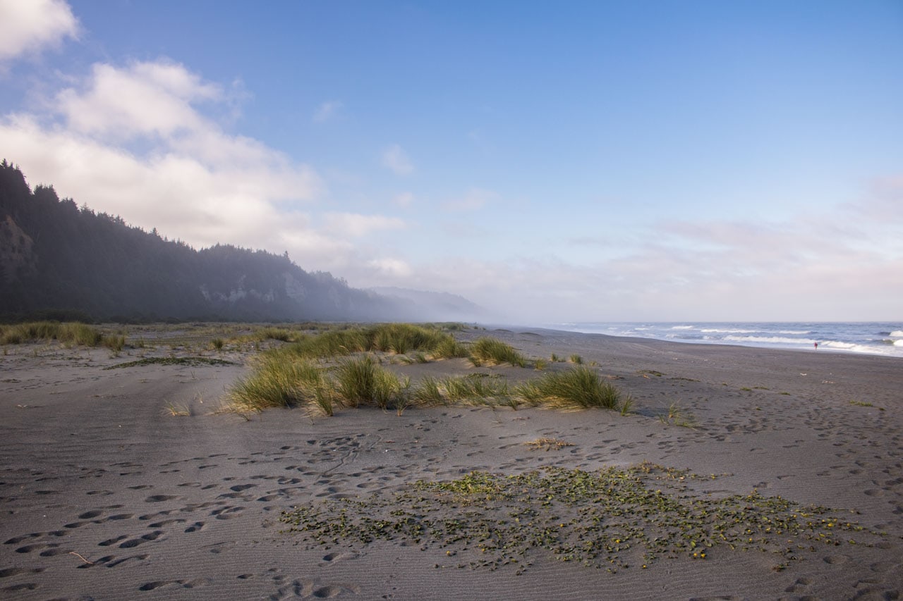
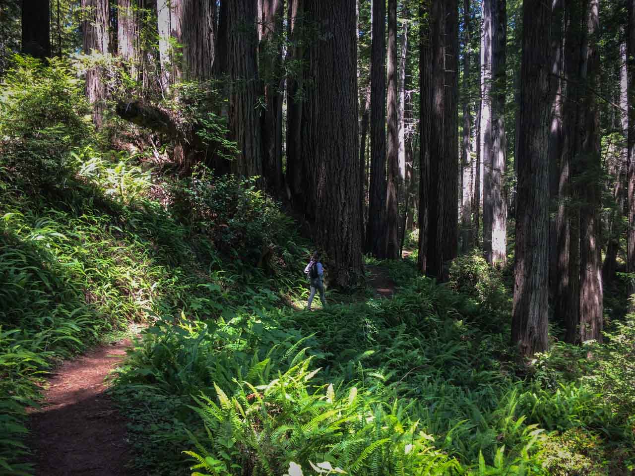
Although hiking the Miner’s Ridge Trail, James Irvine Trail and Fern Canyon Trail loop is a full-day commitment, it’s 100% worth it. In fact, on this 12-mile loop, you get to experience the absolute best of Redwood National Park and State Parks, in all their diversity and beauty.
Calling this the greatest long day hike in the redwoods is not an exaggeration at all. Its greatness is the sheer variety of scenery you’ll get to enjoy.
You’ll hike from Elk Prairie through a spectacular old-growth redwood forest, wander through famous Fern Canyon, and also include a section of the Coastal Trail on Gold Bluffs Beach, where you might come across a herd of Roosevelt elk.
Many hikers start this loop at the top, at the Prairie Creek Visitor Center, hiking down to the coast on the James Irvine Trail and back up on the Miner’s Ridge Trail.
However, if you managed to get a site at the Gold Bluffs Beach Campground—easily one of the best national park campgrounds we’ve ever stayed at—you can conveniently start your hike there, too.
From prairie and forest to beach and canyon, this fantastic loop hike is one of the top day hikes in the national parks.
- Distance: 12 miles (loop)
- Duration: 5-6 hours
- Difficulty: Moderate
More About Redwood National Park
- Park Website
- Travel Guide
- Topographic Map
- Best Redwood Hikes
- Top Things To Do in Redwood National Park
- Accommodation
Notch Trail, Badlands National PArk
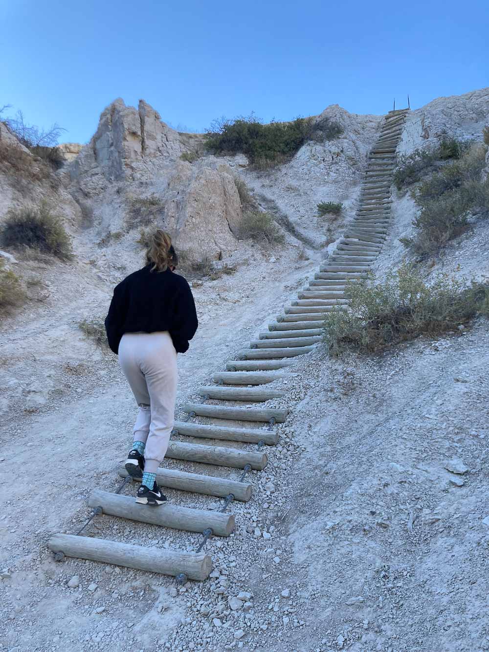
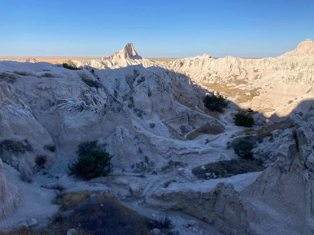
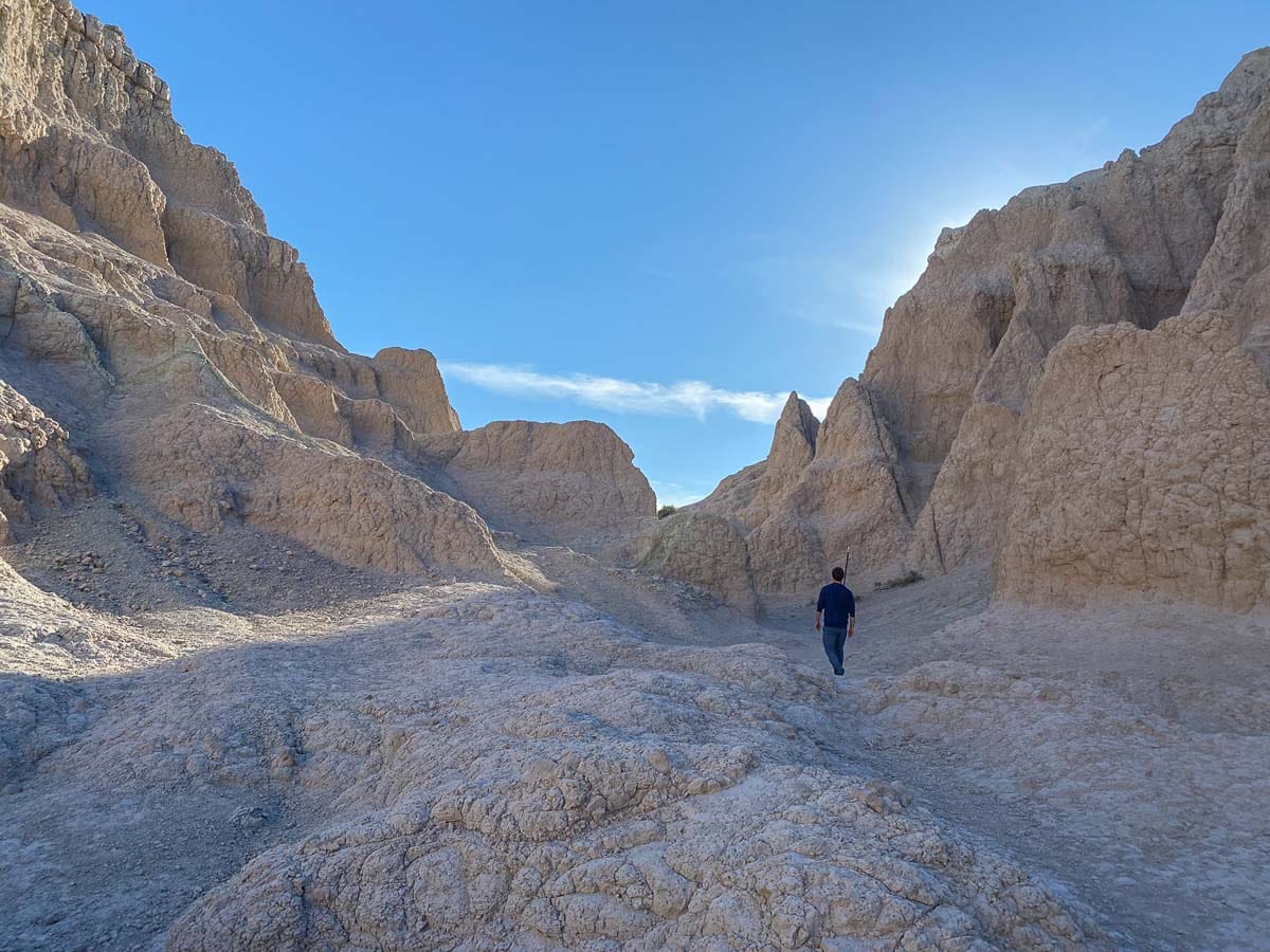
Arguably the most popular day hike in Badlands National Park, the Notch Trail combines a fun ladder climb, a walk along a cliff edge and a spectacular view. If you’re unsure about which hikes to do in the Badlands, this should be at the top of your priority list.
The trail starts at the south end of the Door, Window, Notch and Castle Trail parking lot, winding its way briefly through a beautiful canyon, before ascending a log ladder and continuing along a ledge.
The ultimate destination is “the Notch,” where a dramatic, panoramic view of the White River Valley awaits.
This is one of the most fun hikes in Badlands National Park, but the Park Service reminds hikers to be careful on cliff edges. Additionally, the trail is usually quite slippery during and after rainstorms—think twice before doing this hike in those circumstances.
- Distance: 1.5 miles (out and back)
- Duration: 45-60 minutes
- Difficulty: Moderate (with a steep ladder climb)
More About Badlands National Park
- Park Website
- Travel Guide
- Topographic Map
- Best Badlands Hikes
- Top Things to Do in Badlands National Park
- Where to See Wildlife in Badlands National Park
- Best Badlands Views
- Accommodation
Painted Desert Wilderness, Petrified Forest National Park
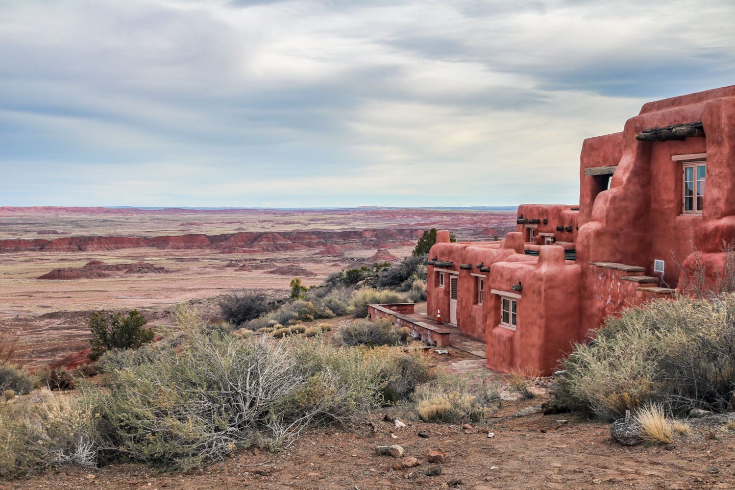
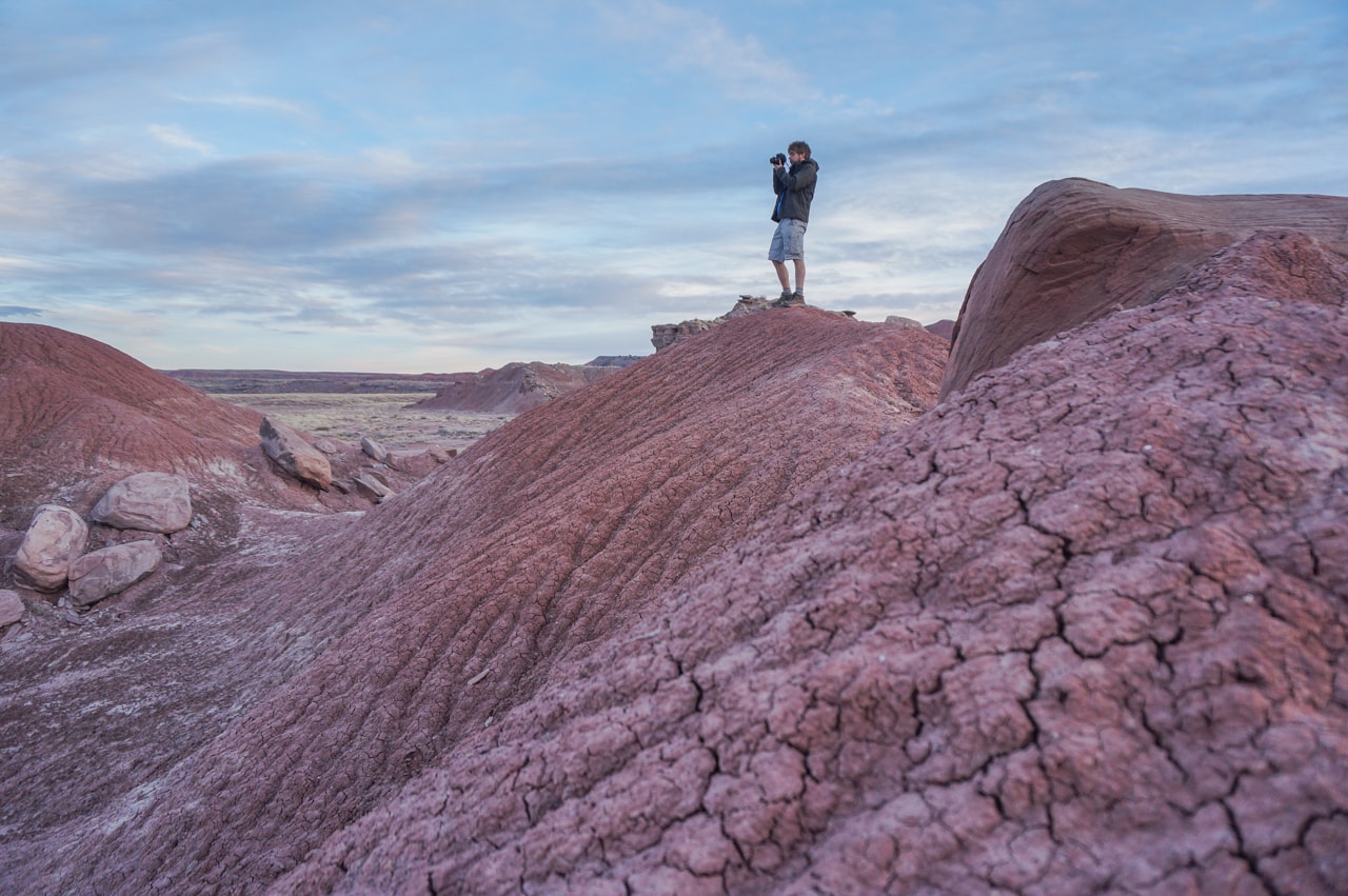

A huge area of red-and-purple-colored badlands in northern Arizona, the Painted Desert stretches from just east of Grand Canyon National Park eastward into Petrified Forest National Park. Much of the desert is in the Navajo Nation.
The Painted Desert makes up the northern part of Petrified Forest National Park, which is the most easily accessible area in this entire desert.
From Kachina Point near the Painted Desert Inn, a National Historic Landmark and now housing a small museum, you can descend into the badlands. This is a fantastic day hike, but it’s also possible to camp in the Painted Desert Wilderness.
The trail from the rim into the Painted Desert is about a mile long, after which it abruptly stops and you’re free to explore as you please. You can literally hike as far and as long as you want.
On day hikes in Petrified Forest, however, make sure to be back at your car at the park’s posted closing time. I like this hike so much because it offers you unlimited freedom to wander in this spectacular wilderness.
- Distance: 2+ miles (out and back)
- Duration: 2+ hours
- Difficulty: Moderate
More About Petrified Forest National Park
- Park Website
- Travel Guide
- Best Petrified Forest Hikes
- Top Things To Do in Petrified Forest National Park
- Accommodation
Precipice Trail Loop, Acadia National Park
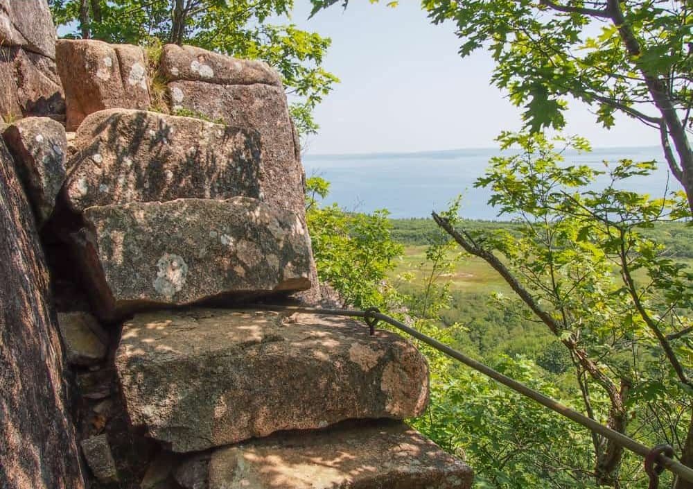
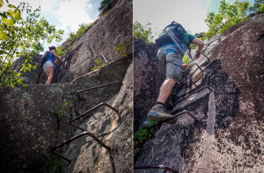
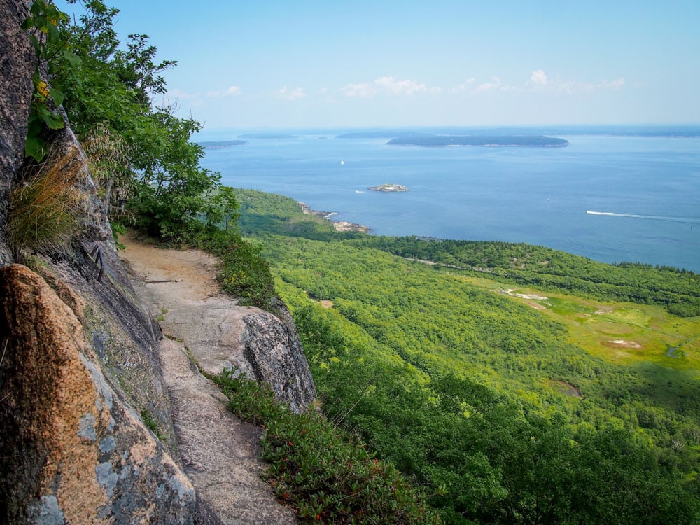
The Precipice Trail is widely considered to be one of the most difficult hiking trails in Acadia National Park.
Even though it’s no longer than one mile, this hike ascends 1,000 feet on the almost vertical eastern flank of Champlain Mountain.
To cover such an elevation gain in this short distance, hikers rely on ladders, ropes and iron rungs to climb sheer rock faces, reach ledges and maneuver through gaps between rocks.
It’s a thrill-ride of a hike with many exposed sections, one of the greatest hikes in Acadia National Park. Although not suggested to the faint-hearted, especially if you’re afraid of heights, it’s definitely recommended to adults with an adventurous spirit, stable feet and mental strength.
Because it’s so steep, the National Park Service recommends hiking the Precipice Trail in only one direction: up. You can loop back down via the North Ridge Trail on Champlain Mountain.
Note: This is not a day hike that’s suitable for small children, while it’s absolutely discouraged in winter or during wet weather. People have gotten seriously injured and even died on this trail, whether due to carelessness or bad luck.
- Distance: 0.9 miles on Precipice Trail (one way), 3.2 miles total (loop)
- Duration: 2-3 hours
- Difficulty: Strenuous
More About Acadia National Park
- Park Website
- Travel Guide
- Topographic Map
- Best Acadia Hikes
- Top Things To Do in Acadia National Park
- Where to See Fall Colors in Acadia National Park
- Best Views in Acadia
- Accommodation
Skyline Trail, Mount Rainier National Park
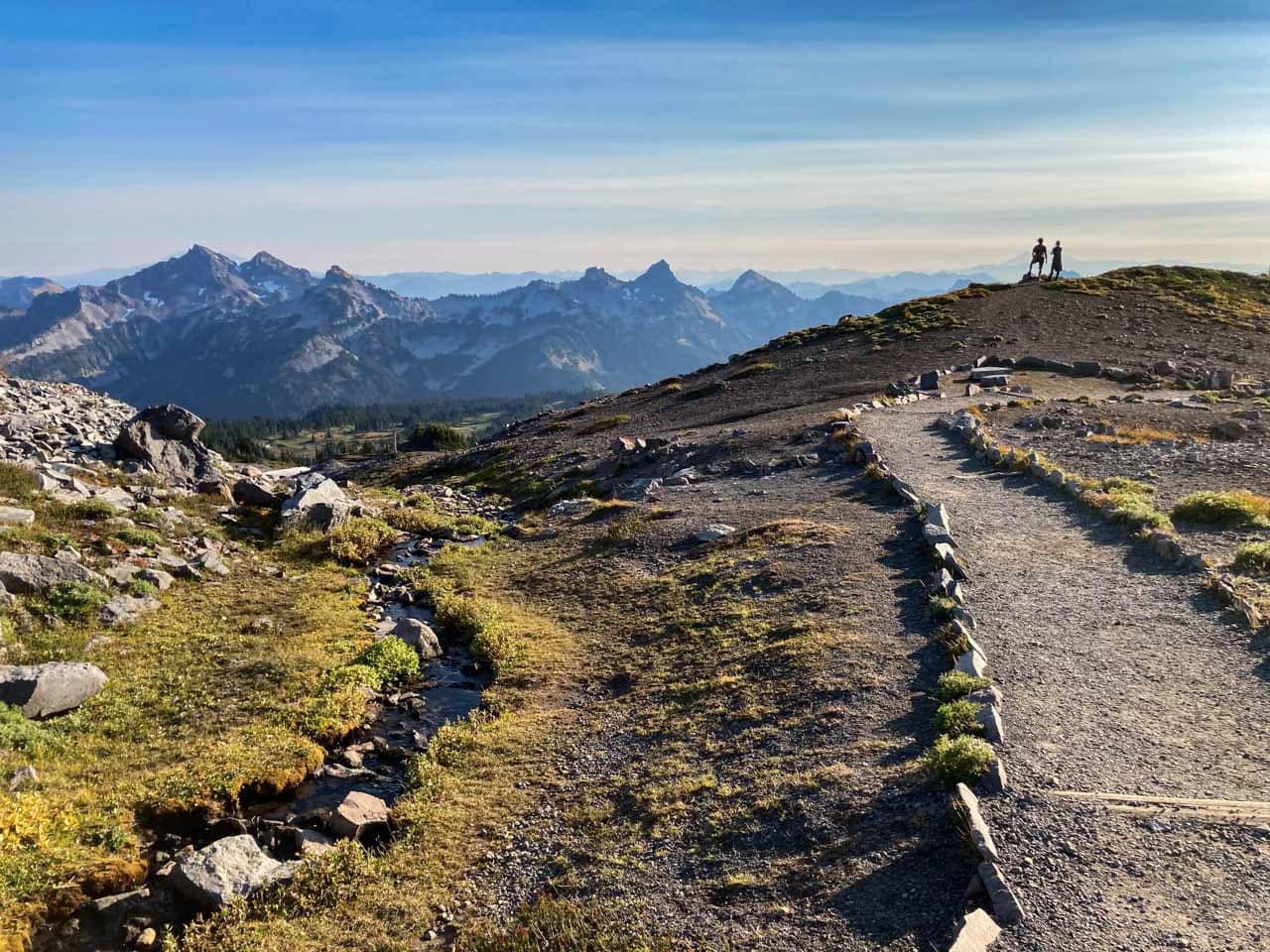
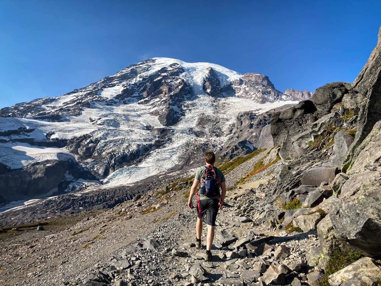
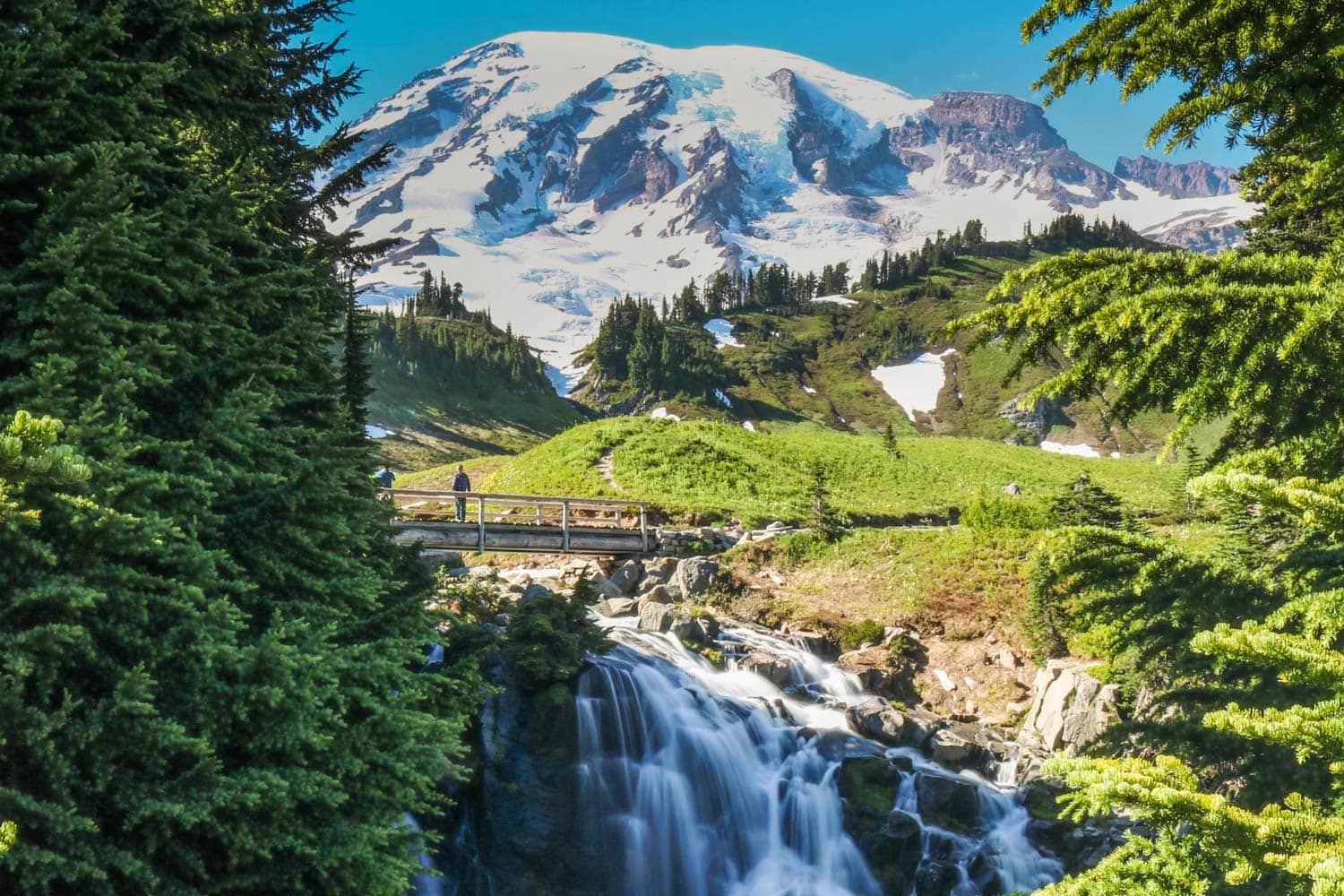
This phenomenal 5.5-mile loop hike starts at the Jackson Visitor Center at Paradise in Mount Rainier National Park, climbing 1,700 feet to well above the tree line.
In summer, the Skyline Trail is where you need to be for the best wildflower viewing in Mount Rainier National Park.
You’ll walk through gorgeous alpine meadows filled with all kinds of flowers, including Indian paintbrush, lupines and avalanche lilies.
“…the most luxuriant and the most extravagantly beautiful of all the alpine gardens I ever beheld in all my mountain-top wanderings”
– John Muir
Other major highlights on this hike are the massive Nisqually Glacier and Panorama Point, which offers breathtaking panoramic views of the Cascade Range.
This vista includes several other volcanoes, such as Mount Adams and even Mt. Hood all the way to the south.
If you walk the Skyline Trail Loop in a clockwise direction, which I recommend, you’ll save the best for last. Although the subalpine flowers and breathtaking vistas are undeniably amazing, it’s Myrtle Falls that really sets this Mount Rainier hike apart from all the rest.
This postcard-perfect Mount Rainier waterfall is a scene that seems to good to be real. Set within a verdant mountain meadow, backed by a spectacular view of Mount Rainier itself, it’s incredibly photogenic. You couldn’t possibly come up with a more picturesque natural scene!
It takes about 4 hours to complete this phenomenal hike. It’s one of my absolute favorite day hikes in the national parks.
- Distance: 5.5 miles (loop)
- Duration: 3-4 hours
- Difficulty: Moderate to strenuous
More About Mount Rainier National Park
- Park Website
- Travel Guide
- Topographic Map
- Best Mount Rainier Hikes
- Top Things To Do in Mount Rainier National Park
- What to Do at Paradise (Mount Rainier)
- Best Mount Rainier Sunset Spots
- Best Views of Mount Rainier
- Mount Rainier Wildflower Guide
- Mount Rainier Fall Colors Guide
- Accommodation
Sliding Sands Trail to Pele’s Paint Pot, Haleakalā National Park
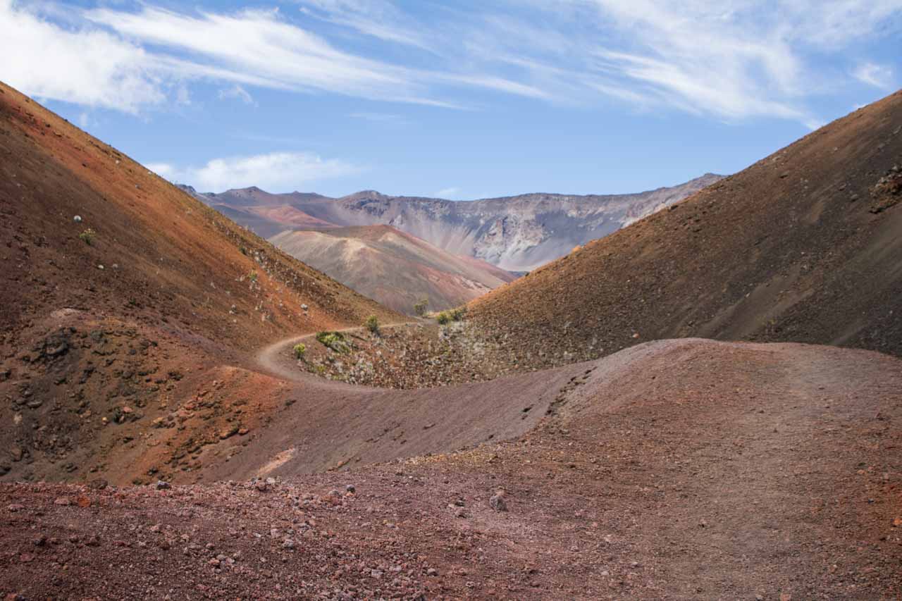
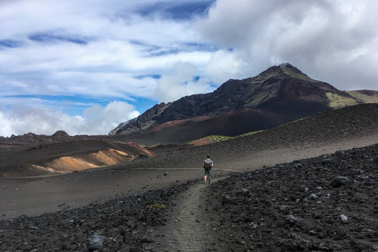
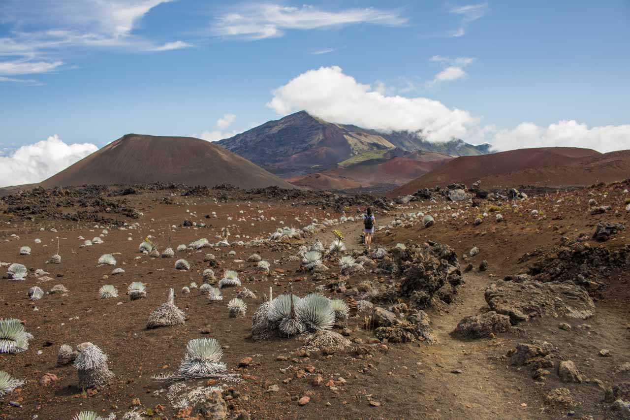
Also known as the Keonehe’ehe’e Trail, the Sliding Sands Trail is one of the greatest hikes in Haleakalā National Park. In fact, I wouldn’t hesitate to call it one of the best hikes in Maui, even in Hawaii!
Starting at the Haleakalā Visitor Center parking lot, the trail switchbacks down into the Haleakalā crater. It’s 3.9 miles to the crater floor, while the elevation change is almost 2,500 feet. On the way, you’ll pass various specimens of the remarkable native Haleakalā silversword.
The ultimate destination of this hike is an area unofficially called Pele’s Paint Pot. Situated near the north slope of the Halali’i cinder cone, it’s famous for its amazingly bright colors. Pele’s Paint Pot is roughly 5.7 miles from the trailhead, in the very heart of the Haleakalā Crater.
After looping around Halali’i and Pele’s Paint Pot, retrace your steps back up to the crater rim. The total distance of this phenomenal day hike is about 11.5 miles.
Note, however, that the hard part is the return trip. It’s a long climb back and you should count on at least twice as much time for the way up as for the way down.
So, in practical terms: if it takes you 2 hours to get to Pele’s Paint Pot, it’ll be at least 4 hours back. Start this Haleakalā Crater hike early! Right after sunrise is the perfect time.
Please take my advice and put on a lot of sunscreen. Also, this is a long day hike in the alpine desert wilderness of Haleakalā National Park and it’s important to bring some day hike snacks and plenty of water. There are no facilities along the way.
- Distance: 11.5 miles (out and back)
- Duration: 6-7 hours
- Difficulty: Very strenuous
More About Haleakalā National Park
- Park Website
- Travel Guide
- Topographic Map
- Best Haleakalā Hikes
- Top Things To Do in Haleakalā National Park
- Accommodation
Wildlife Safety on Day Hikes in the National Parks
One of the greatest things about day hikes in the national parks is the possibility/opportunity to see wild animals. Whether you’re hiking in a forest, the mountains, a desert landscape or along a beach, there’s always the chance you might run into wildlife.
From deer, elk, bison, mountain goats and moose to snakes, bears, mountain lions and even wolves, America’s national parks harbor an abundance of large wildlife. Therefore, an abundance of caution is sometimes also necessary.
Be aware of where you’re hiking, the presence of potentially dangerous animals, and what to do when you encounter one. Read the wildlife safety guides below for more information.
Other National Park Highlights
- Bird Watching
- Fall Foliage
- Mountain Biking
- Weddings and Elopements
- Wildflower Viewing
- Wildlife Watching


