Unforgettable Hikes in Mount St. Helens National Volcanic Monument
One of the most iconic mountains in the Pacific Northwest, Washington’s Mount St. Helens is famous for its 1980 eruption, which is still the most devastating and deadliest volcanic eruption in the history of the United States.
Nowadays, however, it’s a fantastic place to witness the resilience of nature up close.
More than 200 miles of hiking trails crisscross the once-desolate slopes of Mount St. Helens, taking hikers across a regenerating natural landscape, yet offering spectacular views of the massive volcanic crater and other remnants of that cataclysmic event.
Below, you’ll find my favorite hikes at Mount St. Helens National Volcanic Monument. Managed by the U.S. Forest Service, this magnificent monument is a must-visit destination on any road trip in the Cascade Range.
This blog post about the best day hikes in Mount St. Helens National Volcanic Monument contains affiliate links. You can read more about our Terms of Use / Disclosure here.

Best Day Hikes at Mount St. Helens National Volcanic Monument
There are trails at Mount St. Helens on essentially every side of the mountain. The most popular ones, however, are in the north around the Johnson Ridge Observatory (closest to Seattle) and in the south (closest to Portland).
There are options for short but scenic strolls, as well as longer and more challenging day hikes at Mount St. Helens.
There are hikes through lava caves, across wildflower-dotted plateaus, along lakes and even to the very summit of the volcano. Backpackers relish the opportunity to walk all the way around Mount St. Helens on the epic 30-mile Loowit Trail.
So, lace up your hiking boots and go for a walk in one of America’s grandest and most extraordinary landscapes!
Harry’s Ridge Trail
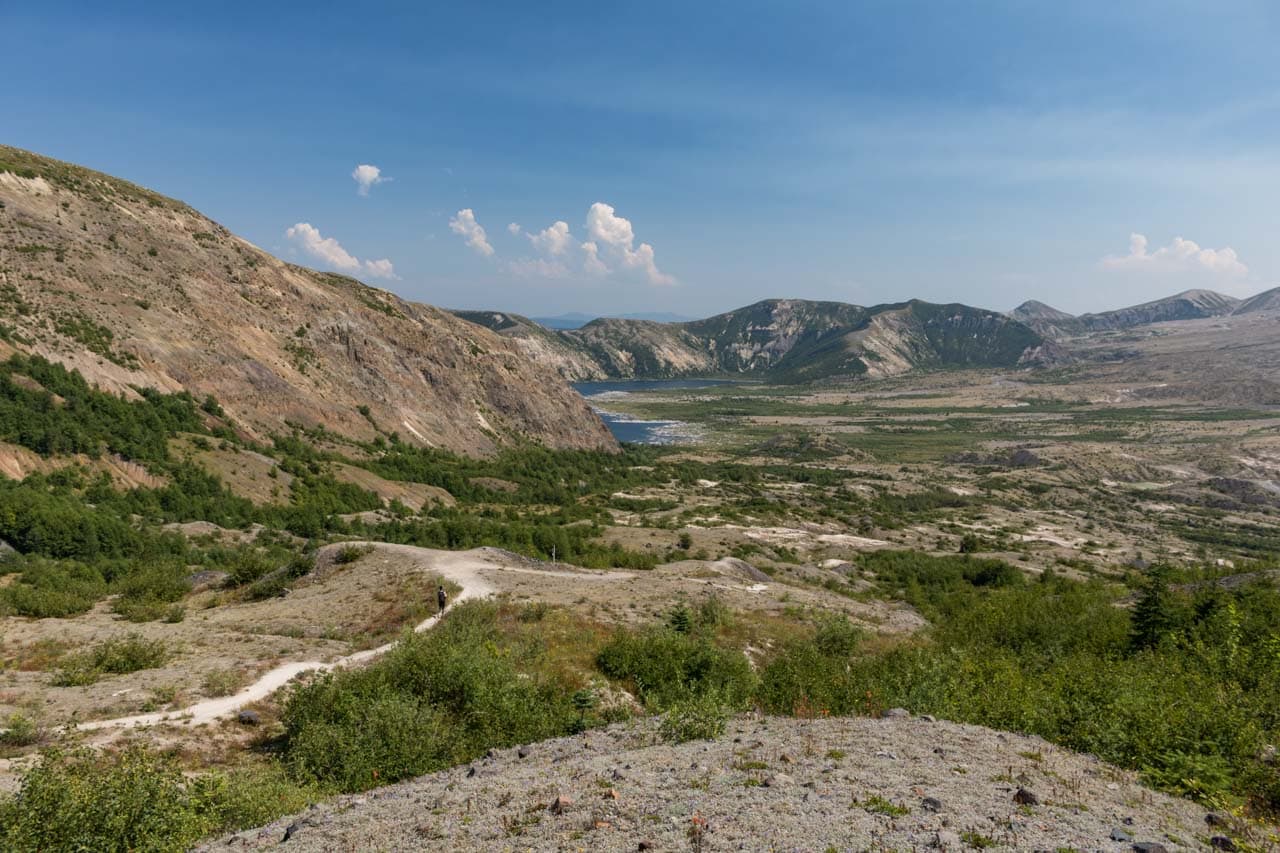

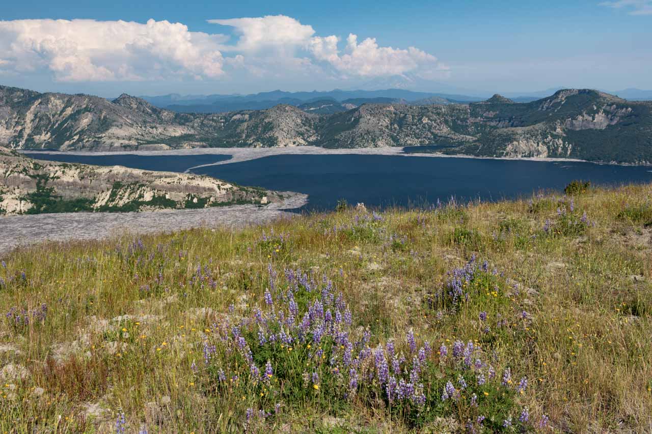
Arguably the best longer day hike from the Johnson Ridge Observatory, the Harry’s Ridge Trail is an 8-mile out-and-back hike that offers phenomenal views of Mount St. Helens.
The trail is off the popular Boundary Trail, which runs for over 50 miles through these spectacular landscapes in central Washington State.
With a fairly gentle trail profile and manageable elevation gain, this is a Mount St. Helens hike of moderate difficulty.
However, there is very little to no shade along the trail, so you should come prepared. Wear a hat and long sleeves, bring lots and lots of water.
Along the way, you’ll be accompanied by glorious views of the Mount St. Helens crater. In summer, wildflowers carpet the slopes all around you.
The end of this hike is a ridge that offers a superb view of Spirit Lake, where hundreds of logs have been floating in the water since St. Helens’ eruption in 1980.
- Distance: 8 miles roundtrip
- Duration: 3-4 hours
- Difficulty: Moderate
- Trailhead location: Johnson Ridge Observatory
Eruption Trail
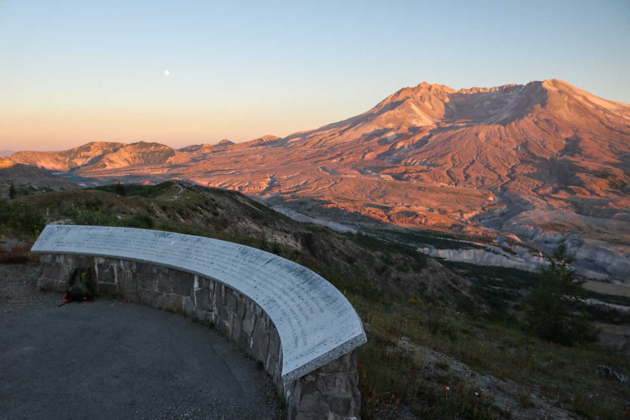


One of the easiest trails at Mount St. Helens, yet one packed with views and scenery, is the Eruption Trail.
Starting from the Johnson Ridge Observatory, this paved trail offers a great introduction to Mount St. Helens and its cataclysmic eruption.
Interpretive panels line this scenic trail, while unobstructed panoramic views of Mount St. Helens can be enjoyed everywhere.
Looking below and behind you, you can clearly see the evidence of the mountain’s eruption in the form of pumice plains, downed trees, massive flow fields and huge boulders.
This is a not-to-be-missed short hike at Mount St. Helens, even if you’re planning on doing a longer day hike like the Harry’s Ridge Trail above.
- Distance: 0.5 miles roundtrip
- Duration: 30 minutes
- Difficulty: Easy
- Trailhead location: Johnson Ridge Observatory
Ape Canyon Trail
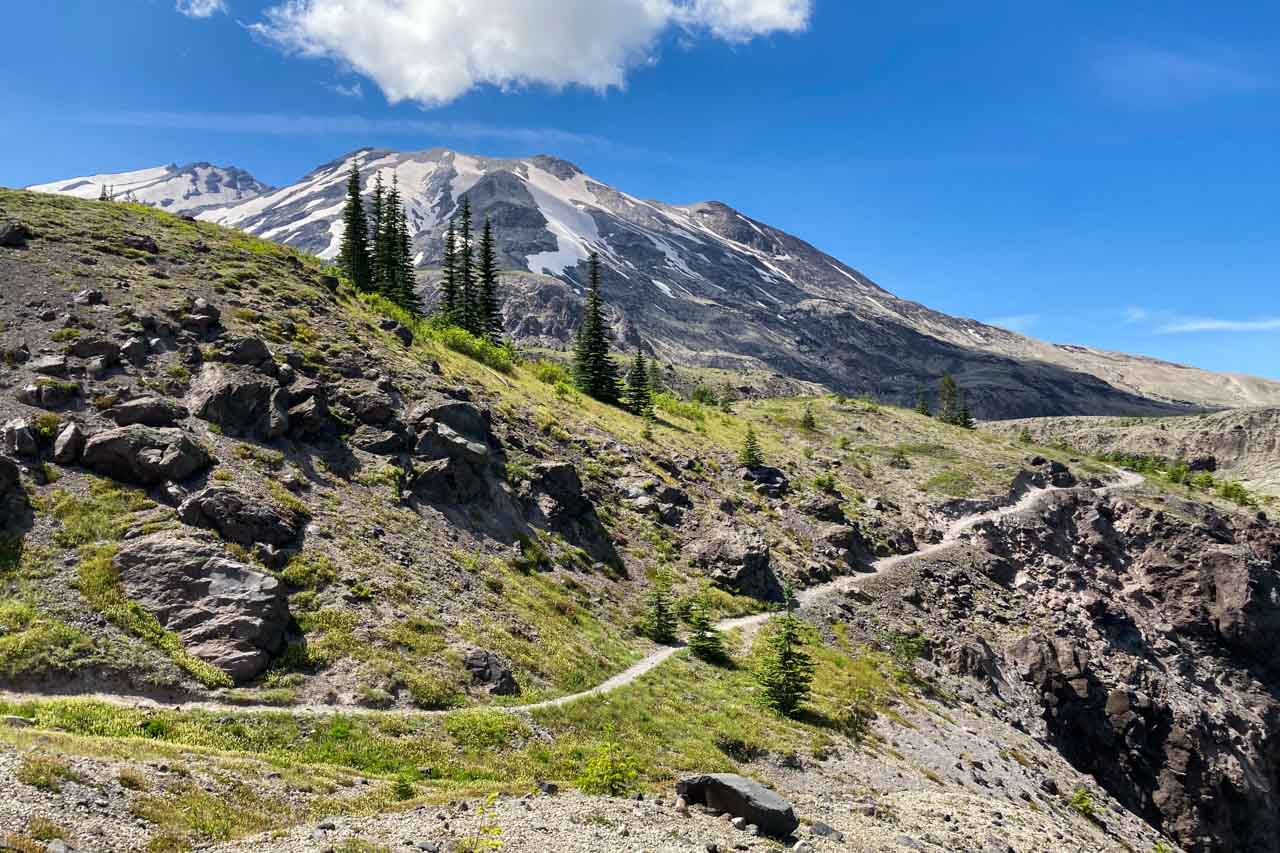
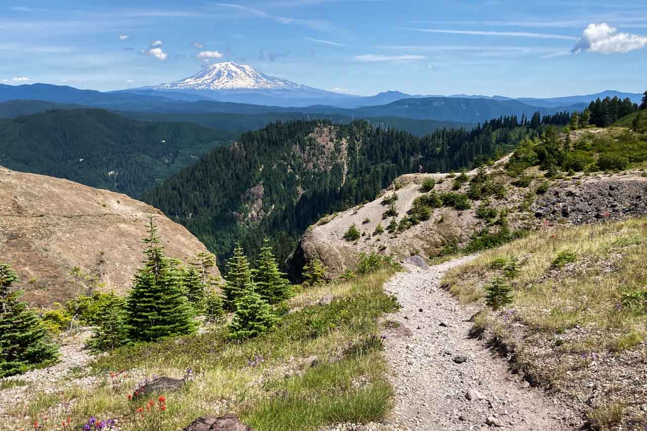

Located on the more remote southern slopes of Mount St. Helens, the Ape Canyon Trail is well worth the effort to get there. In fact, this might just be my personal favorite hike in Mount St. Helens National Volcanic Monument.
An 11-mile out-and-back hike, the Ape Canyon Trail starts along a massive mudflow, which ran down the Muddy River drainage, before climbing steadily through a forest of silver, noble and Douglas firs.
Emerging from the several-mile section through the forest, you suddenly enter a gorgeous area above the tree line. There, expansive alpine meadows and epic panoramic views await.
Facing away from Mount St. Helens itself, which towers majestically above you, the panorama takes in mountains, meadows, rivers and ridges.
You can clearly see Mount Adams dominating the distant landscape, as well as Ape Canyon, which got its name after an alleged encounter with “apemen” in 1924, one of the Pacific Northwest’s many Sasquatch-related stories.
It’s a truly magnificent area, especially in summer, when the wildflowers are blooming, the sun is shining and the sky is clear.
- Distance: 11 miles roundtrip
- Duration: 4 hours
- Difficulty: Strenuous
- Trailhead location: Ape Canyon Trailhead (#234) on Forest Road 83, about 17.5 miles northeast of Cougar, Washington
Other Amazing Hikes at Mount St. Helens National Volcanic Monument
In addition to the Mount St. Helens hikes above, there are several other trails you might want to explore.
(I haven’t done these hikes myself yet, which is why I haven’t included them above. Once I’ve been there, and if I liked them, I’ll add them to the list!)
- Hummocks Trail (north side)
- Lakes Trail (north side)
- Norway Pass (northeast side)
- Ape Caves Lava Tubes (south side)
- Plains of Abraham – Windy Ridge Loop Trail (southeast side)
What Are Your Favorite Hikes in Mount St. Helens National Volcanic Monument? Share Your Mount St. Helens Hiking Experience Below!
More Hikes in Pacific Northwest Parks
- Amazing Hikes in Mt. Hood National Forest, Oregon
- Best Hikes in Crater Lake National Park, Oregon
- Waterfall Hikes in the Columbia River Gorge, Oregon
- Spring Wildflower Hikes in the Columbia River Gorge, Oregon and Washington
- Best Hikes in Mount Rainier National Park, Washington
- Short and Easy Day Hikes in Olympic National Park, Washington

