10 Best Hikes in Virgin Islands National Park
Besides lounging on breathtaking beaches and snorkeling in coral reefs, another popular thing to do in Virgin Islands National Park is hiking.
When I visited the park in January, I spent a significant amount of time exploring its many scenic trails, which allowed me to learn more about its history, bask in beautiful natural scenery, and see amazing views.
With a wide variety of trails to choose from—including gentle strolls along the shoreline of a bay, humbling walks through historic sugar plantations, or strenuous hikes to panoramic views—there will be a hike or two, or more, you can do during your visit as well.
After all, there are more than 20 different hiking trails on the island of St. John, most of which is protected as part of Virgin Islands National Park. Most of those are within the boundaries of the national park.
On those hiking trails in Virgin Islands National Park, you can immerse yourself in the tropical scenery of St. John, learn about its history as a Danish colony, visit historic sugar plantations, see stunning beaches, and enjoy jaw-dropping Caribbean vistas.
In this blog post, I will describe my ten favorite hikes in Virgin Islands National Park. I decided to list them in a “top 10 list” format, just so you have a better idea of which trails I recommend focusing on, in case your time in the park is limited.
This blog post about the best hikes in Virgin Islands National Park contains affiliate links. If you click on one of those links and make a purchase from one of our partners, we may earn a commission, without any extra cost to you. This helps support this website and ensures fair compensation for our team.
Tips For Hiking in Virgin Islands National Park
Hiking in Virgin Islands National Park is generally pretty safe, provided that you follow some basic advice.
For one, there are no dangerous land animals in the park—no bears, no snakes, no moose. There are some feral donkeys and goats in the park, though, but as long as you don’t disturb them, they’ll leave you alone, too.
I recommend following all of these tips for a safe and successful hiking experience in Virgin Islands National Park:
- Get a copy of The Hiker’s Guide to Virgin Islands National Park at the Visitor Center in Cruz Bay. It’s only $5 and is easily the best overview of all trails on St. John. I purchased one myself and I think it’s a fantastic resource to have.
- Bring plenty of snacks and water. A rule of thumb is to bring at least 1/2 gallon of water for every four hours of hiking.
- Be aware that cell phone service can be limited or non-existent. St. John doesn’t have many towns and many trails in Virgin Islands National Park are quite remote, so cell phone service is not available everywhere.
- Stay on the trails. Some trails may pass by private property; don’t trespass. Staying on the trails also ensures that you don’t damage the park’s vulnerable natural resources.
- Wear cool, loose-fitting clothes and sturdy hiking shoes. While all of the trails featured below are pretty well maintained, several of them are gravel trails in the woods, with rocks and exposed roots. Sturdy hiking shoes are a must.
- Remember that parking is limited at most trails. Plan to arrive at your trailhead early in the morning or later in the afternoon (but make sure there’s plenty of time to get back to your car before dark).
- Don’t leave valuables in your car. Break-ins are not uncommon on St. John.
- Use insect repellent. Especially during the rainy summer season, bugs can be a nuisance on many trails.
- Always wear sunscreen. The Caribbean sun is strong and it’s important to protect yourself from UV rays. Always use reef-safe sunscreen, which you can find in shops throughout the island.
- Don’t touch or pick any vegetation. Some plants are poisonous and/or can have stinging insects on them. See this overview of which plants to avoid while hiking in Virgin Islands National Park. Follow the Leave No Trace principles to reduce your impact on this fragile environment.
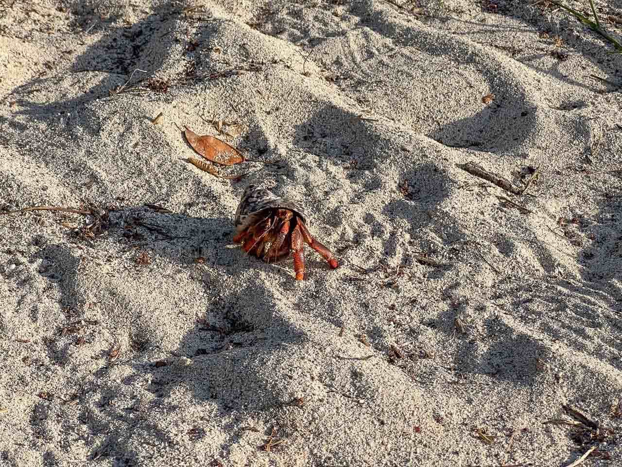
- Watch for hermit crabs! Many Virgin Islands hiking trails run through hermit crab habitat—woodlands close to beaches. You’ll almost certainly see these fascinating little crabs when hiking trails like the Reef Bay Trail and Ram Head Trail. They blend in with their environment and can be hard to spot if you don’t pay attention. Don’t step on them!
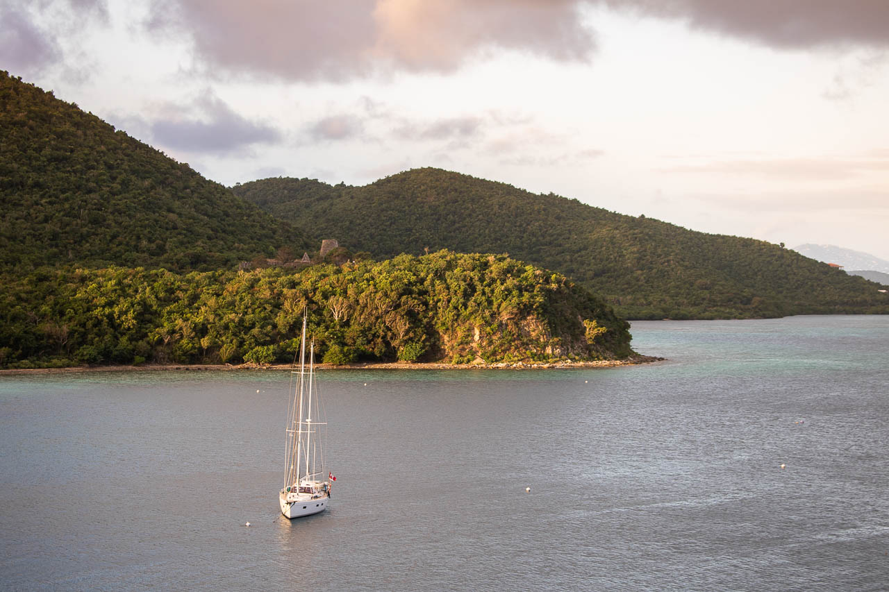
Top 10 Best Hikes in Virgin Islands National Park, St. John
Okay, let’s get to the actual topic of this blog post: the best hikes in Virgin Islands National Park.
Even though I do recommend trying to do as many hikes as you can—it’s an essential experience in this extraordinary national park, allowing you to really immerse yourself in its tropical scenery and history—I also realize that doing ten hikes may not be suitable for many visitors.
What I suggest you do is reading through each of these trail descriptions, looking at the photos, and then deciding which hike(s) you’d like to do during your visit to St. John.
10. Caneel Hill Trail
- Difficulty: Strenuous
- Distance: 2 miles, out and back
- Duration: 1 hour
- Location: Cruz Bay, trailhead is just up the road from the Virgin Islands National Park Visitor Center
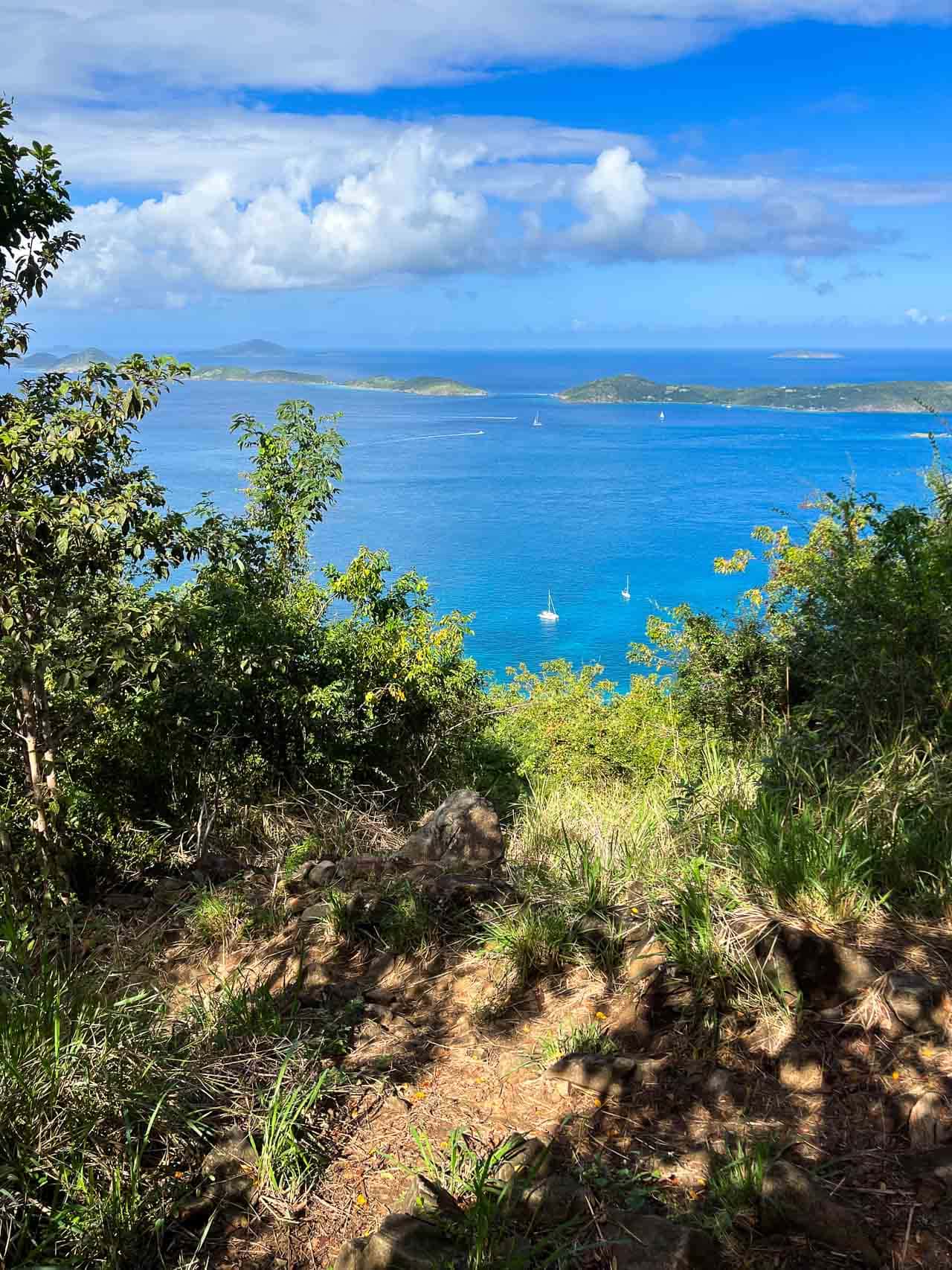
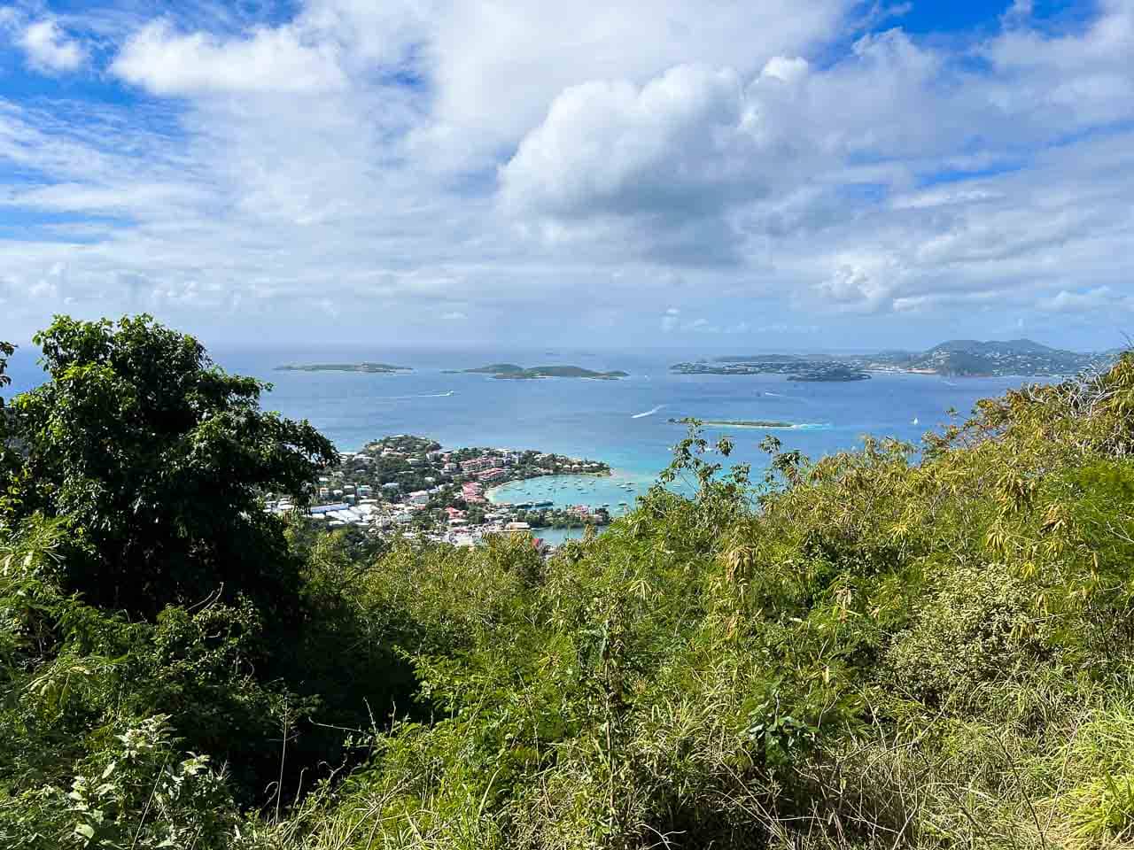
Hike to a hilltop viewpoint on this short but challenging trail. Starting just up the road from the park’s Visitor Center in Cruz Bay, the Caneel Hill Trail climbs about a mile to the summit of 719-foot Caneel Hill.
You’ll walk through a humid tropical forest as you ascent the hillside, so wear light clothing and bring plenty of water. There are sporadic views through the trees on the way up, but the best panoramic view awaits on the observation platform at the top.
After taking in the beautiful view of Cruz Bay, Caneel Bay, and other bays on the northwest shore of St. John, you can retrace your steps back down or continue on the Caneel Hill Trail toward Margaret Hill.
I’d recommend hiking up to the observation platform and back down. This is a trail that’s worth doing if you have plenty of time visiting St. John and looking for a hike near Cruz Bay.
Otherwise—if you only have time for, or are planning to do only one or two hikes—I think you’re better off choosing one of the other hikes in Virgin Islands National Park further down this list.
9. Cinnamon Bay Sugar Plantation Nature Loop
- Difficulty: Easy
- Distance: 0.5 miles, loop
- Duration: 30 minutes
- Location: Across the road from the Cinnamon Bay Beach & Campground parking lot
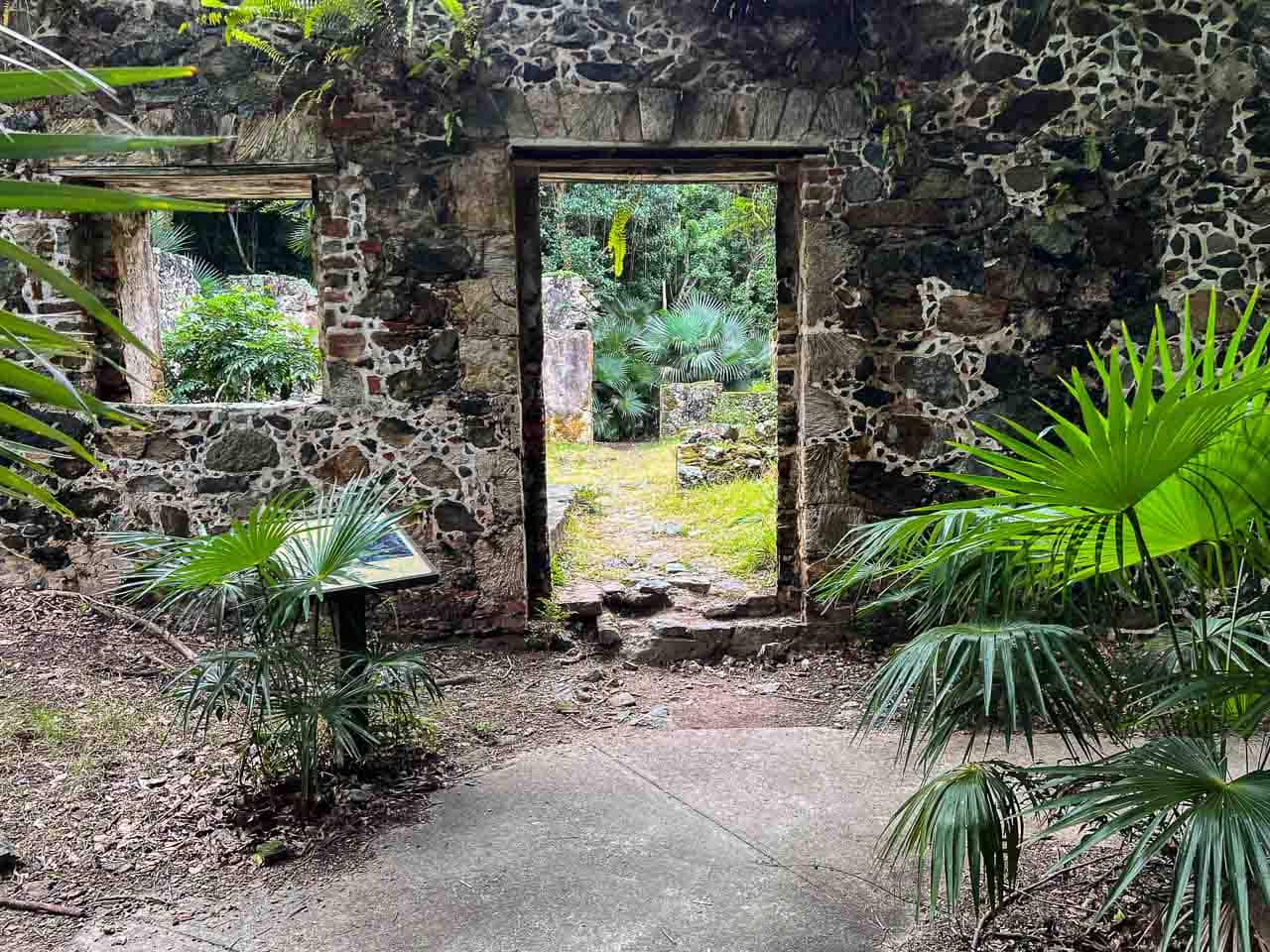
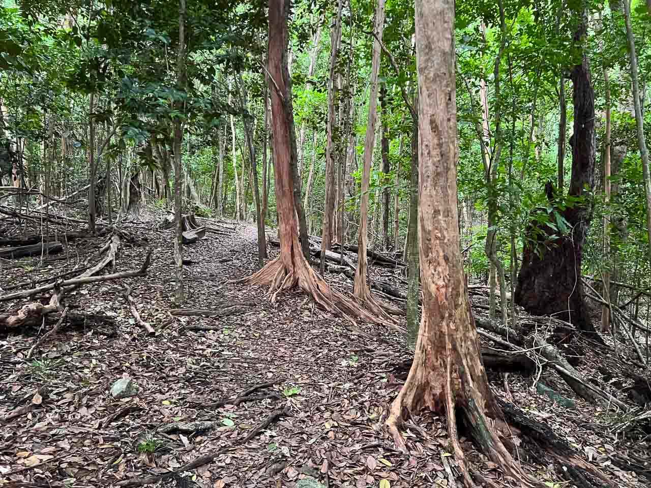
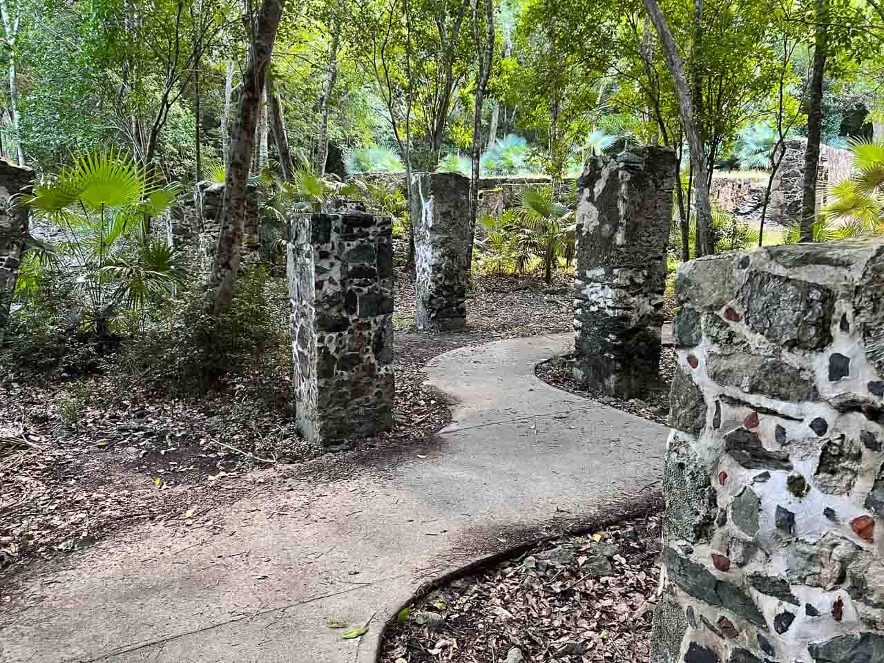
One of the easiest hikes in Virgin Islands National Park, the Cinnamon Bay Sugar Plantation Nature Loop is only half a mile long, but it’s fascinating, nonetheless.
This loop hike, comprised of a boardwalk and gravel path through the woods, takes you through and around the historic Cinnamon Bay Sugar Plantation ruins.
Established in 1717 by the Danes, this sugar plantation was one of the first of its kind on St. John and tells the story of sugar cane production and slavery in the 18th-century Danish West Indies.
When walking the nature loop, you can explore the ruins, which include a horse mill, factory building, slave quarters, a warehouse, cemeteries, plantation house, and cook house.
Note the scent of bay rum trees as you make your way around the trail, which were once used to produce the famous St. John Bay Rum Cologne.
The trailhead of the Cinnamon Bay Sugar Plantation Nature Loop is across North Shore Road from the parking lot at the Cinnamon Bay Beach & Campground.
8. Francis Bay Trail
- Difficulty: Easy
- Distance: 0.7 miles, loop
- Duration: 30 minutes
- Location: Francis Bay Sugar Factory parking lot at the end of Mary Creek road
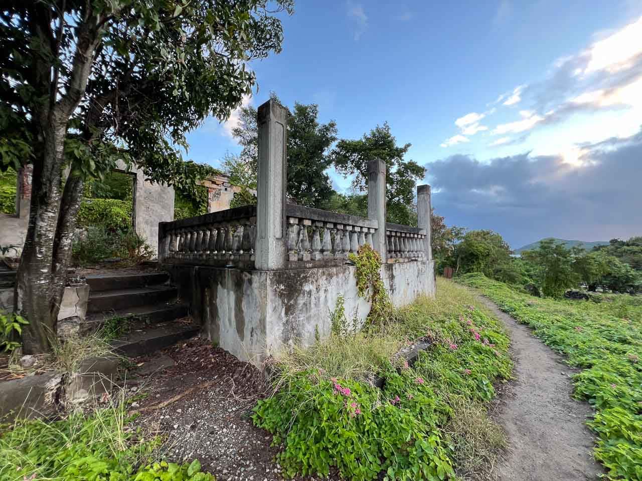
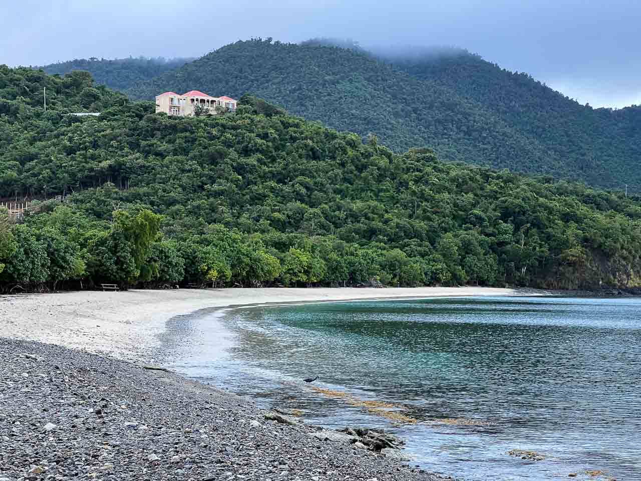
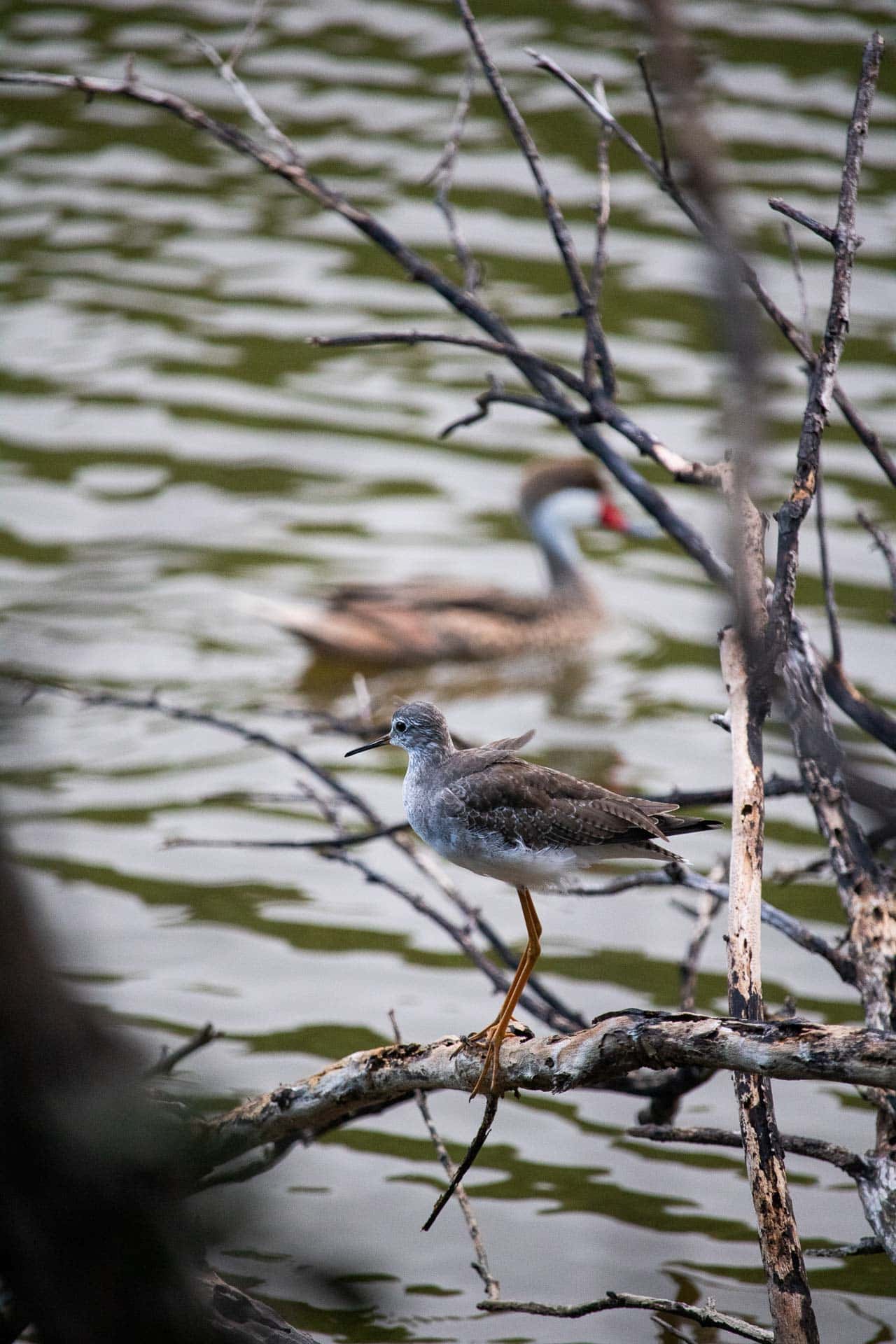
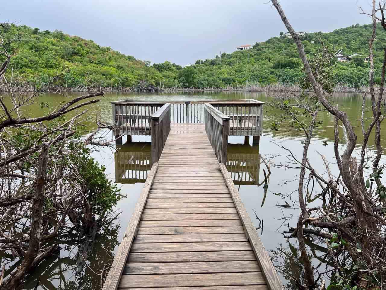
The easy yet scenic and diverse Francis Bay Trail is a wonderful hike for everyone who enjoys wildlife watching and learning about local history.
The trail starts at the small parking lot at the Francis Bay Sugar Factory ruins and runs past the Mary’s Point Estate House. It swings down to the shoreline below, where it continues on a boardwalk to the left.
This boardwalk, which runs through a salt pond lined with mangroves, is arguably the best place on St. John for bird watching. Numerous birds call this area home, including pelicans, cuckoos, thrashers, moorhens, ducks, stilts, sandpipers, and herons.
Two viewing platforms allow you to pause and observe the abundant bird life at the Francis Bay salt pond.
At the end of the boardwalk, you can walk back up to your car via the paved road. Alternatively, you can also spend some time at the wonderful Francis Bay Beach, which offers excellent swimming and snorkeling opportunities, too.
7. Annaberg Sugar Plantation Historic Trail
- Difficulty: Easy
- Distance: 0.25 miles, loop
- Duration: 20-30 minutes
- Location: Annaberg Sugar Plantation parking lot, located at the end of a spur road off of North Shore Road
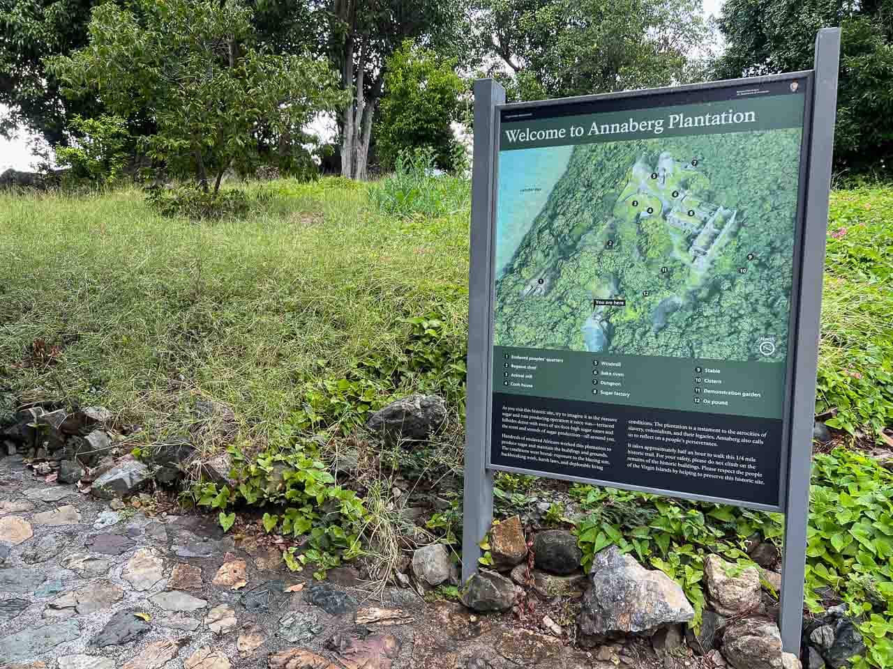
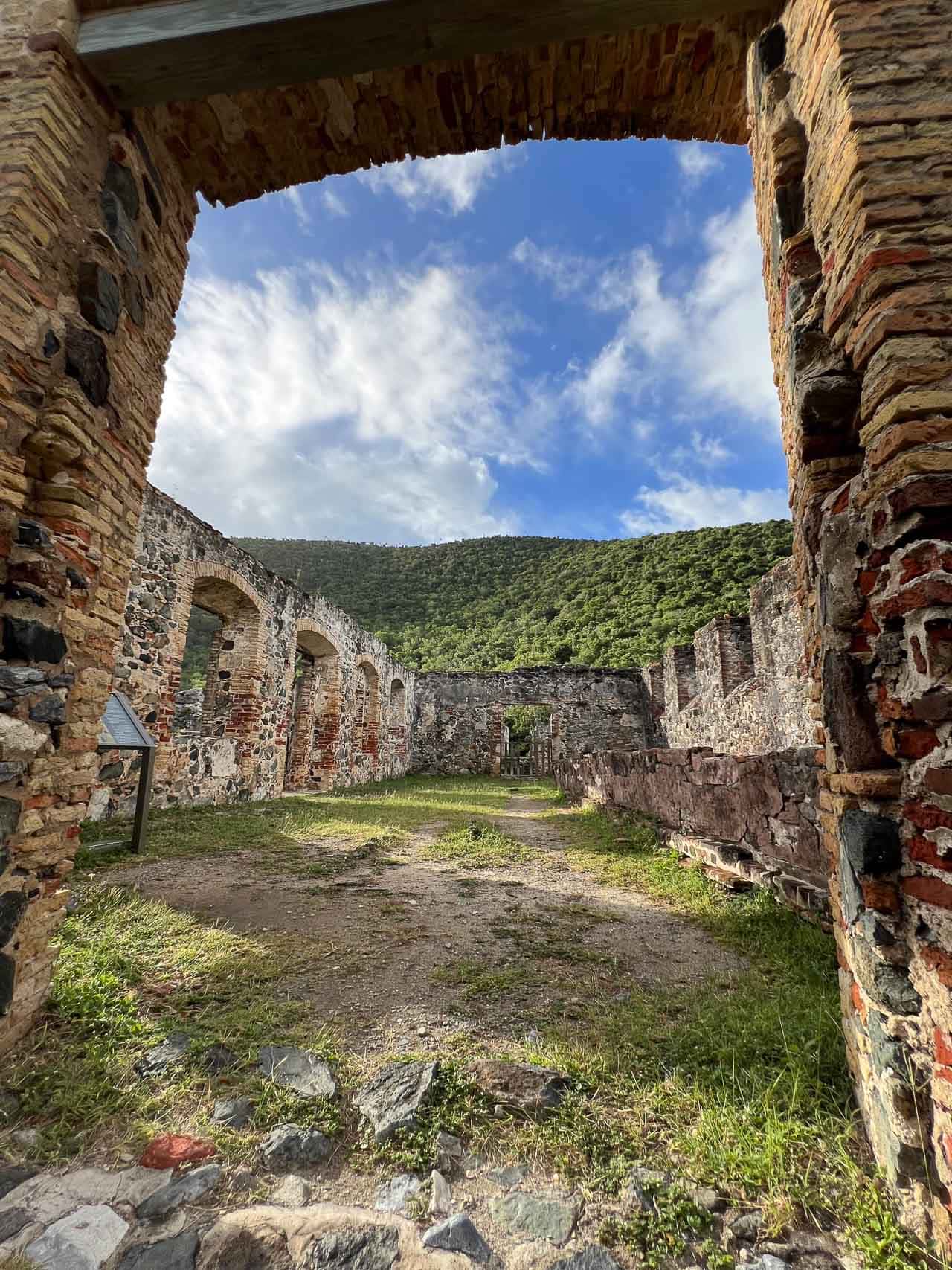
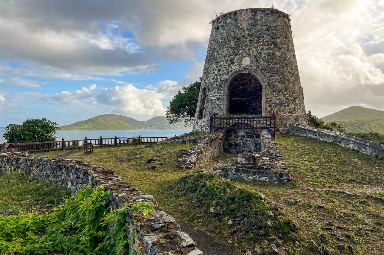
Although only a quarter-mile long, the Annaberg Sugar Plantation Historic Trail is jam-packed with history. This paved path loops through the ruins of an 18th-to-19th-century sugar cane plantation and offers an insight into a time when “sugar was king” on St. John.
This plantation dates from the Danish colonial era in the history of the Virgin Islands, a time when St. John was known by its Danish name St. Jan.
At the peak of the sugar boom, more than 600 enslaved Africans labored at this plantation under what can only be described as brutal conditions. They produced sugar, along with molasses and rum.
In addition to telling the story of slavery in the Virgin Islands, Annaberg also stands as a reminder of the displacement of Indigenous people on St. John, as well as settlement by Europeans.
“As you traverse this historic trail, imagine sugar being processed from cane and sense the spirits of the people who lived, worked, and died here,” the National Park Service says.
The interpretive Annaberg historic trail takes you past several buildings that once made up the plantation, including the striking windmill tower, sugar factory, and slave quarters. I recommend setting aside at least half an hour to immerse yourself in this historically important site.
TIP: If you’re feeling like hiking some more, I highly recommend the Leinster Bay Trail, which starts at the same parking lot. It runs alongside the beautiful north shoreline of St. John toward Waterlemon Bay Beach, where you can continue your hike on the scenic Johnny Horn Trail. See number 2 down this list for more details!
6. Peace Hill Trail
- Difficulty: Easy
- Distance: 0.2 miles, out and back
- Duration: 15-20 minutes
- Location: Parking lot about 0.7 miles east of Hawksnest Beach and 0.7 west of Trunk Bay on North Shore Road
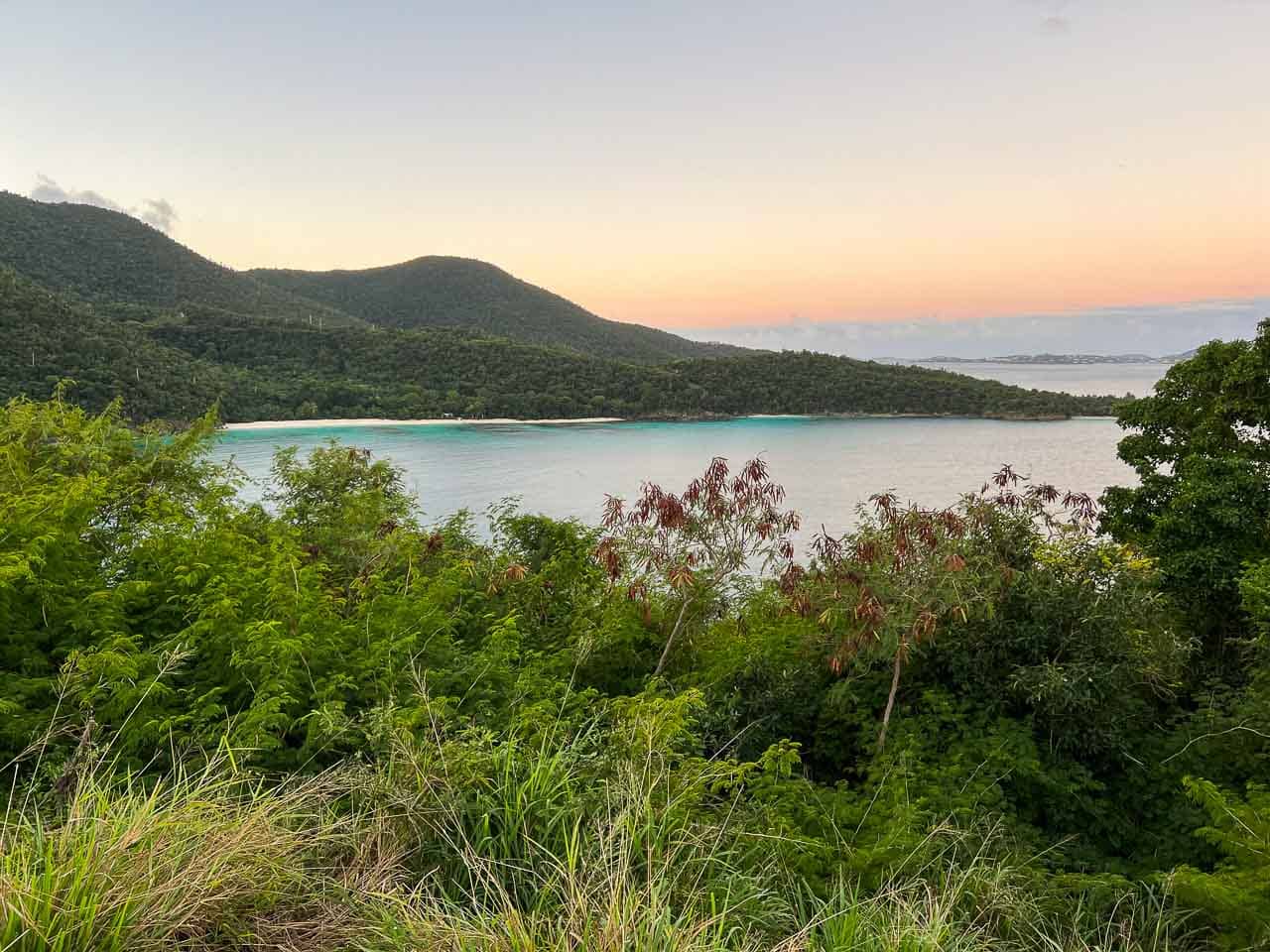
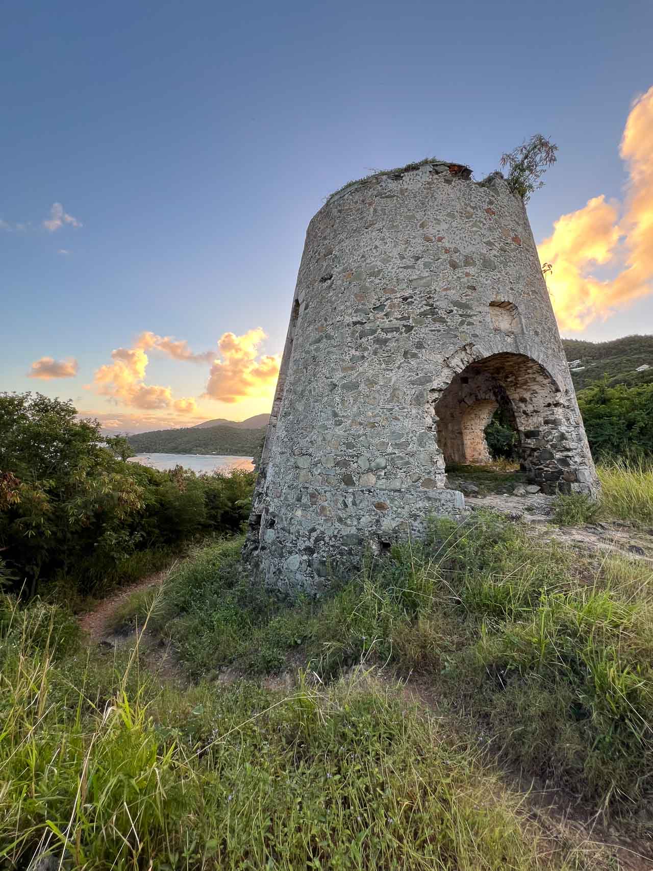
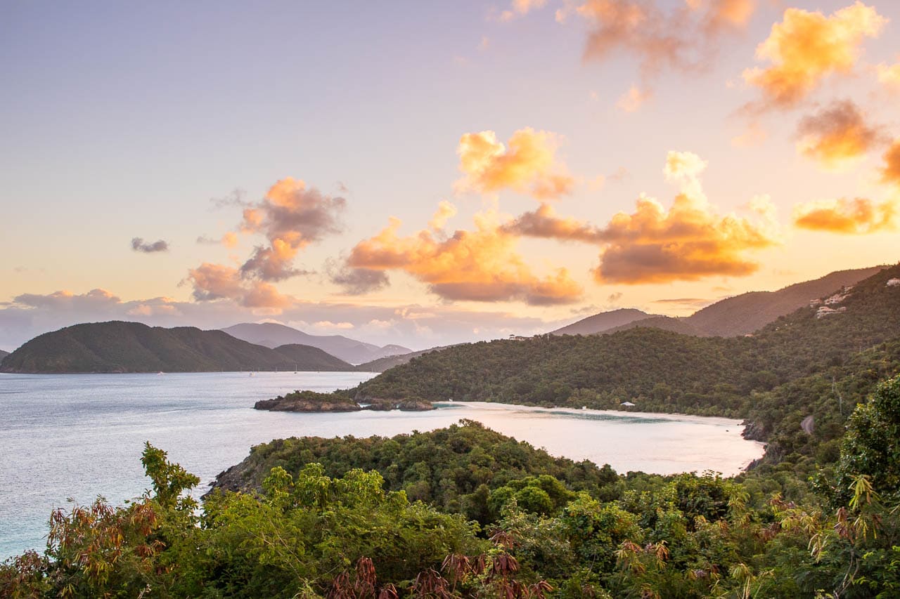
Often skipped by visitors who are eager to get to one of the beautiful beaches, Peace Hill is one of my favorite places in Virgin Islands National Park.
The only reason it didn’t make it in my top five of best hikes in Virgin Islands National Park is because it’s so short. It’s more of a brief stroll than an actual hike worthy of the name. Still, it must be mentioned simply because of its cultural significance and, above all, spectacular panoramic vista.
The Peace Hill parking lot is located on North Shore Road, halfway between Hawksnest and Trunk Bay.
From the parking lot, an easy 0.1-mile trail with a moderate incline brings you to the top of Peace Hill, where the ruins of a windmill—once part of the nearby Denis Bay Plantation—and sensational views await.
There’s a cool view from within the windmill ruins, with its windows beautifully framing the Caribbean coastline beyond. As you explore the small top of Peace Hill, you can also enjoy views of Hawksnest Beach to the southwest, as well as Trunk Bay to the east.
I think this is one of the best views in Virgin Islands National Park because—as its name implies—it is, in fact, usually a pretty quiet and peaceful place. It’s a great spot for a picnic lunch, or to enjoy a sunset or sunrise in Virgin Islands National Park.
I walked up to Peace Hill one morning at sunrise and was all alone, able to enjoy the beautiful setting and amazing views in wonderful contemplative solitude. Highly recommended!
Top 5 Best Hikes in Virgin Islands National Park, St. John
While I did really enjoy the hikes described above during my own visit to Virgin Islands National Park—particularly the Annaberg Sugar Plantation and Peace Hill stood out to me—I do think that the following five trails are even better.
Therefore, if your time in the park is limited and/or you only want to do a couple of hikes, I strongly recommend picking from these five hikes.
5. Cinnamon Bay Trail to America Hill Ruins
- Difficulty: Strenuous
- Distance: 1.3 miles, out and back
- Duration: 1 hour
- Location: Cinnamon Bay Sugar Plantation Ruins, just across the road from the Cinnamon Bay Beach & Campground parking lot
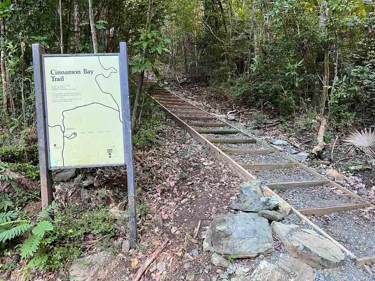
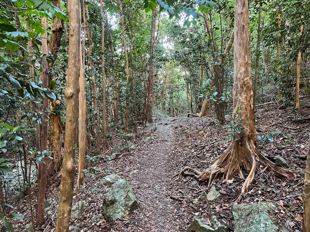
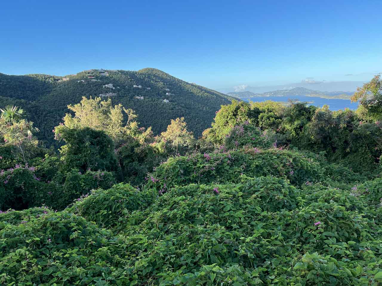
One of my favorite hikes in Virgin Islands National Park, the Cinnamon Bay Trail starts adjacent to the Cinnamon Bay Sugar Plantation ruins (you can easily combine it with the nature loop around the ruins).
Although this isn’t a particularly long hike, it is pretty steep. The first section is a staircase that steeply climbs through a shady and often humid forest before somewhat leveling out.
Note the many tropical tree species that make up this dense forest, including guava berry, mango, mammee apple, genip, and kapok.
After about a quarter-mile, you’ll see a sign for the spur trail to the America Hill Great House ruins. This spur trail is about 0.4 miles one way and has a noticeable incline. Once you get to the ruins, you’ll more than likely be pretty sweaty, so make sure to bring plenty of water on your hike.
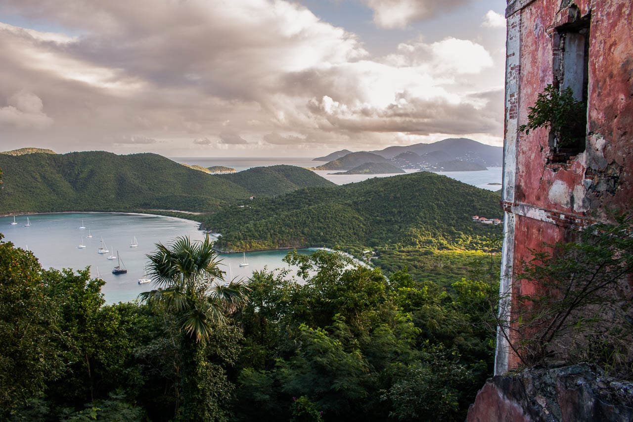
In my opinion, the America Hill Great House Ruins are one of the most underrated historic places in Virgin Islands National Park. Despite being quite weathered down and partially overgrown with vegetation, you can still see the buildings’ beautiful pink color.
As awesome as the ruins are, the main highlight at America Hill is the spectacular view. Overlooking the north coast of St. John, the view takes in both Maho and Francis bays and a number of other Caribbean islands in the distance.
This is easily one of the greatest views in the park, which is why the Cinnamon Bay Trail made it into my top five of best Virgin Islands National Park hikes.
4. Lind Point Trails to Honeymoon Beach
- Difficulty: Easy to moderate
- Distance: Approximately 2.3 miles, loop
- Duration: 1 hour (plus more if spending time on Honeymoon Beach, which I strongly recommend)
- Location: Virgin Islands National Park Visitor Center in Cruz Bay
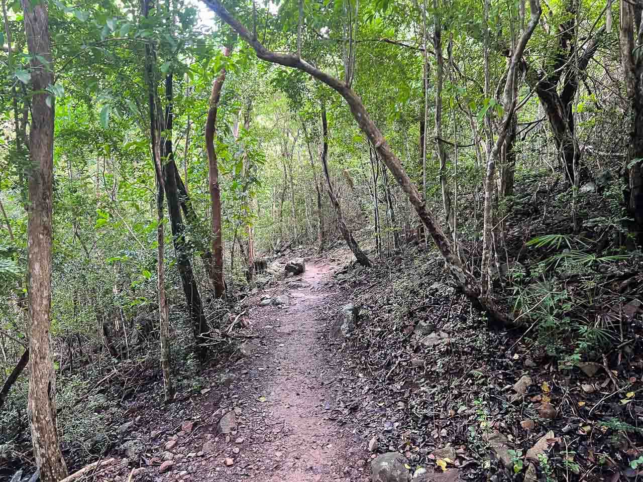
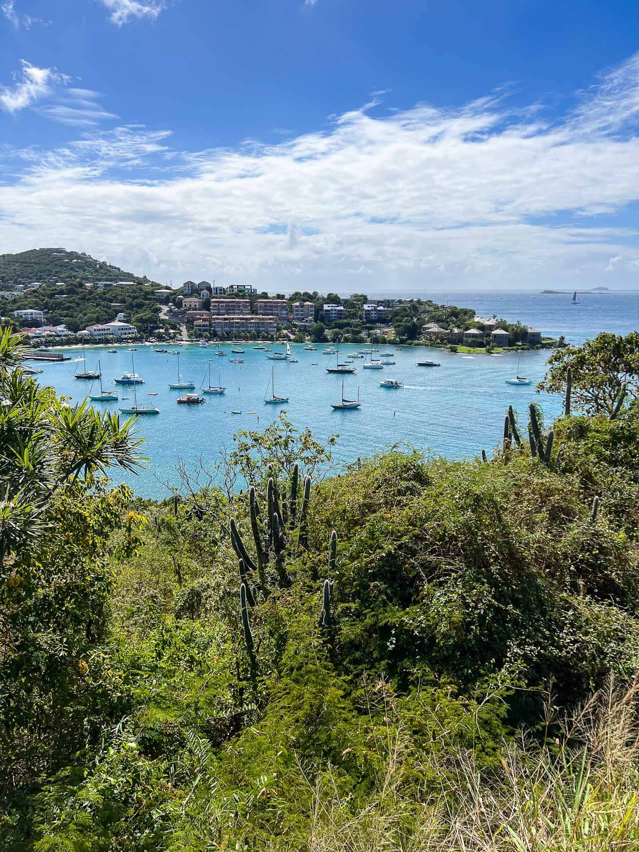
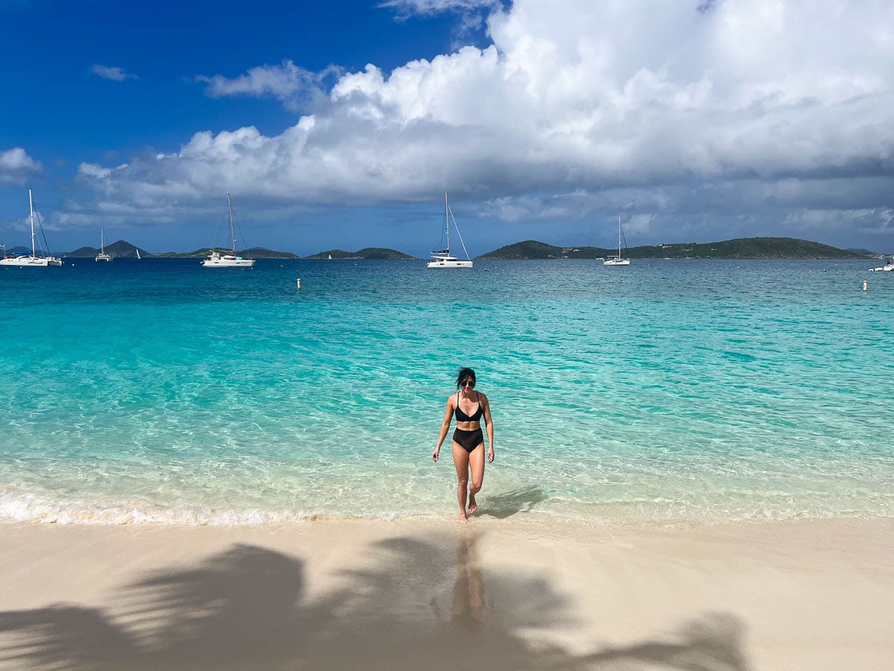
While the actual Lind Point Trails aren’t necessarily outstandingly beautiful, their destination undoubtedly is.
The Lind Point Trails consist of two sections: the Upper Lind Point and Lower Lind Point Trails. I recommend hiking the upper trail to Honeymoon Beach, passing by the wonderful Lind Point Overlook on the way, and taking the lower trail back. It’s about 2.3 miles for the whole roundtrip hike.
The trailhead is right across the road from the Virgin Islands National Park Visitor Center in Cruz Bay. If you’re parking at the limited parking lot, make sure to get a free parking permit at the visitor center!
The uncontested star attraction of the Lind Point Trails is Honeymoon Beach, which is worthy of its name. It’s one of the most beautiful beaches on St. John, boasting shallow turquoise water, soft white sand, swaying palm trees, and amenities including restrooms, showers, cocktail bars, and beach chair rentals.
Honeymoon Beach is also an excellent snorkeling location. I suggest snorkeling at the eastern end of the beach, where a coral reef extends to adjacent Caneel Bay.
3. Reef Bay Trail
- Difficulty: Strenuous
- Distance: 4.4 miles, out and back (plus a bit more if you’re going to see the Taino petroglyphs on the way)
- Duration: 3-4 hours
- Location: Roadside parking near mile marker 5 on Centerline Road
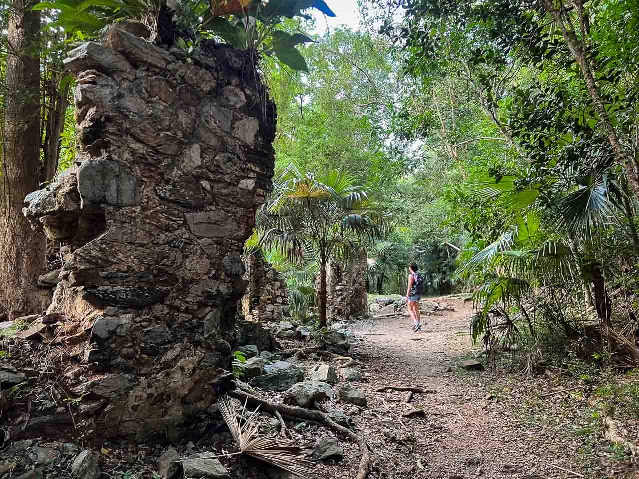
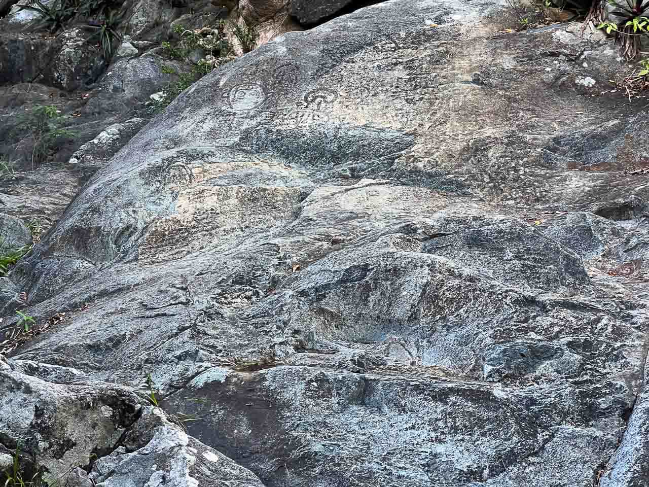
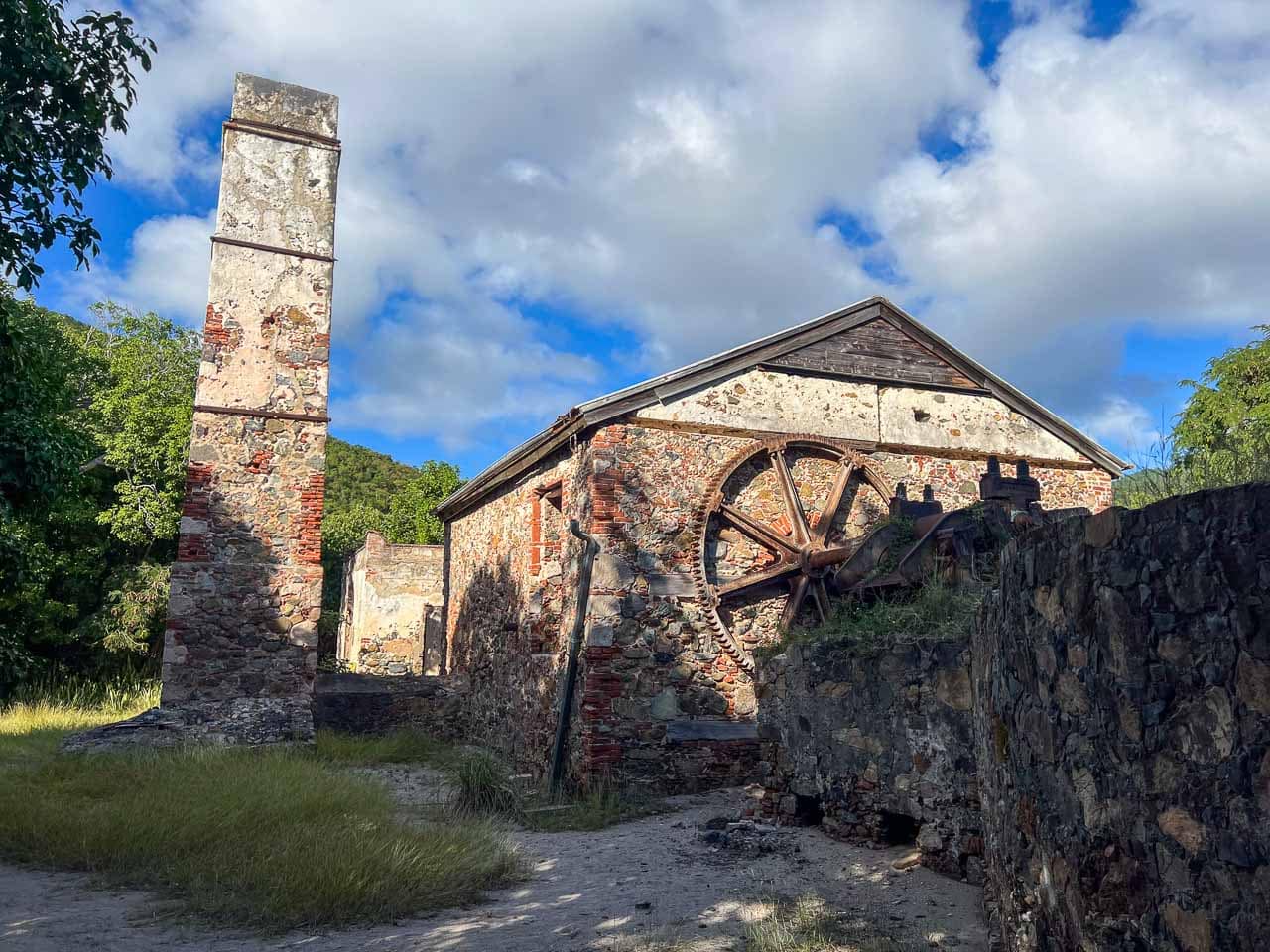

One of the longest and most challenging hikes in Virgin Islands National Park, the Reef Bay Trail runs from Centerline Road in the middle of the island all the way down to the beach at Reef Bay.
On the way, you’ll hike beneath some of the oldest and tallest trees on St. John, alongside plantation ruins, old stone walls from cattle grazing, and ancient pre-Columbian Taino petroglyphs (which are down a short spur trail).
Near the end of the trail stand the magnificent ruins of the Reef Bay Sugar Mill, which was the last operational sugar mill on St. John. The trail ends at Reef Bay Beach, which is a nice spot to relax for a while. I took my snorkeling set with me on this hike and spent some time snorkeling in the shallow water.
Although visibility was quite poor when I was there, I still managed to see a variety of fish and tons of conch shells scattered across the seagrass beds and rocky ocean floor.
Once you’re done exploring the Reef Bay Sugar Mill ruins and relaxing on the beach, it’s time to head back up. Note that the return portion of the Reef Bay Trail is the hardest part. I found the last stretch especially challenging, so pace yourself and make sure to bring plenty of water and some salty snacks!
ALTERNATIVE: If you’re looking for an alternative to the Reef Bay Trail, the L’Esperance Trail is an excellent option. This trail is 2.6 miles one way and also starts on Centerline Road. It eventually links up with the Reef Bay Trail and runs down to the Reef Bay Sugar Mill ruins. Avid hiker may choose the combine both trails to create a challenging loop hike that also includes a walk on Centerline Road.
2. Leinster Bay and Johnny Horn Trails to Murphy Great House Ruins
- Difficulty: Easy to moderate
- Distance: 2.4 miles, out and back
- Duration: 1 hour
- Location: Annaberg Sugar Plantation parking lot, located at the end of a spur road off of North Shore Road
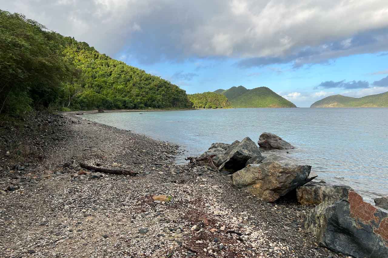
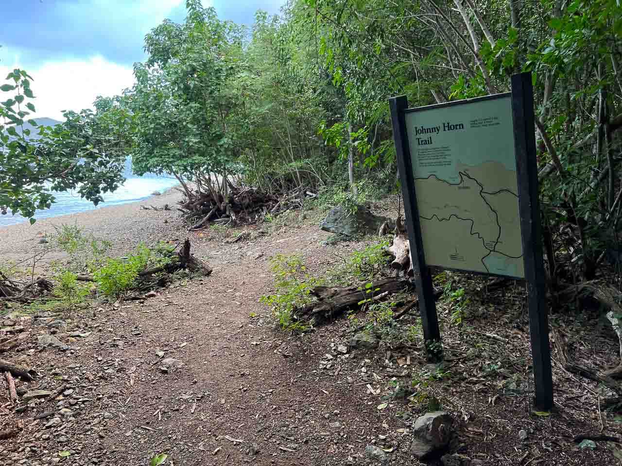
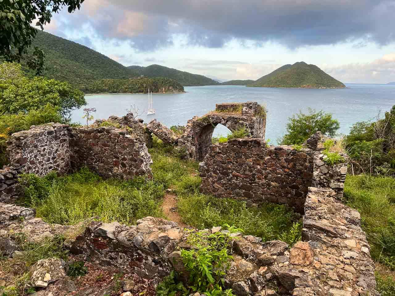
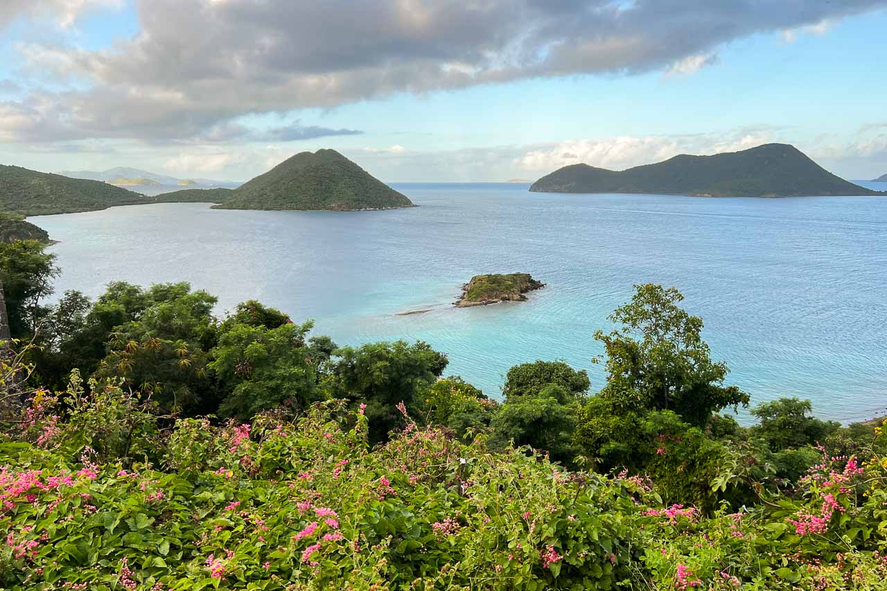
The Murphy Great House ruins—also known as the Windy Hill ruins—are among the greatest “hidden secrets” of Virgin Islands National Park. And if it wasn’t for the number one in this list of best hikes in Virgin Islands National Park (see below), this would easily be my number one hike in the park.
You’ll find these historic ruins at the end of the short spur trail off of the Johnny Horn Trail, which in its turn is accessed via the Leinster Bay Trail. The trailhead of the Leinster Bay Trail is just beyond the Annaberg Sugar Plantation parking lot.
It’s a flat 1-mile one-way hike along the shoreline of scenic Leinster Bay, followed by a relatively steep section on the Johnny Horn Trail.
After passing a first collection of ruins halfway up the hill, you’ll see a sign that points toward the Murphy Great House Ruins.
From the ruins, there’s a truly stunning view of Waterlemon Bay and Leinster Bay. Famous Waterlemon Cay, one of the greatest snorkeling spots in the U.S. Virgin Islands, is clearly visible below.
While this view is spectacular all day long, I’d recommend hiking the Leinster Bay and Johnny Horn Trails at either sunrise or sunset.
I made the effort to start this hike at sunrise and—although I also got caught in a rain shower on the trail—the gorgeous views and beautiful morning sunlight were amazing and well worth it.
TIP: I recommend combining the Leinster Bay and Johnny Horn Trails with a visit to the Annaberg Sugar Plantation ruins. You’ll be parked at the parking lot anyway and these ruins are arguably the greatest on St. John—an absolute top attraction in Virgin Islands National Park.
1. Salt Pond Bay Beach to Ram Head Trail
- Difficulty: Moderate
- Distance: 2 miles, out and back from Salt Pond Bay Beach (which is a short walk down from the parking lot on Route 107)
- Duration: 1 hour
- Location: Salt Pond Bay Beach in the far southeastern corner of St. John
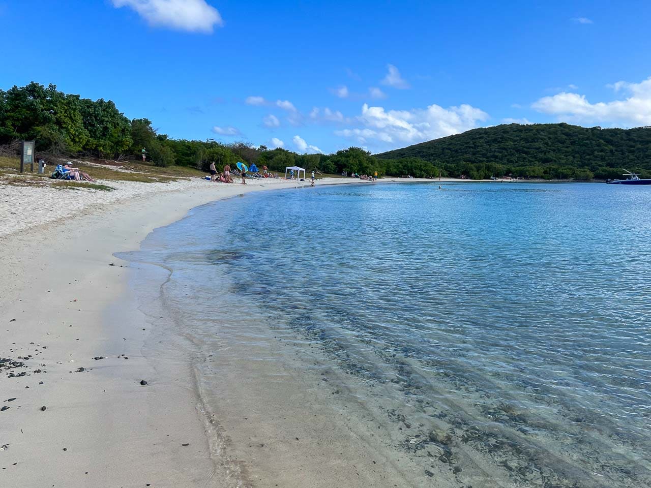
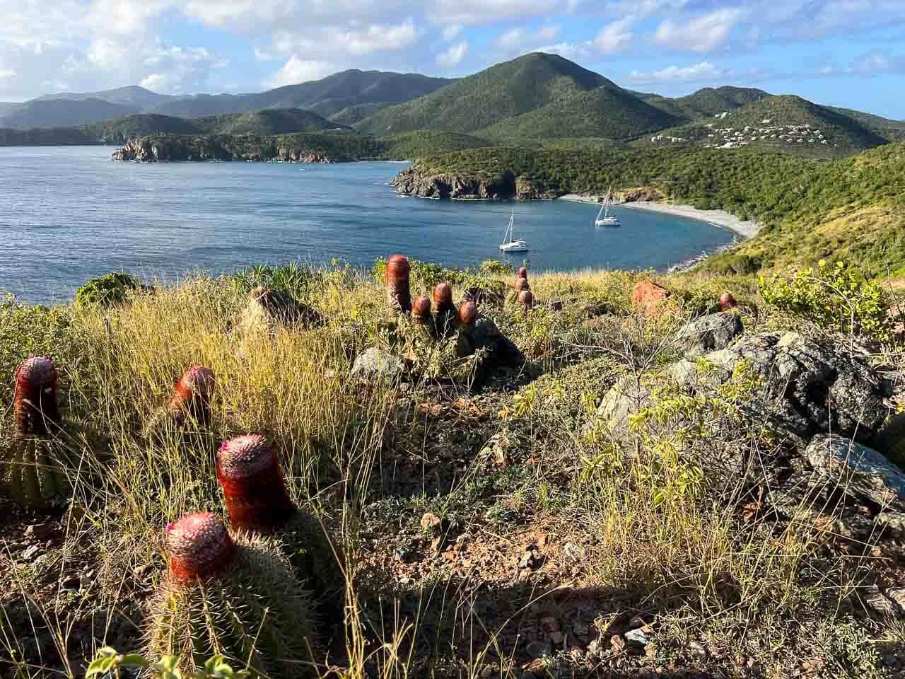
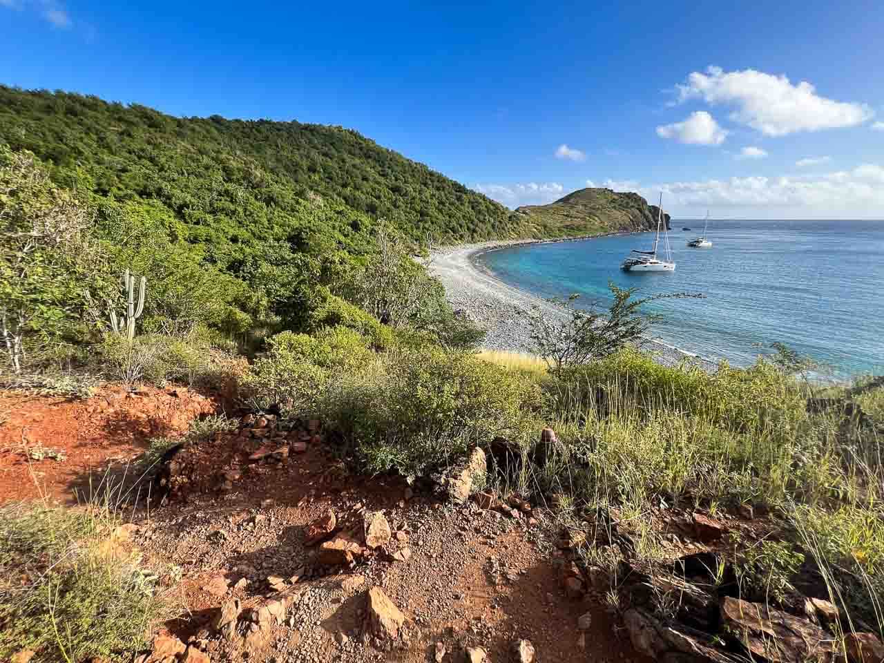
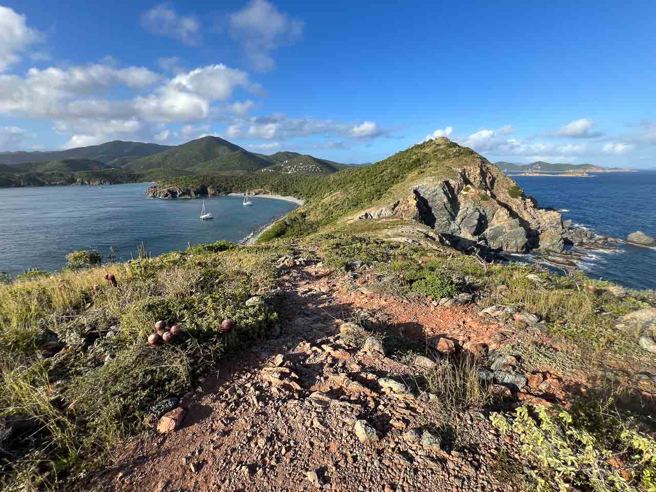
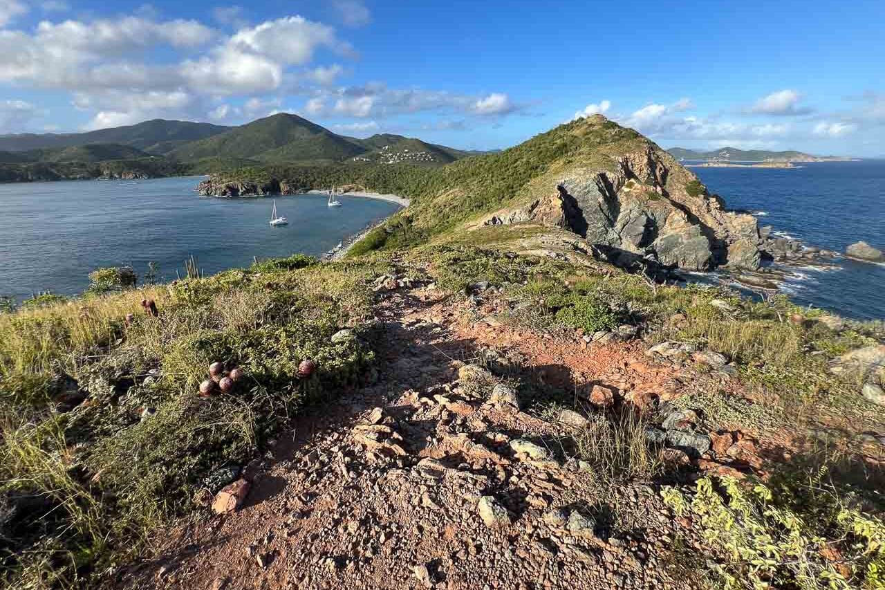
The southernmost point on St. John, Ram Head is a high bluff that overlooks the Caribbean Sea and offers superb views of the remote bays in this part of the island.
The only way to get there is via the Ram Head Trail, a 2-mile roundtrip hike from Salt Pond Bay Beach (which also requires a short walk from the parking lot).
A narrow path that meanders along the coastline and up the bluff, the Ram Head Trail is easily one of the top hikes in Virgin Islands National Park.
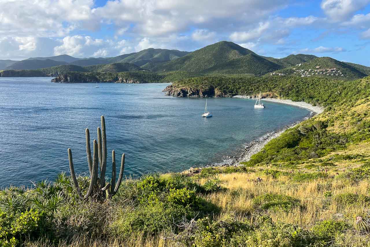
On the way, you’ll clearly notice that this is the drier side of the island of St. John, as you walk among the hundreds of cacti that dot the hillsides.
At Ram Head, you’re rewarded by truly spectacular 360-degree views. From the bluff, you can gaze out across the seemingly endless waters of the Caribbean Sea to the south, as well as Salt Pond Bay to the northwest and the East End peninsula of St. John to the northeast.
Different from the views on the northern side of Virgin Islands National Park, yet by no means less breathtaking, the panorama at Ram Head is a great reason to hike this remote trail.
TIP: I also strongly suggest spending some time at Salt Pond Bay Beach before and/or after your hike. Below the warm and shallow waters of this beautiful bay, there are sprawling seagrass beds, which attract sea turtles, dolphins, and stingrays. It’s one of the best places to go snorkeling in Virgin Islands National Park.
I love the Salt Pond Bay and Ram Head area so much because it’s so diverse. There’s amazing hiking, the beach is beautiful, the snorkeling is superb, and its relative remoteness makes it pretty quiet.
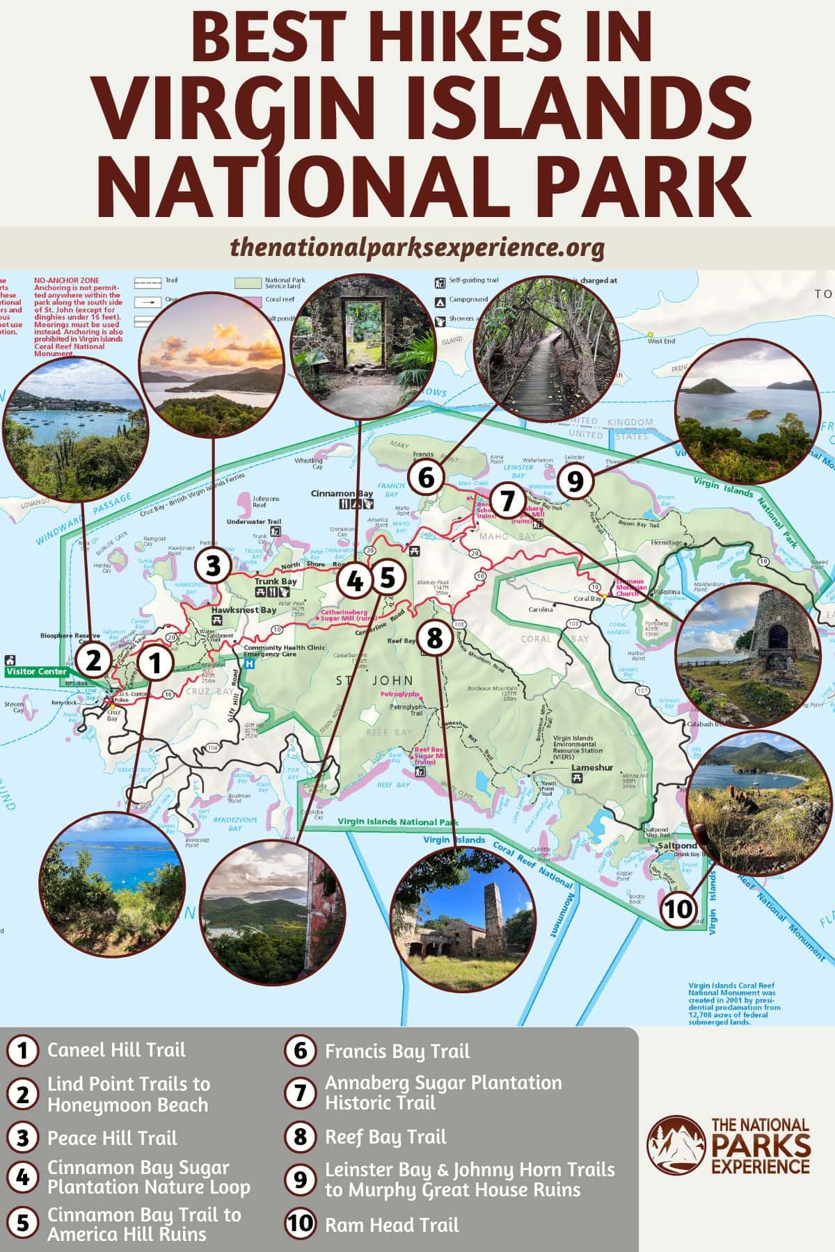
Map of the Best Hiking Trails in Virgin Islands National Park
This map shows the general location of the Virgin Islands National Park hikes featured in this blog post. Seeing where they’re located on a map may help you determine whether or not a particular hiking trail fits your plans when visiting St. John.
More About Virgin Islands National Park
- Park Website
- Travel Guide
- Topographic Map
- Best Time to Visit Virgin Islands National Park
- Most Beautiful Beaches in Virgin Islands National Park
- Best Views in Virgin Islands National Park
- Historic Ruins in Virgin Islands National Park
- Virgin Islands National Park Snorkeling Guide
- Accommodation

