10 Amazing National Parks Along Route 66
This Route 66 national parks post contains affiliate links. You can read more about our Terms of Use / Disclosure here.
The National Park Service and Route 66 have always been linked to one another. In its heyday, Historic Route 66 was the most popular road to the west, both for traveling families and migrants, and it still fulfills that role to this day—at least to some extent.
“America’s Main Street”, as it’s often called, still brings road trippers to many of the best national parks in the Midwest, Southwest and California.
In this article, I zoom in on the best national parks along Route 66. This includes all kinds of National Park Service (NPS) sites, from historical parks and recreation areas to national monuments and a handful of actual national parks.
Serious national park fans will also certainly want to visit the two national historic sites on Route 66 I’ve included below.
Both are related to two former U.S. presidents who’ve played a pivotal role in the story of America’s national parks—respectively Abraham Lincoln and Ulysses S. Grant.
Check out the individual sites to learn how they’ve contributed and paved the way for the National Park System.
10 Awesome National Parks Along Route 66
As most people drive Route 66 from east to west, we’ll also start this virtual Route 66 national parks road trip in Chicago, slowly making our way west toward its terminus in Santa Monica, California.
Note: Of all these National Park Service sites along Route 66, only a minority are actually located on or within eyesight from the historic highway.
In fact, Route 66 runs through only two national parks: Gateway Arch National Park and Petrified Forest National Park. A number of other NPS sites are also just off of Route 66. All the rest require a (short) detour.
To keep this list concise, I’ve only included parks within 100 miles from Route 66 (or a detour of maximum two hours). Most parks, however, are much closer to Route 66 and make for a convenient, beautiful and/or fascinating stopping point on the way.
1. Lincoln Home National Historic Site, Illinois
Location: Springfield
Distance from Route 66: 0 miles
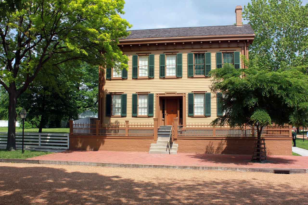
After leaving Chicago on your Route 66 national parks road trip, you’ll soon come across the first significant National Park Service site on the route. In Springfield, Illinois, you’ll find the Lincoln Home National Historic Site.
This amazing site preserves the former home and neighborhood of Abraham Lincoln, the place he lived from 1844 to 1861 before he became the 16th U.S. president.
The site is centered on the historic Lincoln home, which incidentally was the only house he ever owned, and also encompasses the four blocks around it. A visitor center provides lots of fascinating background information.
We all think of Abraham Lincoln as one of the greatest presidents in U.S. history, which is an indisputable fact. But he was, of course, also just another human being.
He was a husband and a parent, a neighbor and a friend. The Lincoln Home National Historic Site shows not just who Lincoln was as a president, but also what kind of man he was in his everyday life.
During his presidency, Lincoln also laid the foundation of nature preservation in America. In 1864, he signed a congressional bill that created the Yosemite Grant, which gave the Yosemite Valley and Mariposa Grove to California for protection.
This was the first time ever that a U.S. federal government set aside natural land specifically for preservation and public use.
It was a groundbreaking precedent and eventually led to the establishment of Yellowstone National Park in 1872 by President Ulysses S. Grant (see below).
2. Gateway Arch National Park, Missouri
Location: St. Louis
Distance from Route 66: 0 miles
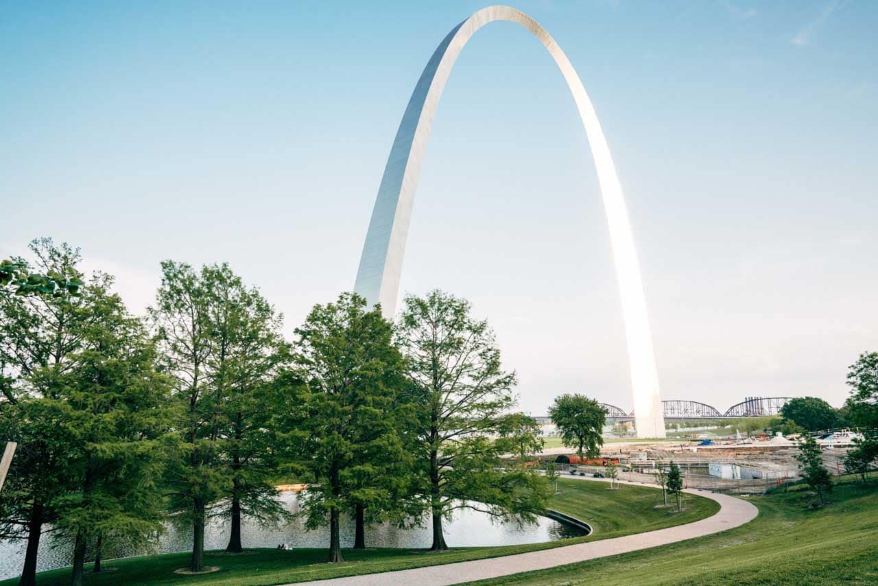
Formerly known as the Jefferson National Expansion Memorial, Gateway Arch National Park is one of the newest national parks in America, renamed and redesignated in 2018. It’s located in downtown St. Louis near the spot where the Lewis and Clark Expedition departed in 1804.
It commemorates the importance of the city of St. Louis in the western expansion of the United States and is a memorial to Thomas Jefferson’s role in opening the West.
Specifically, it commemorates the Louisiana Purchase, the debate of slavery in the Dred Scott case and the first civil government west of the Mississippi River.
Gateway Arch National Park is the smallest national park in the United States and the only one that doesn’t protect a natural area.
Nonetheless, it’s a super-significant site in the story of the nation. In a sense, while there are dozens of other National Park Service sites in cities, this is the only true “urban national park” in the country.
Located in downtown St. Louis, Gateway Arch lies directly on the route of the historic highway, one of the only two national parks on Route 66.
3. Ulysses S. Grant National Historic Site, Missouri
Location: St. Louis
Distance from Route 66: 5 miles (15 minutes)
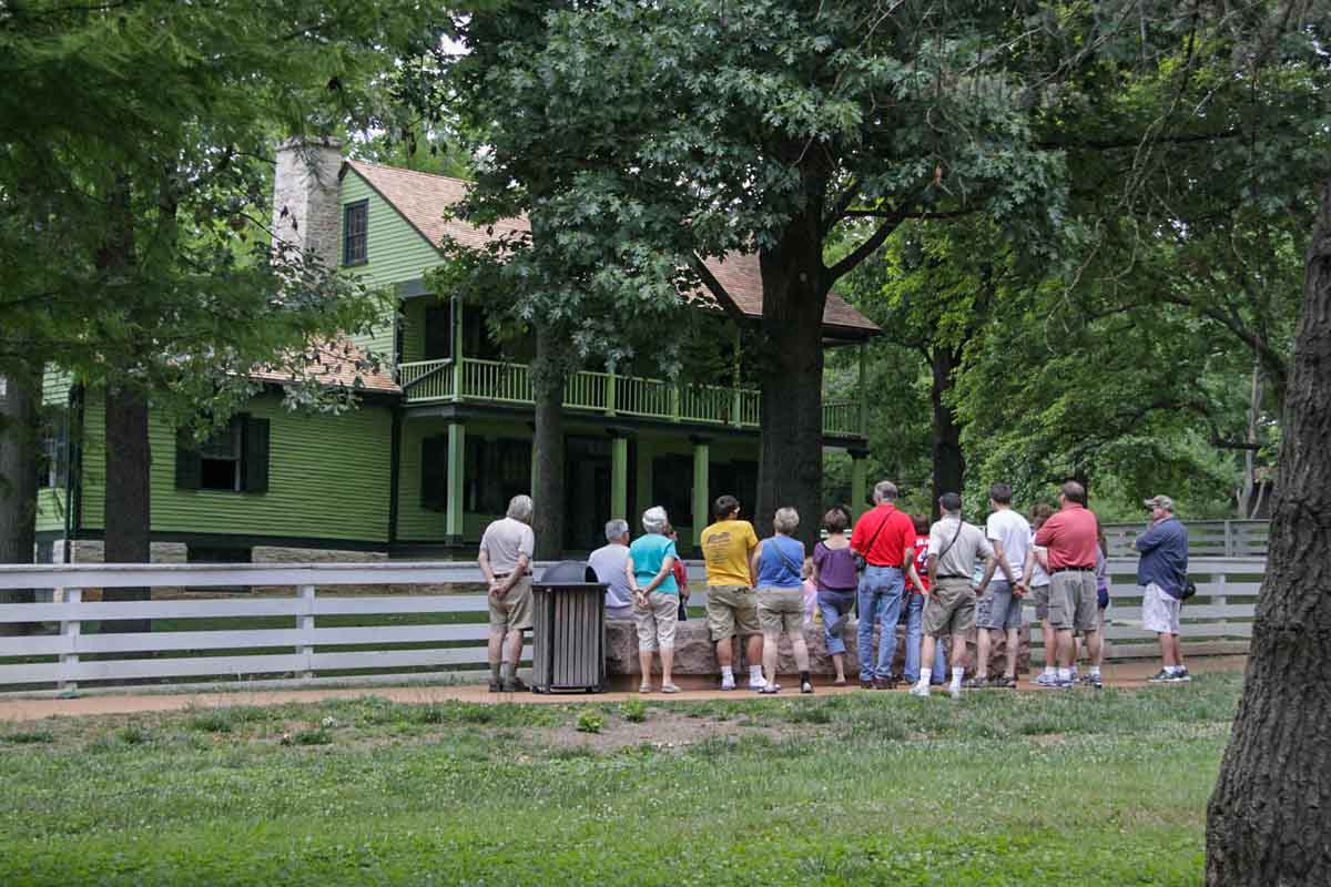
In addition to Gateway Arch, St. Louis has a second presidential National Park Service site that’s well-worth visiting: Ulysses S. Grant National Historic Site.
The renowned general who won the Civil War for the Union, Ulysses S. Grant met his future wife, Julia Dent, at her family home just southwest of St. Louis.
Now located in Grantwood Village, mere miles from Route 66, White Haven, as the family home is known, commemorates the military career, life and presidency of Ulysses S. Grant.
Several historic buildings at Ulysses S. Grant National Historic Site have survived, including White Haven itself, but also the summer kitchen, ice house, chicken coop and Grant’s 1872 horse stable, which now houses a museum.
You can take a guided tour of White Haven, which takes about 30 to 45 minutes.
It’s important to note that, when Grant married his wife in 1848, White Haven was a plantation with an enslaved African-American workforce. Slaves worked the plantation until the end of the Civil War, which was won by Grant. This perfectly illustrates what complicated times the mid-1800s were in the USA.
In terms of America’s national parks, Ulysses S. Grant also played an important role. After all, it was he who, in 1872, signed the first act “to set apart a certain tract of land […] as a public park.”
That park, of course, was Yellowstone National Park in what was then the Territories of Montana and Wyoming—the very first national park created anywhere on the planet.
4. Chaco Culture National Historical Park, New Mexico
Location: Chaco Canyon
Distance from Route 66: 65 miles (1.5 hours)
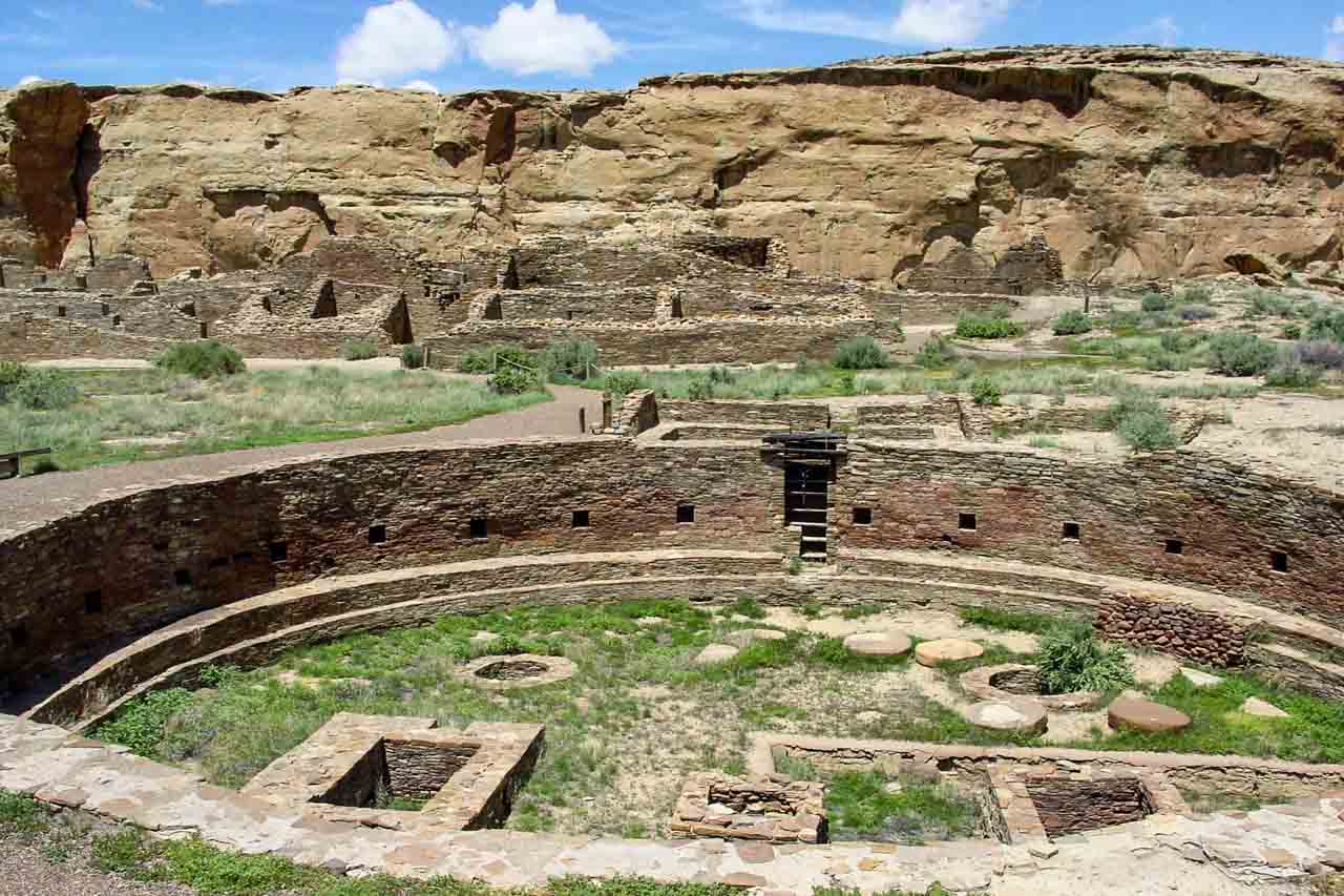
Located between Albuquerque and Farmington in northwestern New Mexico, Chaco Culture National Historical Park is one of America’s greatest archaeological sites.
The park lies within Chaco Canyon, a remote canyon cut out by the Chaco Wash. It preserves what’s arguably the most important pre-Columbian cultural site in the United States, a site that encompasses the largest collection of ancient ruins north of Mexico.
Although countless other Ancestral Puebloan sites dot the American Southwest—other famous locations are Mesa Verde National Park, Hovenweep National Monument and Bandelier National Monument (also near Route 66)—, none of them display the engineering abilities and organizational skills of these ancient people.
Chaco Canyon was home to a thriving civilization of thousands of people from 850 to 1250 AD, before being abandoned quite abruptly after a series of droughts and other adverse events.
Nowadays, the park features hiking and biking trails, and, above all, numerous collections of impressive ruins.
Additionally, Chaco Culture National Historical Park is also an official International Dark Sky Park. So, it’s worth sticking around until after nightfall to enjoy a majestic stellar spectacle.
This is undoubtedly one of the most fascinating national parks along Route 66, its cultural value demonstrated by its UNESCO World Heritage designation.
Chaco Canyon should really be a cornerstone of your Route 66 national parks road trip itinerary.
5. Petroglyph National Monument, New Mexico
Location: Albuquerque
Distance from Route 66: 2.5 miles (10 minutes)
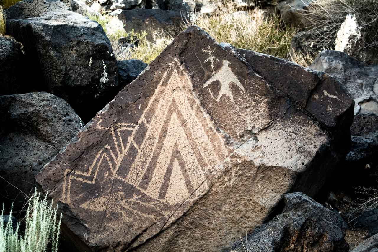
Petroglyphs—centuries-old symbols and designs carved into rocks—are found all over the Colorado Plateau, as well as elsewhere in America.
One of the largest and most accessible petroglyphs sites in North America, however, lies just outside of Albuquerque, New Mexico, and only a couple of miles off of Route 66.
Petroglyph National Monument comprises a 17-mile-long area along the West Mesa of New Mexico, an ancient escarpment of volcanic basalt rock. The park preserves several hundred archaeological sites, as well as approximately 25,000 petroglyphs.
The majority of these rock-carved images date from between 700 and 400 years ago, created by the Ancestral Puebloans, while a small number are younger and carved by early Spanish explorers and settlers.
So, if you’re interested in Native American history, I encourage you to stop at Petroglyph National Monument on your Route 66 adventure.
6. Petrified Forest National Park, Arizona
Location: Holbrook
Distance from Route 66: 0 miles
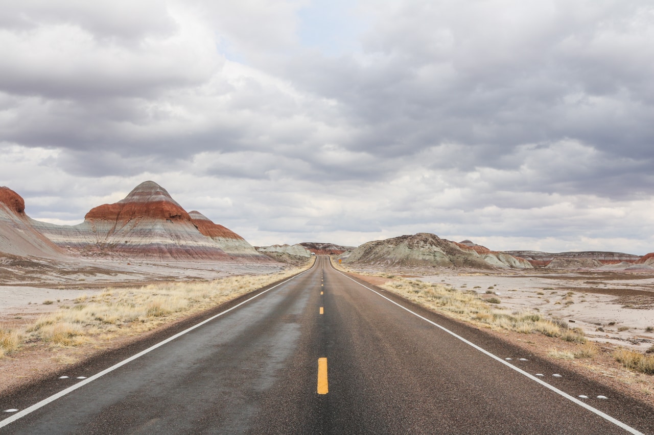
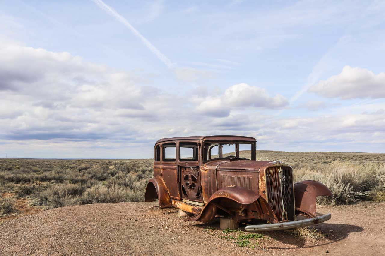
What’s unique about Petrified Forest National Park is that it’s the only national park that preserves a stretch of the original Historic Route 66.
An old and rusty Studebaker marks the location where Old Route 66 once ran across the desert. It’s a major attraction along the road through the park.
There are, of course, also many other things to see in Petrified Forest National Park. Native American sites, red-colored badlands, blue-striped rock formations, and petrified trees make up the remarkably varied landscape of this Arizona national park.
Named for its huge density of petrified logs, this is one of the world’s best places to see fossils from the Late Triassic, which was basically the dawn of the dinosaurs.
These arid landscapes may seem desolate and empty, but a closer look reveals an age-old geological and natural experiment that’s still ongoing to this day.
Various easy Petrified Forest hiking trails wind their way through deposits of colorful petrified wood and spectacular badlands. I also highly recommend going on an overnight backpacking trip into the stunning Painted Desert.
Petrified Forest is without question one of the top Route 66 Arizona attractions, simply because of the fact the old highway used to run right through it.
It’s the ultimate example of the historic connection between the National Park Service and Historic Route 66.
7. Grand Canyon National Park, Arizona
Location: Grand Canyon Village
Distance from Route 66: 60 miles (1 hour)
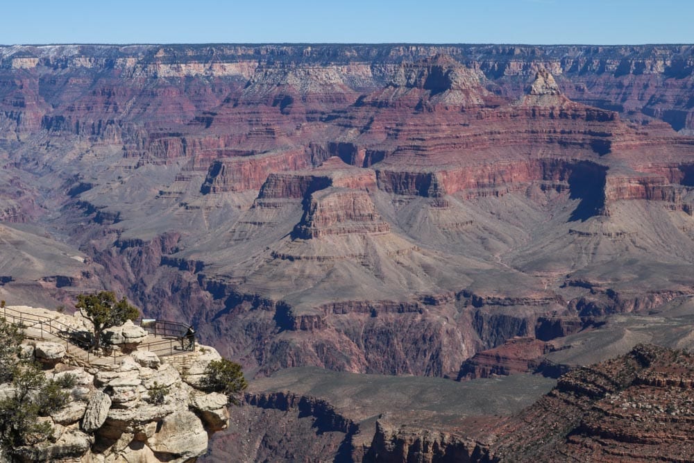
Arguably the most popular detour from Route 66 is Grand Canyon National Park. The main tourist area at this spectacular, world-famous river gorge, Grand Canyon Village on the South Rim, lies only about an hour to the north of Route 66.
One of the most overwhelming places I’ve ever visited, the Grand Canyon totally lives up to its status. It’s a magnificent place, of such magnitude I can’t imagine that someone not being impressed by it.
The sheer size of this thing boggles the mind, impossible to picture if you haven’t actually seen it in real life. This is a canyon that’s 277 river miles (446 kilometers) long, 18 miles (29 kilometers) wide at its widest point, and a mile (1.6 kilometers) deep.
Often considered to be one of the Natural Wonders of the World, Grand Canyon National Park is also a UNESCO World Heritage Site.
While many people spend only a day here, I think that’s just ridiculous. The “grandest” of all three national parks in Arizona, this is an enormous park and you should really do it justice by spending two or three days.
Beyond the many popular Grand Canyon overlooks, there are plenty of other things to see and do as well. Hike down into the canyon and along the South Rim—that’s two days right there.
Spend day three driving the scenic Desert View Drive, one of America’s greatest national park roads before heading back south toward Route 66.
Tip: The best time to visit Grand Canyon National Park is spring.
8. Hoover Dam & Lake Mead National Recreation Area, Nevada
Location: Boulder City
Distance from Route 66: 80 miles (1.5 hours)
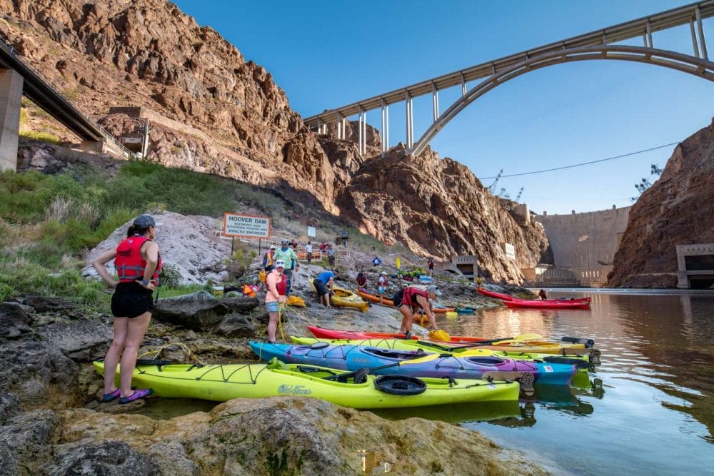
Of all these national parks along Route 66, Lake Mead National Recreation Area requires the longest detour. It’s a marvelous destination, though!
A man-made lake created by the huge Hoover Dam, which you can easily reach from Route 66, Lake Mead is America’s most diverse national recreation area, according to the National Park Service. It’s the largest freshwater reservoir in the county, extending from Nevada into Arizona.
The area encompasses two enormous lakes, but also mountains, canyons and valleys. There are no fewer than nine wilderness areas, too.
Lake Mead offers a wide range of activities, from camping to hiking. Not surprisingly, however, the most popular thing to do is boating. Other water-related activities include fishing, swimming, water skiing, canoeing and even scuba diving.
What makes Lake Mead such a popular side trip while driving Route 66 is the fact it lies only half an hour from Las Vegas. Many travelers want to swing by Sin City, too, on their once-in-a-lifetime Route 66 road trip, so this is a popular combination.
Tip: If you’re looking for more parks to visit around Las Vegas, check out this blog post.
9. Mojave National Preserve, California
Location: Kelso
Distance from Route 66: 0 miles
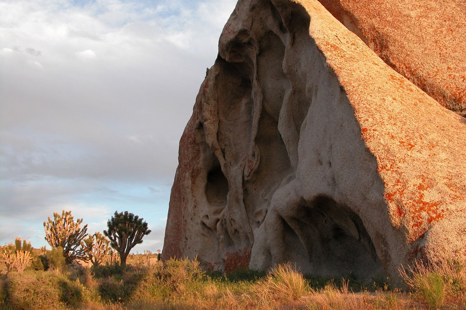
Worthy of its own national park designation, Mojave National Preserve has basically everything nearby Joshua Tree and even Death Valley also have.
Yet, it’s much, much quieter and off the beaten path than those famous national parks. This could be a nice change after the hustle and bustle of Las Vegas, if Vegas is part of your Route 66 road trip itinerary.
This huge preserve is home to Joshua tree forests, sand dunes, abundant spring wildflowers and volcanic cinder cones.
Canyons, mountains and mesas make up a landscape that’s as “Wild West” as they come, especially when considering that abandoned mines, historic homesteads and old military outposts dot the area, too.
This underrated park is one of the greatest National Park Service sites along Route 66. It’s quiet and peaceful, stunning and unique.
In fact, this national preserve actually lies right next to the route, which follows its southern border for a while. It’s one of the most accessible NPS sites on Route 66.
10. Joshua Tree National Park, California
Location: Twentynine Palms
Distance from Route 66: 53 miles (1 hour)
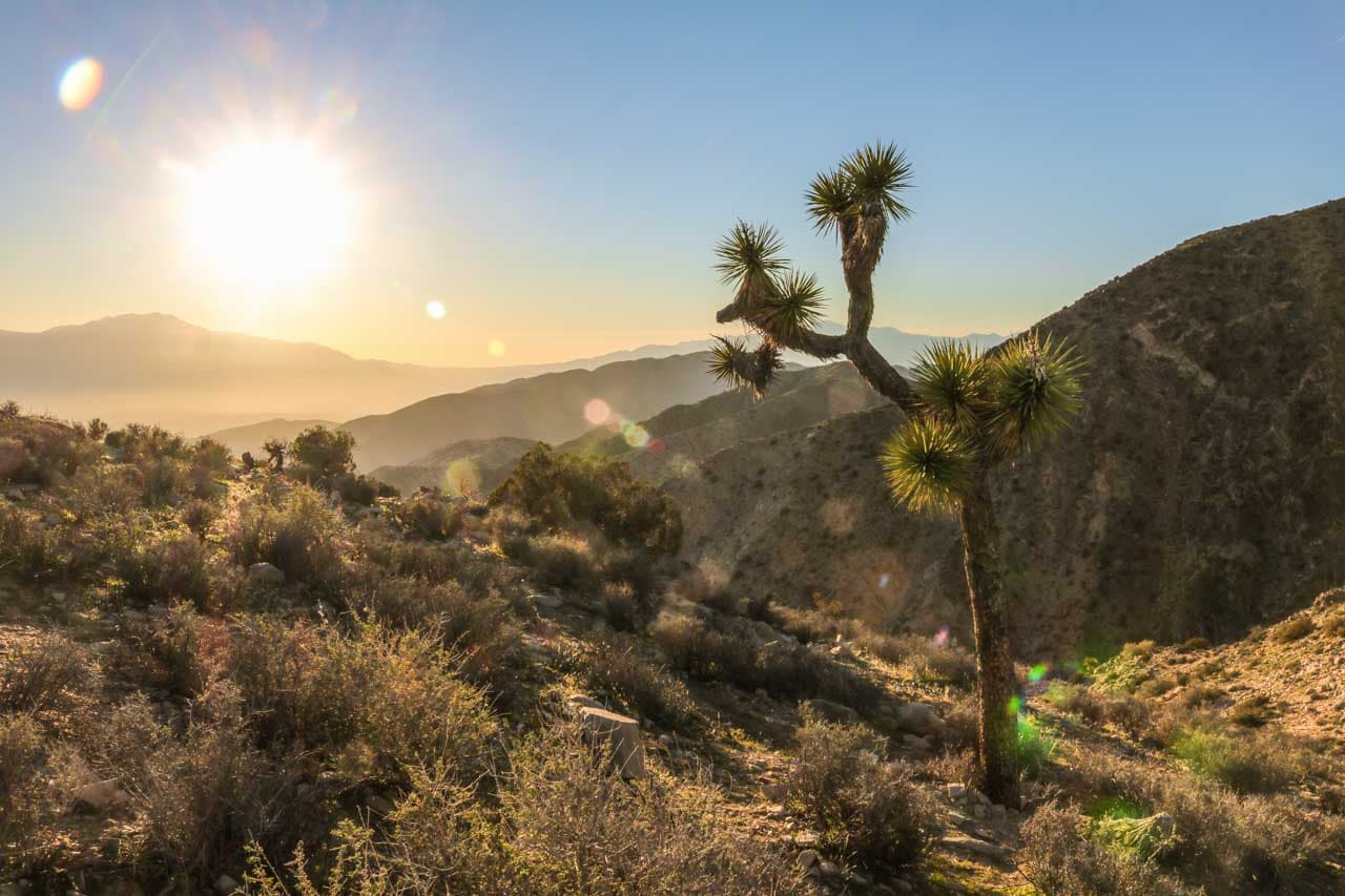
Iconic Joshua trees stand tall in a desert landscape dominated by huge jumbles of rock. Arid hills form a remarkable backdrop. Blue skies offer a stark contrast to the yellows, browns and greens of this unique scenery.
Roadrunners scurry across the sandy desert floors, while ravens circle overhead. Rattlesnakes hunt spiny lizards and kangaroo rats, hummingbirds feed on blossoming bushes, and bighorn sheep hop about boulders.
With this kaleidoscope of features and home to many fascinating attractions, Joshua Tree National Park is an enchanting place. Boasting one of the most obvious names of any American national park, Joshua Tree caters to adventure-minded travelers like few other parks do.
Filled with rough-surfaced boulders and huge piles of rocks, this is one of the best U.S. national parks for rock climbing and bouldering. Hikers and campers, too, will find satisfaction in this amazing desert park in Southern California, as will road trippers, sightseers and photographers.
This is my personal favorite Route 66 national park, the meeting point of the Sonoran and Mojave Deserts, and one of my all-time favorite camping destinations. Jumbo Rocks is awesome!
Tip: Here are some of the best hiking trails in Joshua Tree National Park.
Other National Park Service Sites Near Route 66
In addition to the featured national parks near Route 66 above, there are numerous other National Park Service sites near the “Mother Road”.
Again, they’re easily accessible from Route 66, located within 100 miles (but often much closer). In practical terms, that means it shouldn’t take more than a two-hour detour, at most, to reach any of them.
- Wilson’s Creek National Battlefield – Republic, MO
- George Washington Carver National Monument – Diamond, MO
- Fort Scott National Historic Site – Fort Scott, KS
- Oklahoma City National Memorial – Oklahoma City, OK
- Chickasaw National Recreation Area – Sulfur, OK
- Washita Battlefield National Historic Site – Cheyenne, OK
- Alibates Flint Quarries National Monument – Fritch, TX
- Lake Meredith National Recreation Area – Fritch, TX
- Fort Union National Monument – Fort Union, NM
- Pecos National Historical Park – Pecos, NM
- Bandelier National Monument – Bandelier, NM
- Salinas Pueblo Missions National Monument – Mountainair, NM
- El Malpais National Monument – Grants, NM
- El Morro National Monument – Ramah, NM
- Hubbell Trading Post National Historic Site – Ganado, AZ
- Canyon de Chelly National Monument – Chinle, AZ
- Wupatki National Monument – Flagstaff, AZ
- Sunset Crater Volcano National Monument – Flagstaff, AZ
- Walnut Canyon National Monument – Flagstaff, AZ
- Tuzigoot National Monument – Clarkdale, AZ
- Montezuma Castle National Monument – Camp Verde, AZ
- Santa Monica Mountains National Recreation Area – Calabasas, CA
Annual National Parks Pass
If you’re planning on visiting some (if not all) of these national parks along Route 66, I suggest purchasing an America the Beautiful Annual National Parks Pass. This annual pass is available to everyone and costs only $80.
That’s a ridiculously low price considering what you get in return: access to over 2,000 federal recreation sites. This includes all 400+ National Park Service sites, but also national wildlife refuges, national forests and Bureau of Land Management lands.
You can find more information about the America the Beautiful Pass, what it covers and which options there are on this page.
Map of National Parks Along Route 66
This map contains all National Park Service sites along Route 66. Click on the map to get the printable and enlargeable PDF version.
Note: This map was last updated in 2013. You’ll notice that, for example, Gateway Arch National Park is still referred to as the Jefferson Expansion Memorial.
Credit: National Park Service
Route 66 National Parks Road Trip FAQs
Where Does Route 66 Start and End?
Route 66 starts in Chicago, Illinois on the shore of Lake Michigan and ends in Santa Monica, California on the coast of the Pacific Ocean, swinging through the heart of the Midwest and Southwest.
How Long is Route 66 From Start to Finish?
Currently, Route 66 is 2,278 miles (3,665 kilometers) long, which is slightly shorter than its original length of 2,448 miles (3,939 kilometers).
Why Is Route 66 Famous?
Officially known as U.S. Highway 66, Route 66 is neither the longest nor the oldest transcontinental road in America. It was, however, the shortest year-round route from the Midwest to the Pacific Ocean.
Route 66 also reflects the changing nature of the country, which is the foundation of its fame. It grew exceptionally popular during the 1930s, ‘40s and ‘50s, the decades that saw the rise of the automobile in America. Route 66 symbolizes the transition from dirt roads to cross-country highways and, eventually, the interstate system.
John Steinbeck referred to Route 66 as the “Mother Road” in his novel The Grapes of Wrath because the road was a main westward migration route during the Dust Bowl in the 1930s. After the Great Depression, however, Route 66 steadily grew into a legendary, even mythical, highway—the very symbol of the “open road” and adventure.
Historic Route 66 also played a significant role in post-war optimism in the USA in the 1940s and ‘50s. The limitless opportunities that awaited down the road metaphorized the opportunities of life in post-war America. It was called “America’s Highway” in it heyday for that very reason.
People increasingly went on long family road trips, and oftentimes the destinations were the iconic national parks of the West.
Nowadays, Route 66 still attracts thousands of motorists every year, from RVers to motorcyclists. This world-famous highway continues to inspire countless of people around the world. It remains the heart and soul of American highway culture.
How Long Does It Take to Drive Route 66?
The answer to this question depends greatly on what you’d like to see on the way, the number of times you stop, etc.
If you only stay on the interstates and spend most of each day driving, you can cover the entire Route 66 distance in less than a week.
This would, however, mean that you’ll completely miss out on what Route 66 is all about. You won’t get to see a lot of the route’s quirky and quaint attractions, visit many national parks near Route 66, or do much else, really.
The best way to travel Route 66 is following the old alignments whenever possible and driving through each town’s Main Street. To do this properly, you need at least two and preferably three weeks.
What States Does Route 66 Go Through?
Route 66 runs through eight U.S. states. In this order, they are: Illinois, Missouri, Kansas, Oklahoma, Texas, New Mexico, Arizona and California.
Is Route 66 a National Historic Trail?
The historic connection between Route 66 and the national parks is shown by the proposal to designate Route 66 as a national historic trail, which would make it a part of the National Park Service system.
If that actually happens, Route 66 would join other iconic American routes or trails, such as the Oregon Trail, Trail of Tears, Pony Express, Lewis & Clark Expedition and Iditarod.
So far, though, Route 66 is not quite yet an official national historic trail.
What Are Some Other Route 66 Attractions?
Besides all these awesome national parks along Route 66, there are numerous other highlights, too. Some of the most iconic roadside attractions on Route 66 include the following:
- Grant Park – Chicago, Illinois (official start of Route 66)
- Lincoln’s Tomb – Springfield, Illinois
- Jesse James Wax Museum – Stanton, Missouri
- Uranus Fudge Factory and General Store – St. Robert, Missouri
- 66 Drive-In Theatre – Carthage, Missouri
- Bush Creek Bridge – Baxter Springs, Kansas
- Old Riverton Store – Riverton, Kansas
- POPS – Arcadia, Oklahoma
- Tower Station and U-Drop Inn Café – Shamrock, Texas
- The Leaning Water Tower – Groom, Texas
- Cadillac Ranch – Amarillo, Texas
- MidPoint Café – Adrian, Texas
- Glenrio Ghost Town – Glenrio, Texas and New Mexico
- 66 Diner – Albuquerque, New Mexico
- Meteor Crater – Winslow, Arizona
- ‘Standing on the Corner’ Statue – Winslow, Arizona
- Historic Seligman Sundries – Seligman, Arizona
- Wigwam Motel – San Bernardino, California
- Elmer’s Bottle Tree Ranch – Oro Grande, California
- The Last Stop Shop – Santa Monica, California
- Santa Monica Pier – Santa Monica, California (official end of Route 66)
Have You Ever Driven Route 66? Which National Parks Along Route 66 Did You Visit? Tell Everyone About Your Road Trip in the Comments Below!
Other National Park Road Trips
- Spring Road Trip to Southern California’s Desert Parks
- The Ultimate Arizona National Parks Road Trip
- Mighty 5 Utah National Parks Road Trip
- Driving Virginia’s Blue Ridge Parkway in Fall
- Northern Rockies National Parks Road Trip
- Cascade Volcanoes Road Trip
- Pacific Northwest National Parks Road Trip
- Best U.S. National Park Road Trips


These are not all National Parks, some are monuments and sites and that is not the same as a park.
You are correct, Jennifer. This article contains all kinds of National Park Service (NPS) sites, as I said in the intro. Those are, however, considered “national parks” just because they’re managed by the NPS, even though they don’t have those exact words in their name. The NPS on their website says that their sites are often referred to simply as “parks.” It’s just a matter of how broadly you apply the definition. In this article, I’ve used the broadest possible definition of what national parks along Route 66 are.