9 Best Scenic Views in Virgin Islands National Park
Although best known for its stunning beaches and world-class snorkeling, Virgin Islands National Park has no lack of beautiful landscapes and scenic views either.
When visiting this gorgeous national park on St. John in the U.S. Virgin Islands—one of the greatest tropical destinations in the United States—I recommend that you do not skip the many viewpoints and overlooks scattered throughout the park.
Some of these Virgin Islands views are on the roadside, near or even between the park’s famous beaches, such as Trunk Bay and Maho Bay. Others, on the other hand, require some hiking, especially the Murphy Great House and Ram Head views.
Either way, whether you’re planning on doing some hiking or not, there are several amazing views in Virgin Islands National Park waiting for you.
This blog post about the best views in Virgin Islands National Park contains affiliate links. You can read more about our Terms of Use / Disclosure here.
Top 9 Best Scenic Views in Virgin Islands National Park
Below, you’ll find my favorite scenic views in Virgin Islands National Park, based on my own experience spending several days in the park.
Although you might not care to visit all of these viewpoints or overlooks, I do strongly encourage you to try and see at least three or four.
Some of them absolutely blew my mind and are easily among the most beautiful landscapes I’ve ever seen anywhere in the national parks.
Along with a description of each view, I’ve also made sure to include the “type” of overlook—whether it’s on the roadside or along a trail—as well as its general location. (You can also see the locations of these Virgin Islands National Park views on the map at the end of this blog post.)
9. Cruz Bay Overlook
Type: Roadside
Location: 0.4 miles from the Virgin Islands National Park Visitor Center on North Shore Road
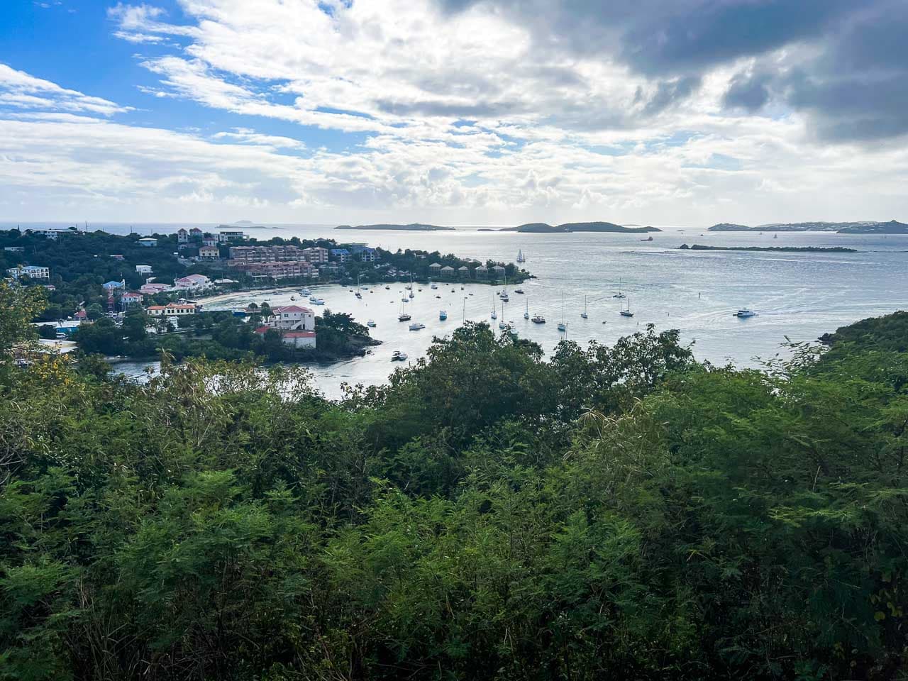
Not an officially marked overlook in Virgin Islands National Park, the Cruz Bay Overlook is a small roadside parking area just north of Cruz Bay on St. John.
It’s about 0.4 miles from the Virgin Islands National Park Visitor Center on North Shore Road. When driving out of town, you’ll see it just on your left-hand side, just a couple of minutes up the road.
From this small roadside overlook, you can enjoy a wonderful view of the town of Cruz Bay, as well as the bay itself, which is often dotted with sailboats and catamarans.
8. Lind Point Overlook
Type: Hiking trail
Location: About 0.4 miles up the Upper Lind Point Trail, which starts at the Virgin Islands National Park Visitor Center
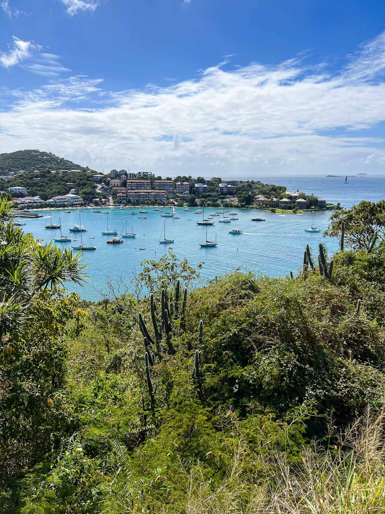
The Lind Point Overlook offers arguably the best view of Cruz Bay on St. John. You can get there via the Upper Lind Point Trail, which is part of the trail network that starts at the Visitor Center.
Lind Point is at the end of a very short spur trail and overlooks boat-dotted Cruz Bay to the south. Looking to the north, you can see the stunning blue waters of the Caribbean Sea, as well as some smaller islands—called cays—in the distance.
You can loop back to the trailhead via the Lower Lind Point Trail, but I highly recommend continuing down to Honeymoon Beach, which is another 0.6 miles or so.
As one of the most beautiful beaches in Virgin Islands National Park, Honeymoon is a great place to relax, snorkel, sunbathe, and sip on a cocktail or two.
7. Annaberg Sugar Plantation Ruins
Type: Roadside
Location: At the end of a spur road off of North Shore Road East, about 1.4 miles northeast of Maho Bay Beach
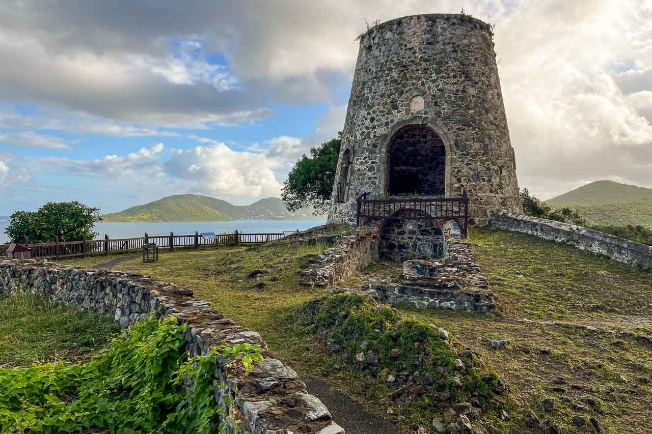
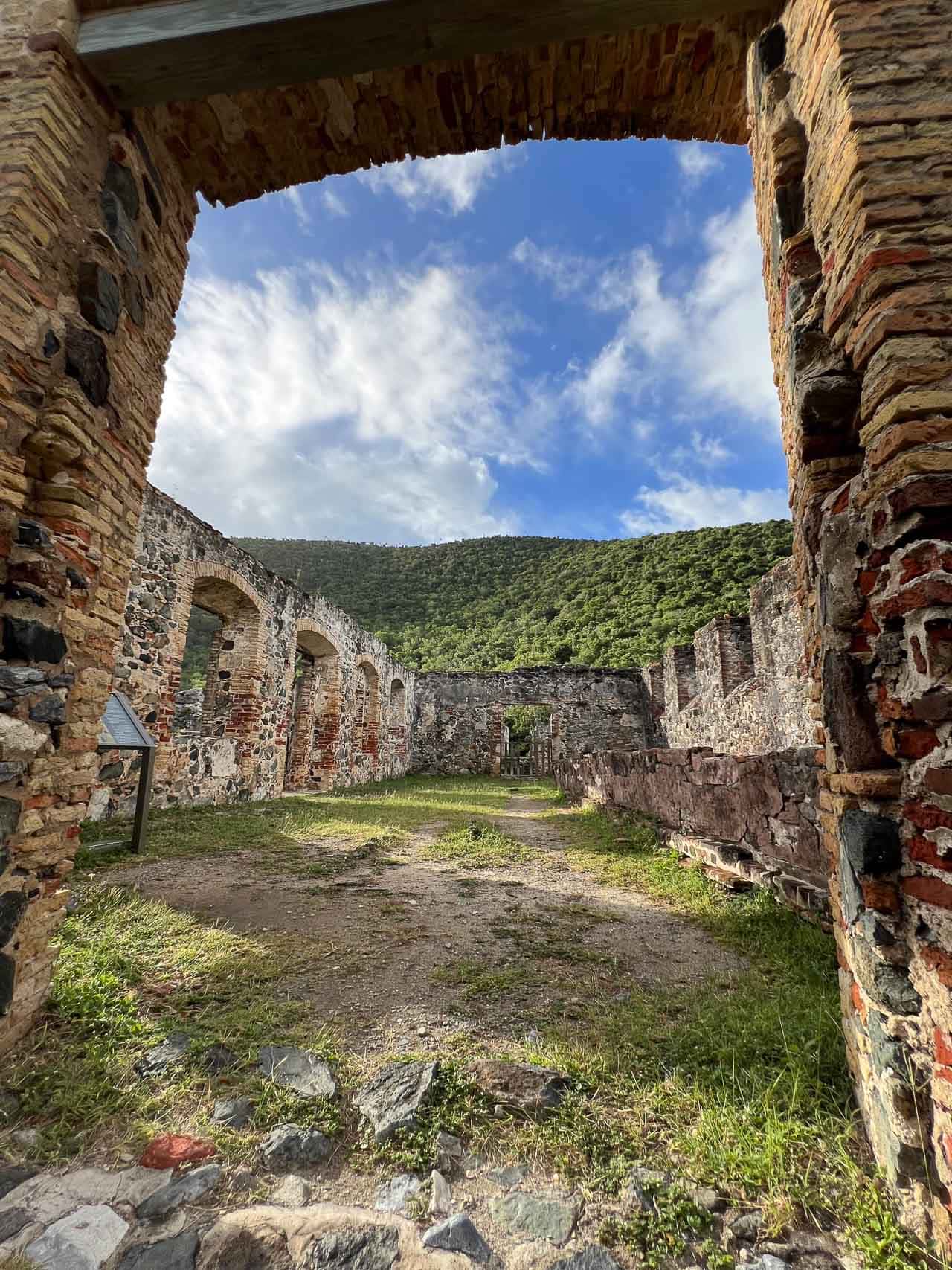
One of the main historic sites in Virgin Islands National Park, the ruins of the Annaberg Sugar Plantation stand on a hill along the north shore of St. John.
This is a great place to learn more about the era of Danish sugar plantations and slavery in the U.S. Virgin Islands. Among the ruins are the remains of enslaved peoples’ quarters, a windmill, animal mill, and the sugar factory itself.
During its “heyday” in the 18th and 19th centuries, the Annaberg Sugar Plantation produced cane sugar, along with molasses and rum.
Nowadays, it’s an important historic site—educating visitors about the horrors of slavery, as well as being a significant ceremonial location among the local population of St. John, many of whom are descendants of the African slaves that once labored at these sugar plantations.
Additionally, there’s also a pretty nice view of the north shore of St. John and some of the British Virgin Islands across the Sir Francis Drake Channel.
6. Maho Bay Overlook
Type: Roadside
Location: 0.6 miles east of the Cinnamon Bay parking lot on North Shore Road; about 0.5 miles west of Maho Bay Beach
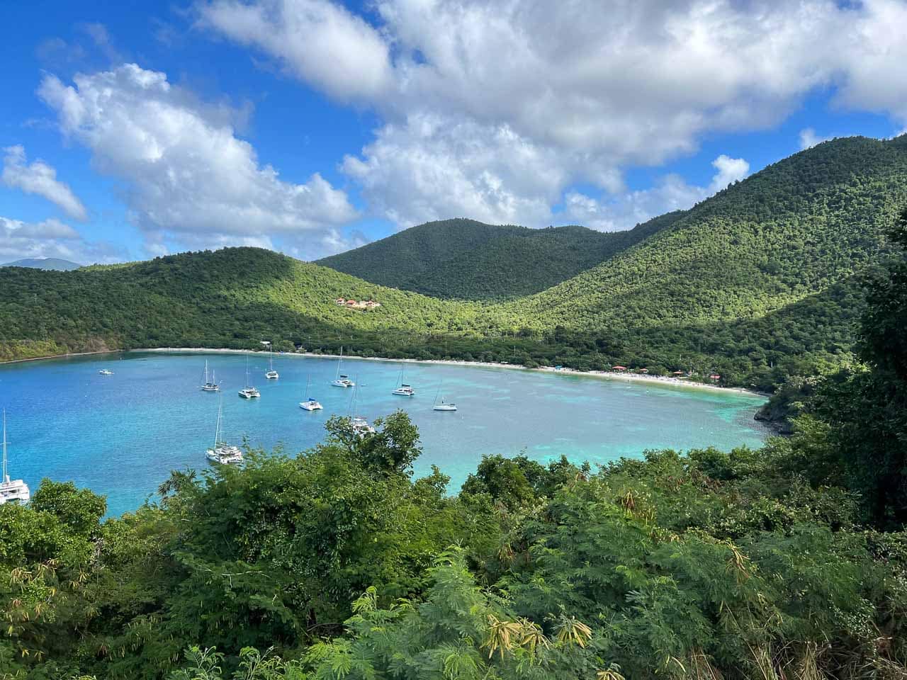
A small roadside pullout atop a hill, the Maho Bay Overlook provides an amazing view of one of the most scenic bays in Virgin Islands National Park.
Don’t miss this one—it’s one of the easiest views you can enjoy in the national park. It’s on North Shore Road about halfway between Cinnamon Bay and Maho Bay itself.
This amazing panoramic view comprises Maho Bay with its clearly visible seagrass beds and beautiful, long and narrow beach, as well as Francis Bay in the distance to the left.
Top 5 Best Scenic Views in Virgin Islands National Park
5. America Hill Ruins
Type: Hiking trail
Location: At the end of a spur trail off of Cinnamon Bay Trail, which starts near the Cinnamon Bay Beach and Campground parking lot
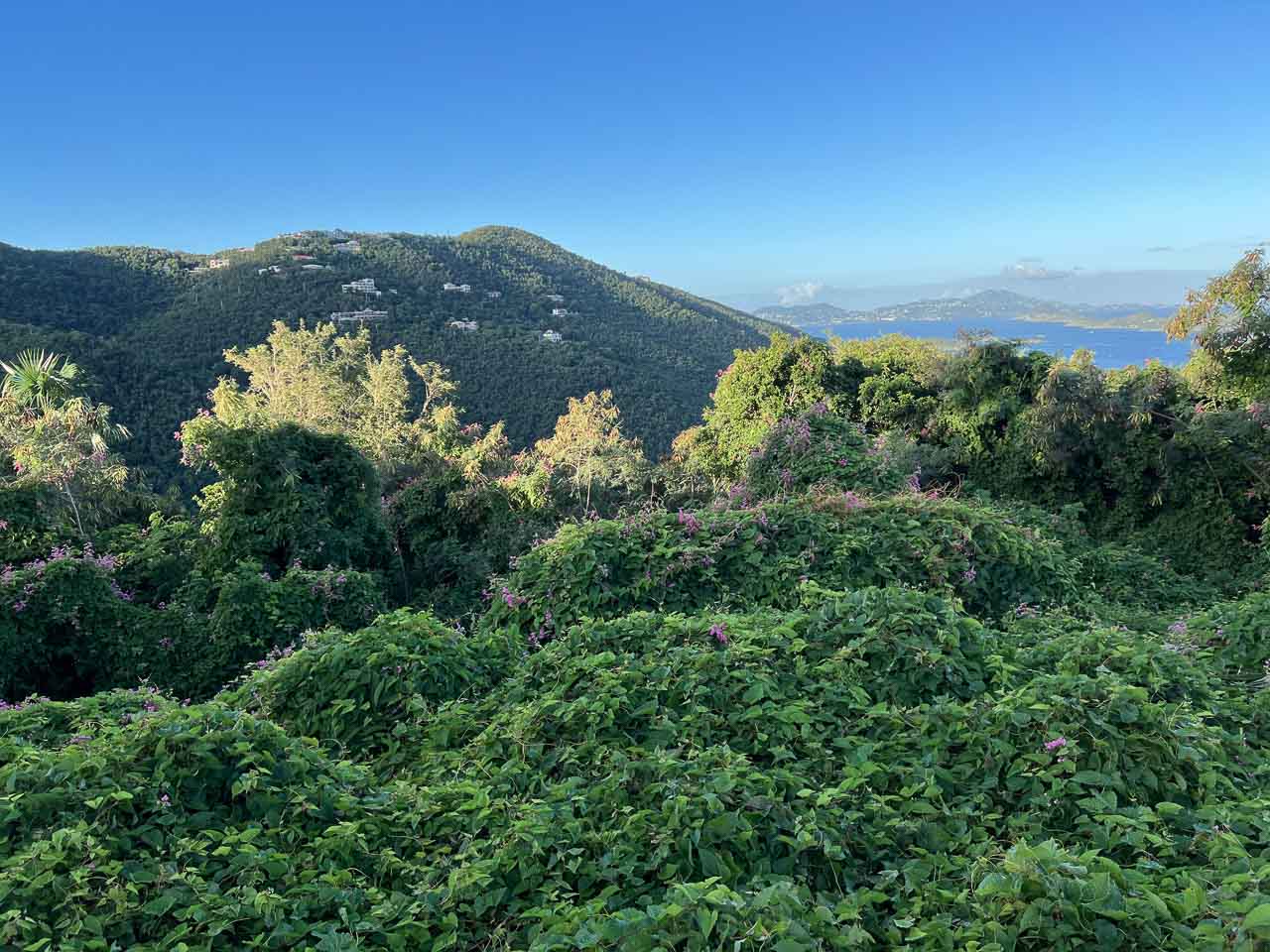
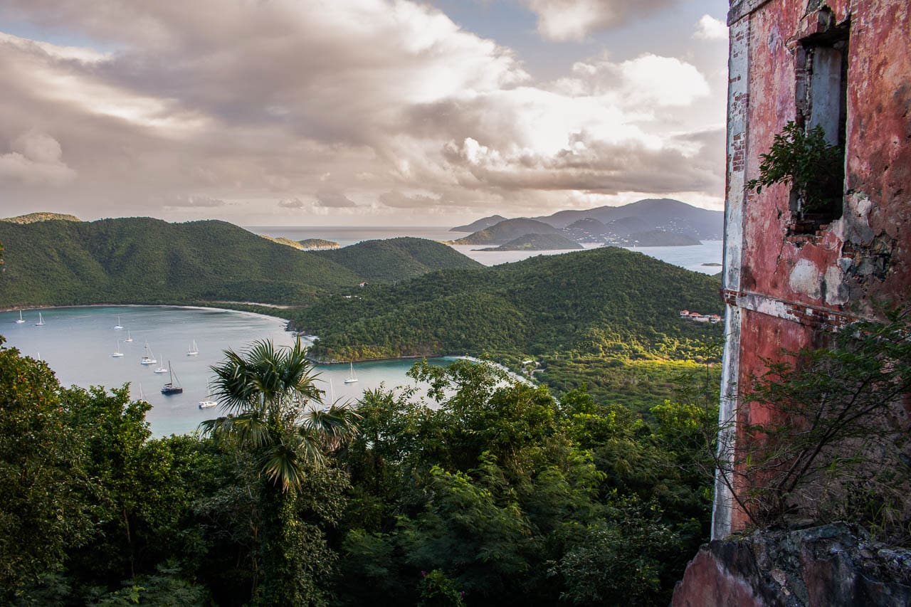
I particularly love the view from the America Hill Ruins because of its historic setting. These are the ruins of a so-called “great house,” which were the residences of more affluent people on St. John, often situated on a hilltop.
The America Hill Ruins are at the end of a 0.4-mile spur trail off of the Cinnamon Bay Trail. The whole roundtrip hike from the trailhead near the Cinnamon Bay Beach and Campground parking lot is about 1.2 miles.
Parts of the trail are rather steep and the forest can be quite humid, but I can assure you it’s well worth the effort.
From the America Hill Ruins, there’s a breathtaking view of Maho Bay, Francis Bay, and Mary Point. I think this vista, which encompasses a part of the great house and the gorgeous bays below, is one of the views that characterize Virgin Islands National Park the most.
4. Peace Hill Windmill Ruins
Type: Roadside, plus a short 0.2-mile roundtrip walk
Location: 0.7 miles east of Hawksnest Beach on North Shore Road; 0.7 miles west of Trunk Bay
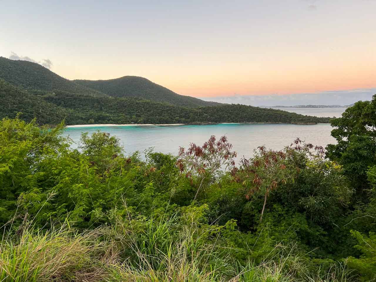
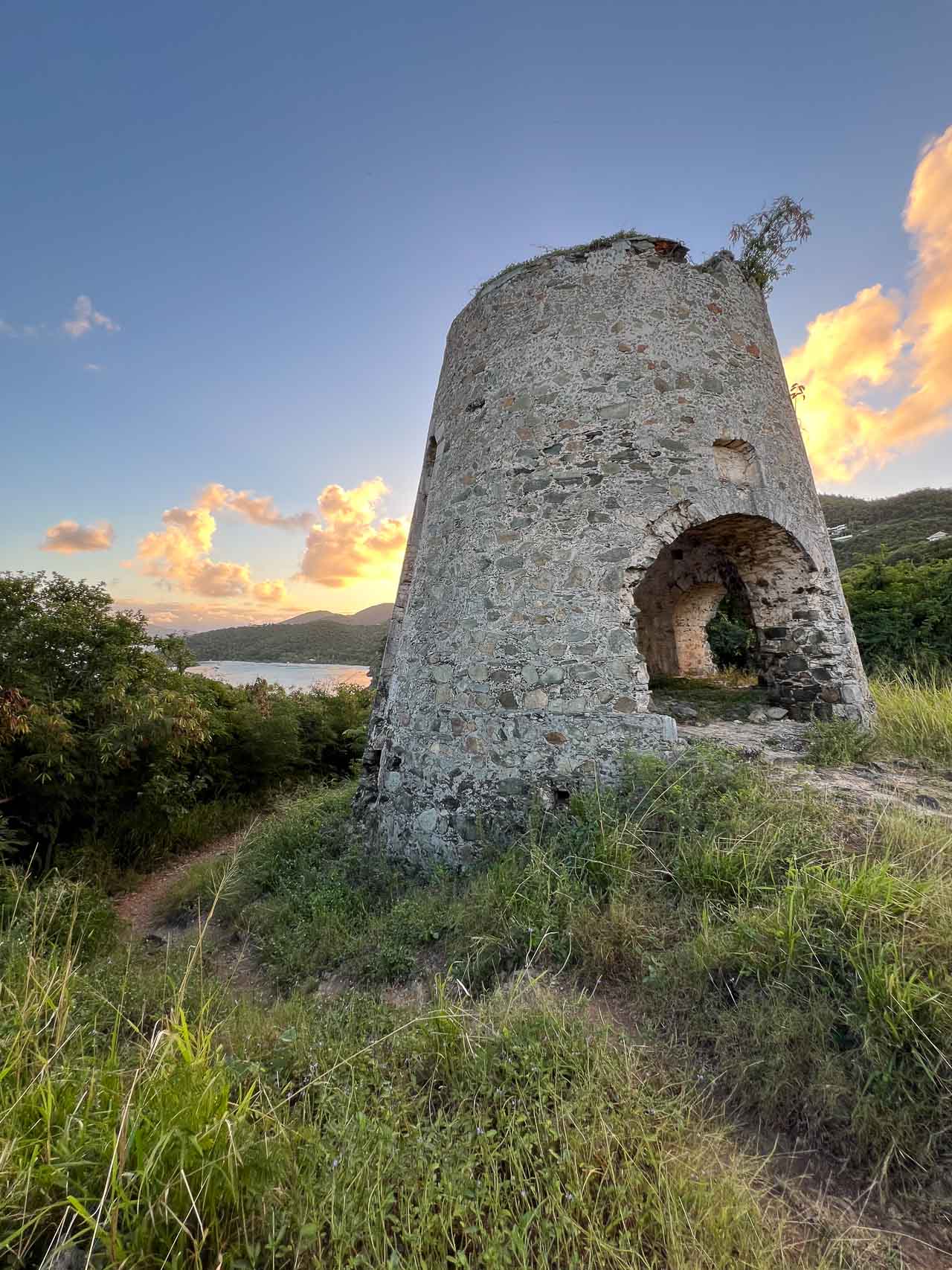
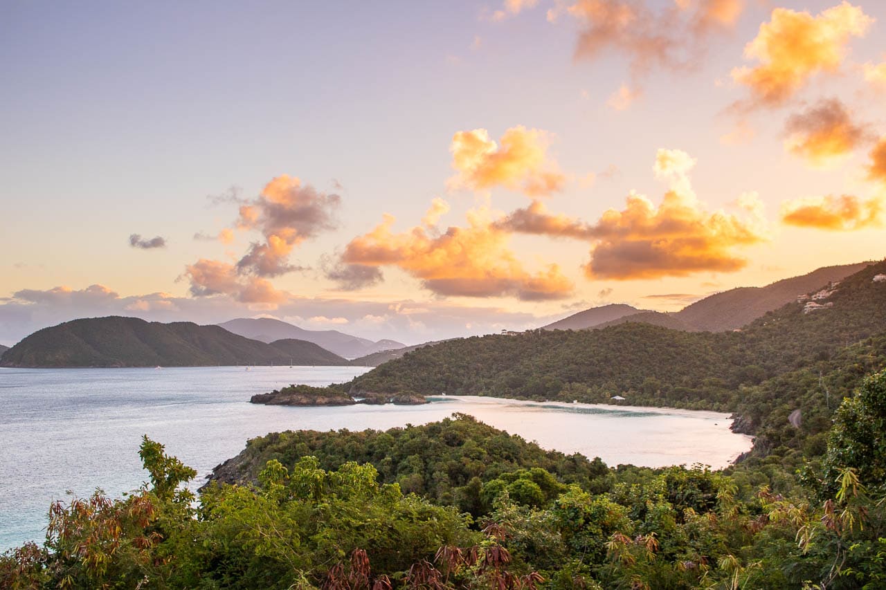
Often skipped by visitors who are eager to get to one of the beautiful beaches, Peace Hill is one of my favorite places in Virgin Islands National Park.
The parking lot is located on North Shore Road, halfway between Hawksnest and Trunk Bay. From the parking lot, a short 0.1-mile trail with a moderate incline brings you to the top of Peace Hill, where the ruins of a windmill and sensational views await.
There’s a cool view from within the windmill ruins, with its windows beautifully framing the Caribbean coastline beyond. As you explore the small Peace Hill summit, you can also enjoy views of Hawksnest Beach to the southwest, as well as Trunk Bay to the east.
I think this is one of the best views in Virgin Islands National Park because—as its name implies—it is, in fact, usually a pretty quiet and peaceful place. It’s a great spot for a picnic lunch, or to enjoy a sunset or sunrise in Virgin Islands National Park.
3. Ram Head
Type: Hiking trail
Location: At the end of the Ram Head Trail, which starts at Salt Pond Bay Beach in the far southeastern corner of the park
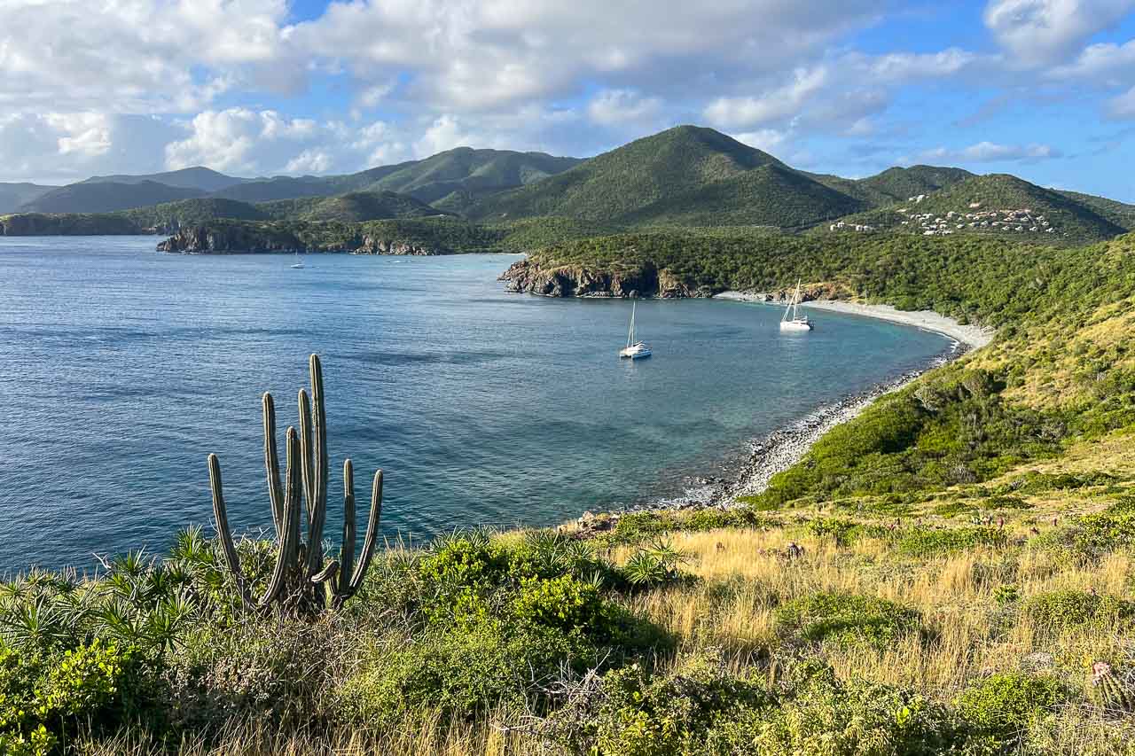
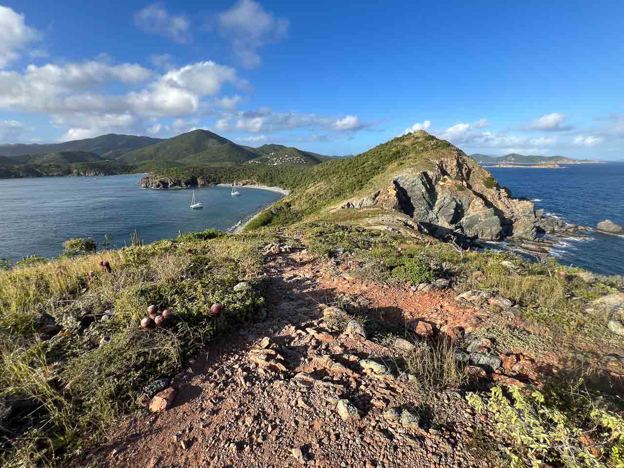
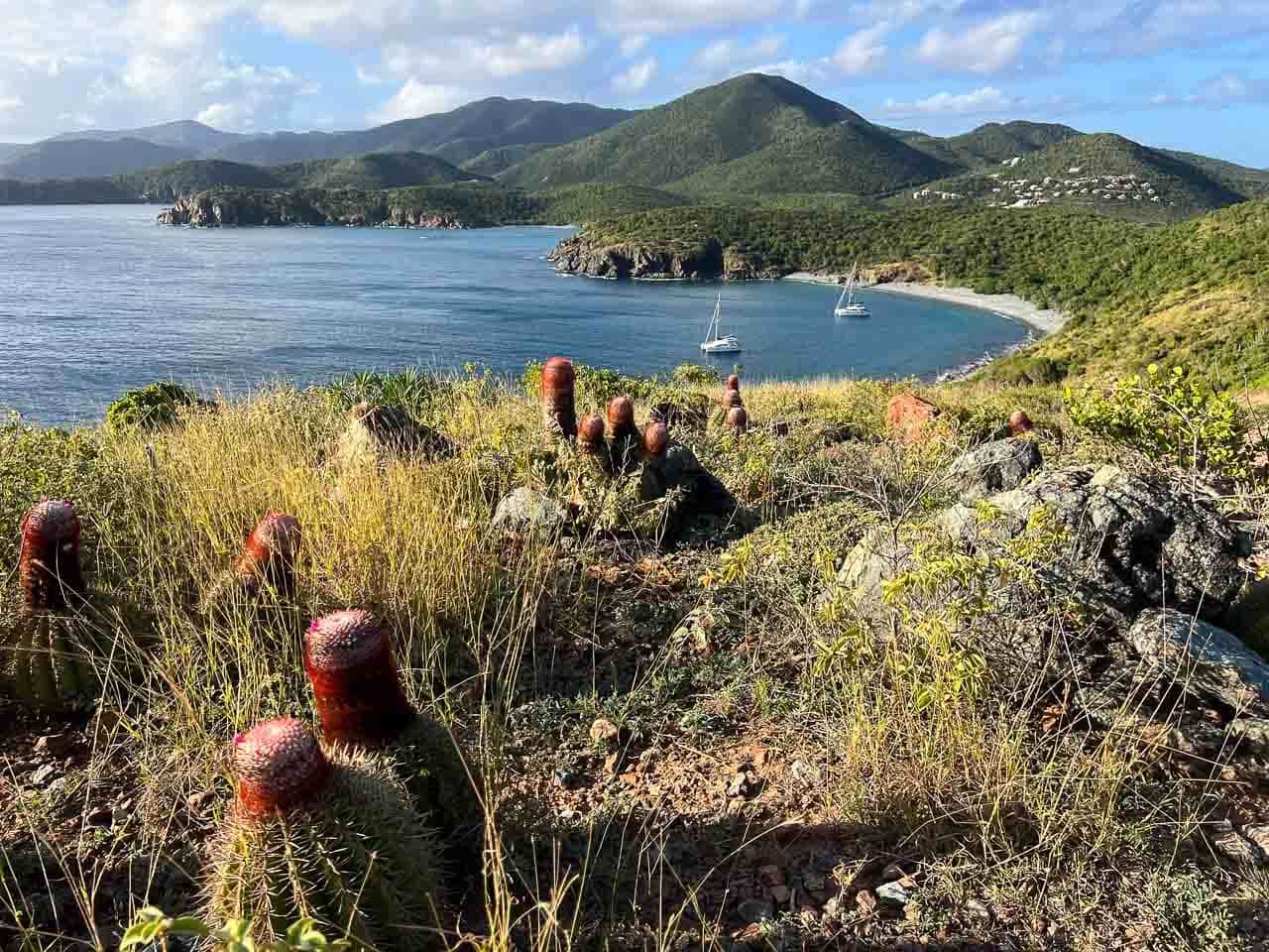
The southernmost point on St. John, Ram Head is a high bluff that overlooks the Caribbean Sea and offers views of the remote bays in this part of the island.
The only way to get there is via the Ram Head Trail, a 2-mile roundtrip hike from Salt Pond Bay Beach (which also requires a short walk from the parking lot).
A narrow path that meanders along the coastline and up the bluff, the Ram Head Trail is easily one of the best hikes in Virgin Islands National Park. On the way, you’ll clearly notice that this is the drier side of the island of St. John, as you walk among the hundreds of cacti that dot the hillsides.
At Ram Head, you’re rewarded by truly spectacular 360-degree views, which take in the seemingly endless waters of the Caribbean Sea to the south, as well as Salt Pond Bay to the northwest and the East End peninsula of St. John to the northeast.
Different from the views on the northern side of Virgin Islands National Park, yet by no means less breathtaking, the panorama at Ram Head is a great reason to hike this remote trail.
TIP: I also recommend spending some time at Salt Pond Bay Beach before and/or after your hike. Below the warm and shallow waters of this beautiful bay, there are sprawling seagrass beds, which attract sea turtles and stingrays. It’s one of the best places to go snorkeling in Virgin Islands National Park.
2. Murphy Great House Ruins
Type: Hiking trail
Location: At the end of a spur trail off of the Johnny Horn Trail, which is accessed via the Leinster Bay Trail, starting near the Annaberg Sugar Plantation Ruins
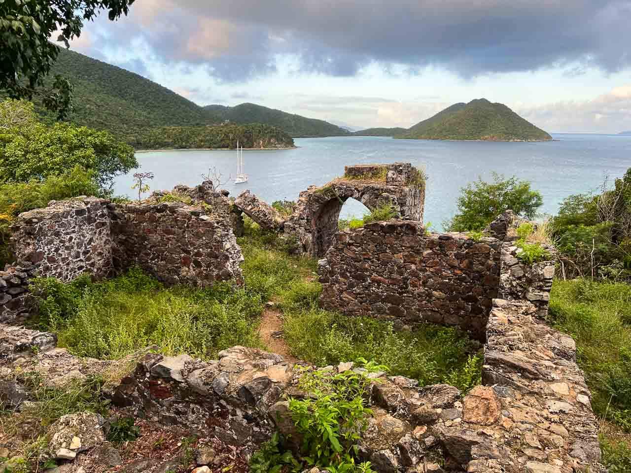
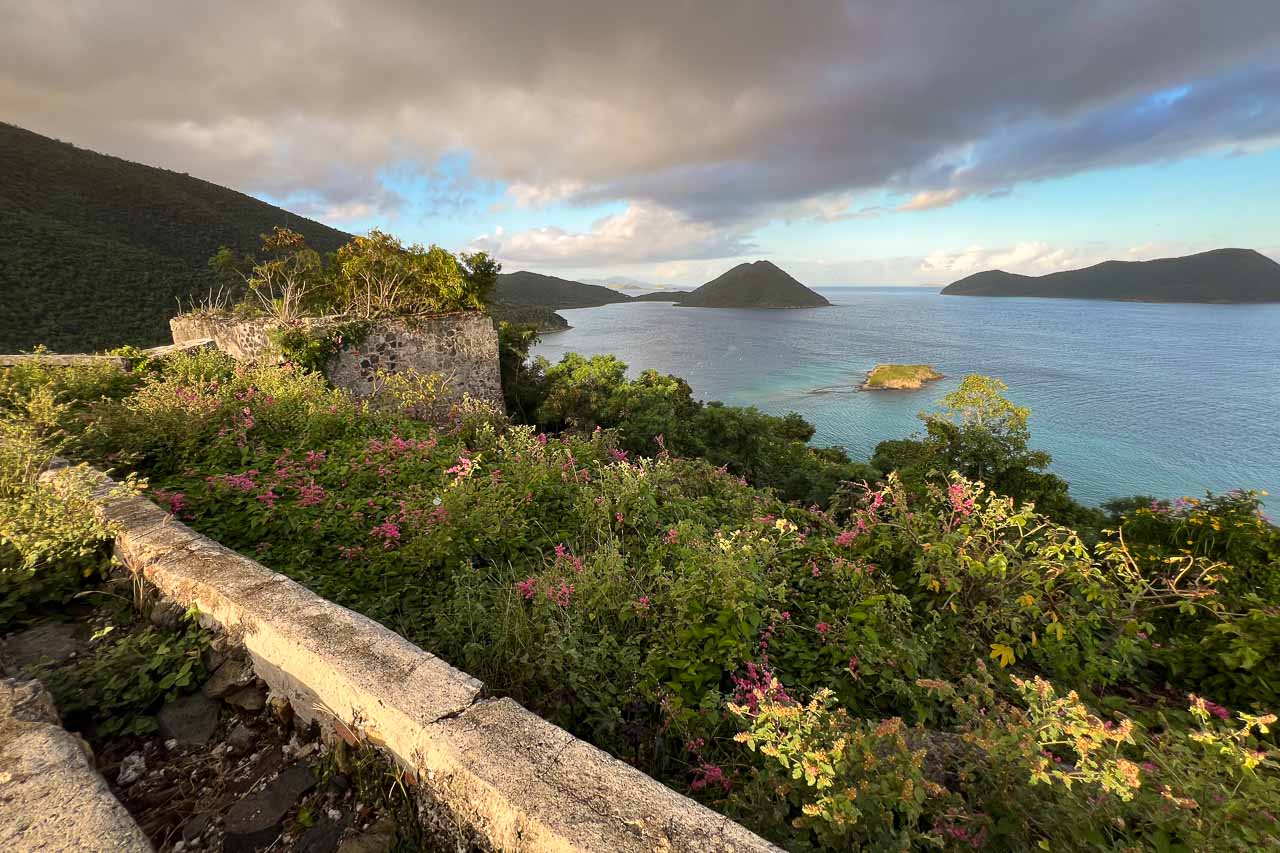
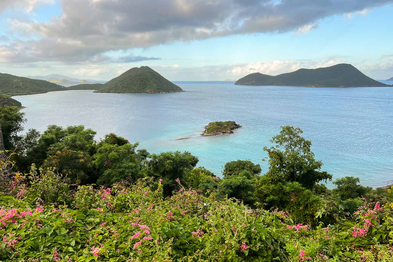
The Murphy Great House Ruins are among the greatest “hidden secrets” of Virgin Islands National Park. And if it wasn’t for the number one in this list of best Virgin Islands National Park views (see below), this would easily be ranked as the park’s top view.
You’ll find these historic ruins at the end of the short spur trail off of the Johnny Horn Trail, which in its turn is accessed via the Leinster Bay Trail. The trailhead of the Leinster Bay Trail is just beyond the Annaberg Sugar Plantation parking lot.
It’s a flat 1-mile one-way hike along the shoreline of scenic Leinster Bay, followed by a relatively steep section on the Johnny Horn Trail.
After passing a first collection of ruins halfway up the hill, you’ll see a sign that points toward the Murphy Great House Ruins (which are sometimes also called the Windy Hill Ruins).
From the ruins, there’s a truly stunning view of Waterlemon Bay and Leinster Bay. Famous Waterlemon Cay, one of the greatest snorkeling spots in the U.S. Virgin Islands, is clearly visible below.
While this view is spectacular all day long, I’d recommend hiking the Leinster Bay and Johnny Horn Trails at either sunrise or sunset.
I made the effort to start this hike at sunrise and—although I also got caught in a rain shower on the trail—the gorgeous views and beautiful morning sunlight were amazing and well worth it.
1. Trunk Bay Overlook
Type: Roadside
Location: 0.2 miles east of the Jumbie Beach parking lot on North Shore Road; 0.3 miles west of Trunk Bay
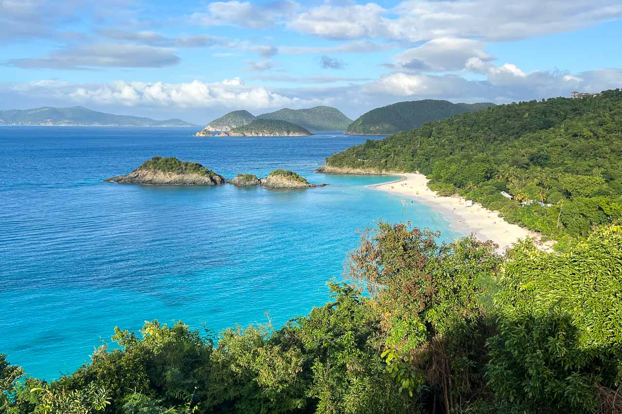
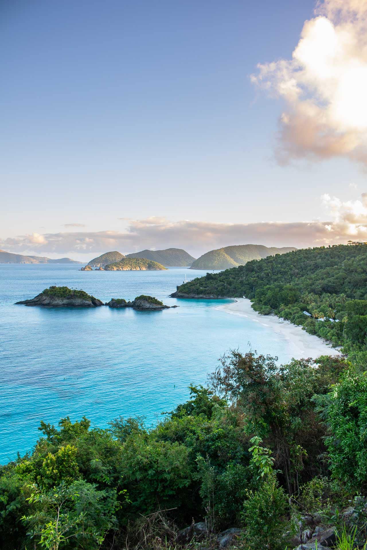
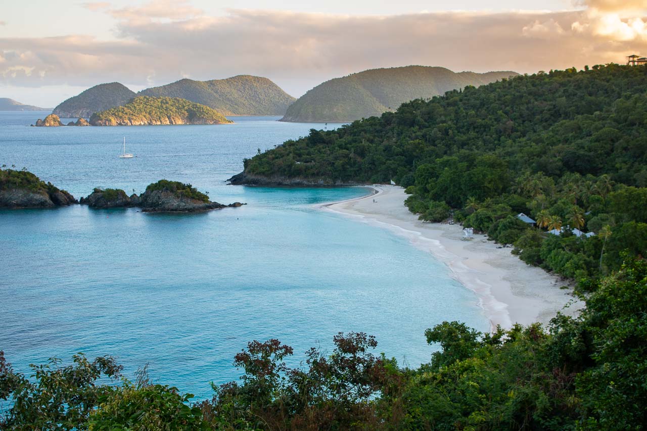
How could Trunk Bay Overlook not take first place in a list of best views in Virgin Islands National Park? Views really don’t get more iconic than this.
Adorning many postcards from St. John and the U.S. Virgin Islands, the view from Trunk Bay is one of the most famous in the entire Caribbean. And enjoying this view doesn’t require any effort either, being located just along North Shore Road between Jumbie Beach and Trunk Bay Beach.
The vista takes in the shimmering turquoise waters of Trunk Bay, the stunning white sand of Trunk Bay Beach, the lush green hills behind the beach, and rocky Trunk Cay just offshore.
You can also see Whistling Cay and the western part of Mary Point in the distance.
This is without any doubt the most famous view in Virgin Islands National Park, an attraction that no one should miss on their visit to the park.
It’s really a sensational sight no matter what time of day it is. Sunrises and sunsets offer colorful skies and wonderful, soft light, while the harsher midday sunshine brings out the sheer blueness of the water even more.
Which Roadside Views in Virgin Islands National Park Should You Not Miss?
The overview above showcases what I think are the best views in Virgin Islands National Park. Now, I do understand that not everyone visits St. John and plans on hiking a bunch.
If you simply want to focus on the park’s beaches and coral reefs—which are its undeniable highlights—I recommend visiting the following roadside viewpoints in Virgin Islands National Park:
- Peace Hill Windmill Ruins (requires a short walk)
- Trunk Bay Overlook
- Maho Bay Overlook
- Annaberg Sugar Mill Ruins
Which Are the Best Hikes With Views in Virgin Islands National Park?
If you do want to explore some of the hiking trails in Virgin Islands National Park and enjoy some scenic views on the way, these are the hikes I’d recommend:
- America Hill Ruins (via Cinnamon Bay Trail)
- Murphy Great House Ruins (via Leinster Bay and Johnny Horn Trails)
- Ram Head (via Salt Pond Bay and Ram Head Trails)
Map of the Best Views in Virgin Islands National Park
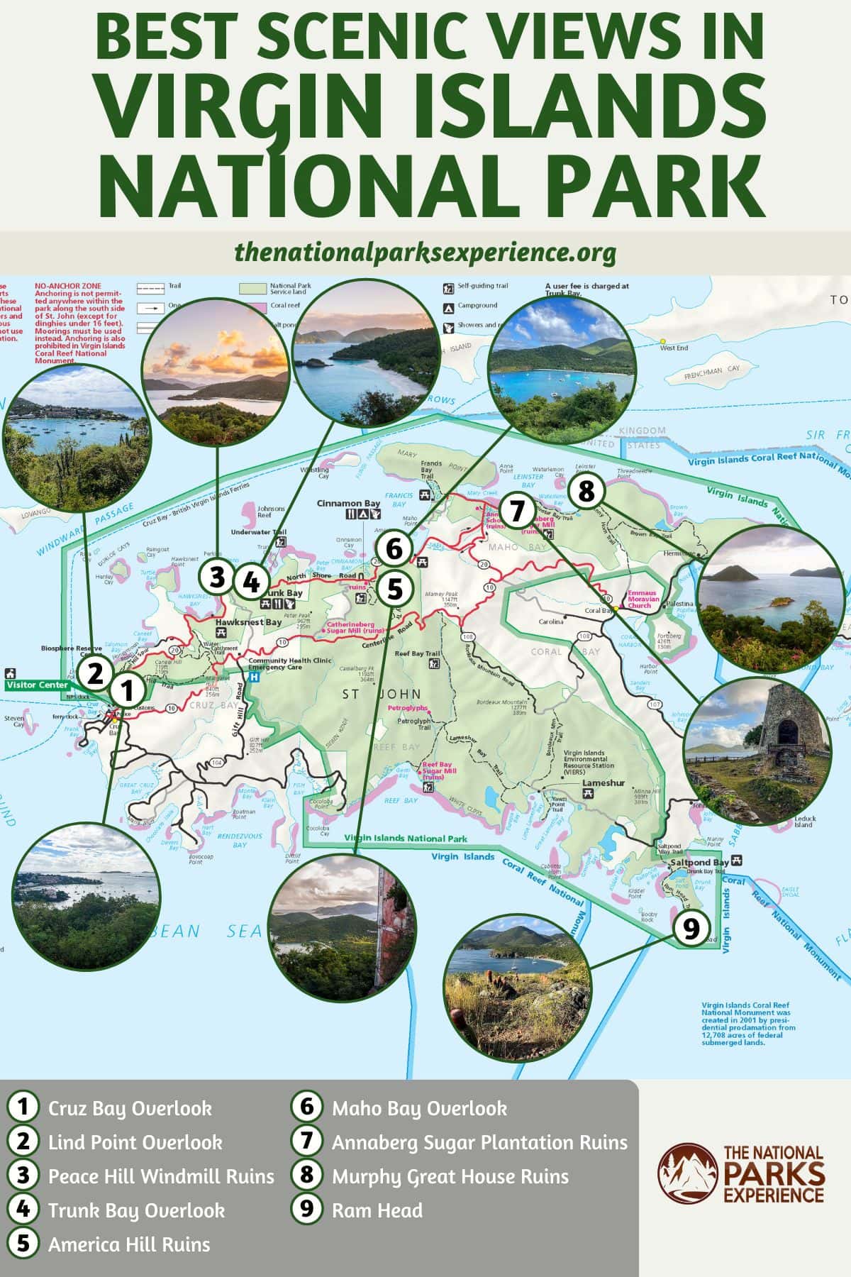
This map shows the general location of each of the views in Virgin Islands National Park described above.
More About Virgin Islands National Park
- Park Website
- Travel Guide
- Topographic Map
- Most Beautiful Beaches in Virgin Islands National Park
- Best Hikes in Virgin Islands National Park
- Best Snorkeling Locations in Virgin Islands National Park
- Historic Plantation Ruins in Virgin Islands National Park
- Best Time to Visit Virgin Islands National Park
- Accommodation
Have You Ever Visited the Virgin Islands? Which Are Your Favorite Views in Virgin Islands National Park? Share Your National Parks Experience Below!
More Scenic Views in the National Parks
- Joshua Tree National Park Views
- Glacier National Park Views
- Grand Canyon National Park Views
- Mount Rainier National Park Views
- Shenandoah National Park Views
- Yellowstone National Park Views


