California’s Death Valley National Park In Photos
From the National Park Service website:
In this below-sea-level basin, steady drought and record summer heat make Death Valley a land of extremes. Yet, each extreme has a striking contrast. Towering peaks are frosted with winter snow. Rare rainstorms bring vast fields of wildflowers. Lush oases harbor tiny fish and refuge for wildlife and humans. Despite its morbid name, a great diversity of life survives in Death Valley.
Death Valley National Park encompasses the lowest point in North America—Badwater Basin—and offers views of the highest mountain in the contiguous United States—Mount Whitney. Situated within the Mojave Desert, it is both the driest and hottest place on the continent. Total annual rainfall averages 2 inches (5 centimeters) and summer temperatures peak at 120°F (49°C) or more. Additionally, Death Valley is the largest American national park outside of Alaska (5,219 sq. miles or 13,517 km²), yet another impressive statistic of this record-setting park.
Death Valley Photo Essay
Visiting the park was one of my personal highlights of 2017. Realizing that I still have a bunch of photos to share about it, I figured I might as well put together a Death Valley National Park photo essay.
Caroline and I spent four days and three nights in Death Valley, exploring the park in depth and hitting a few of its greatest hiking trails. The photos below portray the sheer majesty of Death Valley’s epic landscapes, as well as some of its smaller, less obvious features.
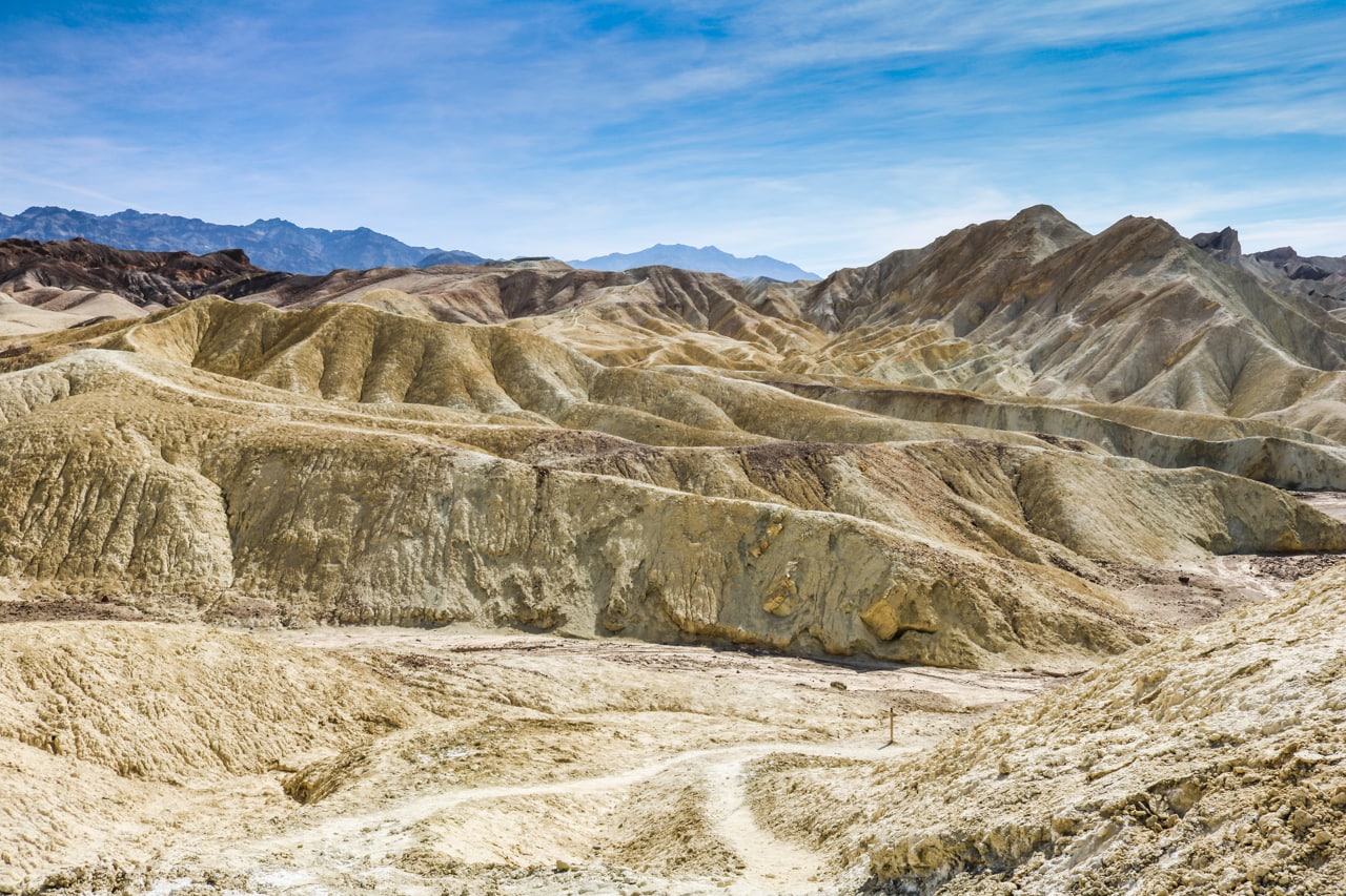
Two hiking trails converge in the heart of Death Valley’s colorful and scorching hot badlands.

Its name might imply the opposite of vitality, yet Death Valley National Park is home to abundant wildlife, including wild “burros”.

Footsteps meander across the Mesquite Flat Sand Dunes, one of the park’s most popular features.

Endless plains of sand, salt and rock is the dominant feature of Death Valley National Park.

The desert heat makes the air vibrate over a desolate road leading toward the towering Sierra Nevada Mountains
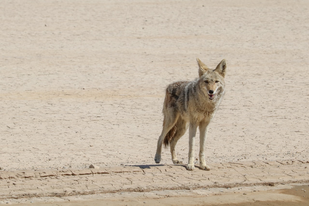
A curious coyote wonders why on earth people still come to a bone-dry place like this.
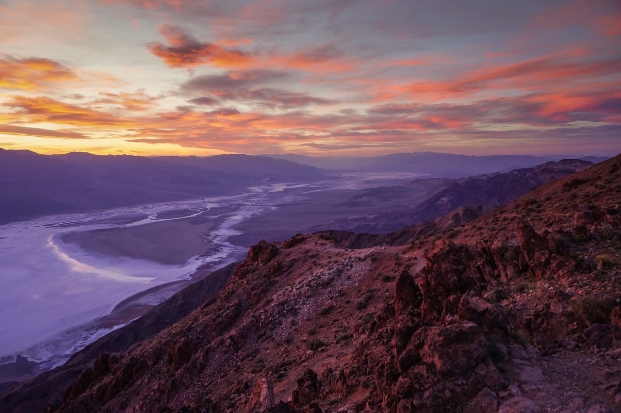
The best view in Death Valley National Park: Dante’s View.

Overlooking the badlands, and with the salt flats of Badwater Basin in the background, Zabriskie Point is another spectacular viewpoint in the park.

Caroline explores the Devil’s Golf Course, a huge plain filled with razor-sharp rocks.

The remains of the Harmony Borax Works teach visitors about Death Valley’s mining history.

An adventurous couple heads into the badlands.

It may be the driest place in North America, but there is some water in Death Valley. Salt Creek is, however, too salty for any life except for the native pupfish.
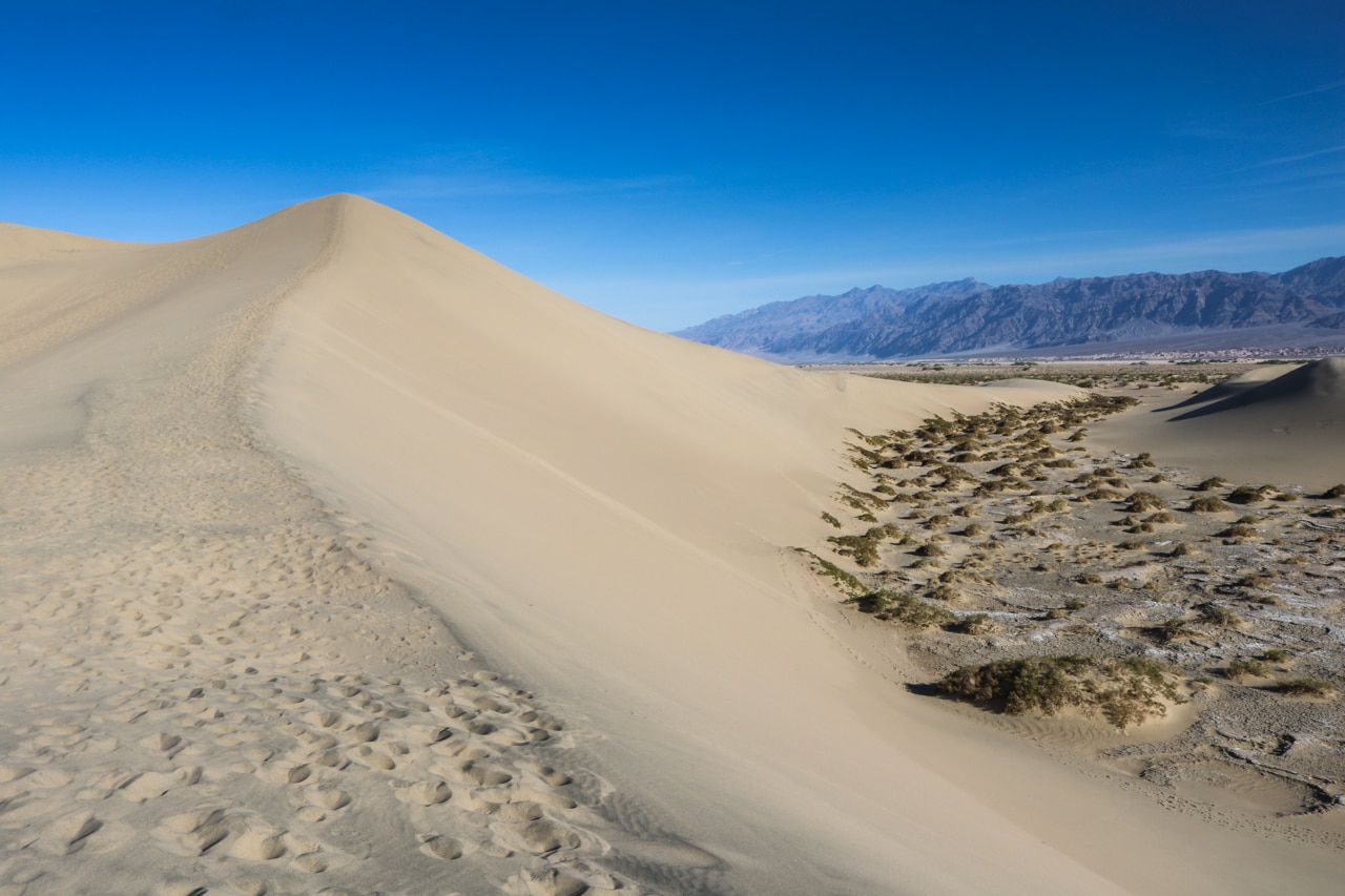
From tall sand dunes to bush-covered flats and rugged mountains – Death Valley in a nutshell.
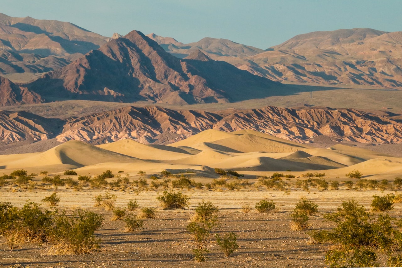
A different perspective of the scene above.
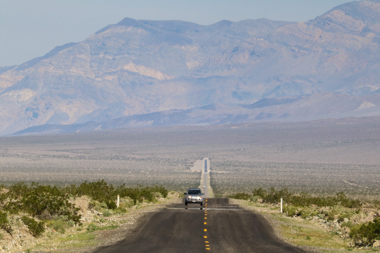
Arrow-straight roads cut through the valley, a drive that will be remembered for years to come.
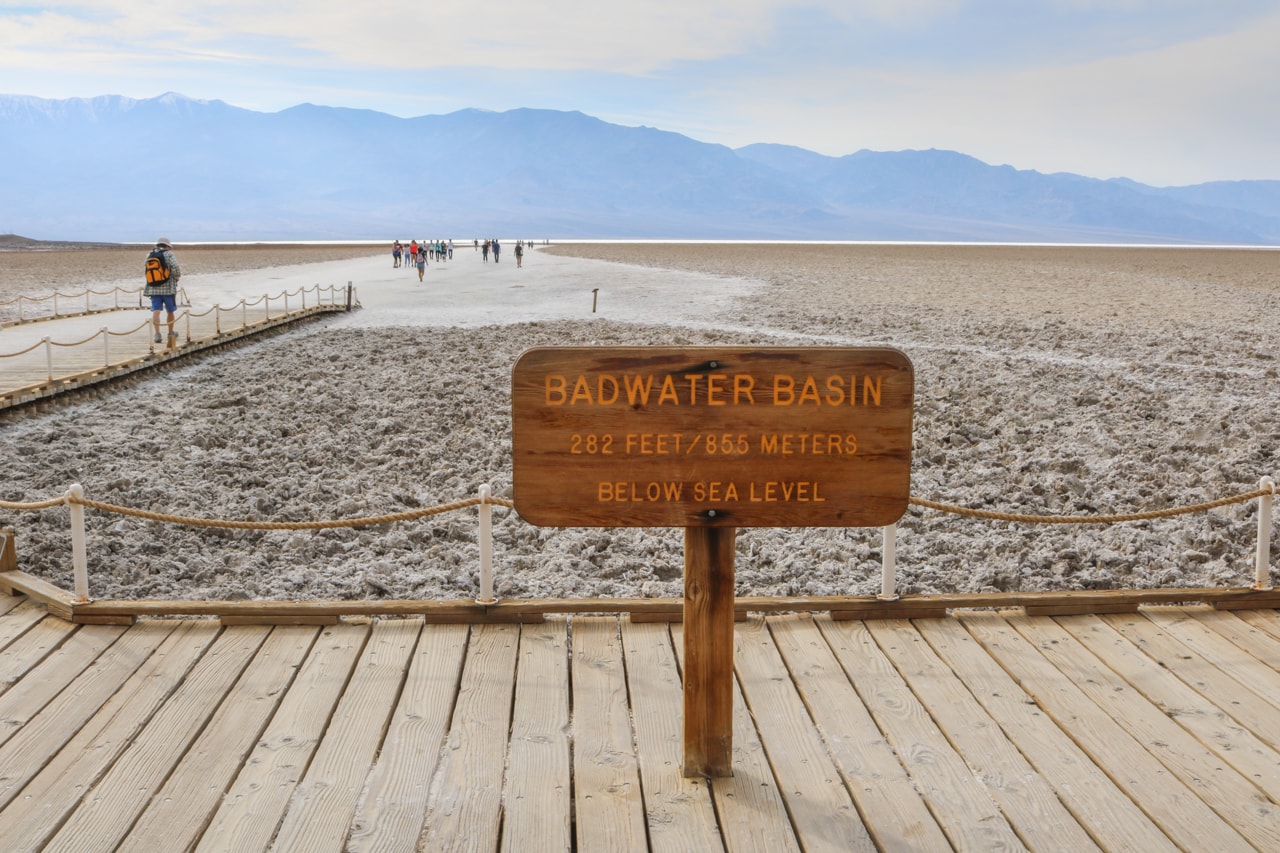
Arguably the most famous place in Death Valley National Park, Badwater Basin is the lowest point in North America.
Hopefully, you’ve enjoyed this selective Death Valley photo essay. Which was your favorite photo? If you liked this and your interest is sparked, check out my blog post about the main highlights in Death Valley. It’s a nice resource for planning your trip.
Other National Park Photo Posts
- Acadia National Park in Photos
- Arches National Park in Photos
- Capitol Reef National Park in Photos
- Channel Islands National Park in Photos
- Olympic National Park in Photos
- Petrified Forest National Park in Photos
- Saguaro National Park in Photos
- Shenandoah National Park in Photos
- Cuyahoga Valley National Park in Photos


Looks like an amazing destination to visit in the near future! Beautiful pictures!
Thanks so much, Sien! 😀
Impressing pictures.
Thank you for posting. I enjoyed reading. 😀
Thanks! Glad you liked them!