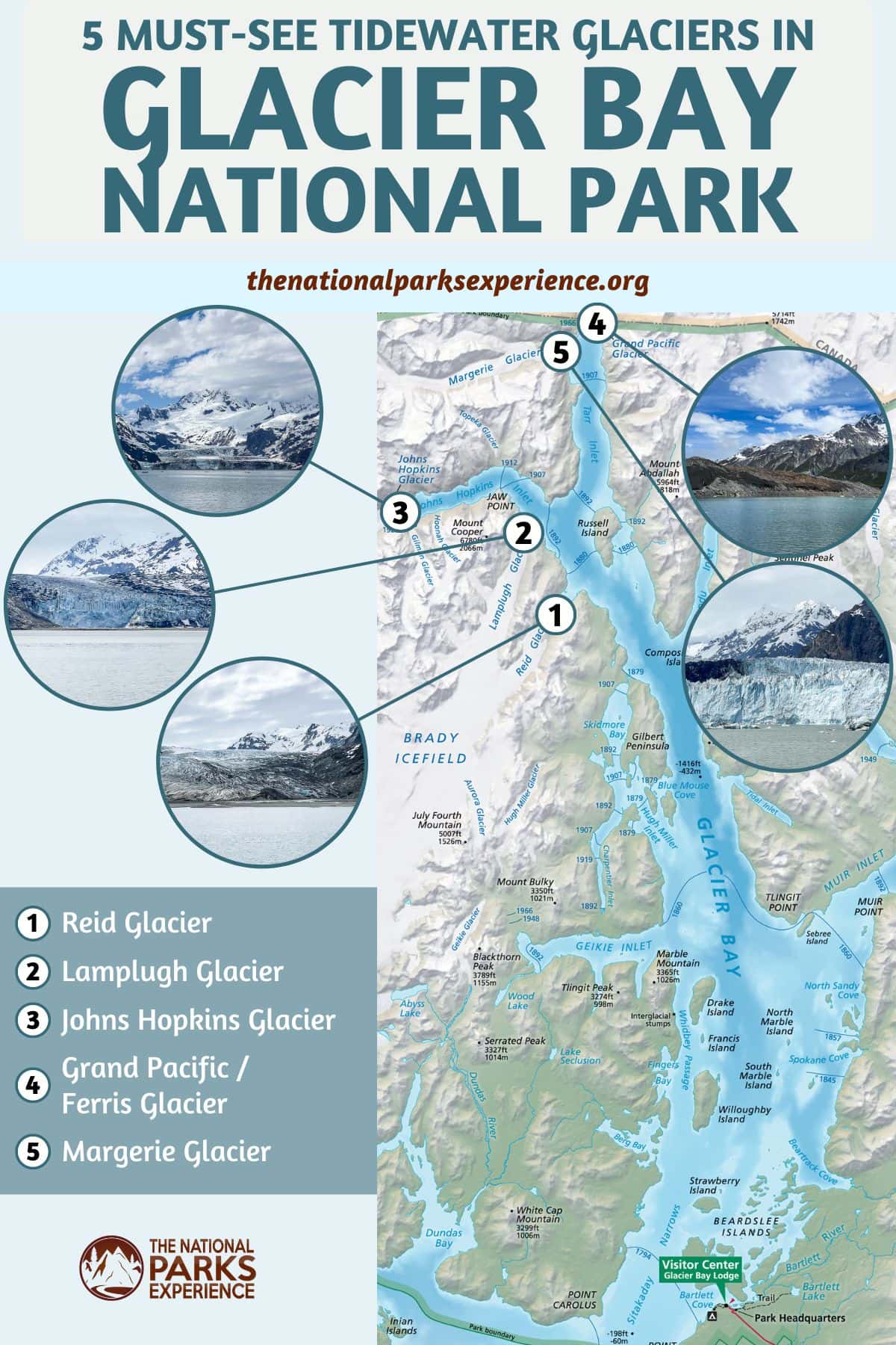
5 Famous Tidewater Glaciers of Glacier Bay National Park
Alaska’s remote Glacier Bay National Park may require some effort to reach, but once there, you’ll be immediately immersed in a landscape that never fails to exceed expectations.
This is a park with many different aspects—it is the homeland of the Huna Tlingit, a sprawling wilderness, a scientist’s playground, a national park, an international biosphere reserve, and a UNESCO world heritage site. It is a dynamic place, ever-changing, always in flux.
In fact, just 250 years ago, there was no Glacier Bay. Instead, there was one giant glacier, a massive river of ice flowing down from the mountains above. About 100 miles long and thousands of feet deep, it covered the whole bay.
Actually, that glacier created what is now Glacier Bay. As it retreated north, at a speed of up to a mile a year, it left behind an enormous channel that filled up with water as the glacier receded. Nowadays, from its mouth at Icy Strait to its furthest inlets, Glacier Bay is roughly 65 miles long.
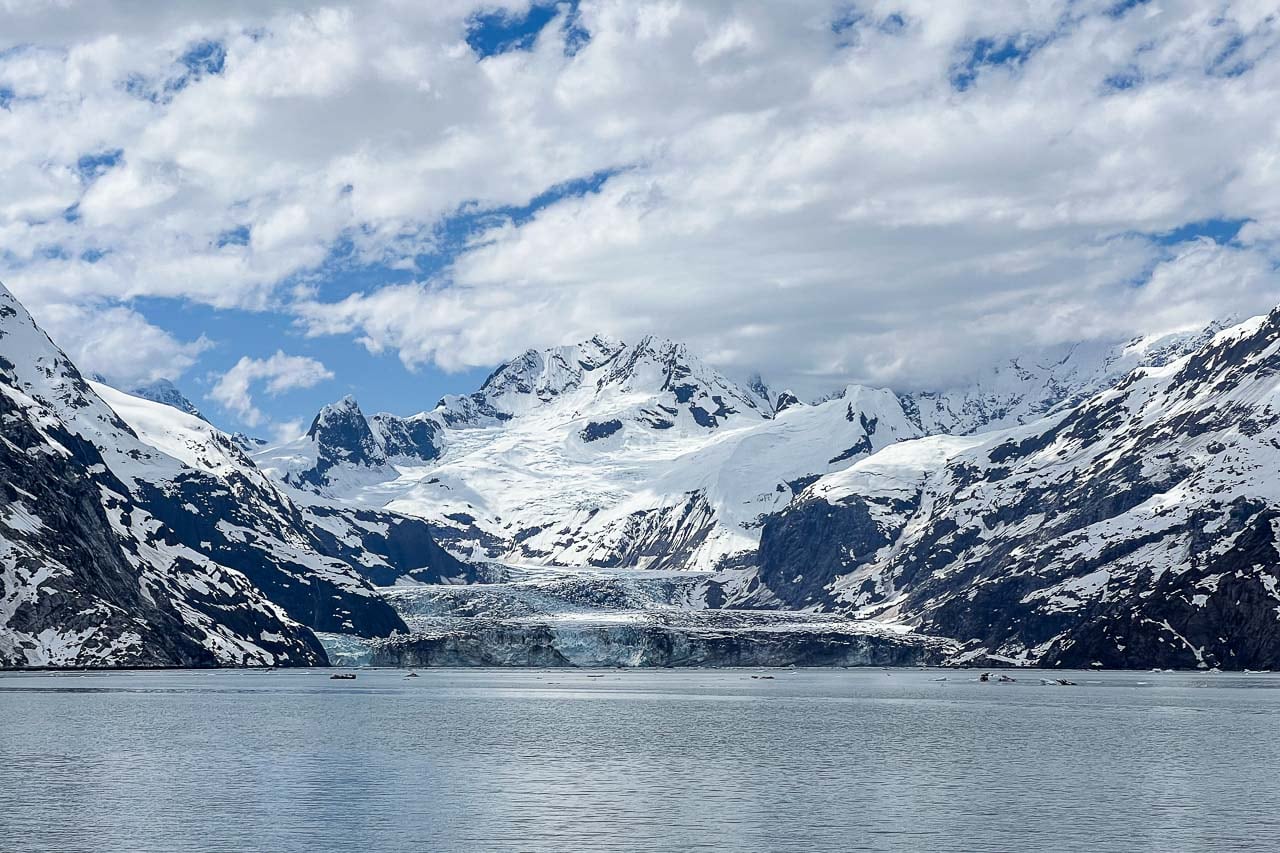
It’s at the heads of those inlets that you’ll find what’s arguably Glacier Bay National Park’s biggest attraction—the tidewater glaciers.
These spectacular glaciers are what’s left of the gigantic glacier that gouged out Glacier Bay. In my opinion, they’re among the crown jewels in the entire National Park System.
What Are Tidewater Glaciers?
While there are still more than 1,000 glaciers in Glacier Bay National Park, almost all of them are high up in the mountains, invisible to visitors. However, there’s a small number of glaciers—fewer than a dozen—that extend all the way down to the bay’s waterline, actually touching the saltwater, whether permanently or at high tide. Those are known as tidewater glaciers.
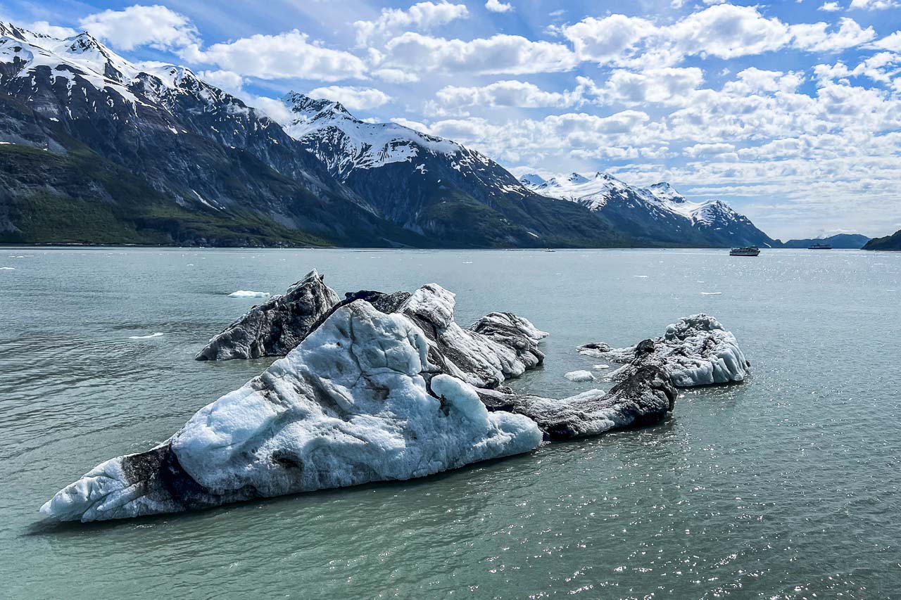
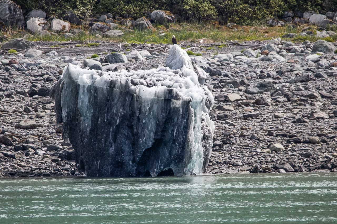
A noteworthy trait of the tidewater glaciers of Glacier Bay is that several of them calve shards of ice into the sea, which then float down the bay as icebergs. This phenomenon occurs because the salty seawater is both (relatively) warm and quite erosive. Waves may melt and wash away chunks of ice in the front of the tidewater glaciers, which causes chunks to crash into the water.
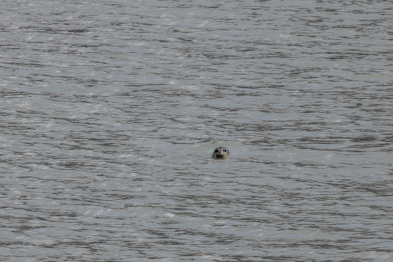
These icebergs may last more than a week, providing resting places for wildlife like gulls, cormorants, bald eagles, and harbor seals.
Witnessing a glacier calve ice is nothing short of jaw-dropping, an unforgettable experience, and perhaps the main reason why people visit Glacier Bay National Park (along with its incredible wildlife viewing opportunities).
How Can You See the Famous Tidewater Glaciers of Glacier Bay, Alaska?
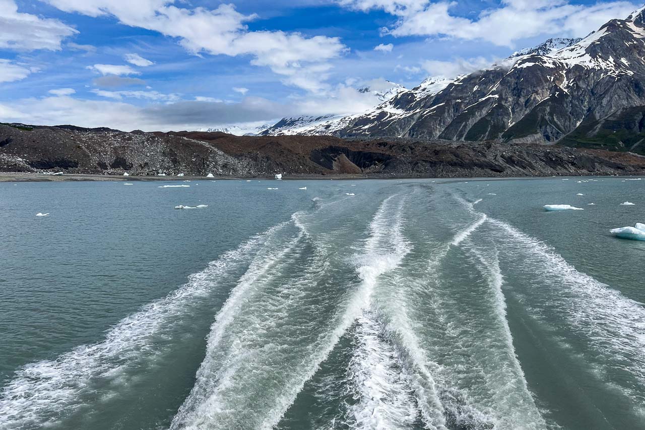
Because Glacier Bay National Park’s tidewater glaciers are located in the bay’s most distant corners, seeing them requires traveling up the bay by boat. There are basically four options to do that:
- Private boating in Glacier Bay (more information)
- Cruise ships in Glacier Bay (more information)
- Tour vessels in Glacier Bay (more information)
- Glacier Bay Day Tour from Bartlett Cove (more information)
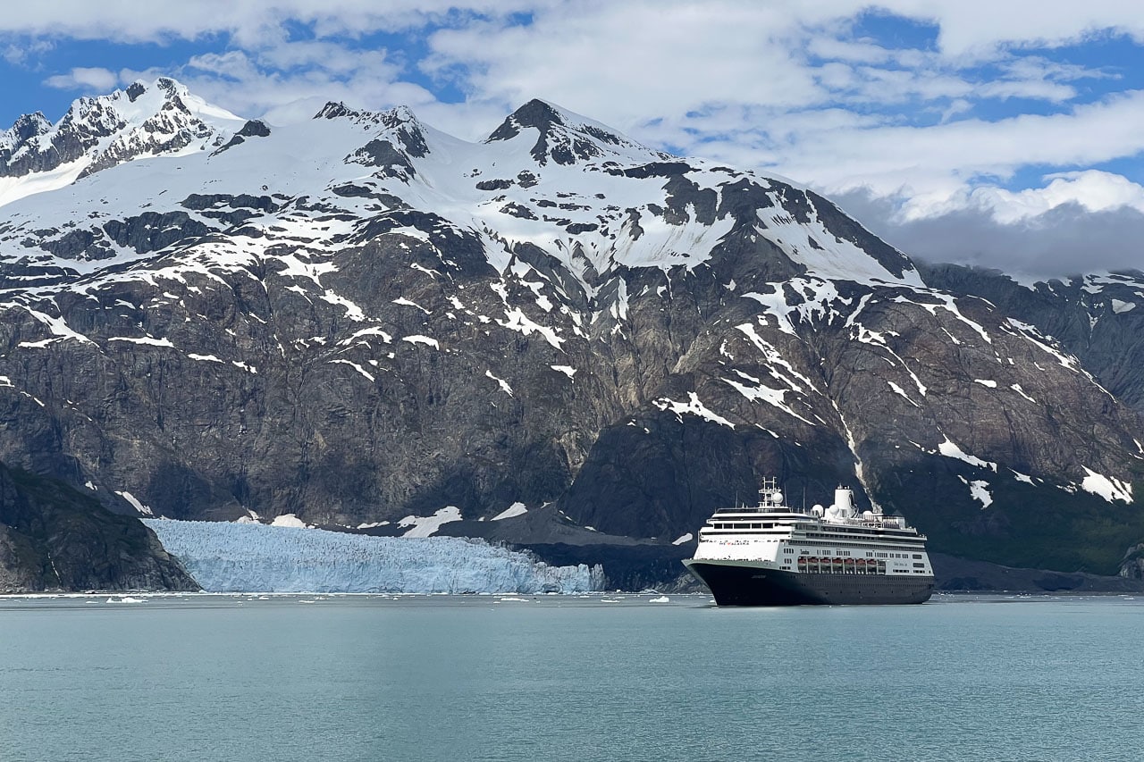
The vast majority of visitors to Glacier Bay arrive in the park on a cruise ship, often on longer cruises along the coast of southeast Alaska.
However—and this is my personal favorite way of visiting the park—you can also explore Glacier Bay on a day tour from the Glacier Bay Lodge at Bartlett Cove, which is the only part of the park reachable by road.
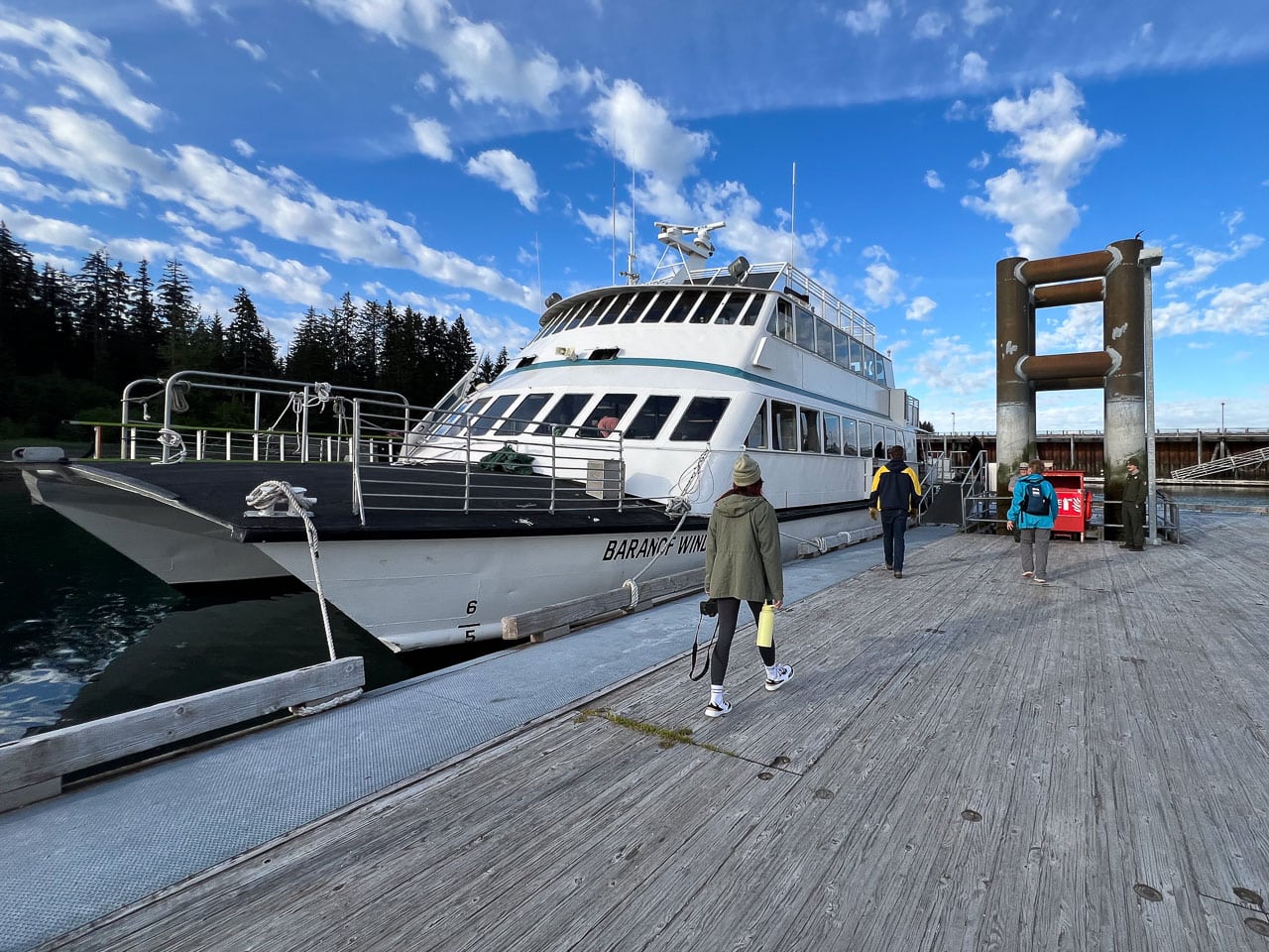
The Glacier Bay Day Tour lasts just over eight hours and takes you all the way up to the remotest shorelines and inlets, which is where the tidewater glaciers are situated. As you travel up the bay, there’s a great chance of spotting a variety of Glacier Bay wildlife as well.
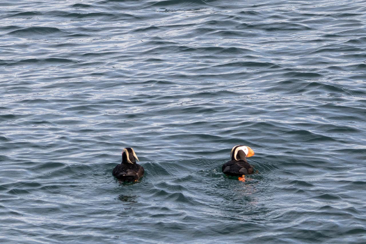
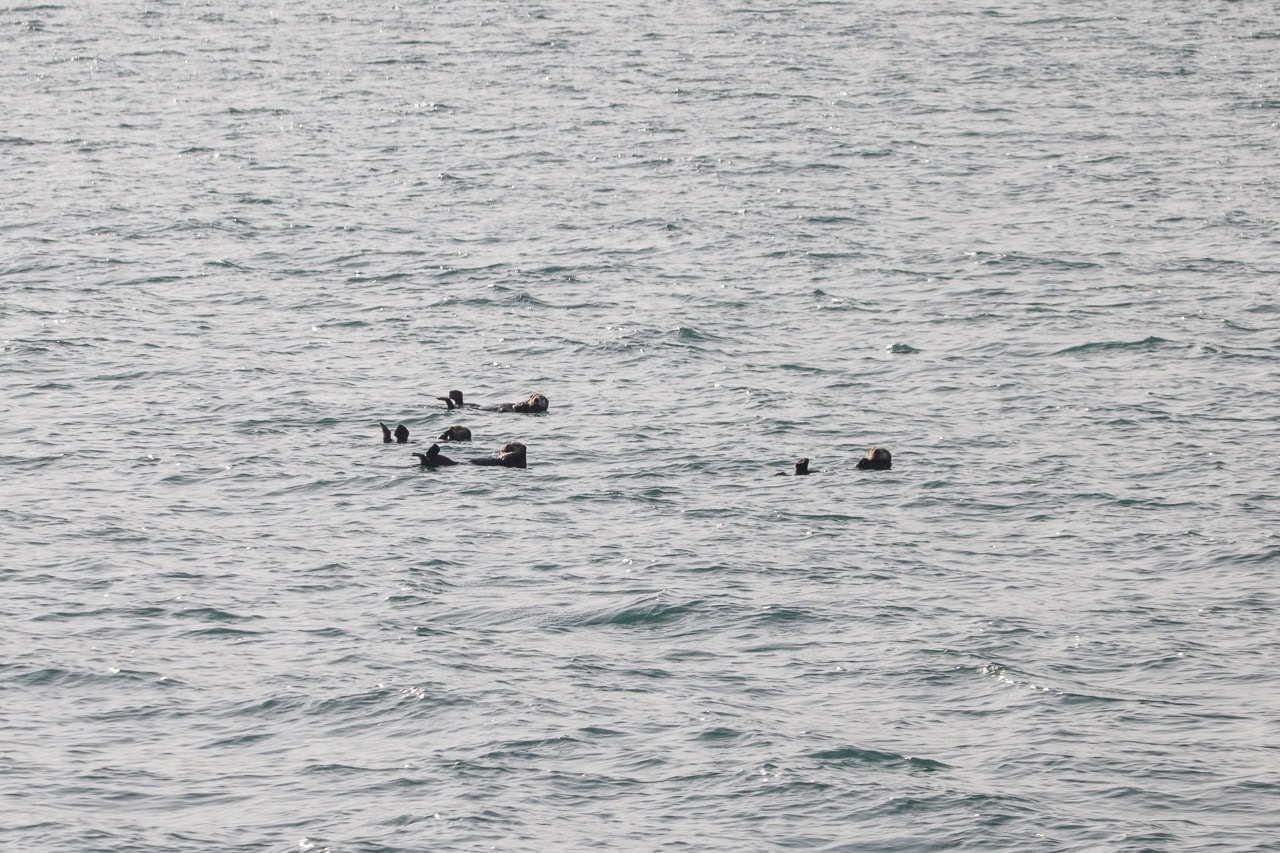
When I did this tour, I saw brown bears, bald eagles, sea lions, sea otters, harbor seals, porpoises, puffins, and mountain goats. Although I didn’t see them on my tour, humpback whale and orca sightings aren’t uncommon either.
Besides abundant wildlife, a Glacier Bay boat tour also allows you to see a number of different tidewater glaciers. I’ll describe the five tidewaters glaciers in Glacier Bay you might see on a boat tour below.
5 Famous Tidewater Glaciers of Glacier Bay National Park
The following five tidewater glaciers in Glacier Bay National Park sit at or near the water’s edge at the far northern end of the main arm of the bay. This is where all cruise ships and the Glacier Bay Day Tour go. They’re the most visible, most accessible, most famous, and most beautiful tidewater glaciers in the park.
1. Reid Glacier
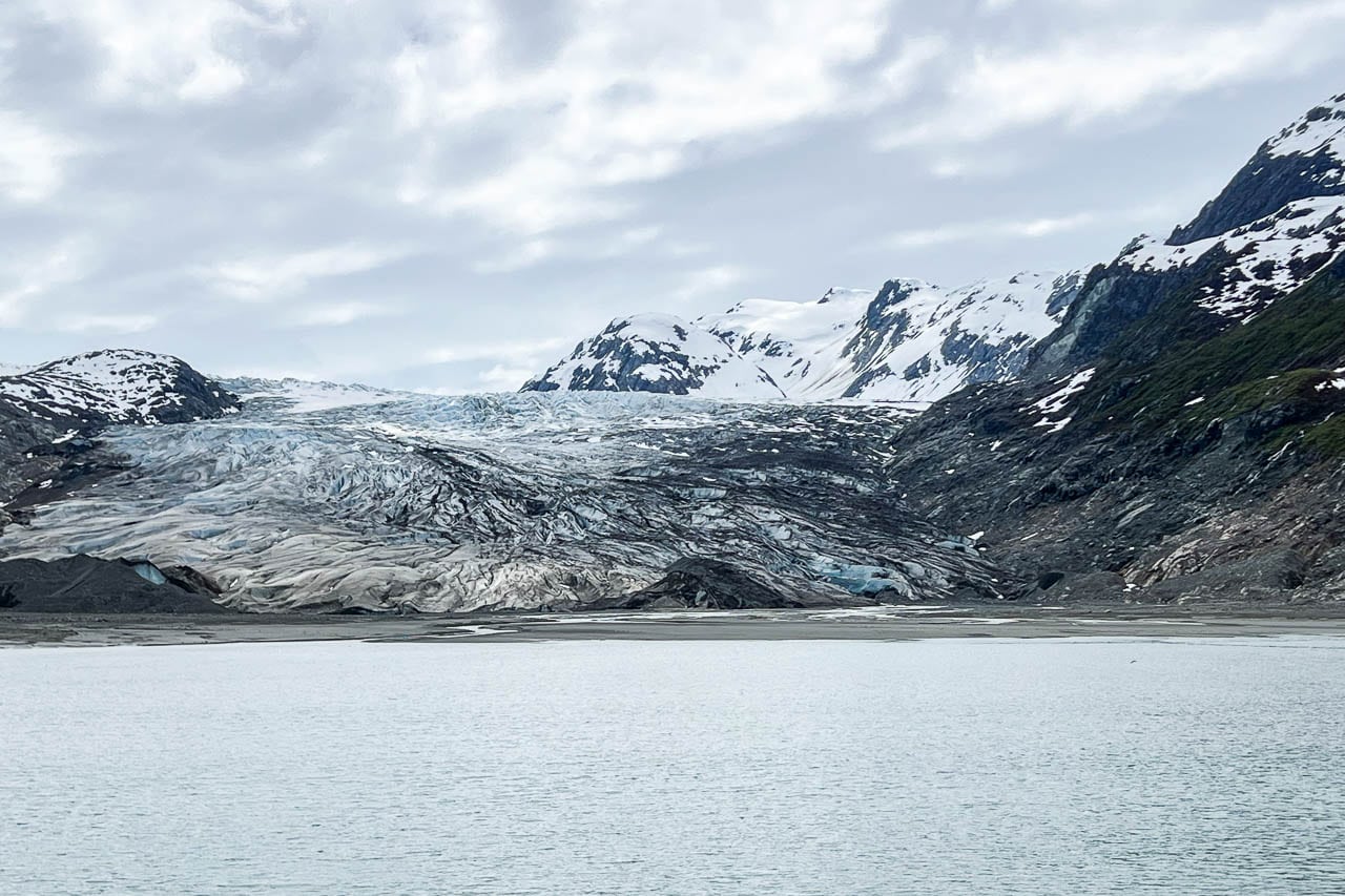
Just like nearby Lamplugh Glacier (see below), Reid Glacier has its origins in the Brady Icefield, a vast mass of ice just east of the Fairweather Range.
More than 10 miles long, about 0.75 miles wide, and 150 feet high, the glacier is now fully grounded, which means that it doesn’t permanently touch the water any longer.
Reid Glacier occupied all of Reid Inlet in 1899, but has gradually receded to its current location. Its central portion continues to recede at approximately 30-50 feet each year, while the other parts of the glacier recede at 30 feet or less per year.
Streams drain out of Reid Glacier on its eastern and western margins, carrying sediment that slowly fills the inlet in front of the glacier. You can see these deposits at low tide.
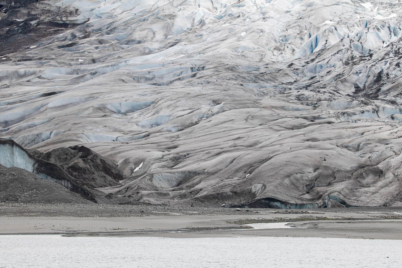
2. Lamplugh Glacier
Affectionally called “Lamplugh the Blue” by locals, Lamplugh Glacier is renowned for its intense blue color. Fed by the Brady Icefield, this tidewater glacier is more than 19 miles long, 0.9 miles wide, and 165 feet high. Its flow rate is about 0.75-1 foot per day.
The terminus of Lamplugh Glacier has become grounded and saltwater from the bay now reaches its ice face only at high tide.
A huge subglacial stream flows from its central portion, which often creates substantial caves in the glacier’s face. These kinds of subglacial streams deposit lots of sediment-rich water into Glacier Bay, giving the water at the ice edge a milky, brownish-tan color.
Starting in 2010, outwash from the glacier has accumulated as mudflats that extend along the whole face of Lamplugh Glacier.
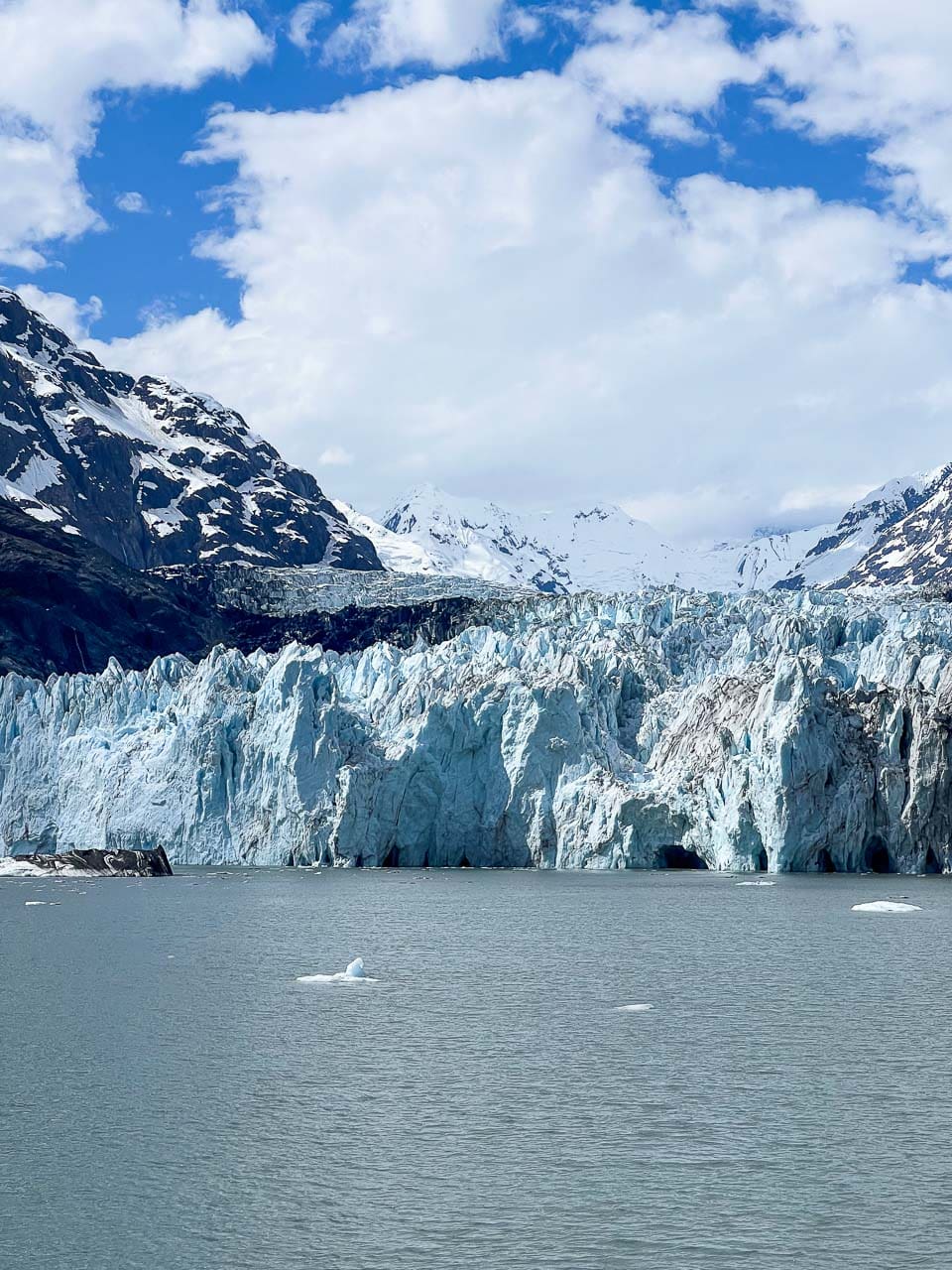
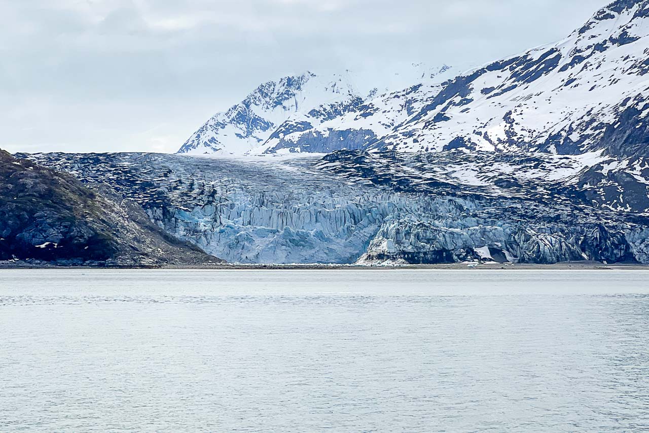
3. Johns Hopkins Glacier
One of the most famous tidewater glaciers in Glacier Bay National Park, Johns Hopkins Glacier sits in the far northwestern corner of the bay, at the end of its namesake Johns Hopkins Inlet.
Johns Hopkins Glacier is fed by many tributary glaciers, which can extend more than 12 miles up into the peaks of the Fairweather Range. The glacier’s flow rate is about 5-12 feet per day. It’s roughly 1 mile wide and 225-300 feet high. At the meeting points of those icy tributaries, there are several dozens of so-called medial moraines.
Debris from these moraines is clearly visible in the ice face, as well in the form of black bands that extend upwards in the glacier. The glacier’s ice transports this debris, releasing it into the bay either by melting or by calving into the water in the form of icebergs.
Johns Hopkins Glacier is noteworthy for its submarine calving—essentially, this means that huge chunks of ice break off from the glacier deep below the water’s surface. These icebergs then rise rapidly, shooting up suddenly at the surface. (This is why vessels and kayaks are advised against or restricted from getting too close to Johns Hopkins Glacier.)
Additionally, Johns Hopkins Glacier is the only tidewater glacier in Glacier Bay National Park that has been advancing in recent years, making it an anomaly in the region.
In summer, Johns Hopkins Inlet is a popular hangout for many hundreds of harbor seals, who find refuge on the icebergs when pupping and mating.
During this time, a large part of the inlet is closed to vessels—although you can still see this imposing glacier from a distance. Also keep an eye out for sea otters and birds like black-legged kittiwakes.
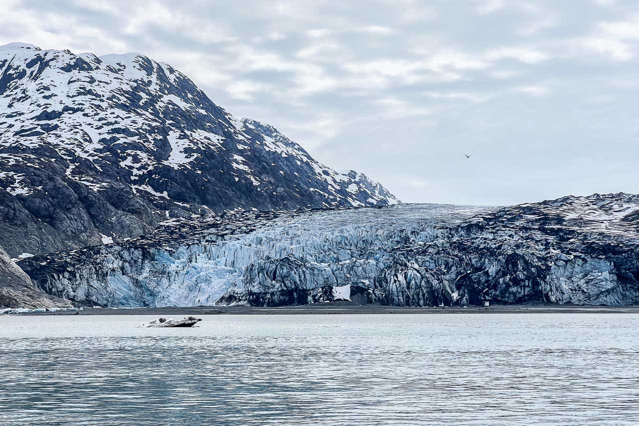
4. Grand Pacific Glacier / Ferris Glacier
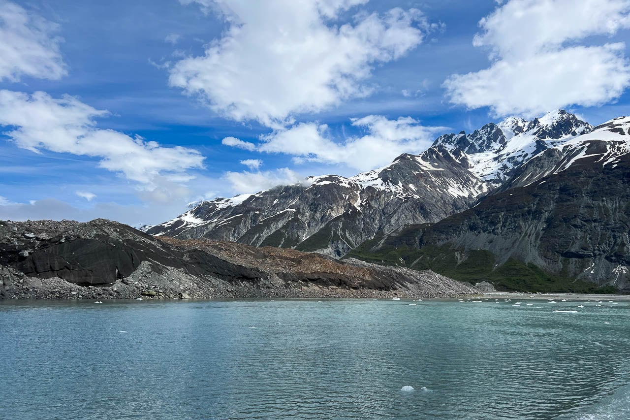
The ice face of Grand Pacific Glacier, the furthest glacier from the mouth of Glacier Bay, has retreated so much, it’s almost outside of the national park’s boundary and in Canada now. This is the last remaining piece of the original giant glacier that once filled the entire bay.
Currently, Grand Pacific Glacier is more than 20 miles long, 1.35 miles wide, and 65-165 feet high. Its flow rate is about 0.5-1 foot per day, satellite data shows.
Up to 1991, Grand Pacific Glacier and Margerie Glacier (see below) were connected, but due to Grand Pacific’s retreat, they no longer touch.
Nowadays, a small stream flows between the termini of the Grand Pacific and Margerie tidewater glaciers. Grand Pacific Glacier, once an imposing wall of ice, has become fully grounded and has lost its sheer front of ice.
Even more so, the terminus of the glacier doesn’t even look like ice anymore. Rather, it looks like a hill of sand, debris, and rocks, which are transported down by the adjacent Ferris Glacier and mixed with the ice. In fact, much of what you actually see there is the ice and debris from Ferris Glacier, while Grand Pacific Glacier sits behind it.
You can see how far Grand Pacific Glacier has receded in the past decades on this aerial map comparison from NASA.
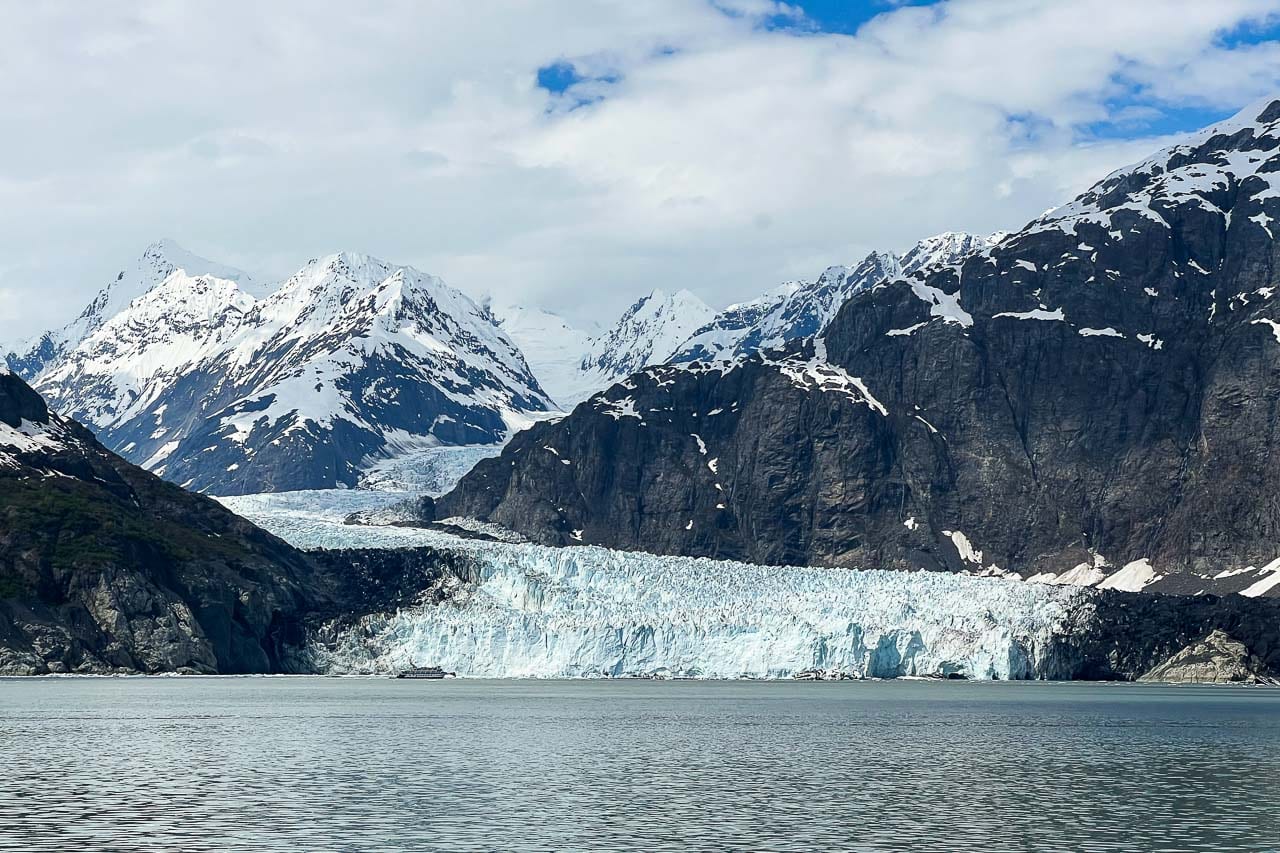
5. Margerie Glacier
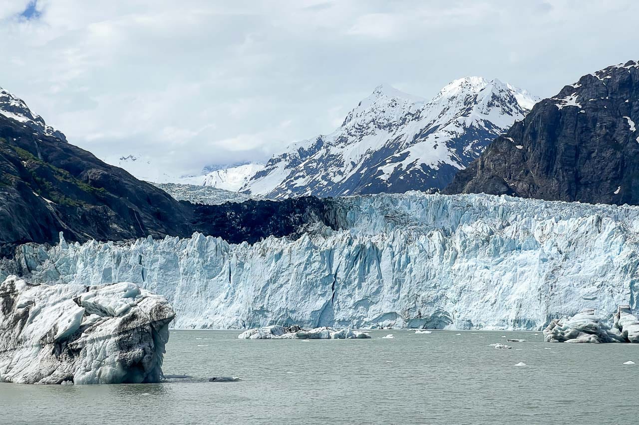
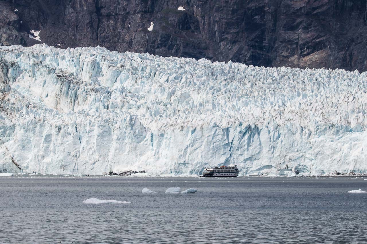
The number one highlight of a trip across Glacier Bay is Margerie Glacier, an iconic tidewater glacier that’s famous for its regular calving activity.
It is one of the prime destinations for park visitors on cruise ships, tour boats, and sea kayaks—along with Johns Hopkins Glacier, this is one of two relatively accessible tidewater glaciers that calve on a regular basis.
Margerie Glacier originates in the snowfields of the Fairweather Range and is approximately 21 miles long. It is 0.85 miles wide and its ice face rises 200 feet above the waterline. Thanks to its flow rate of 3-7 feet per day, there’s always a good chance of seeing icebergs calve from this stunning tidewater glacier.
As I said above, Margerie Glacier and Grand Pacific Glacier were joined up until 1992, but have separated due to the retreat of Grand Pacific.
Since 1998, the terminus of Margerie Glacier has receded slightly as well, which resulted in the formation of a small embayment within the ice face. In 2017, there were dramatic changes to this portion of the glacier, exposing a sizable area of bedrock.
Additionally, constant meltwater runs out from subglacial streams below the water’s surface, causing upwellings and sometimes even fountains at the surface.
At places where the meltwater and calving icebergs disturb the water, you might see black-legged kittiwakes fly around trying to catch small marine animals. Also keep your eyes peeled for other birds like puffins, cormorants, bald eagles, and gulls, as well as harbor seals and sea otters.
Map of Spectacular Tidewater Glaciers in Glacier Bay National Park