16 Stunning Images of National Parks Seen From Space
Many people visit America’s national parks to enjoy spectacular landscapes, scenic views and unique sights. And while there are numerous amazing overlooks in the national parks, nothing beats the view from space.
Seeing the national parks from space in real life is a privilege reserved only for astronauts. However, thanks to some NASA astronauts, we can, in fact, see what the national parks look like from space.
NASA astronauts traveling in the International Space Station have shared breathtaking images of America’s national parks as they circle around the globe.
You can see some of those below, for the ultimate bird’s eye view of the parks.
These 16 Spectacular Images Show America’s National Parks From Space
Redwood National and State Parks, California
Located along the coast of northern California, the Redwood National and State Parks protect groves of coast redwoods, the tallest trees on Earth.
The park complex is also home to native prairie, oak forests, pristine rivers and a beautiful coastline. Visitors enjoy wildlife viewing, walking among gigantic trees, whitewater rafting and spending time on the beach.
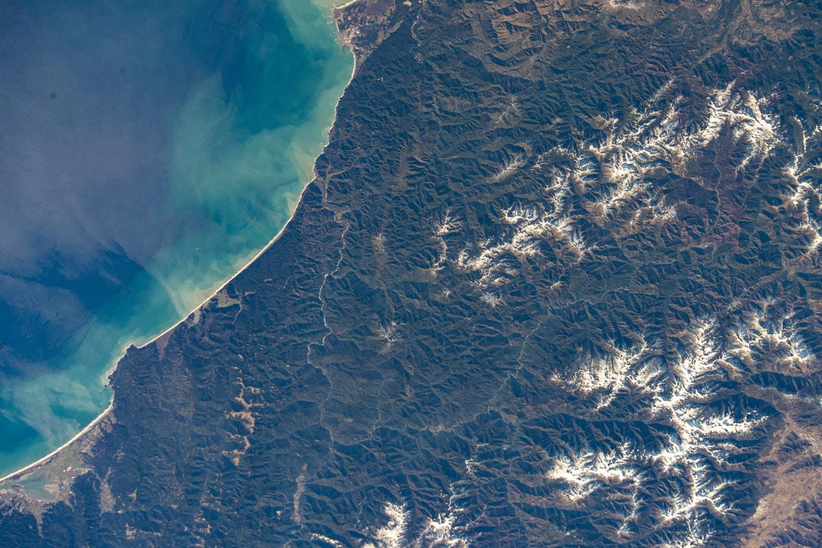
This NASA image clearly shows the diversity of the Redwood National and State Parks. Rivers wind through hills covered with redwoods, you can see patches of prairie, and tin ribbons of sandy beaches separate the forest from the ocean.
Crescent City is on the coast just below the upper edge of the image. Another prominent feature is the Klamath River, only the mouth of which is part of the Redwood National and State Parks complex.
The longish and narrow brown area amid dark greens in the lower right corner is the Bald Hills and prairie of Redwood National Park.
Yosemite National Park, California
One of the most famous national parks in America, Yosemite National Park encompasses the world-renowned Yosemite Valley, which is home to iconic rock formations like El Capitan and Half Dome, as well as spectacular waterfalls, such as Yosemite Falls, Vernal Falls and Bridalveil Falls.
Yosemite also protects the Mariposa Grove of giant sequoias, Tuolumne Meadows and the historic Wawona area. The controversial Hetch Hetchy reservoir is within Yosemite National Park, too.
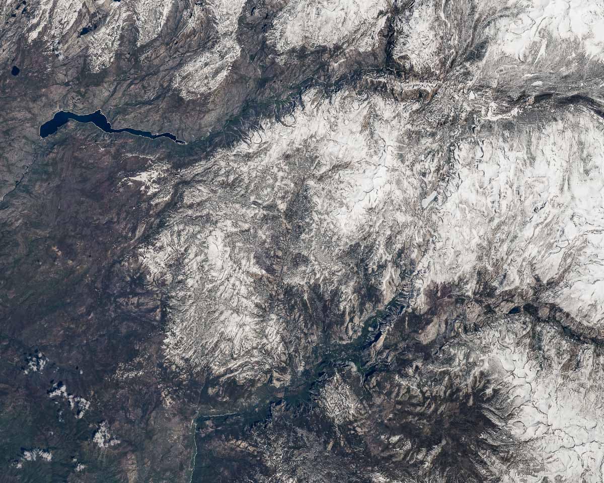
This photo of Yosemite National Park from space includes many of the park’s best known locations.
The Hetch Hetchy reservoir is clearly visible in the upper left corner, while the Yosemite Valley takes up much of the lower part of the image. On the right, Tenaya Lake and the Tuolomne Meadows high country can be seen as well.
Death Valley National Park, California
Holder of a number of records, Death Valley National Park in southern California is truly a park of epic proportions. It is the largest national park in the contiguous United States, home to the lowest spot in North America: Badwater Basin.
Besides that, in summer, Death Valley is also one of the hottest and driest places on Earth.
Yet, despite this harsh environment, the park supports a variety of wildlife, from coyotes and snakes to various birds, bighorn sheep and even fish.
Top attractions in Death Valley National Park include aforementioned Badwater Basin, the Mesquite Flat Sand Dunes, Zabriskie Point, Dante’s View, Harmony Borax Works and Artists Palette.
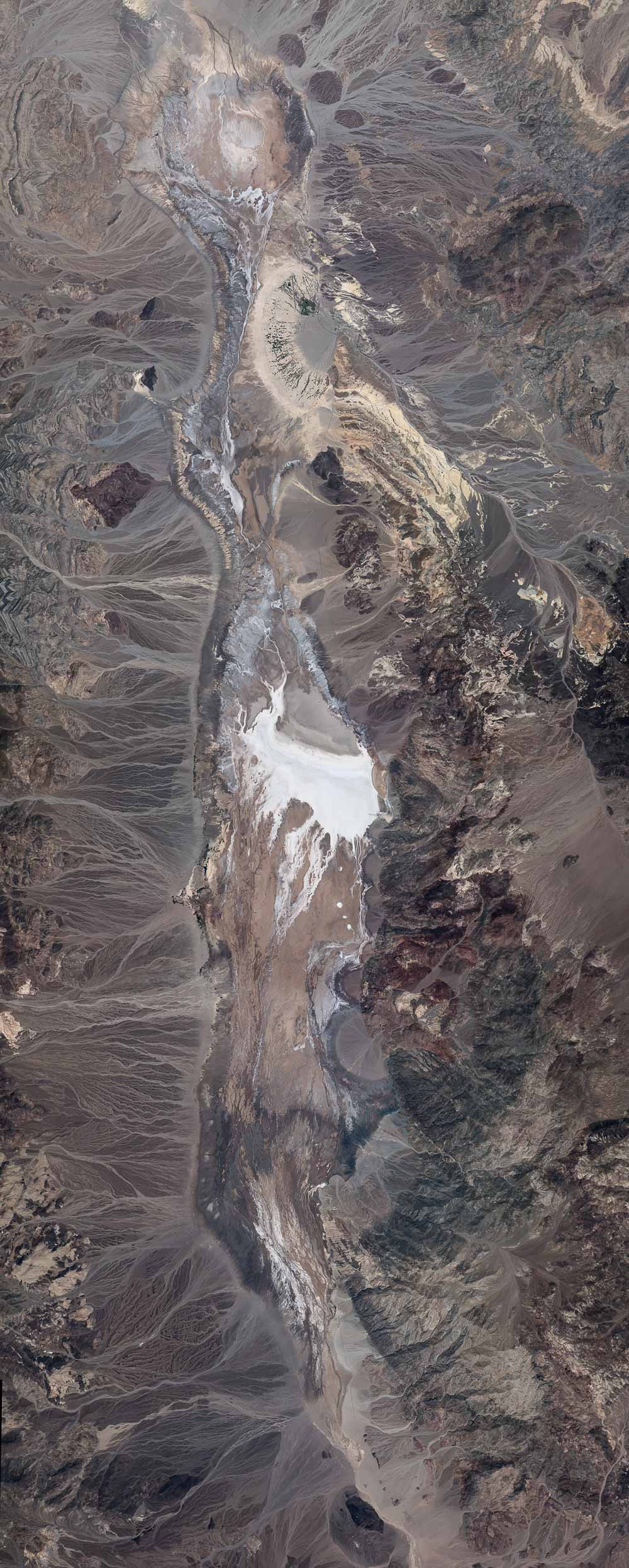
This fascinating NASA image showcases the amazing patterns in Death Valley’s Badwater Basin.
It clearly shows the numerous desert washes that flow into the basin from the surrounding mountains. The white salt flats contrast starkly with the brown landscape. On the right side of the white flats, you can see the Badwater Basin parking lot and the short distance people usually walk.
When studying the image closely, you can also make out a couple of roads in Death Valley. There’s a fairly straight line running up from Badwater Basin, which is the Badwater Road.
About where that road runs through an area of a lighter beige color, there’s another road running toward the image’s lower right corner, Route 190. Along this road, you’ll find Zabriskie Point and Dante’s View.
Artists Palette sits roughly in between those two roads, above Badwater Basin, an area of differently colored lines surrounded by beige. Furnace Creek is the small area of dark-green lines just above that, slightly to the left.
Wind Cave National Park, South Dakota
Underneath one of the last remaining intact prairies in America lies Wind Cave, an extraordinarily long and complex cave system.
The cave gets its name from the barometric winds at its entrance. One of Wind Cave’s top attractions is its boxwork, a remarkable formation that’s extremely rare elsewhere in the world.
Above ground, a variety of wildlife roams the sprawling prairie, including American bison and elk, as well as prairie dogs, pronghorn and endangered black-footed ferrets. Another noteworthy animal in Wind Cave National Park is the burrowing owl.
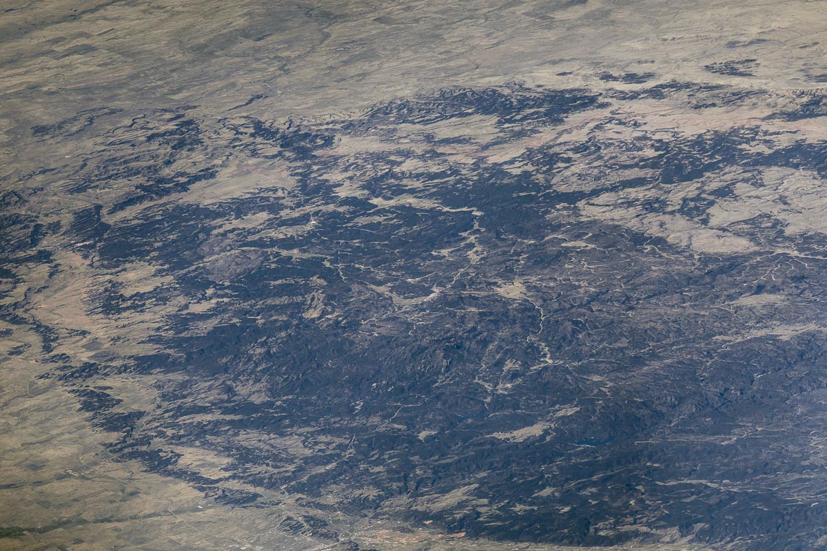
This image is part of larger composite image of the Black Hills in South Dakota. You can clearly see why the hills were given their English name, a sprawling collecting of dark-colored hills amid a brown prairie landscape.
Although not obviously visible, Wind Cave National Park sits in the upper left area of this satellite photo of the Black Hills.
Badlands National Park, South Dakota
Arguably one of the most astonishing landscapes in America is found in South Dakota’s Badlands National Park. The Badlands are a collection of eroded hills, featuring multi-colored layers of rock that house one of the world’s richest fossil beds.
Besides the Badlands themselves, this national park also protects areas of mixed-grass prairie, the home of animals like bison, prairie dogs, black-footed ferrets and bighorn sheep.
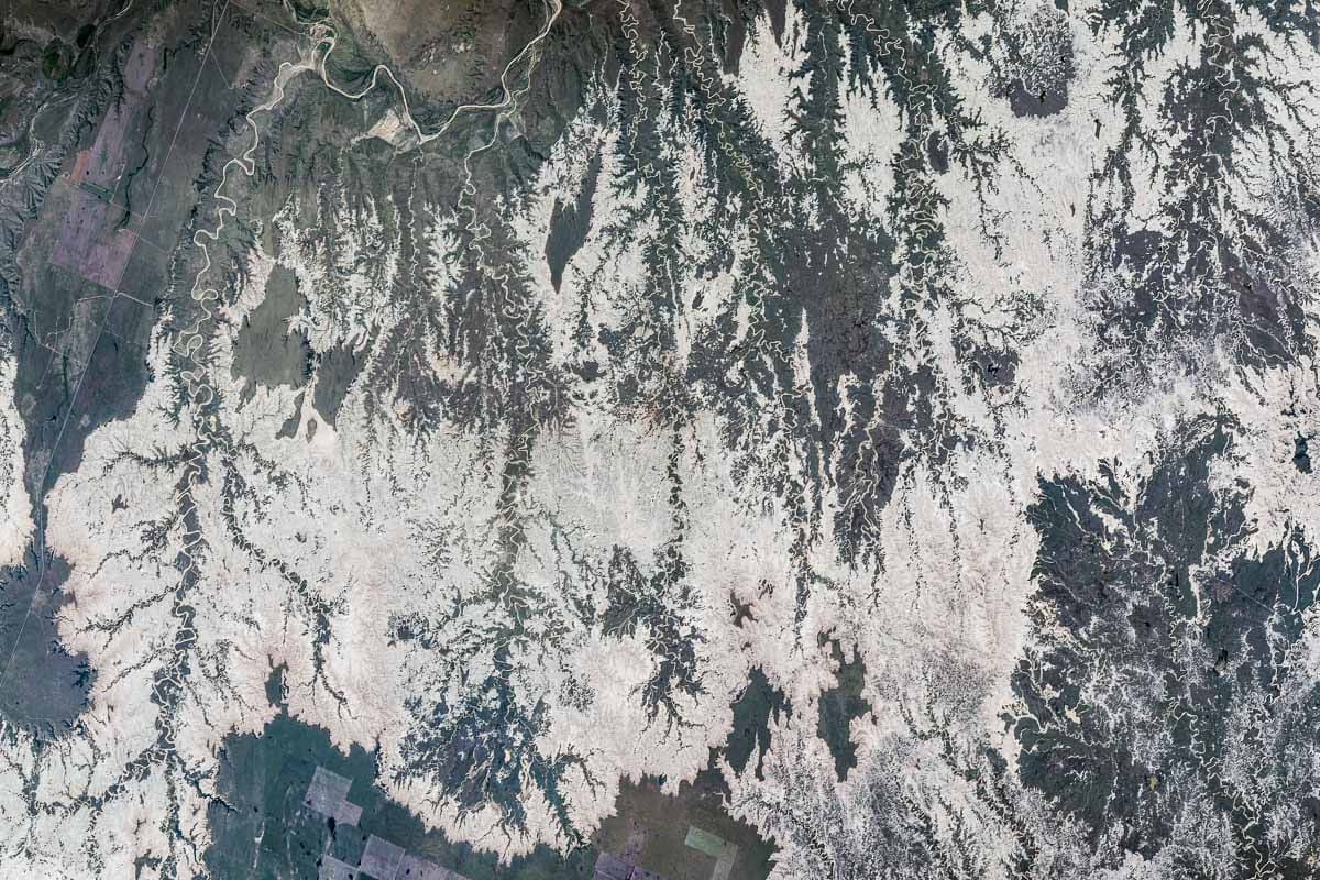
The way the remarkable Badlands are created is shown beautifully in this NASA image taken from space. Numerous creeks and streams zigzag through the landscape, cutting and carving the iconic hills.
This image depicts most of the Stronghold Unit of Badlands National Park.
Denali National Park, Alaska
The tallest mountain in North America, Denali dominates the landscape of Denali National Park in southern Alaska.
Seeing this majestic mountain is a highlight for many visitors, as are exploring the park’s vast wilderness areas and spotting wildlife like grizzly bears, caribou, moose and wolves.
In winter, Denali offers world-class dog sledding and Northern Lights viewing.
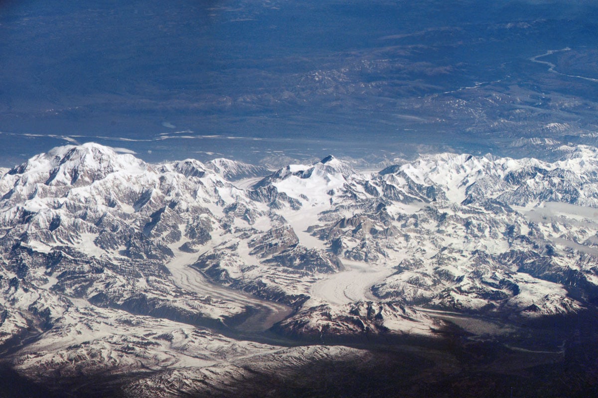
Part of a larger composite image, this photo features the spectacular snow-covered mountains in Denali National Park. You can see gigantic glaciers flowing down the mountains’ flanks, while wide river valleys extend beyond the image’s edges in the distance.
Katmai National Park, Alaska
Famous around the world for its phenomenal brown bear viewing opportunities, Katmai National Park’s most popular area is Brooks Falls, where numerous bears gorge on salmon in summer.
Additionally, the park encompasses huge tracts of wilderness, comprised of lakes, meadows, mountains and volcanoes, and a long, unspoiled coastline.
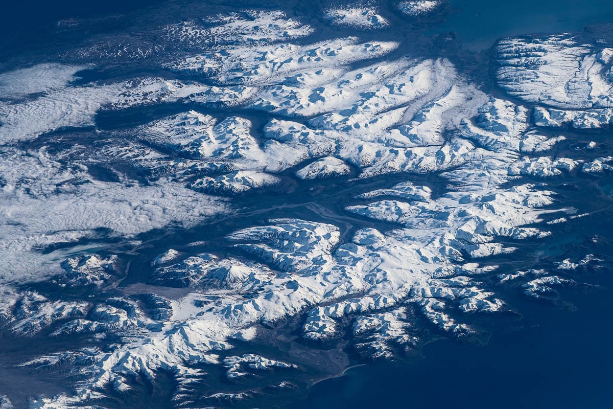
An absolutely stunning image of Katmai National Park from space, this photo encompasses many of the park’s greatest natural features.
The Mount Griggs stratovolcano rises unmistakably from the landscape in the lower left of the image, while the brownish-gray Valley of the Ten Thousand Smokes runs to its left.
Kukaklek Lake and Nonvianuk Lake are visible in the upper left corner. The popular Brooks Falls area is obscured by clouds, but would be somewhere along the image’s middle left edge.
Glacier Bay National Park, Alaska
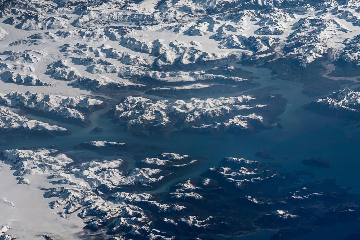
Located in the famed Inside Passage, Glacier Bay National Park protects 3.3 million acres of rugged Alaskan wilderness. This includes deep fjords, pristine coastlines, rugged mountains, temperate rain forests and huge glaciers.
Visited by most people on cruises, the park is most famous for its marine wildlife, which ranges from harbor seals, sea lions and sea otters to humpback whales and orcas.
On land, visitors might spot mountain goats, moose and the occasional black or brown bear.
This spectacular image of Glacier Bay National Park from space displays the park’s elongated fjords and inlets, as well as its rugged mountain ranges. On the right side of the image, Muir Inlet extends upwards, while the smaller Rendu and Queen Inlets are visible on the left.
The main body of water crossing the image horizontally is Glacier Bay itself. Four prominent islands dot the bay: Composite Island on the left (between Rendu and Queen Inlets) and the triangular trio of Drake Island, Sebree Island and Willoughby Island on the right.
White Sands National Park, New Mexico
Home to the largest gypsum dune field in the world, White Sands National Park is one of the youngest national parks in America.
It is in the Tularosa Basin of New Mexico and encompasses 275 square miles of desert. The park is famous for its fossil deposits and well-preserved prehistoric footprints. White Sands offers everything from hiking, biking and sand sledding to scenic drives and photography.
The park is surrounded almost entirely by the White Sands Missile Range.
The beauty of the NASA photo of White Sands National Park below is that it shows both the national park and the White Sands Missile Range. The image contains the whole dune field, which makes up the right side of the light-colored area, and most of Alkali Flat, which is the somewhat smoother-looking area on the left.
The line across the dune field in the middle of the image is a road in the White Sands Missile Range, just north of the White Sands National Park boundary. Dried-up Lake Lucero is clearly visible in the very lower left corner of the image.
Additionally, you can also see the main wind direction at White Sands in this image: from the southwest to the northeast.

Olympic National Park, Washington
Sometimes referred to as “three parks in one,” Washington’s Olympic National Park comprises much of the Olympic Peninsula.
This amazingly diverse park preserves some of the wildest coasts in the continental United States, spectacular mountains, gorgeous temperate rain forests, remote river valleys and crystal-clear lakes.
Places of particular interest include the Hoh Rain Forest, Lake Quinault, Ruby Beach and Rialto Beach, Hurricane Ridge, and Sol Duc Hot Springs and Falls.
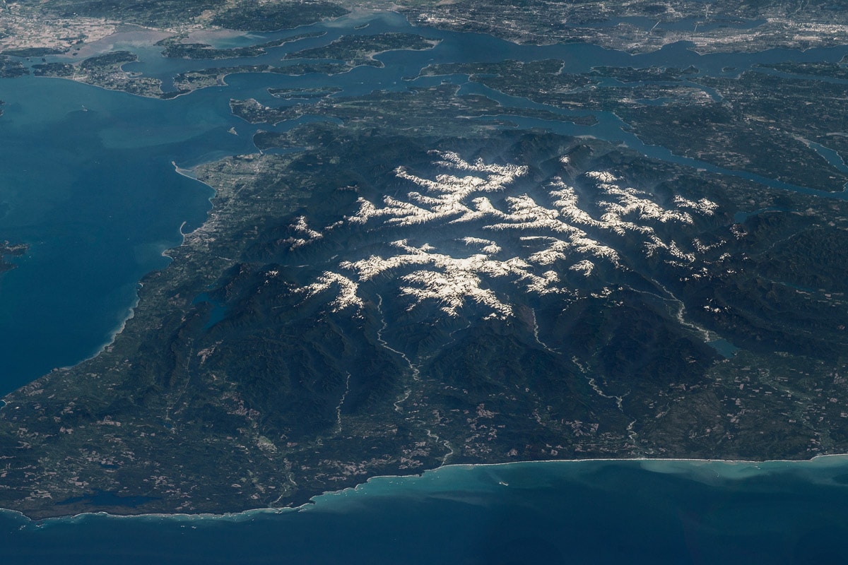
The entirety of Olympic National Park is captured by this amazing image taken in space. From the snow-covered Olympic Mountains to the rivers and rain forests to the rugged coastline, the park’s sheer diversity is at full display here.
Mount Olympus sits in the middle of the image, in between and above the Hoh River and Queets River, which are clearly distinguishable, running down from the mountains to the ocean. Toward the right, the Quinault River empties into Lake Quinault. Lake Crescent lies on the left, while Ozette Lake can be seen in the lower left corner.
Puget Sound occupies much of the top of the image, with Seattle in the upper right corner.
Mount Rainier National Park, Washington
Mighty Mount Rainier is the centerpiece and namesake of Mount Rainier National Park.
Situated in central Washington, this breathtaking national park park harbors numerous glaciers, sprawling alpine meadows filled with wildflowers, old-growth forests, raging rivers and some stunning waterfalls.
Scenic spots around Mount Rainier are Paradise, Reflection Lakes, Myrtle Falls, Tipsoo Lake, the Grove of the Patriarchs and Sunrise.
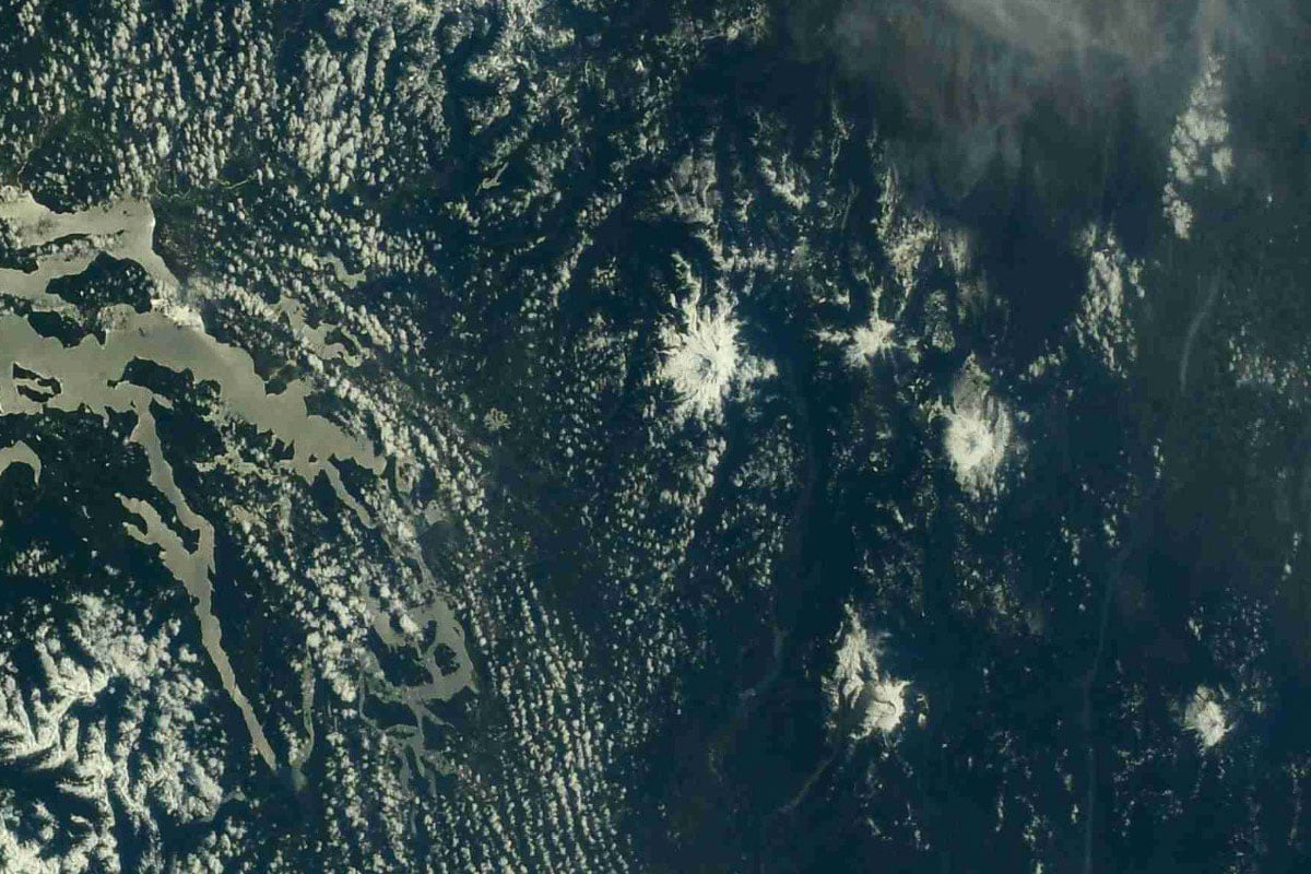
This image of Mount Rainier National Park from space isn’t as close-up as other images in this list of national parks seen from space. Few details of the national park are distinguishable.
However, Mount Rainier itself is clearly visible. It is the big white spot more or less in the middle of the image, on which the national park is centered.
The other white spots in the right part of the image are other prominent volcanoes in the Cascade Range. Mount Adams is to the right (south) of Mount Rainier, while Mount St. Helens is below and right (southwest). The Columbia River cuts through the image on the right, with Mt. Hood sitting in the lower right corner.
Everglades National Park, Florida
The Florida Everglades are the largest subtropical wilderness in the United States. Much of this biodiverse region is protected in Everglades National Park, a large park just west of Miami.
In these wetlands and patches of woodland—a “River of Grass”—a vast number of animals thrive. Everglades is primarily a birding destination, home to over 350 species of birds, such as ibis, storks, herons, roseate spoonbills, vultures, hawks, hummingbirds and countless others.
Additionally, the park is the only place in the world where American alligators and crocodiles live side by side.
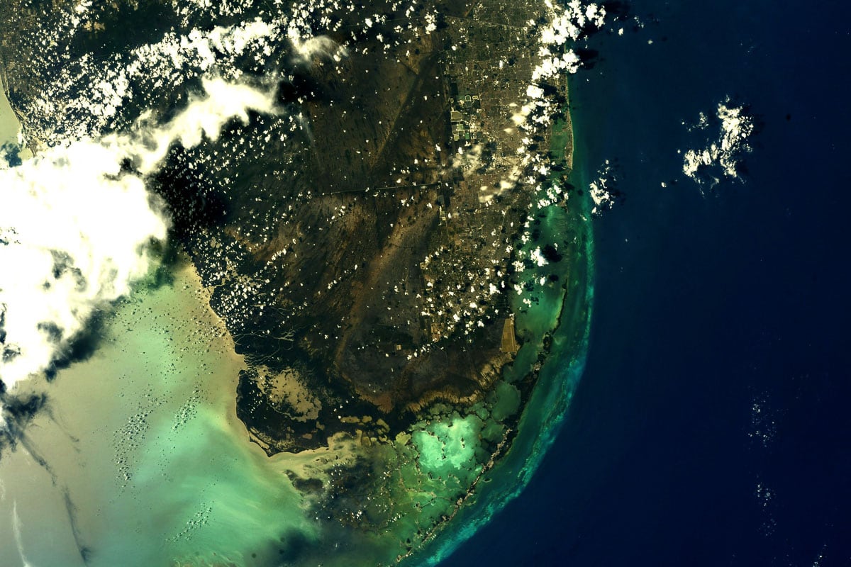
Everglades National Park makes up most of the middle area of this beautiful NASA photograph. When you look closely, you can even see the park’s boundaries.
Especially the eastern boundary is obvious, separating the natural environment from the clear-cut development southwest of Miami. A straight road running westward across the landscape is (part of) the northern boundary of Everglades National Park.
The park extends south into the ocean’s lagoons, almost to the Florida Keys, while also encompassing most of the western shoreline of the tip of Florida.
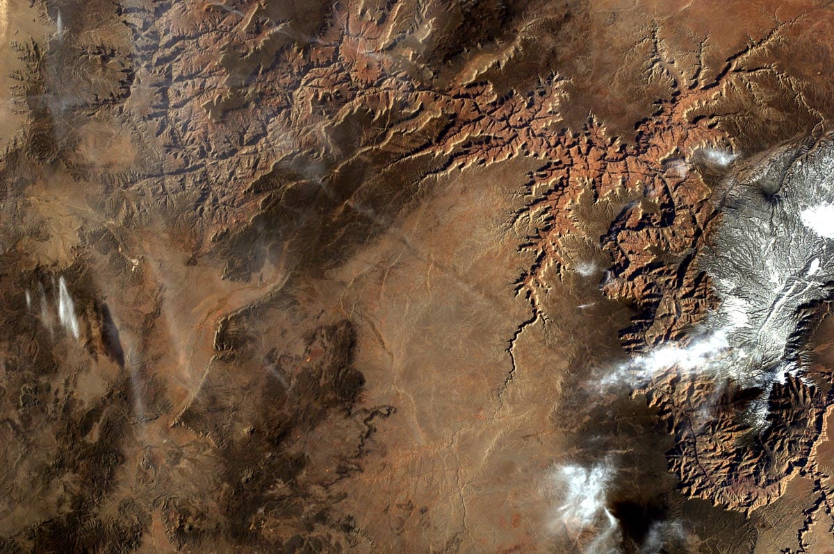
Grand Canyon National Park, Arizona
“One of the most spectacular examples of erosion anywhere in the world,” Grand Canyon National Park is one of the most visited natural wonders on the planet.
The park protects a long stretch of the Grand Canyon, carved by the Colorado River, as well as areas of the plateaus on both the North and South Rim. Popular activities include sunrise viewing, hiking, mule riding, stargazing and wildlife watching.
The carving powers of the Colorado River are evident when looking at this extraordinary photo of Grand Canyon National Park from space. An enormous “scar” in the landscape, the Grand Canyon is arguably, if possible, even more spectacular when seen from above.
This image includes much of Grand Canyon National Park, which occupies the majority of the right side of the image. The popular South Rim is in the lower right corner, the North Rim just above it on the other side of the canyon.
Two side canyons are also apparent. Kanab Canyon extends diagonally toward the upper right corner, while Havasu Canyon, the location of famous Havasu Falls, is just off center, running downwards and slightly to the left.
Grand Teton National Park, Wyoming
Wyoming’s Grand Teton National Park may be relatively small, but it certainly packs a punch. It’s named after the magnificent Teton Range, which rises abruptly from the Jackson Hole valley.
A series of lakes lie at the foot of the mountains, while the Snake River meanders its way south from Jackson Lake. The park is also home to abundant wildlife, from moose, bison and pronghorn to black bears and grizzly bears.
Much of the spectacular Teton Range is captured in this detailed NASA photo, including a large part of Grand Teton National Park.
The park’s beautiful lakes are unmistakable, especially sprawling Jackson Lake on the right. Just below Jackson Lake are Leigh Lake and egg-shaped Jenny Lake. Little Phelps Lake can also be seen, a little lower in the image.
The Snake River cuts across the lower right part of the image, bisecting the Jackson Hole valley.
If you’re wondering where Grand Teton is, the park’s namesake mountain is just to the left of and slightly below Jenny Lake, near the end of clearly visible Cascade Canyon. Mount Moran sits directly to the left of Leigh Lake, in between Moran Canyon and Leigh Canyon.

Yellowstone National Park, Wyoming, Montana and Idaho
The oldest national park in the world, iconic Yellowstone National Park preserves a variety of natural features.
From iconic hydrothermal features like Old Faithful and Grand Prismatic Spring to the jaw-dropping Grand Canyon of the Yellowstone, vast Yellowstone Lake and the colorful travertine terraces of Mammoth Hot Springs, Yellowstone has it all.
And then there’s the animals. Bison, elk, bighorn sheep, moose, pikas, wolves, bears, bald eagles, osprey, sandhill cranes,… They all call Yellowstone home.
This sensational photograph of Yellowstone National Park from space includes the entire park and much of the surrounding areas. It might take a while to get oriented, but it helps knowing that we’re looking to the southwest across Yellowstone, putting things more or less upside down.
The focal point is Yellowstone Lake in the lower-left center of the image. You can see the South and Southeast Arms extending upward, while the West Thumb points to the right. A patch of lighter green amid darker green surroundings, Hayden Valley is just below Yellowstone Lake.
Another prominent feature is Lamar Valley, the “Serengeti of North America,” which is partially visible along the image’s lower left edge. The towering Absaroka Range dominates the lower right corner of the photo.
Additionally, this NASA satellite image also encompasses all of Grand Teton National Park, effectively showing two national parks from space at once. The Teton Range and Jackson Lake can be seen in the middle of the image, a bit to the right of and above Yellowstone Lake.

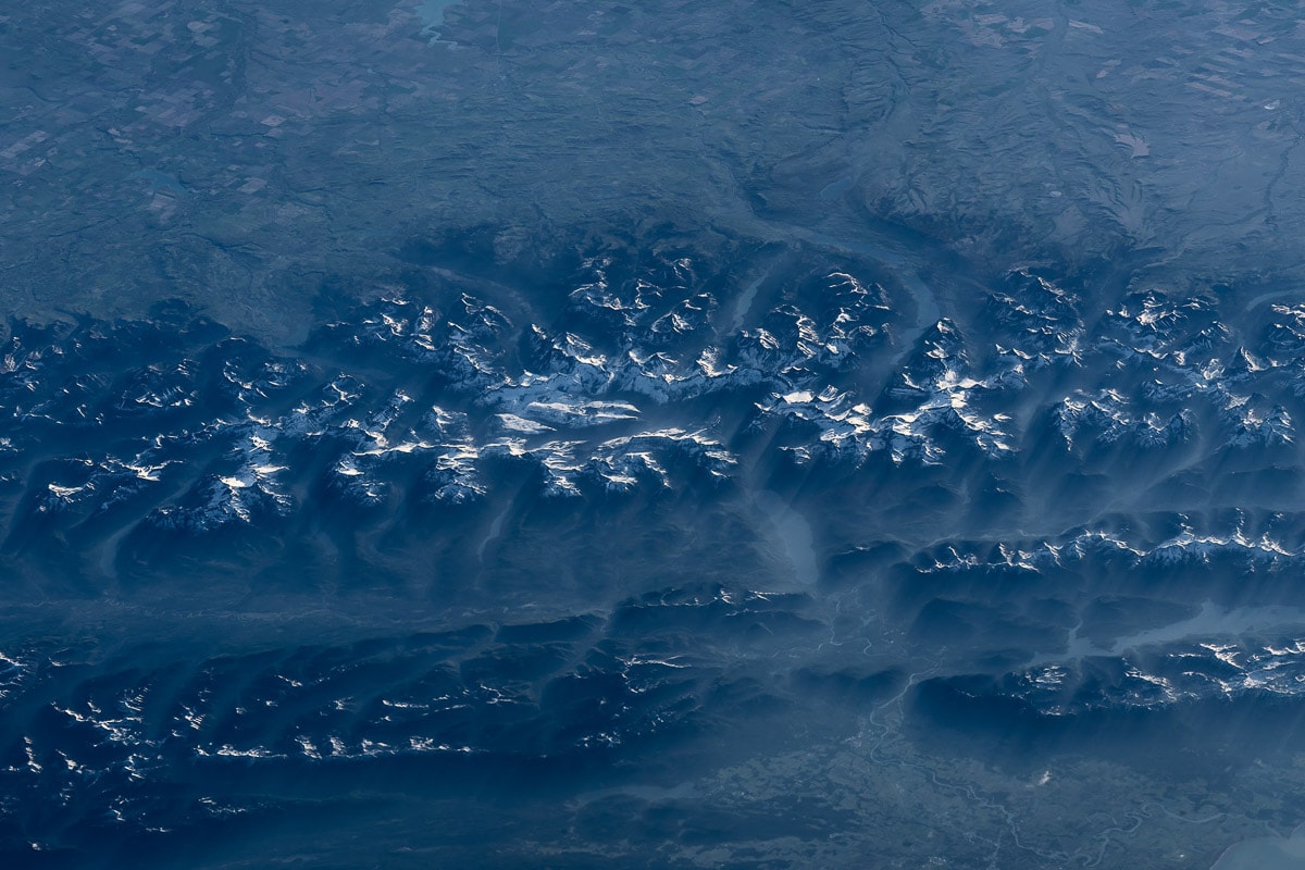
Glacier National Park, Montana
Located in the heart of the “Crown of the Continent” ecosystem in northern Montana, Glacier National Park is one of America’s most breathtaking parks.
Large glacier-carved lakes, glacial tarns and mountain streams characterize this park, which also has sprawling woodlands, gorgeous alpine meadows and spectacular mountain views.
Wildlife abounds in Glacier, too, ranging from the park’s iconic mountain goats and bighorn sheep to moose, marmots, pikas, black bears and grizzly bears.
Wonderfully showcasing the unique character of Glacier National Park from space, this NASA image features the park’s long glacial lakes, steep cliffs and rugged mountain peaks.
Several distinct natural features are visible, first and foremost huge Lake McDonald in the lower right center of the image. Just above that, you can see both Lake Sherburne and St. Mary Lake. On the far right, Lower Two Medicine Lake touches the image’s right edge.
To the left of Lake McDonald, four other long glacier-carved lakes can be seen. From left to right, they are Kintla Lake, Bowman Lake, Quartz Lake and Logging Lake.
Although not distinguishable, the Going-to-the-Sun Road and Logan Pass would be exactly in the middle of this image. Situated outside of Glacier National Park, the Flathead Range extends horizontally to the right of Lake McDonald.
Disclaimer: The images of the national parks seen from space in this post are courtesy of NASA and its astronauts.
You can learn more about the collaboration between the National Park Service and NASA here.


