23 Greatest Going-to-the-Sun Road Highlights, Hikes, Overlooks & Scenic Spots
The result of Mother Nature’s sculpting abilities and man’s engineering skills, the Going-to-the-Sun Road (GTTSR) in Glacier National Park is one of the greatest mountain drives in the world.
It is the only road that crosses UNESCO World Heritage-protected Glacier National Park in northern Montana, a scenic driving adventure unlike anything else on Earth.
As you wind your way up to Logan Pass, the highest point on the road, it’s impossible to not be awestruck by the park’s sheer cliffs, steep slopes, deep valleys and towering peaks.
Throw some turquoise alpine lakes and an abundance of wildlife into the mix, and you’ve got yourself a truly epic national park road filled with highlights.
Guide to Glacier’s Going-to-the-Sun Road: Highlights, Hikes, Overlooks & Scenic Spots
During my visit to Glacier National Park, I drove the Going-to-the-Sun Road half a dozen times, from before sunrise to mid-morning to the afternoon and at dusk.
It’s a fantastic experience any time of day, but sunrises are definitely my favorite time to be on this road.
Below, I’ve listed the top Going-to-the-Sun Road highlights. This includes essentially all major Going-to-the-Sun Road overlooks, man-made features, a few not-to-miss trails, some waterfalls and great places to see Glacier National Park’s famous wildlife.
First, however, let’s get the practicalities out of the way. Here are some Going-to-the-Sun Road facts and other information you might want to know.
This post about Going-to-the-Sun Road highlights and scenic spots contains affiliate links. You can read more about our Terms of Use / Disclosure here.
Going-to-the-Sun Road Facts and FAQ
How Long is the Going-to-the-Sun Road?
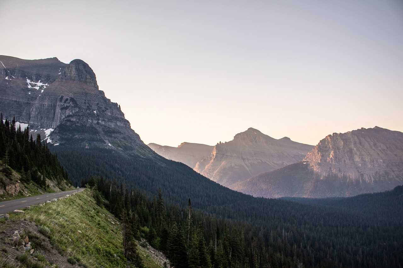
The Going-to-the-Sun Road is exactly 50 miles long. Its highest point is Logan Pass (6,646 feet), located in the heart of the park. Logan Pass is 32 miles from the west entrance in West Glacier and 18 miles from the east entrance in St. Mary.
How Long Does It Take to Drive the Going-to-the-Sun Road?
If you don’t stop at all, it takes a minimum of 2 hours to drive the road’s full 50 miles.
However, if you’d like to see all the Going-to-the-Sun Road highlights listed below, you’ll need at least a full day. I recommend spend two to three days exploring the road’s numerous attractions and trails.
When Is the Going-to-the-Sun Road Open?
Because of its high elevation and snowy conditions, the Going-to-the-Sun Road is closed most of the year. There’s no predetermined date that it opens.
Opening dates depend on snowpack and plowing progress. Due to heavy snowfall and frequent late-spring avalanches, this is one of the most difficult roads to plow and keep clear in North America. It’s not unusual for plowing to take more than ten weeks.
Generally speaking, though, the road opens sometime in late-June or early-July. It typically closes to vehicles in mid-October.
To get a better idea of when the Going-to-the-Sun Road opens, you can see historic opening and closing dates of the GTTSR on this page on the park’s website.
When Was the Going-to-the-Sun Road Built?
Construction on the road started in 1921, but wasn’t finished until 1932, more than a decade later. It was officially dedicated in July 1933.
After its completion, the Going-to-the-Sun Road was the first place to be registered as a National Historic Landmark, a National Historic Place and a Historic Civil Engineering Landmark.
What Wildlife Can I See on the Going-to-the-Sun Road?
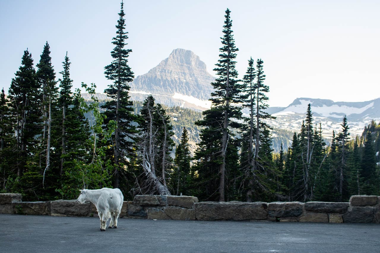
The GTTSR runs straight to prime wildlife habitat. From the dense woodlands of the west, across alpine Logan Pass, to the forests and meadows of the east, the entire road offers excellent Glacier National Park wildlife viewing opportunities. Seeing wildlife is absolutely one of the Going-to-the-Sun Road highlights.
These are some of the high-profile animals that I’ve seen on the road (and where I’ve seen them):
- Black bears (on the Avalanche Lake Trail)
- Grizzly bear (between Sunrift Gorge and Sun Point)
- Mountain goats (at and around Logan Pass)
- Bighorn sheep (at and around Logan Pass)
- Elk (at Two Dog Flats)
- Moose (at ponds along the north shore of St. Mary Lake)
Note, though, that those are just the places where I saw wildlife myself. You can run into animals literally anywhere along the road. Pay attention while driving and always stay in your car, especially when observing bears and moose.
For more information about wildlife safety, I recommend reading these blog posts:
- Black bear safety tips
- Grizzly bear safety tips
- Elk safety tips
- Moose safety tips
- Mountain lion safety tips
Are There Any Size Restrictions for Vehicles?
Yes, there are. Because of sharp turns, low rock overhangs and some very narrow sections, there are vehicle size restrictions in place.
Between Avalanche Campground in the west and Rising Sun in the east, vehicles and vehicle combinations longer than 21 feet and wider than 8 feet are prohibited on the Going-to-the-Sun Road.
It’s also important to know that a vehicle (combination) over 10 feet high, although allowed, could have trouble between The Loop and Logan Pass.
How Did the Going-to-the-Sun Road Get Its Name?
Initially called the “Transmountain Highway” during its construction period, the road was officially designated the “Going-to-the-Sun Road” at its dedication in 1933. The road got its name from nearby Going-to-the-Sun Mountain.
The mountain’s name may have its roots in Native American legends. According to a local legend, as well as a 1933 press release from the Department of the Interior:
“The deity, Sour Spirit, came down from the sun to teach Blackfeet braves the rudiments of the hunt. On his way back to the sun, Sour Spirit had his image reproduced on the top of the mountain for inspiration to the Blackfeet.”
The name could also stem from the creativity of a late-19th-century Euro-American explorer who may have invented the legend and the name.
Whatever story is true—perhaps it’s a combination of both—the Going-to-the-Sun Road was, is and always will be a place of inspiration.
Where Can I Stay on the Going-to-the-Sun Road?
Lodging on the Going-to-the-Sun Road is available on its lower elevation sections, both in the west and east. There is no Glacier National Park accommodation on the alpine portion of the road.
- Village Inn at Apgar and Apgar Village Lodge
- Lake McDonald Lodge and Motel Lake McDonald
- Rising Sun Motor Inn & Cabins
- St. Mary Village (just steps outside the park boundary in St. Mary)
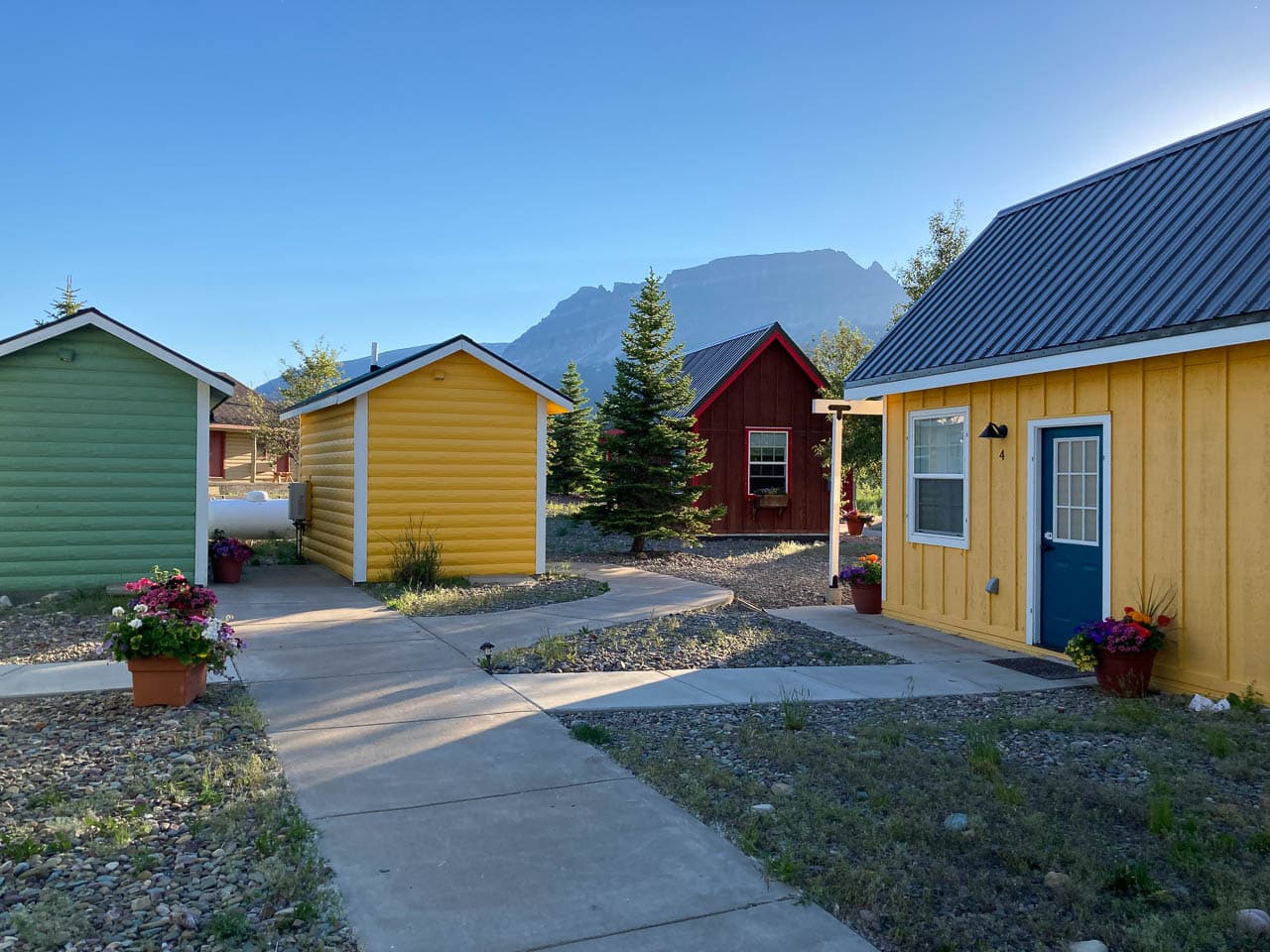
In addition to a few nights at the Village Inn at Apgar and the Many Glacier Campground, I spent four nights in one of the Tiny Homes at St. Mary Village.
I highly recommend staying there for easy access to the many eastern Going-to-the-Sun Road highlights. It’s also closer to Logan Pass than the accommodations on the west side.
This would also be a great location for day trips to Many Glacier, in case you weren’t able to reserve a room or campsite there.
Additionally, there are also five campgrounds along the road. Those are Apgar, Sprague Creek, Avalanche, Rising Sun and St. Mary. Please check the camping page on the Glacier National Park website for opening dates, amenities and prices.
What Is the Speed Limit on the Going-to-the-Sun Road?
The speed limit is 45 mph at lower elevations and 25 mph in the alpine section of the road.
What Are the Best Hikes on the Going-to-the-Sun Road?
There are numerous hiking trails on the Going-to-the-Sun Road, both nice and short, and long and challenging. In fact, some of the Going-to-the-Sun Road highlights described below are hikes. Here’s a short overview of some excellent hiking suggestions along the road.
- Johns Lake Loop: easy, loop, 1.8 to 3 miles
- Trail of the Cedars: easy, loop, 0.7 miles
- Avalanche Lake Trail: moderate, out and back, 4.6 miles
- Highline Trail: strenuous, out and back (or point to point), 15.2 miles (or 11.8 miles)
- Hidden Lake Overlook: moderate, out and back, 2.8 miles
- Siyeh Pass (or Piegan Pass): strenuous, out and back (or point to point), 9.2 miles (or 10.1 miles)
- St. Mary and Virginia Falls: moderate, out and back, 3.2 to 3.6 miles
What Services Are Available?
First of all, there is no gas available anywhere in Glacier National Park. This, of course, includes the entire length of the Going-to-the-Sun Road. Make sure to fuel up at gateway towns like West Glacier and St. Mary.
You can find all kinds of information at three visitor centers on the GTTSR. Those are, from west to east, the Apgar Visitor Center, the Logan Pass Visitor Center and the St. Mary Visitor Center.
There are five designated picnic locations on the road: Apgar, Sprague Creek, Avalanche, Sun Point and Rising Sun.
Food services, such as restaurants and/or grocery stores, are available at Apgar, Lake McDonald Lodge and Rising Sun.
You can find more information about these and other services along the Going-to-the-Sun Road, including boat tours, Red Bus tours, rafting and horseback riding excursions, here.
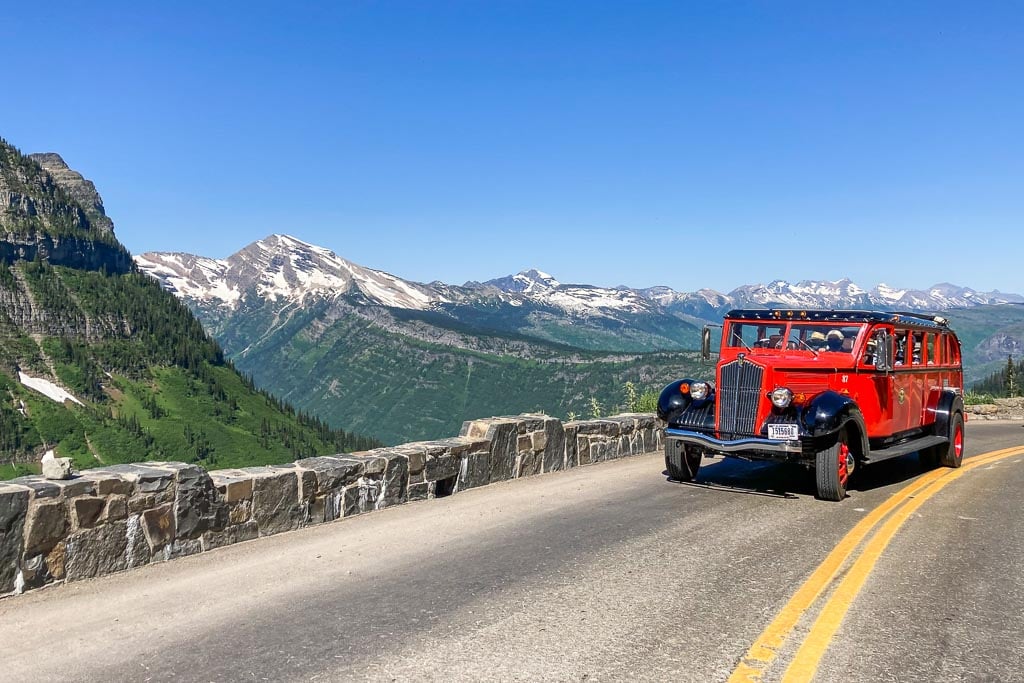
Can I See a Glacier From the Going-to-the-Sun Road?
Yes! The best place to see a glacier from the Going-to-the-Sun Road, by far, is the Jackson Glacier Overlook. It is on the eastern portion of the road, between Siyeh Bend and Sunrift Gorge.
Do I Need a Reservation to Drive the Going-to-the-Sun Road?
Yes, you do… sort of. Just like previous years, Glacier National Park uses a ticketed entry system for the Going-to-the-Sun Road in 2024, too.
From May 24 through September 8, 2024, between 6 a.m. and 3 p.m., you will need an entry reservation to access the Going-to-the-Sun Road via the West Entrance near Lake McDonald. Reservations are valid for one day.
If you’d like to enter the Going-to-the-Sun Road via the St. Mary Entrance, on the other hand, you do not need a timed entry reservation.
However, if you have a service reservation, such as a hotel or campsite booking, bus tour, boat ride or horseback ride reservation, you also do not need a Going-to-the-Sun Road ticket. You can also access Glacier’s famous mountain road outside of the ticketed hours and dates.
You can find more information about the Going-to-the-Sun Road ticket system here.
23 Highlights of the Going-to-the-Sun Road, Glacier National Park
Okay, so now that we got all that information out of the way, let’s continue with the (more) fun stuff.
If you’re planning a trip to Glacier National Park—and that should absolutely include seeing all the Going-to-the-Sun Road highlights—here are more than twenty places you shouldn’t miss on the Going-to-the-Sun Road. They’re listed from west to east, from West Glacier to St. Mary.
Most are literally on the roadside, while others might require a short stroll or even a longer hike. All are beautiful and essential for a complete and unforgettable Going-to-the-Sun Road experience.
Lake McDonald
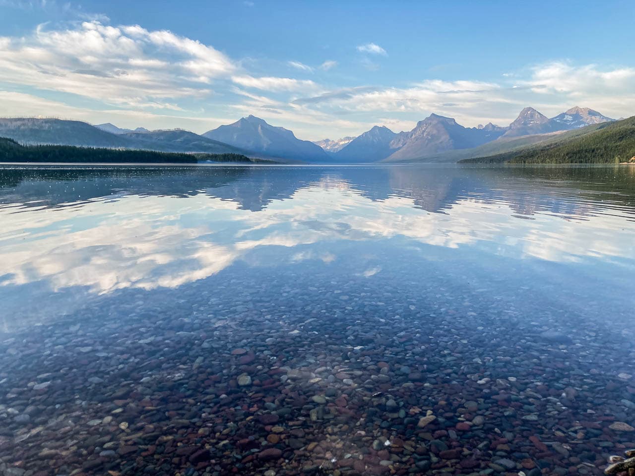
The largest lake in Glacier National Park, Lake McDonald is 10 miles long and almost 500 feet deep. A direct result of glacial carving, the lake is surrounded by tall peaks and the forested slopes of its U-shaped valley.
This is the main hub of the park’s west side, home to the bustling Apgar Village, the iconic Lake McDonald Lodge and a few campgrounds. Lake McDonald is also one of the best places to see the sunset in Glacier National Park.
From Apgar on its southwestern shore, there’s a fantastic view of the majestic peaks on the lake’s other end, which are lit up by the evening sun.
Additionally, Lake McDonald is famous for its colorful pebbles and crystal-clear, often reflective, water. This is also the only lake along Going-to-the-Sun Road where you can go boating, kayaking and canoeing.
Lake McDonald Lodge
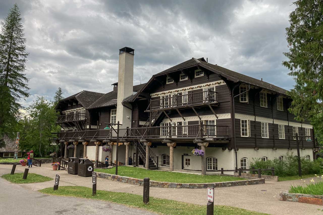
Located at the east end of Lake McDonald, the iconic Lake McDonald Lodge is an impressive Swiss chalet-style lodge. It’s one of the most popular places to stay on Glacier National Park’s west side.
Even if you don’t spend the night there, this rustic and historic lodge is still a place worth checking out. Explore its majestic lobby, filled with stuffed mountain goats and the heads of elk, moose and bighorn sheep.
Fun fact: Lake McDonald Lodge is older than the Going-to-the-Sun Road, which is why its main entrance facing the lake, away from the road.
McDonald Creek
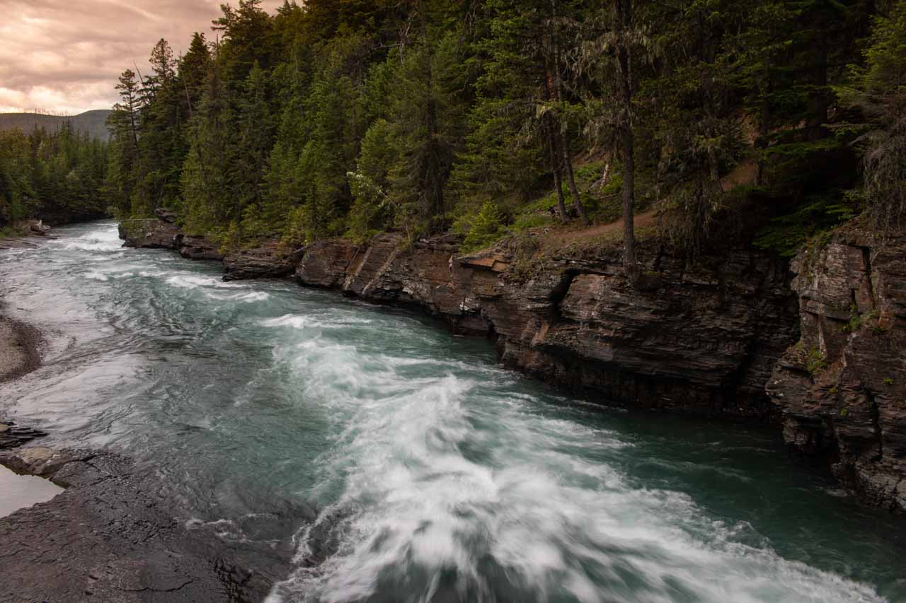
For many people, McDonald Creek is nothing more than a quick stopping point along the western section of the Going-to-the-Sun Road. A couple of parking areas offer views of places like Lower McDonald Falls and Sacred Dancing Cascades.
In my opinion, this is one of the most underrated locations on the Going-to-the-Sun Road. Although it’s not as spectacular as the park’s cliffs and peaks, abundant wildlife or colorful wildflower meadows, McDonald Creek is a wonderful spot to enjoy the stillness and more intimate details of nature.
Spend some time on the creek banks, skip some rocks, hike a trail—the Johns Lake Loop Trail partially parallels the creek—or enjoy the scenery while picnicking.
Trail of the Cedars
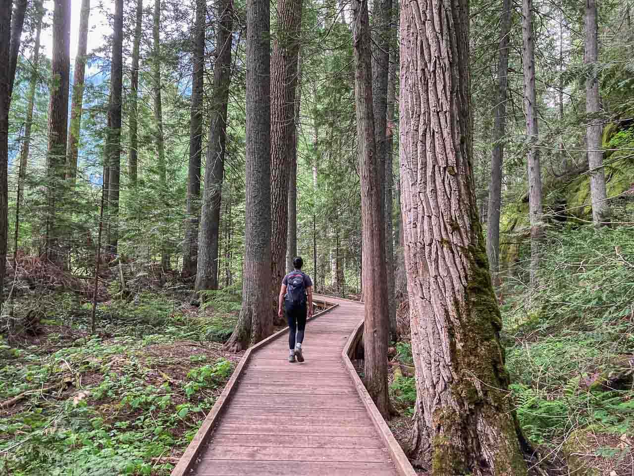
One of the most popular easy hikes in Glacier National Park, the Trail of the Cedars starts at the extremely busy Avalanche Picnic Area. Make sure to get here as early in the morning as you can to find a parking spot.
A wonderful loop, this trail is mainly a wheelchair-accessible boardwalk that runs through a beautiful rain forest reminiscent of the Pacific Northwest.
There’s no elevation gain to speak of, making this a fantastic option for people with different abilities or less desire to take on the challenging Glacier National Park hiking trails.
As you stroll through a forest of towering 500-year-old red cedars, black cottonwoods and hemlocks, listen to the song of birds and take in the wonderful woodland scents.
The Trail of the Cedars also crosses two bridges across Avalanche Creek, which is especially stunning at Avalanche Gorge.
Very short and super-easy, this trail offers you the chance to immerse yourself in Glacier’s lush west-side forests. Combine the Trail of the Cedars with the excellent Avalanche Lake Trail (see below) for a longer hike.
Avalanche Lake Trail
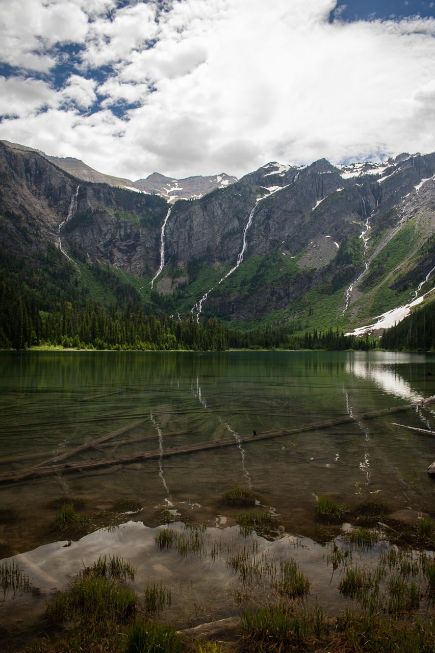
If you’re looking for a moderate hike on the west-side section of the Going-to-the-Sun Road, few trails are better—or busier—than the Avalanche Lake Trail.
This extremely popular hike starts about halfway around the Trail of the Cedars, climbing shortly but steeply to the top of Avalanche Gorge.
You’ll hike through thick woods, every now and then catching a glimpse of towering glacier-carved walls just to your left. The trails ends at beautiful Avalanche Lake, backed by a cirque with sheer cliffs and lined with waterfalls.
Several benches are set up along the lakeshore, ideal for enjoying a picnic lunch or just admiring this extraordinary landscape. Alternatively, you can also continue hiking to the far end of the lake, which is much less crowded. Retrace your steps back to the trailhead.
Note: The Avalanche Lake Trail is often posted for bears frequenting. I saw a black bear just off the trail near the lake. Remember to make noise while hiking, especially in areas with less visibility, such as woods and dense bushes, even if the trail is crowded with other hikers.
West Tunnel
When driving from the west, the West Tunnel is right below, or before, The Loop. This engineering masterpiece is nothing less than the grand entrance to the most majestic part of the Going-to-the-Sun Road.
The tunnel is 192 feet long and features two large windows offering views of the Upper McDonald Creek Valley below. The windows also beautifully frame Heavens Peak. Note that there’s no place to park within the tunnel, but you can park at pullouts below it and walk over.
The Loop
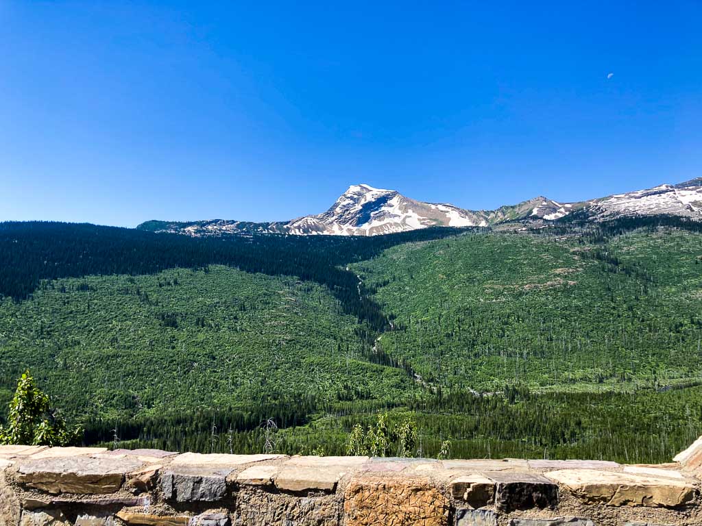
The biggest switchback on the Going-to-the-Sun Road, The Loop offers arguably the best view of iconic Heavens Peak, which towers above the valley. You can park either below or above the bend to take in the panorama.
Additionally, The Loop is also a popular starting point for hikes to Granite Park Chalet—this trailhead offers the shortest route to this famous mountain cabin.
Haystack Falls
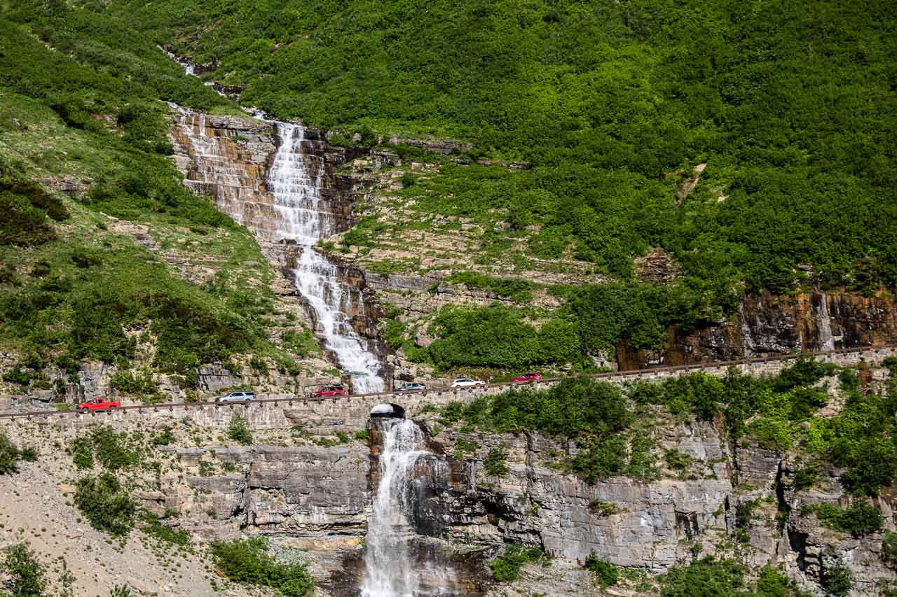
Tumbling down the mountainside in a magnificent series of cascades, Haystack Falls is a classic Going-to-the-Sun Road view. It is about 2 miles up the road from The Loop. You can easily recognize it. It’s the waterfall that crosses underneath the road, so can actually drive across it.
Note: Haystack Falls is often confused with Bird Woman Falls, another well-known waterfall in this part of Glacier National Park. This is because the roadside location of the sign that marks Bird Woman Falls also offers a great view of Haystack Falls, just up the road. Bird Woman Falls is actually across the valley.
Weeping Wall
One of the most fun and remarkable highlights of the Going-to-the-Sun Road is the Weeping Wall. As its name suggests, this is a rock wall that “weeps” in a rather long series of waterfalls. If you’re driving downhill, the Weeping Wall will be on your right and you might want to roll up your windows.
The Weeping Wall is at its most impressive in late-spring and early-summer when it’s fed by melting snow and ice above. It slows down to a little more than a drip toward the end of summer.
Big Bend
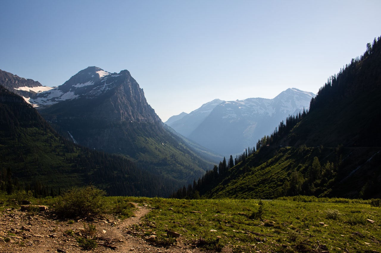
One of the best spots to enjoy the sunset on the Going-to-the-Sun Road, Big Bend is, well, a big bend in the road.
When coming from the west, it’s just past the Weeping Wall. A large parking lot makes it impossible to miss and indicates its popularity among visitors. You definitely won’t be alone here.
Take your time at Big Bend—this Going-to-the-Sun Road panorama is truly breathtaking—and watch the sun rays, shadows and colors shift along the cliffs and peaks across the valley. The view includes Mount Oberlin, Cannon Mountain, Heavens Peak and Clements Mountain.
If you’re at this amazing spot in mid-summer, you’ll also be treated to a magnificent display of wildflowers.
Triple Arches
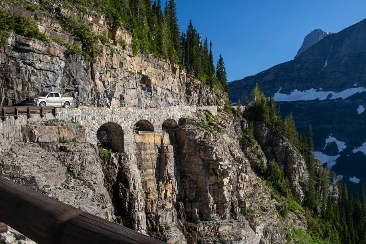
Both the West and East Tunnels are impressive, but this is probably the single greatest engineering feat on the entire Going-to-the-Sun Road. Situated about 1.5 miles beyond Big Bend, the Triple Arches are best viewed when driving uphill.
They are right next to a waterfall that cascades down the cliff, a magnificent piece of road construction that almost defies the imagination.
Because the road is literally cut into the cliffside and very narrow here, there are no pullouts or parking spaces that offer a view of the Triple Arches.
You have to drive pretty slowly on this section anyway, though, so you’ll be able to enjoy this awesome sight from your car.
Oberlin Bend Overlook

The Oberlin Bend Overlook is at a wide curve in the road just before Logan Pass and below Mount Oberlin. From the parking lot, there’s a wheelchair-accessible path to the overlook.
Keep your eyes peeled for mountain goats, the official mascot of Glacier National Park, which abound in this area.
The Oberlin Bend Overlook also offers spectacular views of the Going-to-the-Sun Road’s final stretch toward Logan Pass, as well as the Highline Trail and the Continental Divide.
Logan Pass
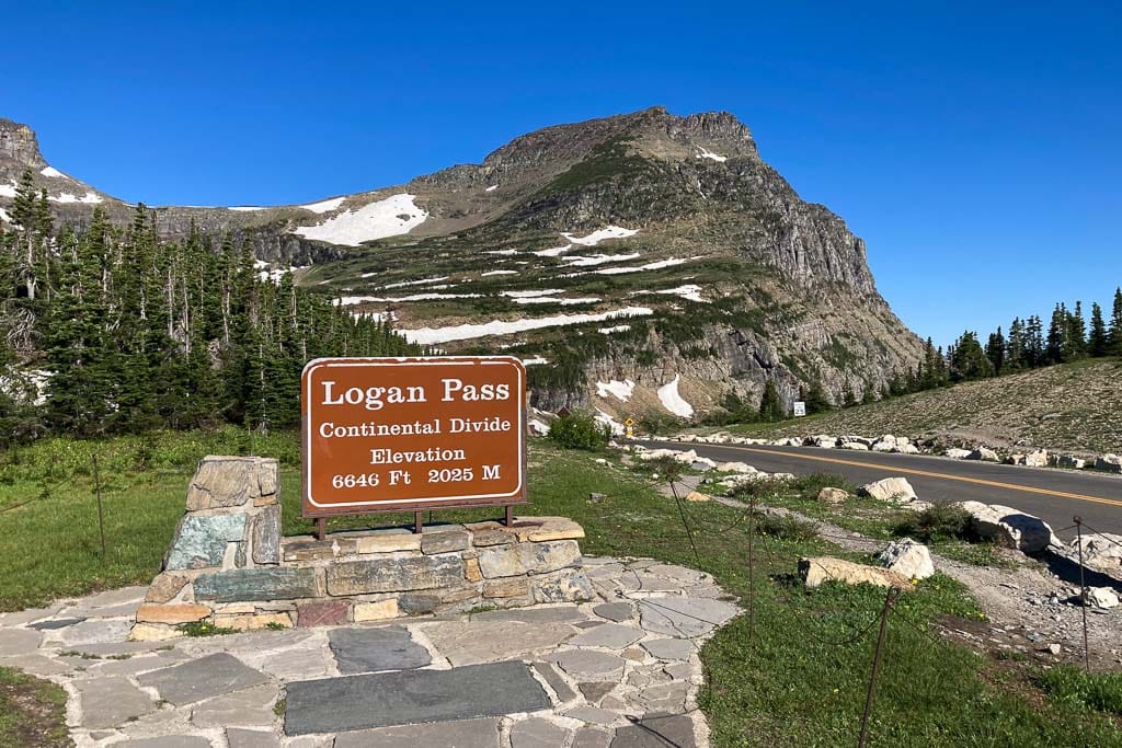
The ultimate destination for many visitors to Glacier, Logan Pass is the highest point on the Going-to-the-Sun Road (6,646 feet).
When the road is open, usually from late-June through mid-October, this is an extremely busy place. In mid-summer, the parking lot is typically full between 8 am and 4.30 pm. Get here as early in the morning as you can.
Once you’ve found a parking spot, you can stroll the interpretive trail at the Logan Pass Visitor Center or just take in the panorama from the parking lot itself. This is also the starting point for hikes to the iconic Hidden Lake Overlook (see below) or on the world-renowned Highline Trail.
In addition to stunning wildflowers and wonderful sunrises and sunsets, Logan Pass is also one of the top locations for wildlife viewing in Glacier National Park.
At Logan Pass, you’ll almost certainly see bighorn sheep, while mountain goats are very common as well. If you’re patient (and lucky), you might spot a grizzly bear lumbering through the meadows, too. All of this makes Logan Pass one of the top Going-to-the-Sun Road highlights.
Hidden Lake Overlook

The Hidden Lake Overlook is also at Logan Pass, but worth zooming in on. This is one of my favorite shorter hikes in Glacier National Park, a stunning walk across colorful alpine meadows to one of Glacier’s most famous viewpoints.
The trail starts just behind the Logan Pass Visitor Center and combines boardwalks, to protect the fragile flowers underneath, and gravel. It is absolutely glorious at sunrise, when crowds are at their smallest and animals at their most active.
As the trail climbs to the Hidden Lake Overlook, you can enjoy panoramic views of Logan Pass and see ancient rock layers in the cliffs of Clements Mountain to your right.
The upper section of the trail features small waterfalls and reflective moraines, as well as excellent opportunities to see mountain goats and bighorn sheep.
From the platform at Hidden Lake Overlook, one of Glacier’s most iconic views sprawls before you: Hidden Lake backed by striking Bearhat Mountain. It’s a 2.8-mile roundtrip hike.
East Tunnel
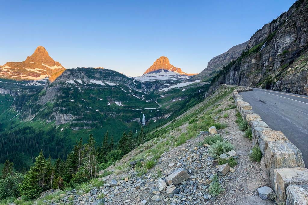
While literally all overlooks and pullouts on the Going-to-the-Sun Road are worth stopping at, I personally love those below the East Tunnel most. To the east of Logan Pass, the East Tunnel is the larger of the road’s two tunnels.
This 408-feet-long tunnel was excavated entirely by hand, an impressive man-made feature in a landscape dominated by majestic peaks and deep valleys.
The pullouts are on the downhill side of the tunnel and offer a great view of the East Tunnel itself, as well as Going-to-the-Sun Mountain, after which the road was named.
Looking up toward Logan Pass, the panorama takes in Mount Reynolds and Clements Mountain. I think this is one of the best views in the national parks.
Siyeh Bend
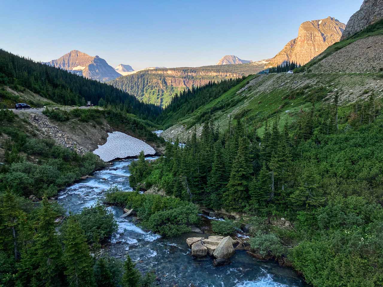
Another huge curve in the Going-to-the-Sun Road, Siyeh Bend features a spacious parking lot. This is the trailhead for strenuous hikes to Siyeh Pass and Piegan Pass, both of which involve a hike through the stunning wildflower-filled meadows of Preston Park.
If you’re not hiking, there’s still a really nice view to enjoy here. Take the vista of the creek bubbling its way down the valley, flanked by towering mountains.
Additionally, the Siyeh Bend area is where the alpine vegetation of Logan Pass transitions to the verdant forests around St. Mary Lake.
Jackson Glacier Overlook
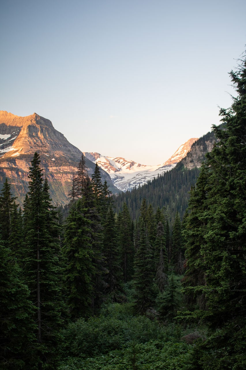
For the best glacier views on the Going-to-the-Sun Road, stop at Jackson Glacier Overlook. From the parking lot, there’s an unobstructed view of Jackson Glacier, about six miles in the distance.
St. Mary and Virginia Falls Trail
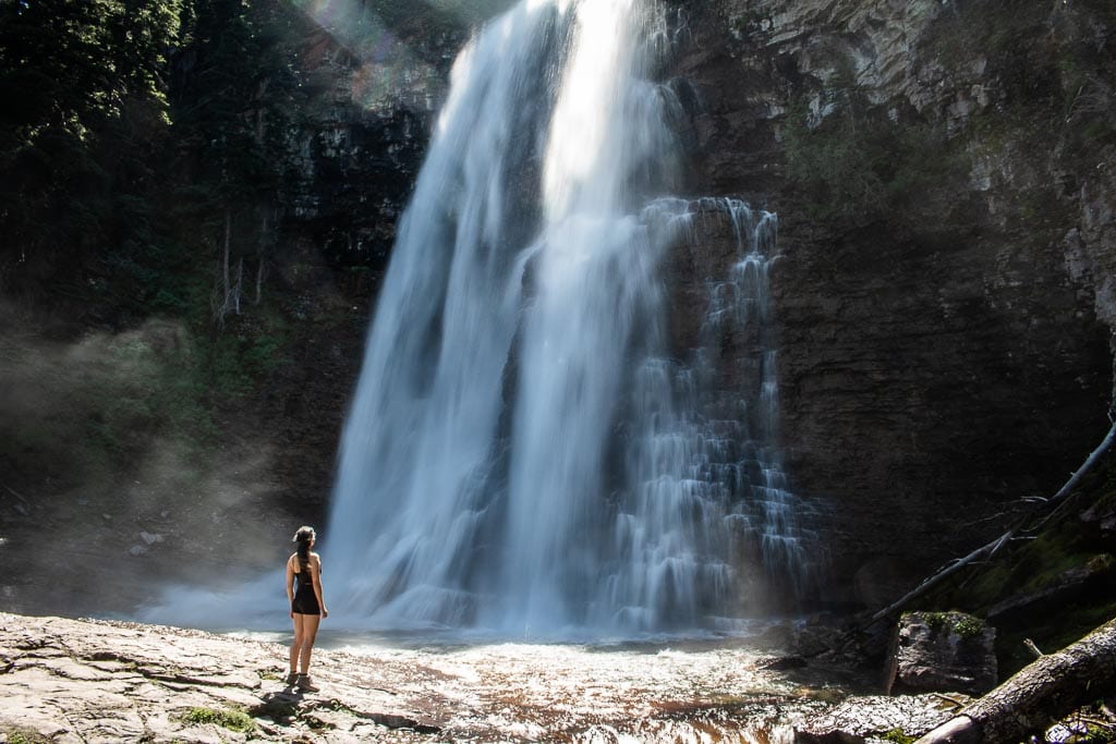
There are only a few day hikes in Glacier National Park that lead to waterfalls. None are as great as the St. Mary and Virginia Falls Trail, easily one of my favorite Going-to-the-Sun Road highlights. Depending on where you start this hike near the head of St. Mary Lake, distances vary. I’ll describe the shortest option below.
The most direct routes to St. Mary Falls and Virginia Falls start at the St. Mary Falls Shuttle Stop or Trailhead on the Going-to-the-Sun Road.
The total distance from these starting points is respectively 3.2 and 3.6 miles. (Other places where you can start this hike are Sunrift Gorge and Sun Point, both of which add several miles to its total distance.)
From either the shuttle stop or trailhead, this busy trail first descends for about 1 mile toward St. Mary Falls, a picturesque multi-tiered waterfall in a small gorge. On a summer’s day, you’ll certainly relish the cooler temperatures at the falls.
Cross the wooden bridge across the stream and climb about 0.7 miles to beautiful Virginia Falls. This large and wide waterfall makes for a great picnic spot. Often windy, there’s a constant spray of droplets coming from the waterfall, a welcome way to cool off when it’s hot.
Sun Point
Now essentially a large parking lot with restrooms, picnic sites, information boards and a couple of trails, Sun Point used to be one of Glacier National Park’s early tourist hubs. Once home to a collection of cabins, which were accessible only via boat from St. Mary, this was a base camp for trips into the park’s heart.
From Sun Point, a quick walk from the parking lot, you can gaze across St. Mary Lake and see the Continental Divide, Fusillade Mountain and Going-to-the-Sun Mountain. For a relatively short hike, take the easy 1.2-mile trail to Baring Falls.
St. Mary Lake
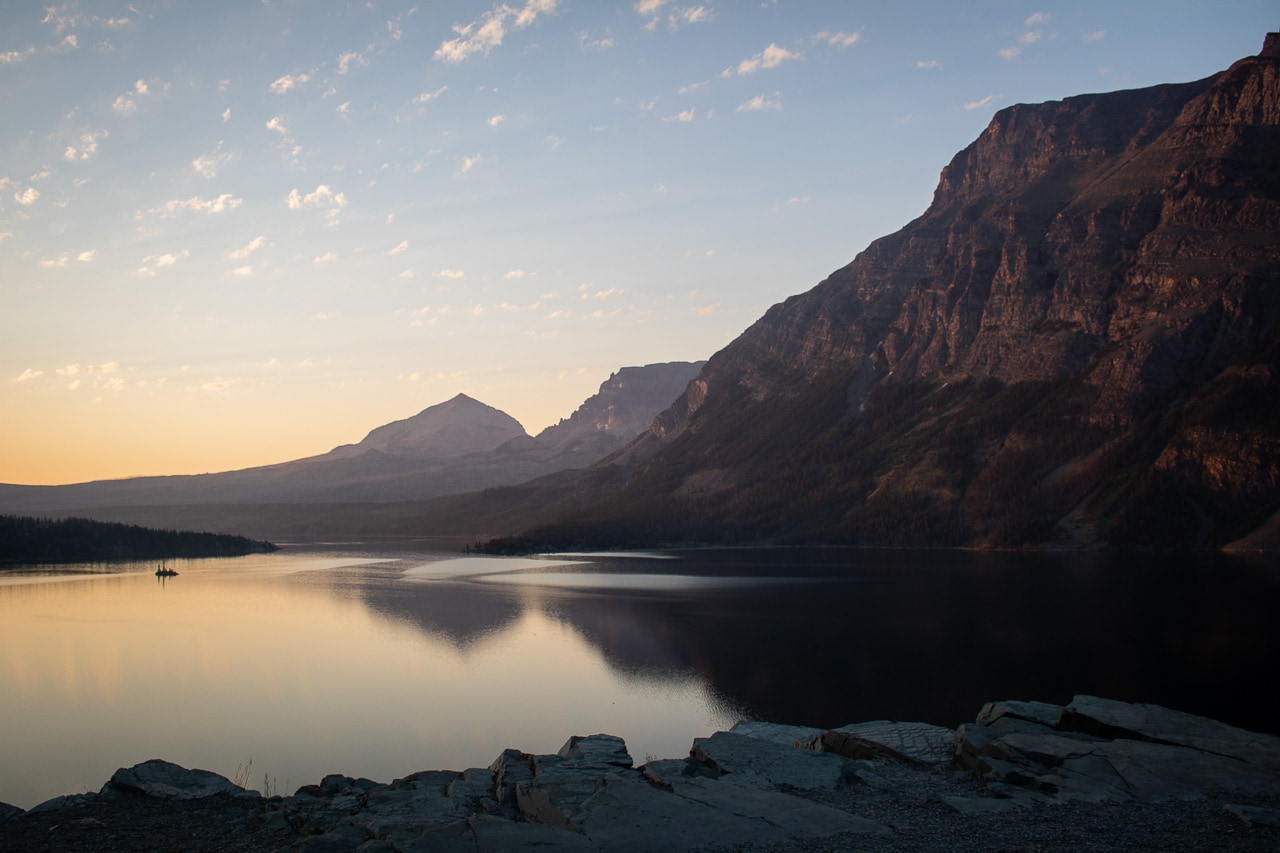
The heart of the eastern section of the Going-to-the-Sun Road, sprawling St. Mary Lake is Glacier National Park’s second-largest lake, after Lake McDonald.
About 10 miles long and up to 300 feet deep, this high-altitude lake sits at the meeting point of the Great Plains and the Rocky Mountains. While mighty mountains surround its western end, the eastern end features grasslands and meadow landscapes.
Many of the Going-to-the-Sun Road attractions on the east side are at or near St. Mary Lake. This includes other Going-to-the-Sun Road highlights mentioned in this blog post, such as Sun Point, Wild Goose Island, as well as Two Dog Flats.
There are several pullouts along the road as it parallels the lake’s north shore. For accommodation and some services, stop at Rising Sun, which has cabins, a campground, a picnic area and grocery store.
Wild Goose Island Overlook
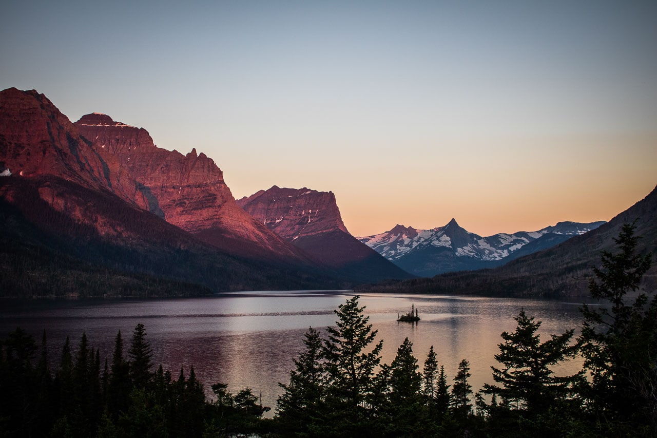
A bucket-list Glacier National Park photography location, little Wild Goose Island is one of the park’s most photographed spots. It’s also one of the greatest Going-to-the-Sun Road highlights.
From the overlook, tall trees form a beautiful frame for this little islet in the massive body of water that is St. Mary Lake, while the Continental Divide provides a spectacular background.
At the center of the backdrop, Fusillade Mountain somewhat mirrors the shape and trees of Wild Goose Island, a perfect detail that makes this spot even more special.
Because the Wild Goose Island Overlook faces west, it’s also one of the best places on the Going-to-the-Sun Road to enjoy the sunrise.
Just before sunrise, the magnificent peaks surrounding the lake begin lighting up in hues of pink, purple and red. A yellow-orange glow in the distant sky balances out the sunrise colors, creating a perfect palette of daybreak tints.
Surprisingly, you might not have to share this gorgeous spot with many other people. Undoubtedly, there will be some photographers there at sunrise, but most visitors will be either still asleep or on their way to Logan Pass to grab a parking spot early in the morning.
Two Dog Flats
It doesn’t look like much more than sloping meadow near St. Mary Lake’s east end, but Two Dog Flats is definitely worth stopping at.
Especially at dawn and dusk, this is a fantastic place to see some of Glacier’s famous wildlife. Elk are frequently seen here, while lucky (and patient) visitors might see a coyote or bear as well.
In summer, Two Dog Flats, which truly is where the prairie and the mountains meet, features an abundance of colorful wildflowers.
Glacier National Park Entrance Sign at St. Mary
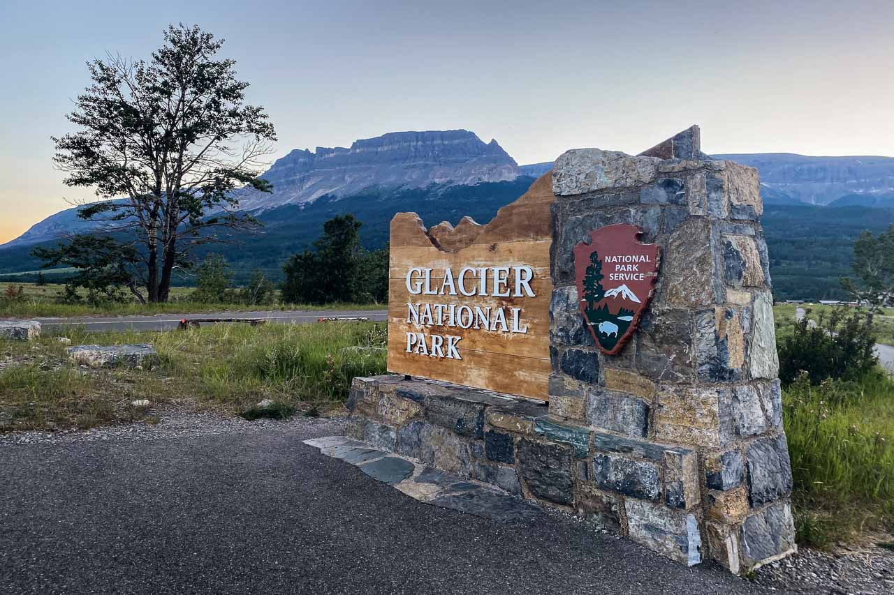
Yes, there are Glacier National Park signs at more than one entrance to the park. And yes, maybe it’s weird to end your Going-to-the-Sun Road with an entrance sign. But I include it here because so many people like taking a photo of, or having their picture taken with, a national park sign.
You’ll find the Glacier National Park sign at just across the river at St. Mary. It’s a few hundred yards past St. Mary Village’s numerous different accommodation options.
Recommended Glacier National Park Books
- Glacier National Park: Hiking, Camping, Lakes & Peaks (Travel Guide) – Moon / Becky Lomax
- The Father of Glacier National Park: Discoveries and Explorations In His Own Words – George Bird Grinnell
- Rangers, Trappers and Trailblazers: Early Adventures in Montana’s Bob Marshall Wilderness and Glacier National Park – John Fraley
- Death in Glacier National Park: Stories of Accidents and Foolhardiness in the Crown of the Continent – Randi Minetor




This is a great resource for us in planning our first visit to Glacier NP … coming in September and can hardly wait! Many thanks!
Really glad you found some useful information, Sharon! September is a beautiful time to visit Glacier, you’ll have a blast.
Our group will be at Glacier National Park on June 22 – 25, 2022. Loved your informative article on going to the Sun Road highlights. I now have some ideas of were to go and hikes to do. Our first stop will be Logan pass after reading your article. Some in our group cant hike to far. Thank you for a good informative article.
Beautiful time of year to visit Glacier, Terry! We were there around the same time last year, too. You’ll have a blast! Remember, though, that the Going-to-the-Sun Road might not yet be completely open next week. There’s still a significant amount of snow (and avalanche risk) at higher elevations, so it could be a couple of weeks before the road fully opens and visitors can access Logan Pass. Please keep this in mind and keep an eye on the park’s website for updates: https://www.nps.gov/glac/planyourvisit/directions.htm.
Appreciate info and links in this article! Thank you!
Glad you enjoyed it, Jan!